|
|
Main benchmarks recovered in good or poor condition. |
|
|
Main benchmarks that have been destroyed. |
|
|
Reference benchmarks recovered in good or poor condition. |
|
|
Reference benchmarks that have been destroyed. |
|
|
Azimuth benchmarks recovered in good or poor condition. |
|
|
Azimuth benchmarks that have been destroyed. |
|
|
A main, reference, or azimuth benchmark not searched for. |
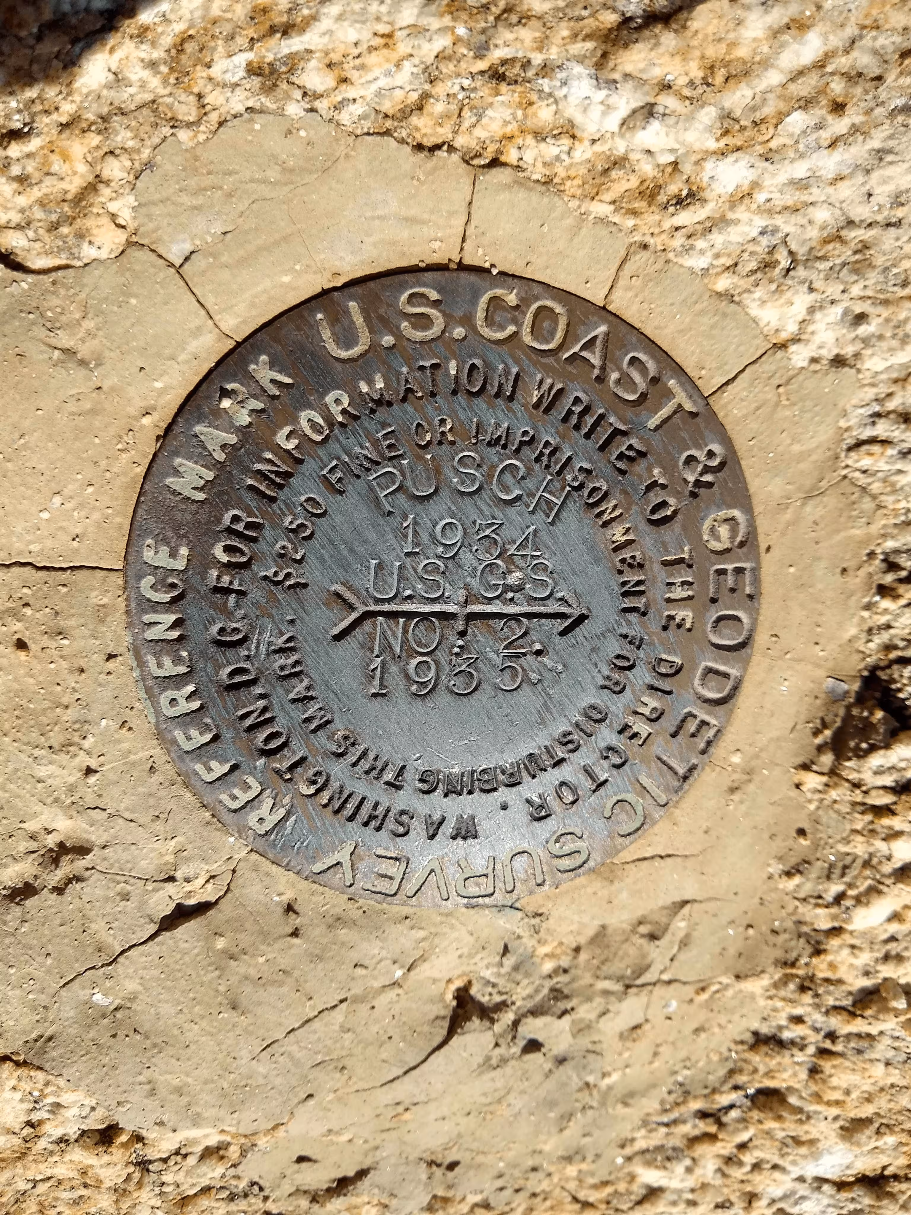
"PUSCH NO: 2"
| NGS PointID: | CC8062 |
| Reference Benchmarks: | PUSCH, PUSCH NO: 1 |
| Azimuth Benchmark: | Q 19 |
| Condition: | Ware and a few minor scratches present |
| Stamping: | PUSCH 1934 U.S.G.S. NO: 2 1935 |
| Coordinates: | 32.371972, -110.939267 |
| Elevation: | 5354 ft (1632 m) |
| Setting: | A rock outcrop |
| Monumentor: | USC&GS |
Datasheet Description:
Reference Mark NO. 2, a standard bronze reference disk, is 16.550 meters (54.30 feet) from station S 76 deg 13 min W.
"PUSCH NO: 2" is a benchmark monumented by the USC&GS in 1935 located in Pima County, Arizona. It is a dedicated reference mark for PUSCH.
The best way to get to "PUSCH" is to start at the Linda Vista Trail head located on Linda Vista Road east of the interesction of Linda Vista Road and Oracle Road (AZ 77). (32.380722, -110.961139)
Follow the trail that follows the wash. The GPX track follows the whole route. Continue on the trail heading southeast until you intersect with another trail. Take a left for a short distance until a trail splits off to the right. Note the "NOT A FOREST SYSTEM TRAIL BEYOND THIS POINT" sign. You will tell why continuing the hike. Follow the steep trail until the summit of Pusch Peak. The benchmark disk is located on the rock outcrop the summit is located at. The benchmark is just below the summit.
"PUSCH NO: 2" is located 54.140 feet or 16.502 meters 256 degrees from the main benchmark. It is located at a lower elevation than the main benchmark, on the summit of a rock outcrop, visible from the station.