|
|
Main benchmarks recovered in good or poor condition. |
|
|
Main benchmarks that have been destroyed. |
|
|
Reference benchmarks recovered in good or poor condition. |
|
|
Reference benchmarks that have been destroyed. |
|
|
Azimuth benchmarks recovered in good or poor condition. |
|
|
Azimuth benchmarks that have been destroyed. |
|
|
A main, reference, or azimuth benchmark not searched for. |
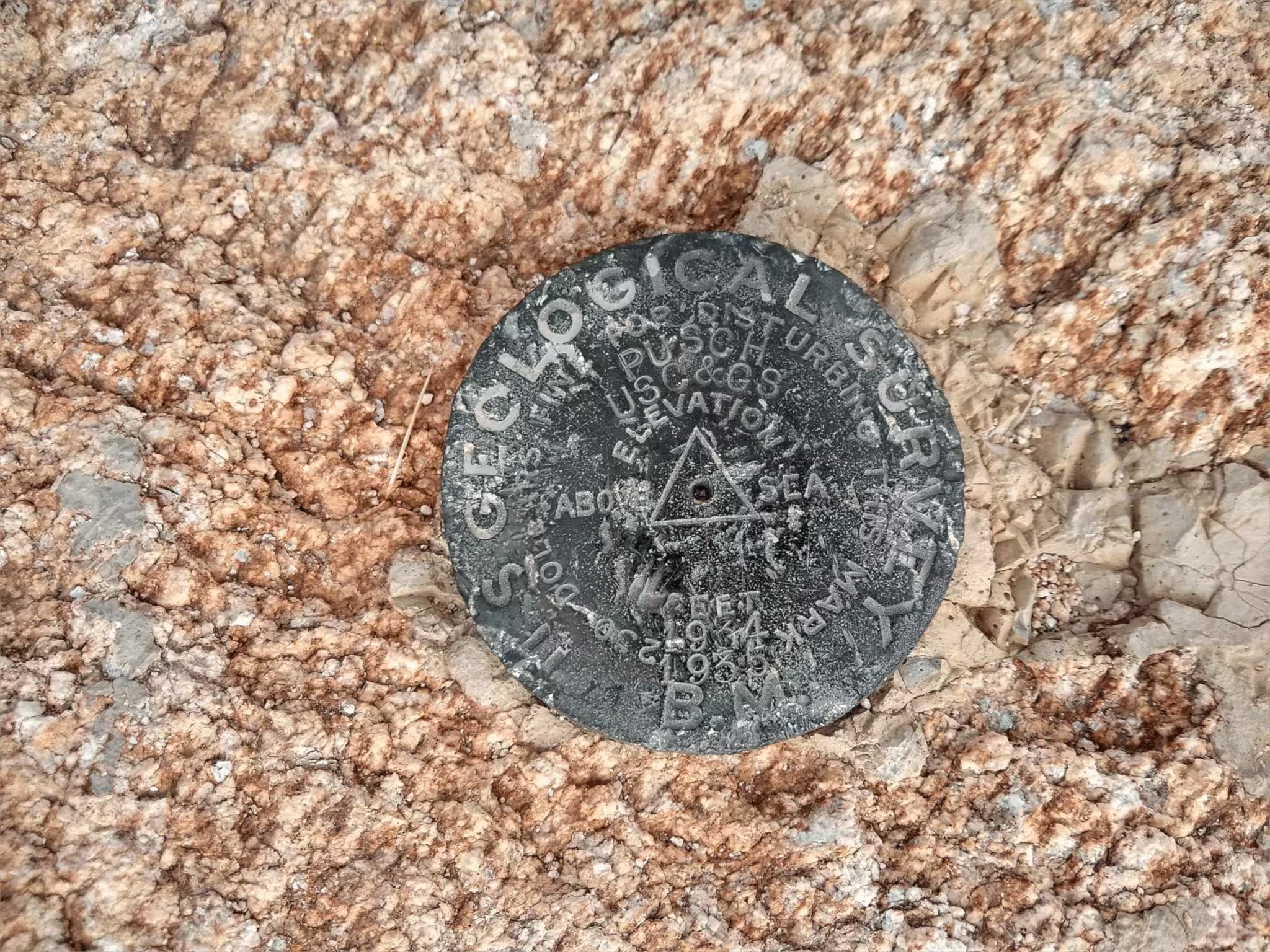
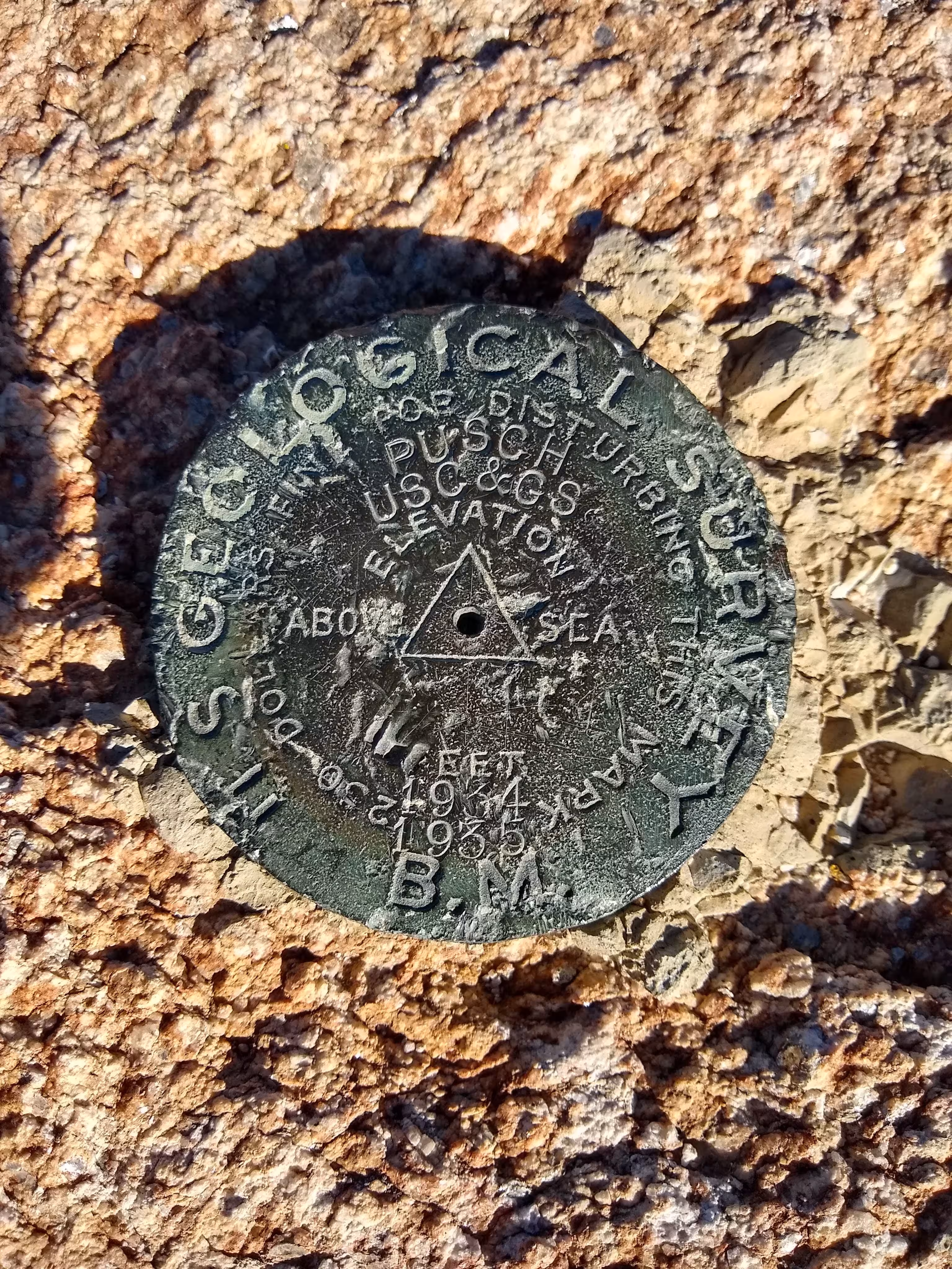
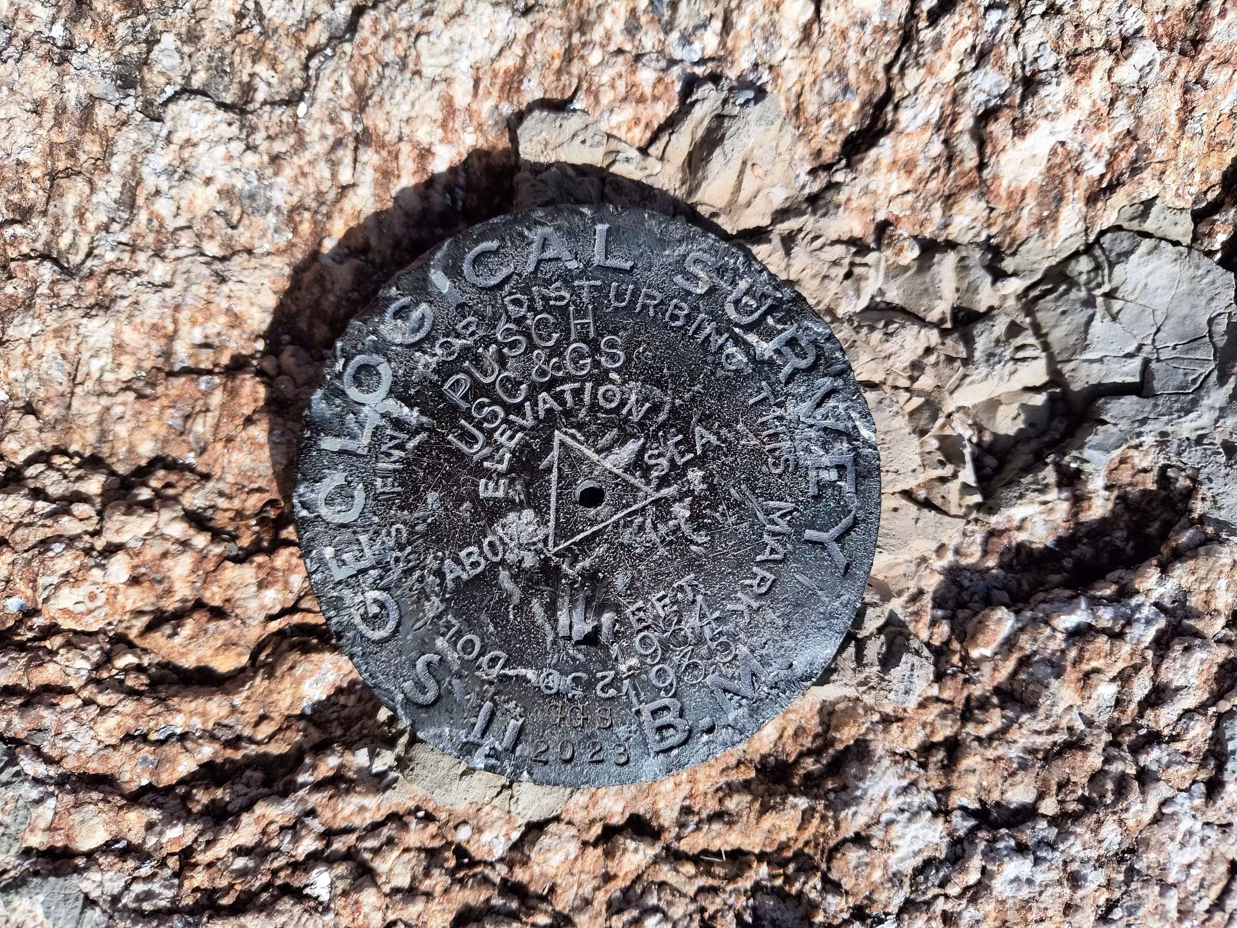
"PUSCH"
| NGS PointID: | CZ1865 |
| Reference Benchmarks: | PUSCH NO: 1, PUSCH NO: 2 |
| Azimuth Benchmark: | Q 19 |
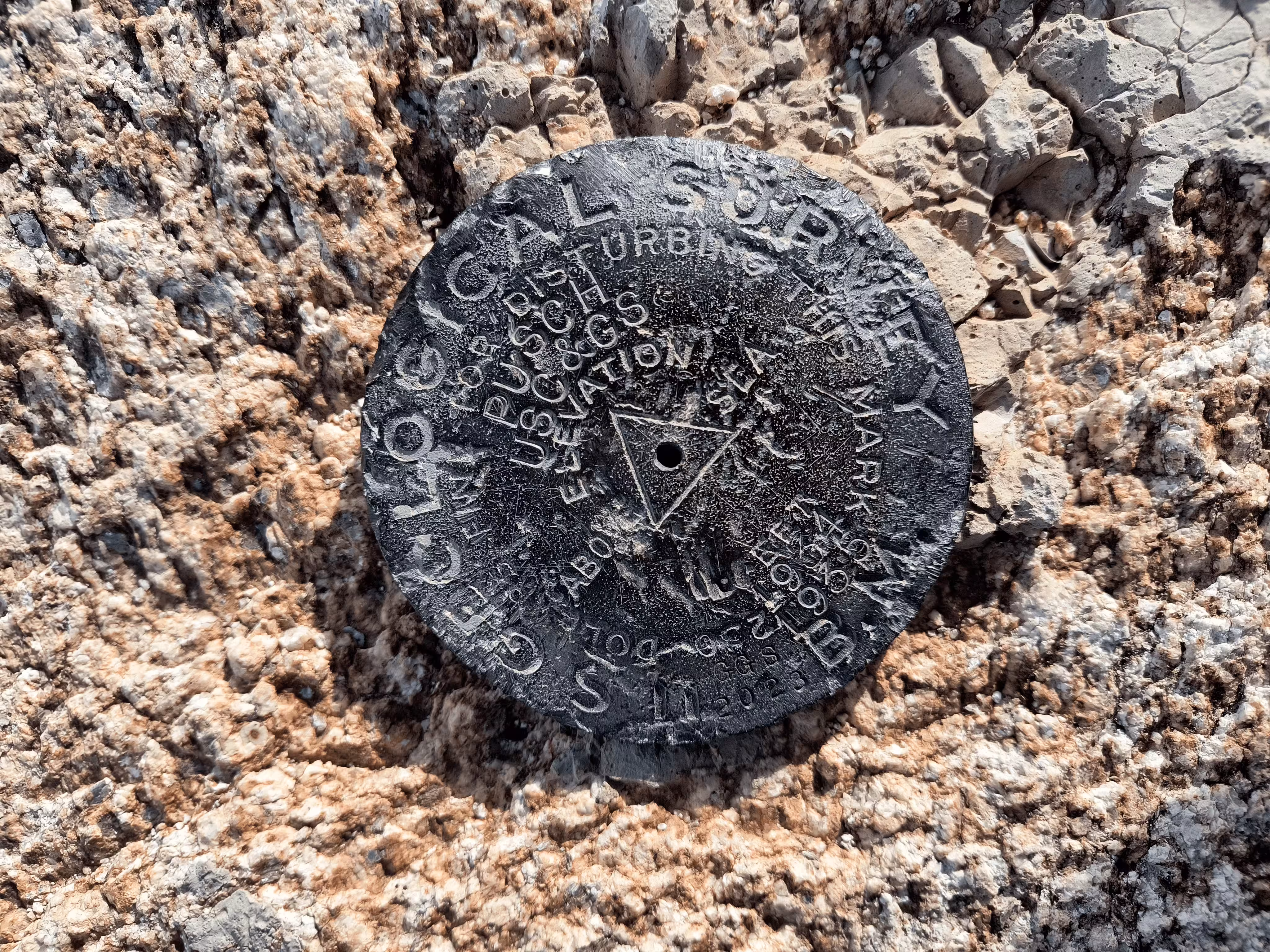
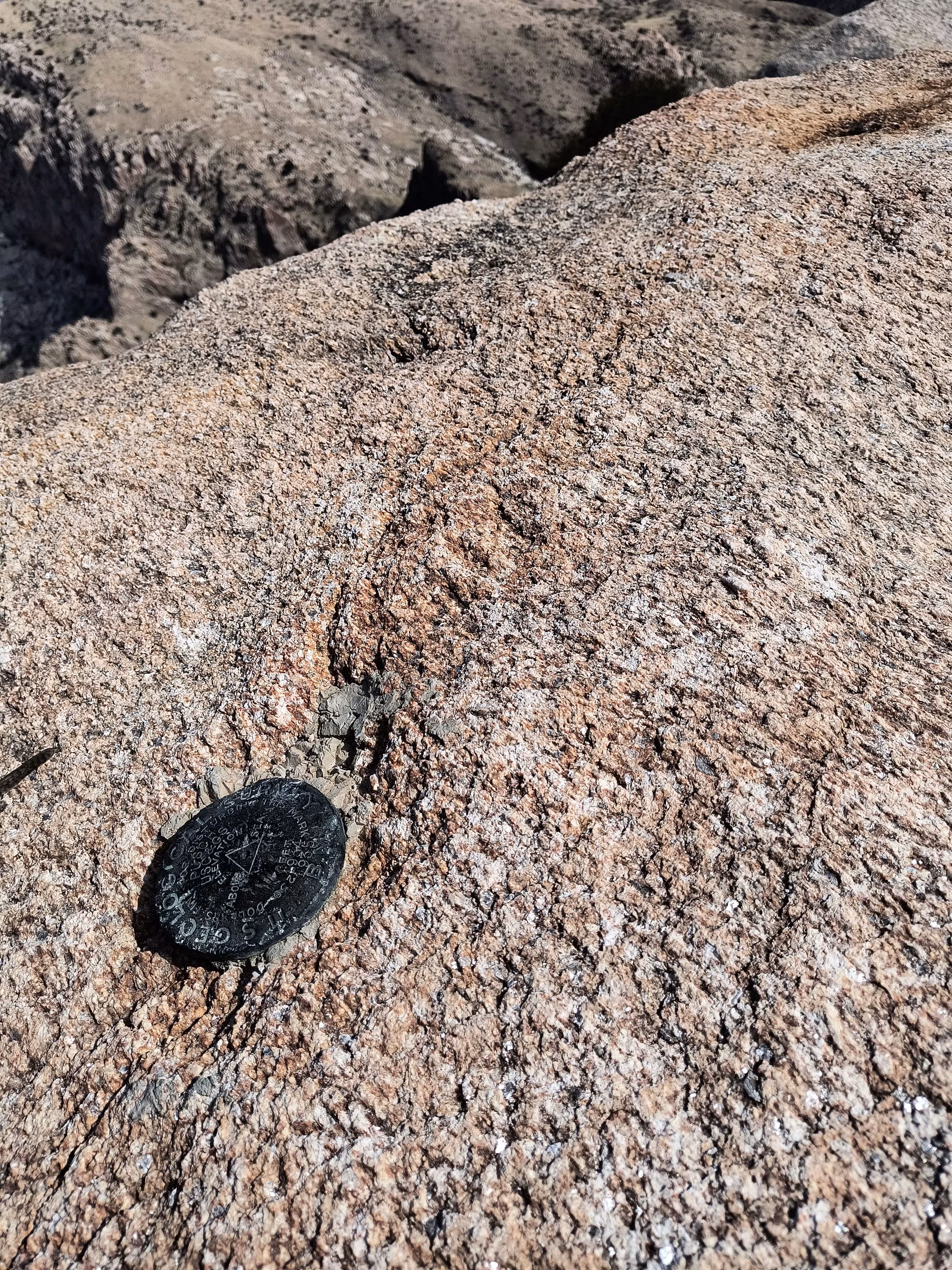
| Condition: | Intact, gashes and scratches present |
| Previous Stamping: | PUSCH USC&GS 1934 1935 |
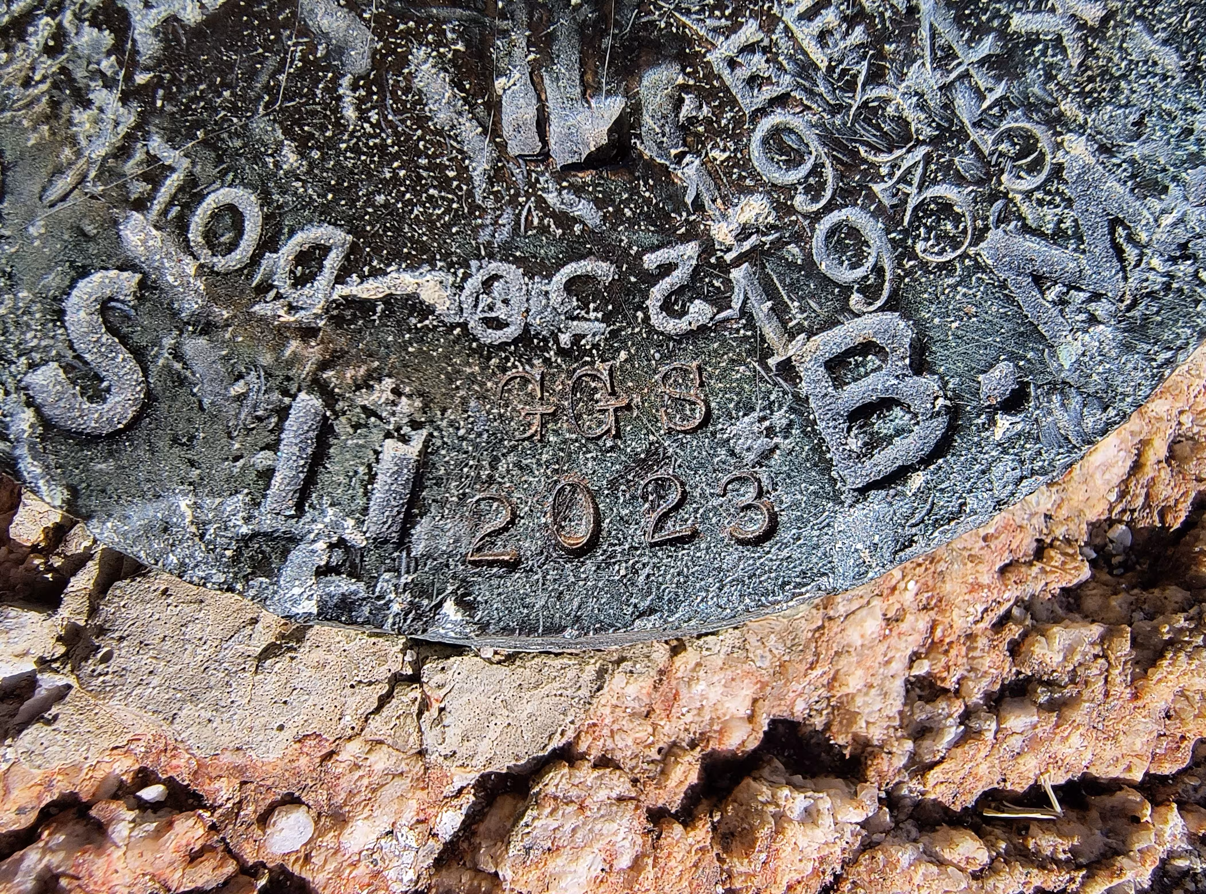
| Current Stamping: | PUSCH USC&GS 1934 1935 GGS 2023 |
| Coordinates: | 32.372008, -110.939097 |
| Elevation: | 5365 ft (1635.5 m) |
| Setting: | A rock outcrop |
| Monumentor: | USGS |
USGS Original Description:
On a sharp, white peak at the southwest end of the Santa Catalina Mountains, 2 miles southwest of steam pump on Pusch's ranch on the Tucson, Oracle and Mammoth road, 10 miles north of Tucson.
1935 Datasheet Description:
About 7 miles, air line, north of Tucson on the southwest end of the Catalina Mountains. The station mark is a standard U.S. Geological Survey disk set in drill hole in large boulder. Reference Mark NO. 1, a standard bronze reference disk, is 13.510 meters (44.32 feet) from station S 41 deg 47 min E. Reference Mark NO. 2, a standard bronze reference disk, is 16.550 meters (54.30 feet) from station S 76 deg 13 min W. The azimuth mark, a standard U.S. Coast and Geodetic Survey bench mark stamped Q 19 1933 is at the west side of highways 80 and 89 and at the northwest side of a road crossing, 0.85 mile north of the point of leaving the highway, 11 paces north of the los altos road center and 13 paces west of the center of highways 80 and 89. It is about 3 miles from station S 34 deg 50 min 10 sec W.
"PUSCH" is a benchmark monumented by the USGS in 1903 located in Pima County, Arizona. It has 2 reference marks and a non-dedicated azimuth.
Originally monumented in 1903 by the USGS to make the first USGS topographic maps of the Tucson area that were published in 1904, serving as the main azimuth mark for many of the old USGS benchmarks around the Tucson area. Originally, the benchmark had no reference marks.
However, it seems that in either 1934 or 1935, the USGS and USC&GS visted the benchmark. According to the USC&GS datasheet says that in 1935 the USGS recovered the station in good condtition and also provided a description involving measurements using the reference marks. Furthermore, in the USGS datasheet it says that the USC&GS and USGS both visited in 1935.
The stamping on the mark originally said, "PUSCH USC&GS 1934 1935". However more was added in 2023, "GGS 2023". The reference marks have similar stamping but on standard USC&GS reference disks, "PUSCH NO: 2 U.S.G.S 1934 1935".
I assume the original party of USC&GS surveyors marked the USGS mark PUSCH in 1934 and in 1935 the reference marks were placed, putting both dates on the reference marks in the typical format as if PUSCH was placed in 1934 and the reference marks in 1935. Or perhaps the station was being worked on during the turn of the year. The agency on the USGS disk designated that it is also a USC&GS station as well as a USGS one. The agency on the reference marks (now mark) shows that they are for the USGS disk. There are other cases of this practice but many have had the main disk lost. The station originally had no markings, like this benchmark in Sacramento, California, this benchmark in San Jose, California, this benchmark in Terlingua, Texas, this benchmark in Grand Canyon, Arizona, or this other benchmark in Grand Canyon, Arizona.
The best way to get to "PUSCH" is to start at the Linda Vista Trail head located on Linda Vista Road east of the interesction of Linda Vista Road and Oracle Road (AZ 77). (32.380722, -110.961139)
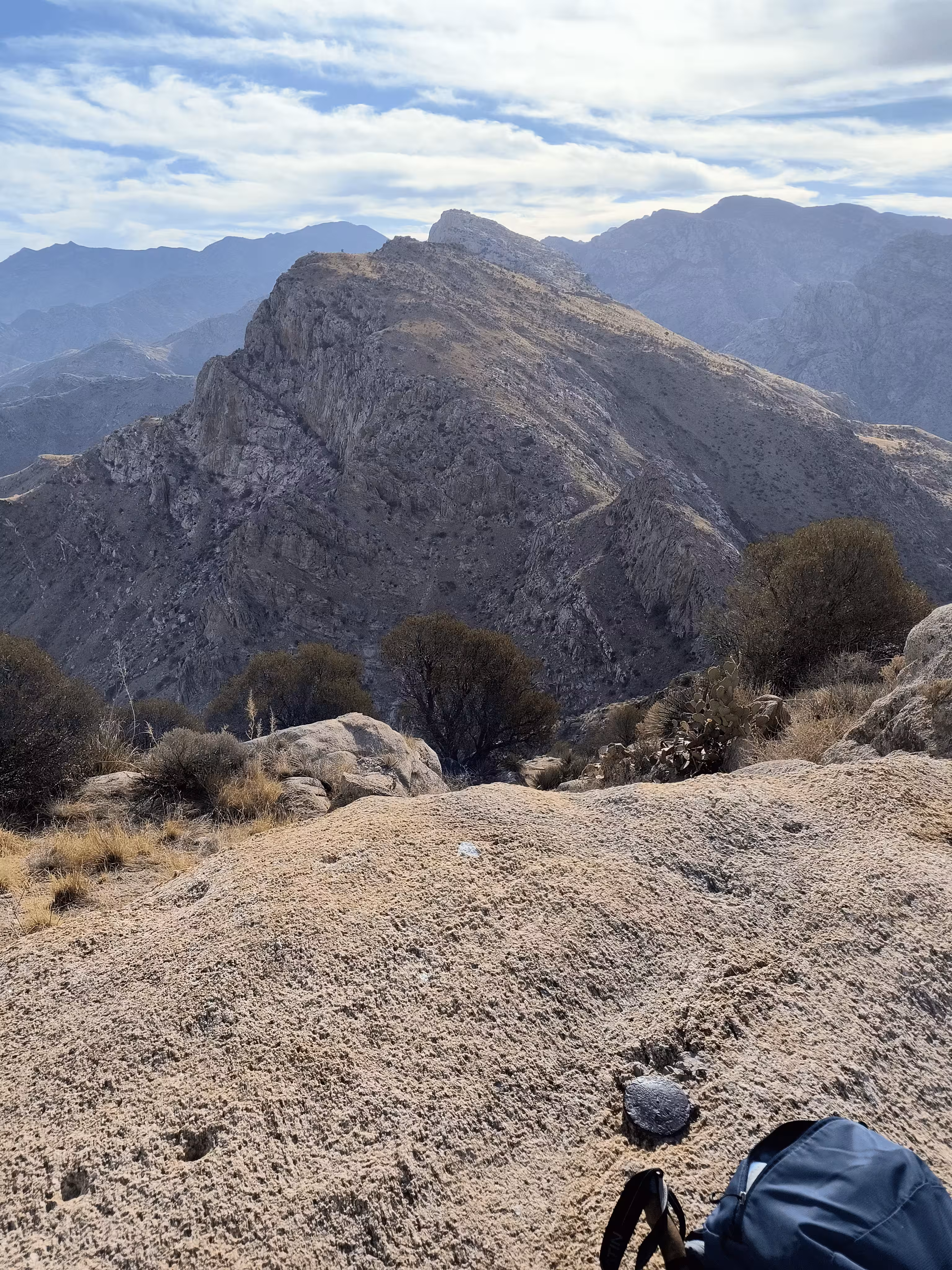
Follow the trail that follows the wash. The GPX track follows the whole route. Continue on the trail heading southeast until you intersect with another trail. Take a left for a short distance until a trail splits off to the right. Note the "NOT A FOREST SYSTEM TRAIL BEYOND THIS POINT" sign. You will tell why continuing the hike. Follow the steep trail until the summit of Pusch Peak. The benchmark disk is located on the rock outcrop the summit is located at. The benchmark is just below the summit.
"PUSCH NO: 1" was located 44.272 feet or 13.494 meters 138 degrees from the main benchmark. It was located just below the summit of a rock outcrop. It has been destroyed.
"PUSCH NO: 2" is located 54.140 feet or 16.502 meters 256 degrees from the main benchmark. It is located at a lower elevation than the main benchmark, on the summit of a rock outcrop, visible from the station.
"Q 19" has been destroyed.