Note that references are not shown due to convoluted information. | |
|
|
Main benchmarks recovered in good or poor condition. |
|
|
Main benchmarks that have been destroyed. |
|
|
Reference benchmarks recovered in good or poor condition. |
|
|
Reference benchmarks that have been destroyed. |
|
|
Azimuth benchmarks recovered in good or poor condition. |
|
|
Azimuth benchmarks that have been destroyed. |
|
|
A main, reference, or azimuth benchmark not searched for. |
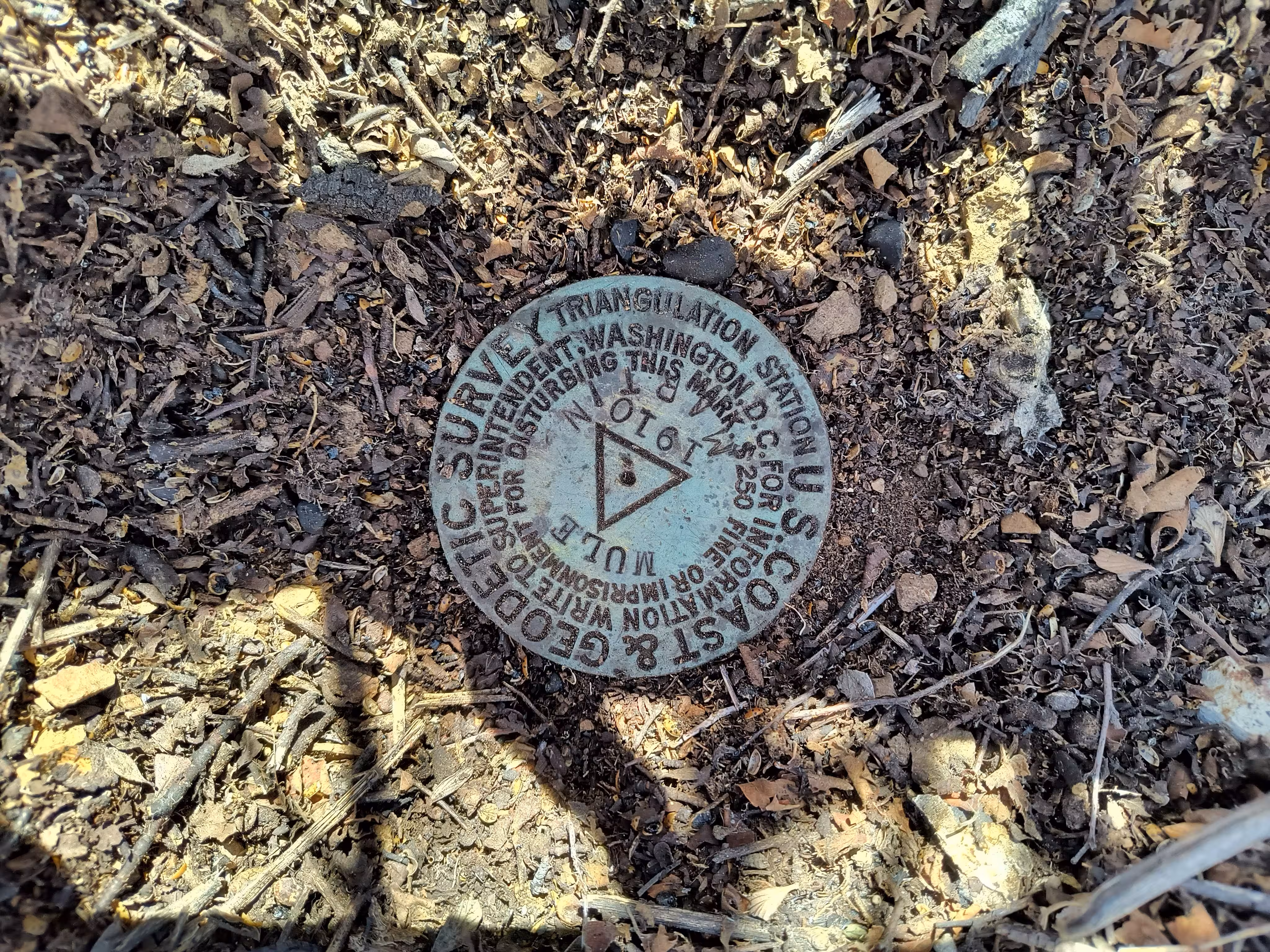
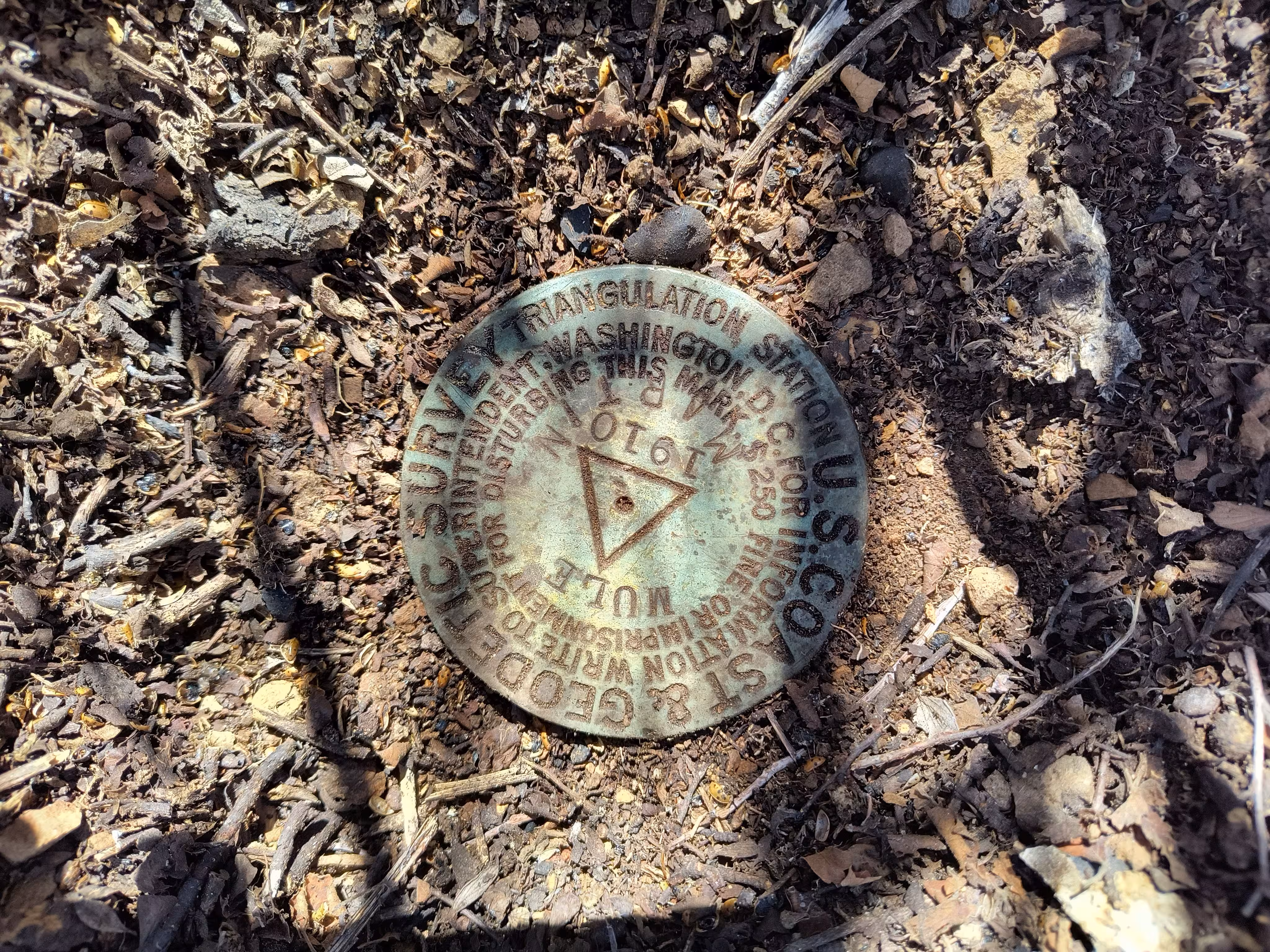
"MULE"
| NGS PointID: | CF0355 |
| Reference Benchmarks: | MULE RM 1, MULE RM 2, MULE NE CROSS, MULE SW CROSS |
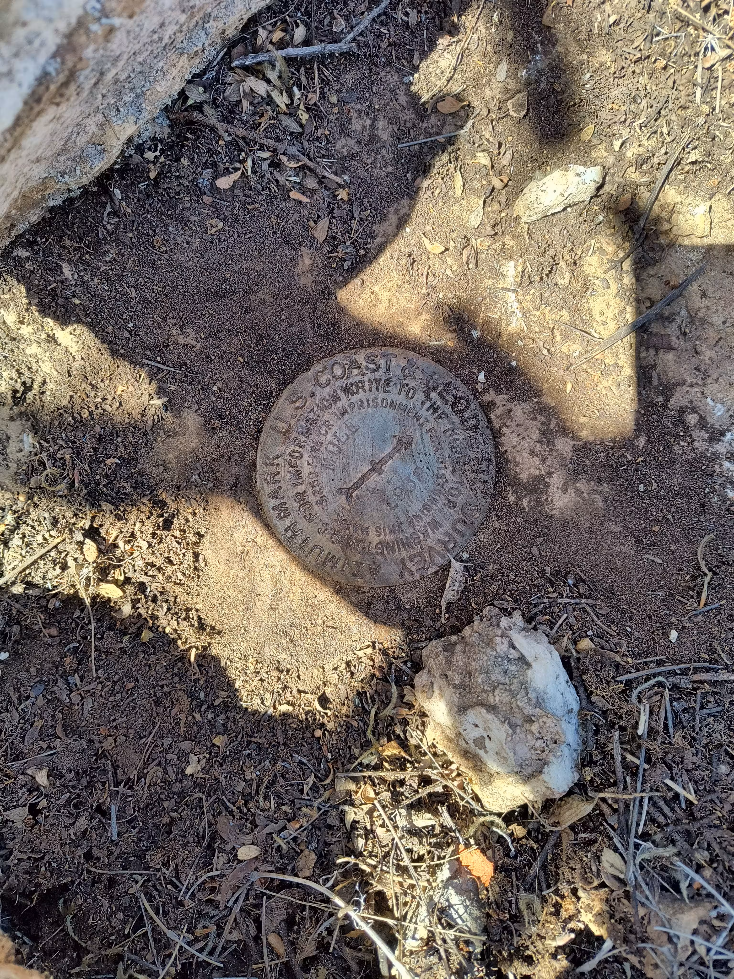
| Azimuth Benchmarks: | MULE 1936, MULE 1938 |
| Condition: | Minor ware |
| Stamping: | MULE 1910 |
| Coordinates: | 31.443703, -109.959247 |
| Elevation: | 7373.7 ft (2247.5 m) |
| Setting: | A 1 inch pipe secured to the ground with concrete |
| Monumentor: | USC&GS |
Datasheet Description:
This station is in approximately the same location as the United States Geological Survey station. It is on the SE and lower one of the two highest peaks of the mule mountains, 7-1/2 miles N, 5 deg W from Naco, 4 miles NW of Don Luis, and 2-1/2 miles W of Bisbee, towns on the El Paso and Southwestern Railroad. The station is marked by a standard disk station mark, cemented in the top of a 1-inch iron pipe, 18 inches long, which was driven down flush with the surface of the ground. The reference mark, a cross out in a ledge of rock with a one-half inch drill hole one-fourth of an inch deep at its center, is 5.79 meters from the station N 30 deg 36 min E.
Station recovered. Station mark in good condition. Reference mark, a drill hole in rock, barely discernible. New reference mark and azimuth mark established. Revised description as follows-- Reached from bisbee by U.S. Highway 80 NW up steep grade about 2 miles to summit. Thence follow old trail up ridge SW, following general course of soil conservation service fence, about 1-1/2 miles to summit and station. Station is near NW corner of flat summit, which has a large open grassy area on N slope. Can also be reached from summit of highway by left fork, old road, down s side of canyon about 1/2 mile. Thence left, up a side canyon about 1/2 mile to clevelands house. A trail leads to a mine a short distance NW of station.
Mark is a standard tablet in top of 1-inch iron pipe, driven flush with surface of ground, stamped MULE 1910. It was surrounded by a ring of flat rocks.
Reference mark 1910 is a shallow cross out on point of exposed ledge rock, with small drill hole at center. The rock has eroded until mark is hard to find.
Refernce mark 1936 is a standard tablet set in narrow exposed outcrop of rock SSW of station, on flat summit of mountain. It is slightly below level of grass, and may become covered. Stamped mule 1910 1936.
Azimuth mark is standard tablet set in solid rock on SW rim of ridge lying NE of U.S. Highway 80. Reached from summit of highway by steep road to right. Follow this road 1.0 mile to end of grade. Continue NW on trail 0.15 mile to government fence. Continue W 0.25 mile, and azimuth mark is 28 paces S of road, on a large rock outcrop, about 40 yards N of point where mountain slopes steeply to S, and 5 feet W of a small rock cairn. Stamped MULE 1910 1936.
Reference mark no. 1, was established and is stamped 1938.
Azimuth mark, is about 0.2 mile SSW of the station on the first hill which is about 150 feet lower than the station.
"MULE" is a benchmark monumented by the USC&GS in 1910 in Cochise County, Arizona. It has 4 reference marks (2 disks, 2 markings in rock) and two dedicated azimuths.
The best way to get to "MULE" from Mule Pass is to follow the social trail to Mount Ballard. From the main bare summit of the peak, go to coordinates of benchmark, located to the north.
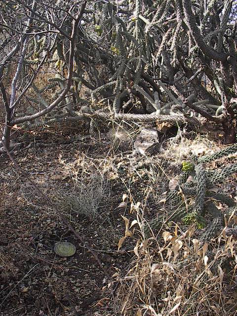
The benchmark is under a single rock at ground level. See this picture for a general idea of the surroundings. I didn't take one, sorry.
"MULE 1936" is the original azimuth mark placed in 1936 located 29 degrees from the main benchmark. It is located on a very open large rock outcrop, 1.93 miles (3.11 kilometers) from the station.
"MULE 1938" is the second azimuth mark placed in 1938 located 203 degrees from the main benchmark. It is located on the summit of the nearest hill southwest of the benchmark, .16 miles (.25 kilometers) from the station.