|
|
Main benchmarks recovered in good or poor condition. |
|
|
Main benchmarks that have been destroyed. |
|
|
Reference benchmarks recovered in good or poor condition. |
|
|
Reference benchmarks that have been destroyed. |
|
|
Azimuth benchmarks recovered in good or poor condition. |
|
|
Azimuth benchmarks that have been destroyed. |
|
|
A main, reference, or azimuth benchmark not searched for. |
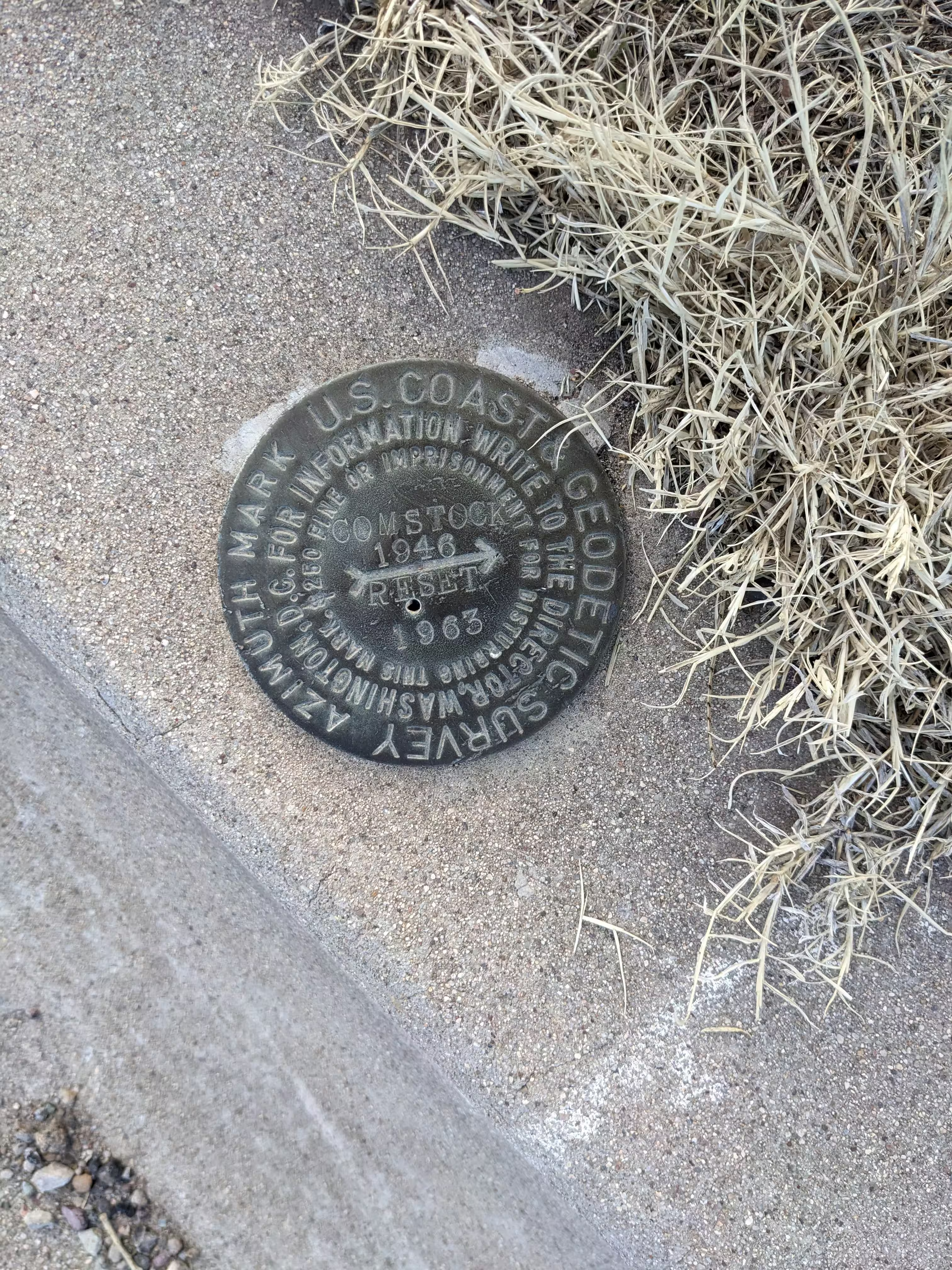
"COMSTOCK RESET Azimuth"
| NGS PointID: | CC7186 |
| Reference Benchmarks: | COMSTOCK, COMSTOCK NO 1, COMSTOCK NO 2 |
| Condition: | Large gashes and scratches. |
| Stamping: | COMSTOCK 1946 RESET 1963 |
| Coordinates: | 31.716148, -110.070689 |
| Elevation: | 4509.12 ft (1374.38 m) |
| Setting: | A rock outcrop |
| Monumentor: | USC&GS |
Datasheet Description:
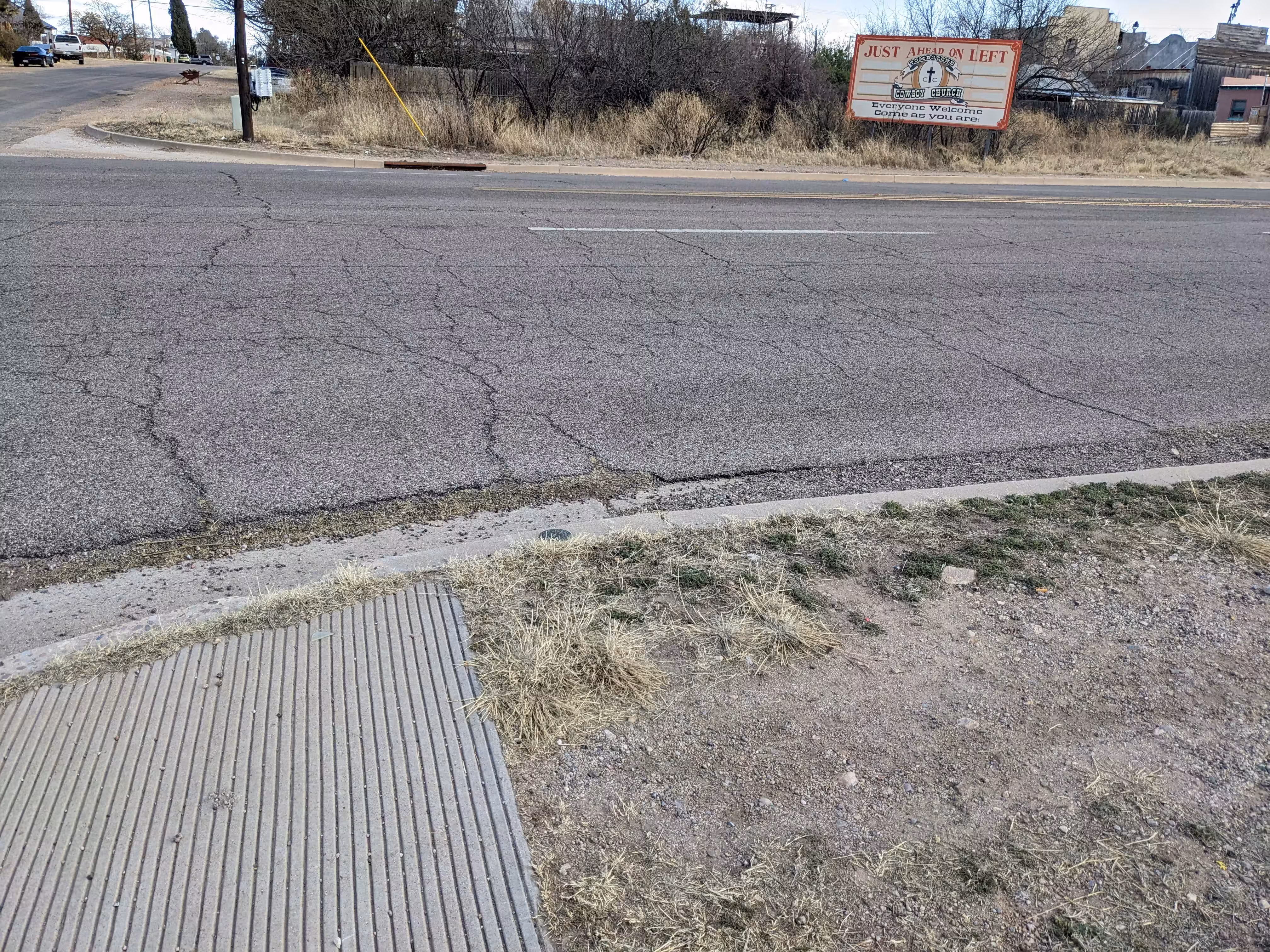
The new azimuth mark could not be set on line since a power line has been constructed with a pole exactly on line between the station and the azimuth mark. The reset azimuth mark can be located by the original description, however, it is now set on the same side of the highway in a new concrete curb and not in a headwall as previously. The old mark was not removed and has since been buried in the new highway fill. Airline distance and direction from nearest town--Ltr of Arizona Hwy Dept. Dated may 20, 1964--
"COMSTOCK RESET" is a benchmark monumented by the ADOT in 1963 located in Cochise County, Arizona. It is a dedicated azimuth mark for COMSTOCK.
The reset azimuth mark is located on the curb at AZ 80 and Safford Street. The original azimuth mark is under the highway fill after the highway was expanded.