|
|
Main benchmarks recovered in good or poor condition. |
|
|
Main benchmarks that have been destroyed. |
|
|
Reference benchmarks recovered in good or poor condition. |
|
|
Reference benchmarks that have been destroyed. |
|
|
Azimuth benchmarks recovered in good or poor condition. |
|
|
Azimuth benchmarks that have been destroyed. |
|
|
A main, reference, or azimuth benchmark not searched for. |
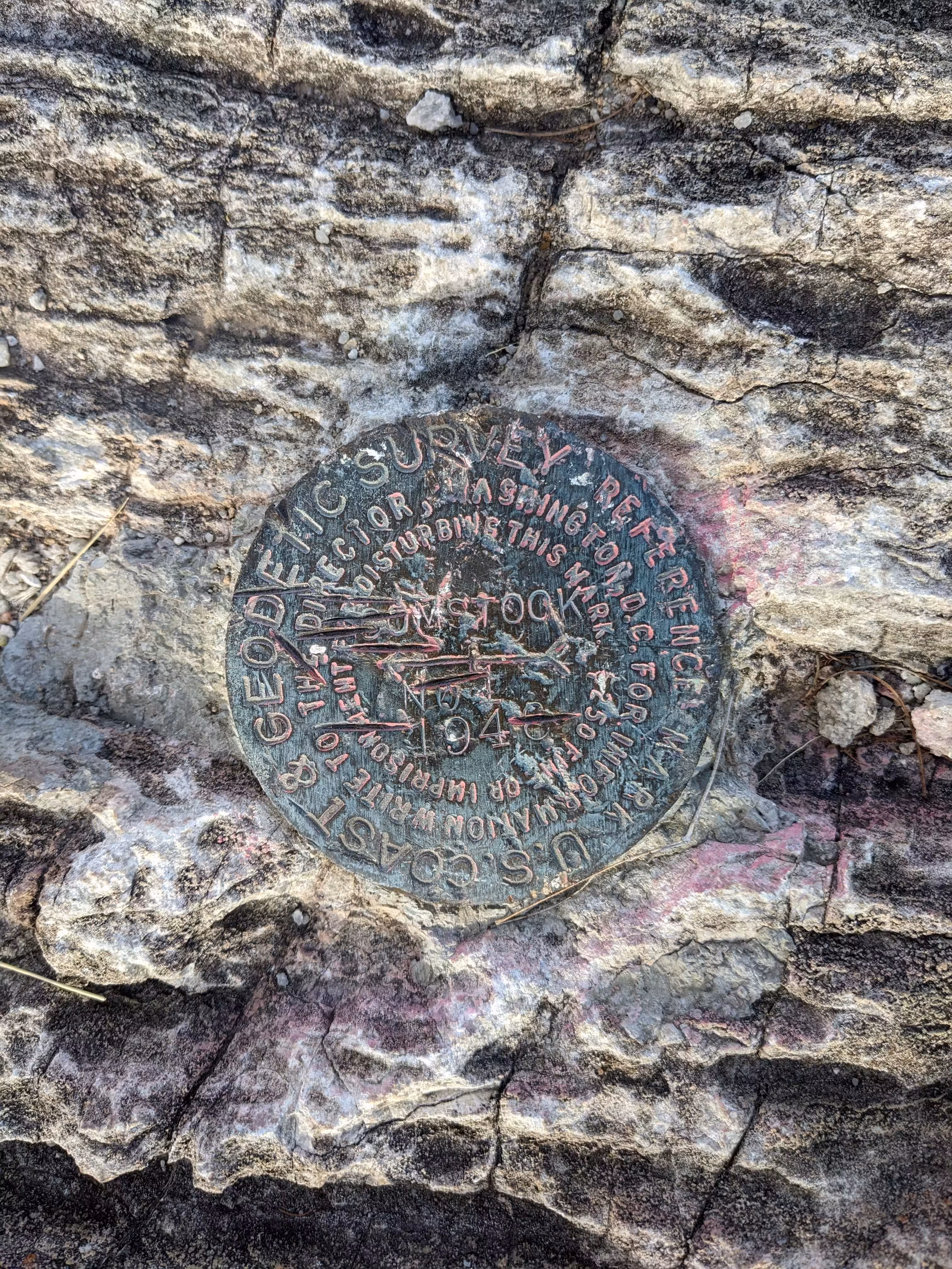
"COMSTOCK NO 1"
| NGS PointID: | CC7187 |
| Reference Benchmarks: | COMSTOCK, COMSTOCK NO 2 |
| Azimuth Benchmark: | COMSTOCK RESET |
| Condition: | Large gashes and scratches. |
| Stamping: | COMSTOCK NO 1 1946 |
| Coordinates: | 31.719608, -110.073967 |
| Elevation: | 4592.55 ft (1399.81 m) |
| Setting: | A rock outcrop |
| Monumentor: | USC&GS |
Datasheet Description:
Reference mark 1 is a bronze reference disk, stamped COMSTOCK 1946 NO 1, and is set flush in outcropping bedrock. It projects about 3 inches above the ground and is about 12 inches lower than station.
"COMSTOCK NO 1" is a benchmark monumented by the USC&GS in 1946 located in Cochise County, Arizona. It is a dedicated reference mark for COMSTOCK.
The best way to get to "COMSTOCK" is to walk up the hiking path from Safford Street which leads to the top of the hill. The benchmark is in a clearing on the northeast side of the old basin.
"COMSTOCK NO 1" is located 19.360 feet or 5.901 meters 118 degrees from the main benchmark. It is located below the station in the same clearing.