|
|
Main benchmarks recovered in good or poor condition. |
|
|
Main benchmarks that have been destroyed. |
|
|
Reference benchmarks recovered in good or poor condition. |
|
|
Reference benchmarks that have been destroyed. |
|
|
Azimuth benchmarks recovered in good or poor condition. |
|
|
Azimuth benchmarks that have been destroyed. |
|
|
A main, reference, or azimuth benchmark not searched for. |
"COMSTOCK"
| NGS PointID: | CG0960 |
| Reference Benchmarks: | COMSTOCK NO 1, COMSTOCK NO 2 |
| Azimuth Benchmark: | COMSTOCK RESET |
| Condition: | Large scratches present. |
| Stamping: | COMSTOCK ASA 762 1962 |
| Coordinates: | 31.719633, -110.074021 |
| Elevation: | 4595.34 ft (1400.66 m) |
| Setting: | Rock outcrop |
| Monumentor: | USC&GS |
Datasheet Description:
Station is located on a low prominent hill, on the NW edge of Tombstone, and just W across U.S. Highway 80 and railroad tracks from boothill graveyard. The hill is shown on U.S. Geological Survey charts as comstock hill.
To reach station from post office in tombstone, go n on u.s. Highway 80 for 0.4 mile to the boothill motel and west side store and turn left on the first track road after passing the store (about 50 yards and immediately at the end of the curve in the highway). (The azimuth mark is located 0.05 mile beyond this point on highway.) After turning left on dirt road, go 0.1 mile to fork. Take left fork across railroad tracks and then keep second fork from right and go 0.15 mile to wire gate after passing to the right of tin shacks. Pass through, turn right and follow dim tracks for 0.15 mile to top of hill and station site.
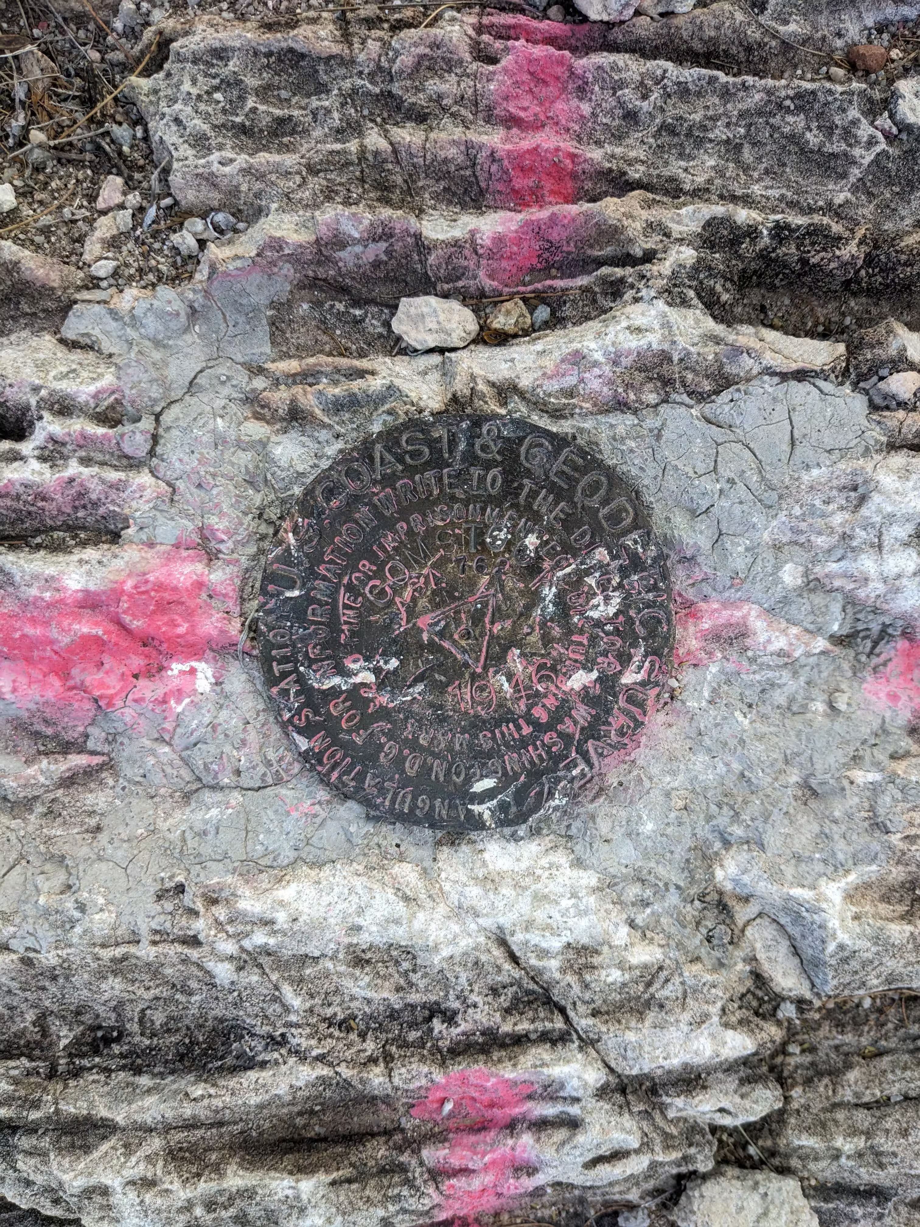
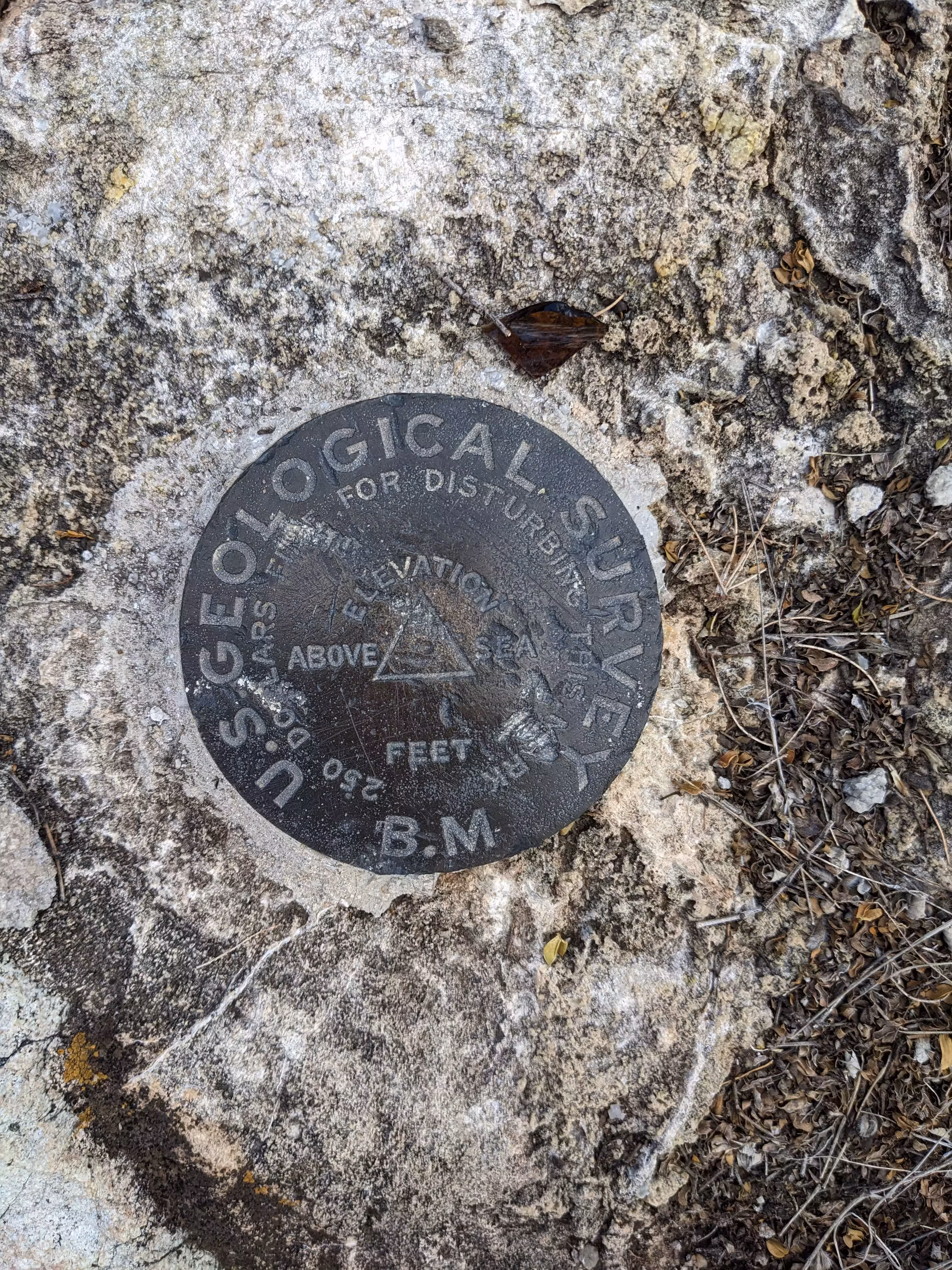
The station mark is a bronze station disk, stamped COMSTOCK 1946, and set flush in outcropping bedrock that is flush with the surrounding ground. It is located 14.8 feet N of an old lamppost and 6.1 feet NE of the NE arc of a circular curb.
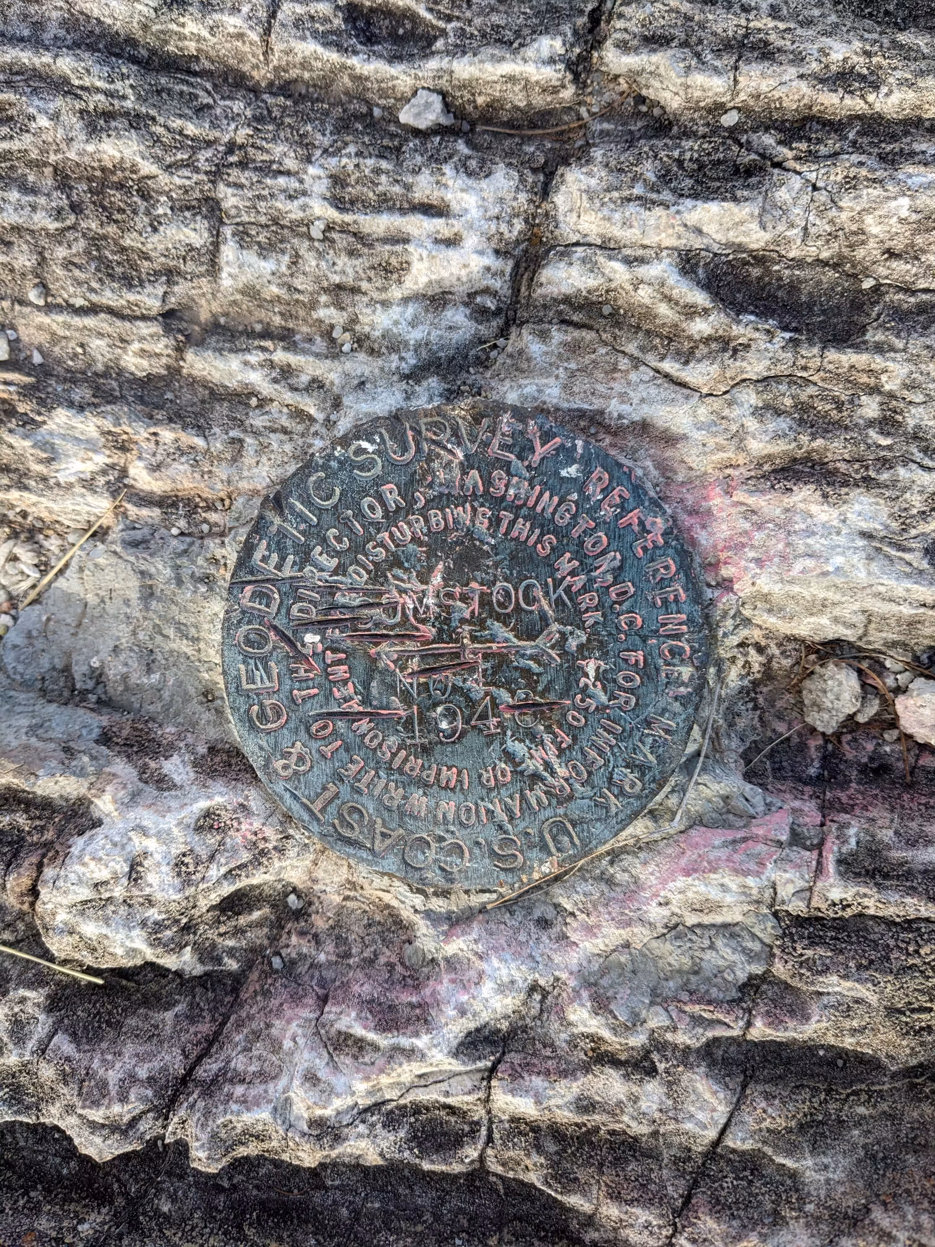
Reference mark 1 is a bronze reference disk, stamped COMSTOCK 1946 NO 1, and is set flush in outcropping bedrock. It projects about 3 inches above the ground and is about 12 inches lower than station.
Reference mark 2 is a bronze reference disk, stamped COMSTOCK 1946 NO 2, and is set in outcropping bedrock that projects about 14 inches on the high side and 2 inches on the lower side. It is about 12 inches higher than station.
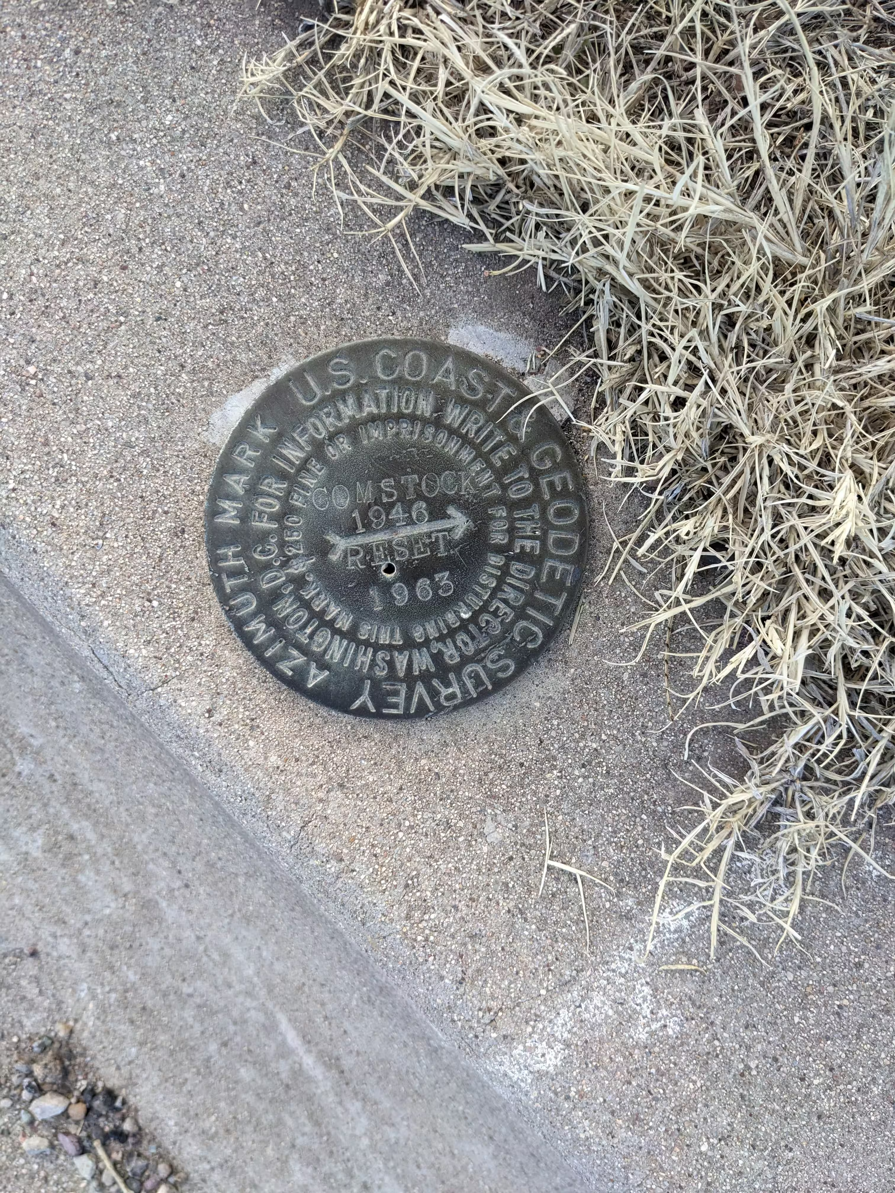
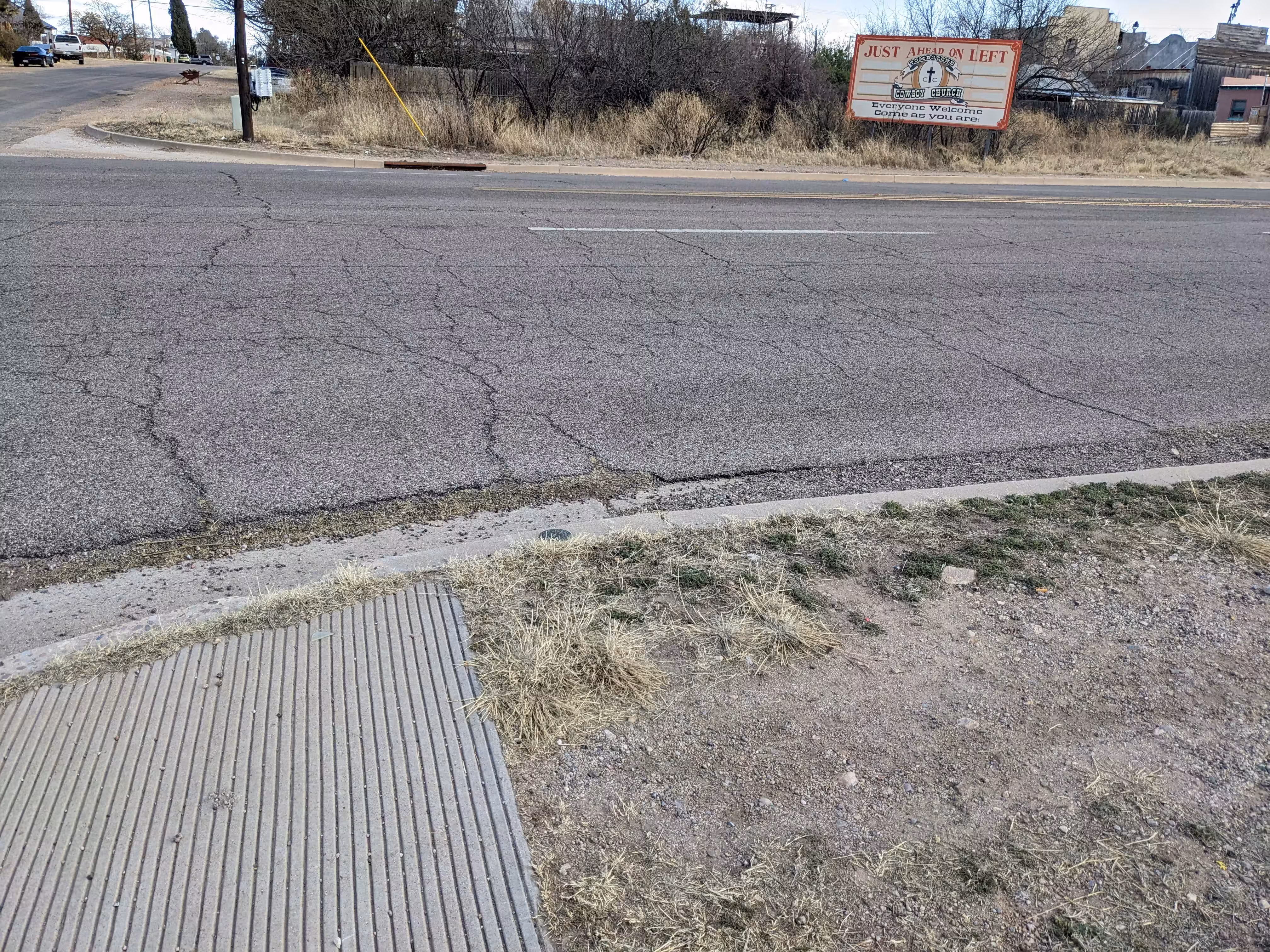
The azimuth mark is a bronze azimuth disk, stamped COMSTOCK 1946, and is set in a 7-foot concrete culvert 2.2 feet from the N end. It is located at the junction of U.S. Highway 80 and Safford Street, on the W side of the highway, and is about 1/2 mile SE of station by airline.
Height of light above station mark - 1.3 meters.
"COMSTOCK" is a benchmark monumented by the USC&GS in 1946 located in Cochise County, Arizona. It has 2 dedicated reference marks and a dedicated azimuth mark.
The best way to get to "COMSTOCK" is to walk up the hiking path from Safford Street which leads to the top of the hill. The benchmark is in a clearing on the northeast side of the old basin.
"COMSTOCK NO 1" is located 19.360 feet or 5.901 meters 118 degrees from the main benchmark. It is located below the station in the same clearing.
"COMSTOCK NO 2" is theoretically located 44.744 feet or 13.638 meters 252 degrees from the main benchmark. It is theoretically located 1 foot above the station. It would be located near the nearby USGS benchmark.
The reset azimuth mark is located on the curb at AZ 80 and Safford Street. The original azimuth mark is under the highway fill after the highway was expanded.