|
|
Main benchmarks recovered in good or poor condition. |
|
|
Main benchmarks that have been destroyed. |
|
|
Reference benchmarks recovered in good or poor condition. |
|
|
Reference benchmarks that have been destroyed. |
|
|
Azimuth benchmarks recovered in good or poor condition. |
|
|
Azimuth benchmarks that have been destroyed. |
|
|
A main, reference, or azimuth benchmark not searched for. |
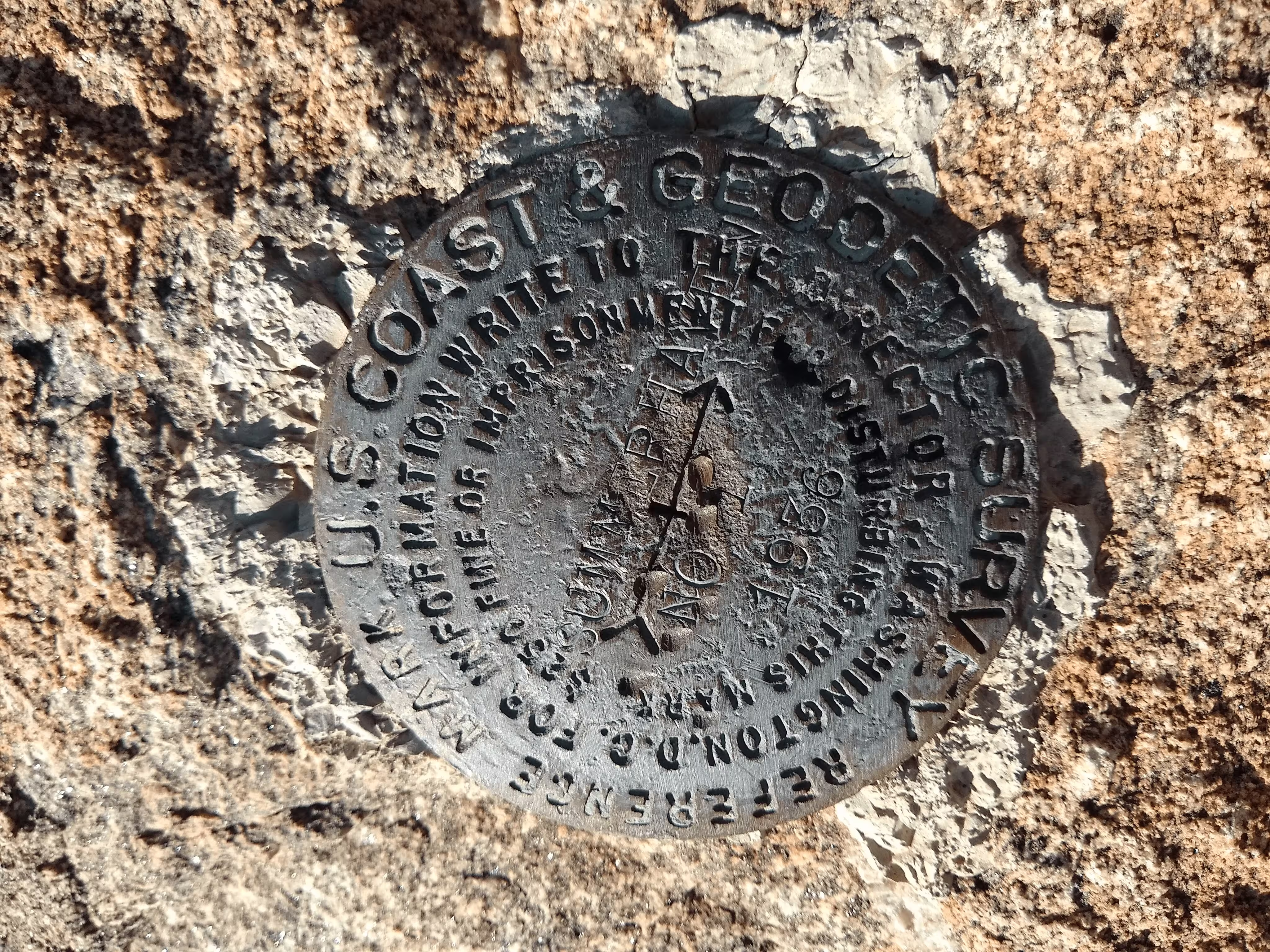
"SUMMERHAVEN NO 1"
| NGS PointID: | CC8320 |
| Reference Benchmarks: | SUMMERHAVEN, SUMMERHAVEN NO 2, |
| Azimuth Benchmark: | SUMMERHAVEN AZ MK |
| Condition: | Ware and minor pieces punched out of disc. |
| Stamping: | SUMMERHAVEN NO 1 1936 |
| Coordinates: | 32.453494, -110.753669 |
| Elevation: | 8067.01 ft (2458.83 m) |
| Setting: | A rock outcrop |
| Monumentor: | USC&GS |
Datasheet Description:
R.M. No. 1 Is wsw of the station and projects about 3 feet above ground.
"SUMMERHAVEN NO 1" is a benchmark monumented by the USC&GS in 1936 located in Pima County, Arizona. It is a dedicated reference mark for SUMMERHAVEN.
The best way to get to "SUMMERHAVEN" is to start at the Arizona Trail and Mount Lemmon Road. From there, pack north along the Arizona trail until a saddle. From here, follow the ridgeline to the station. There is a fence that runs along the ridge but does not need to be crossed.
"SUMMERHAVEN NO 1" is located 10.715 feet or 3.266 meters 239 degrees from the main benchmark. It is located at about the same elevation as the station.