|
|
Main benchmarks recovered in good or poor condition. |
|
|
Main benchmarks that have been destroyed. |
|
|
Reference benchmarks recovered in good or poor condition. |
|
|
Reference benchmarks that have been destroyed. |
|
|
Azimuth benchmarks recovered in good or poor condition. |
|
|
Azimuth benchmarks that have been destroyed. |
|
|
A main, reference, or azimuth benchmark not searched for. |
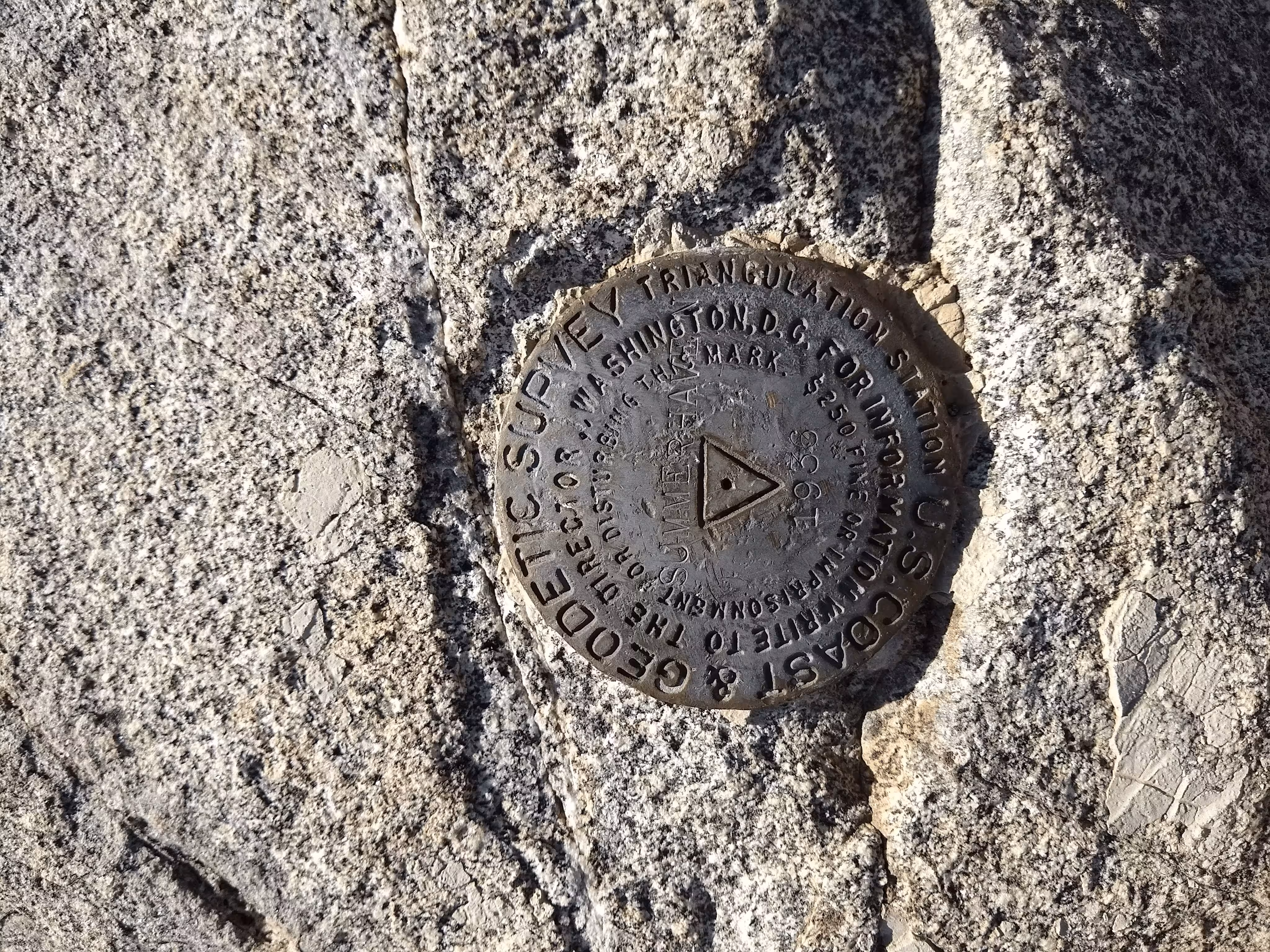
"SUMMERHAVEN"
| NGS PointID: | CZ1857 |
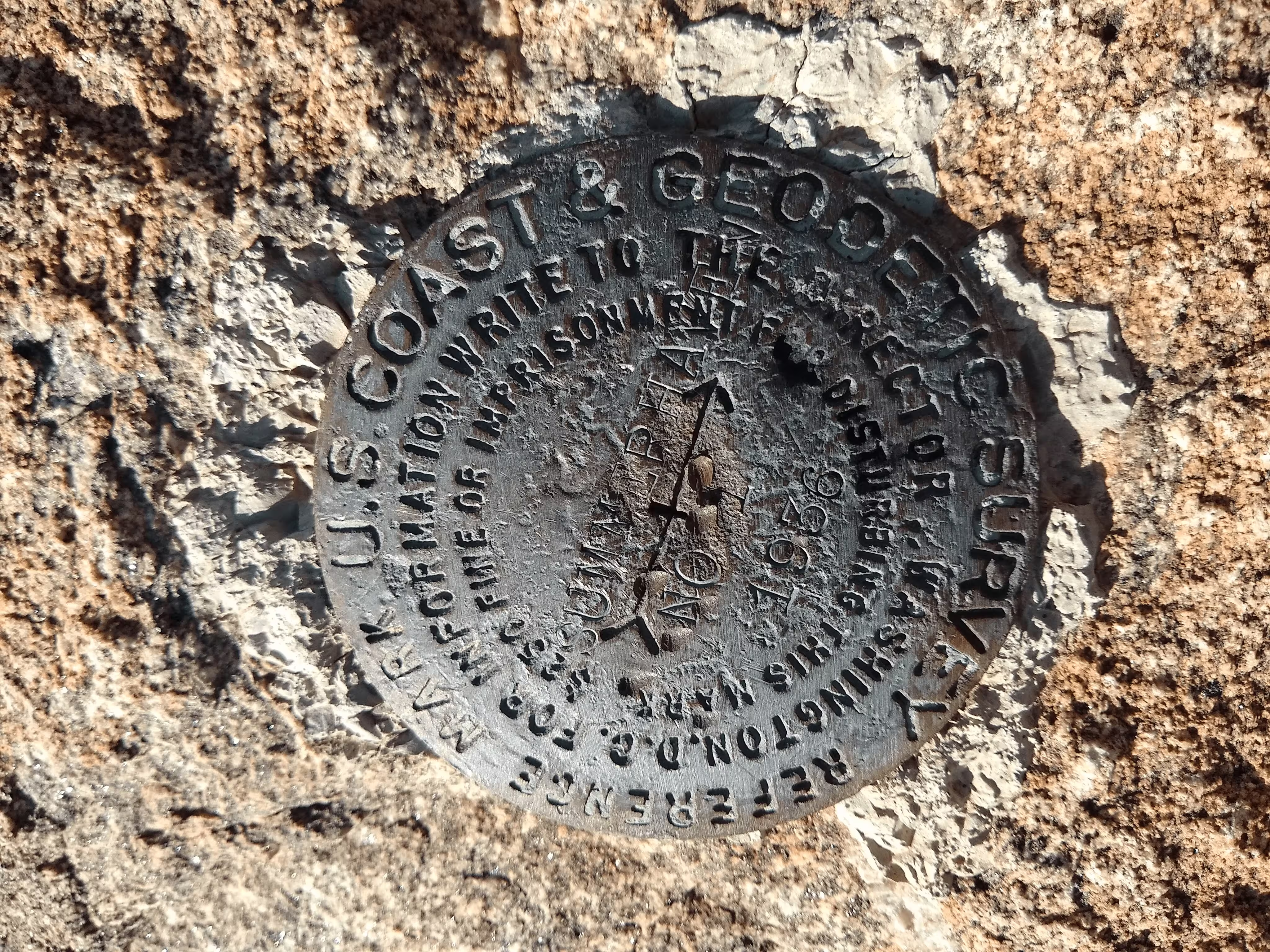
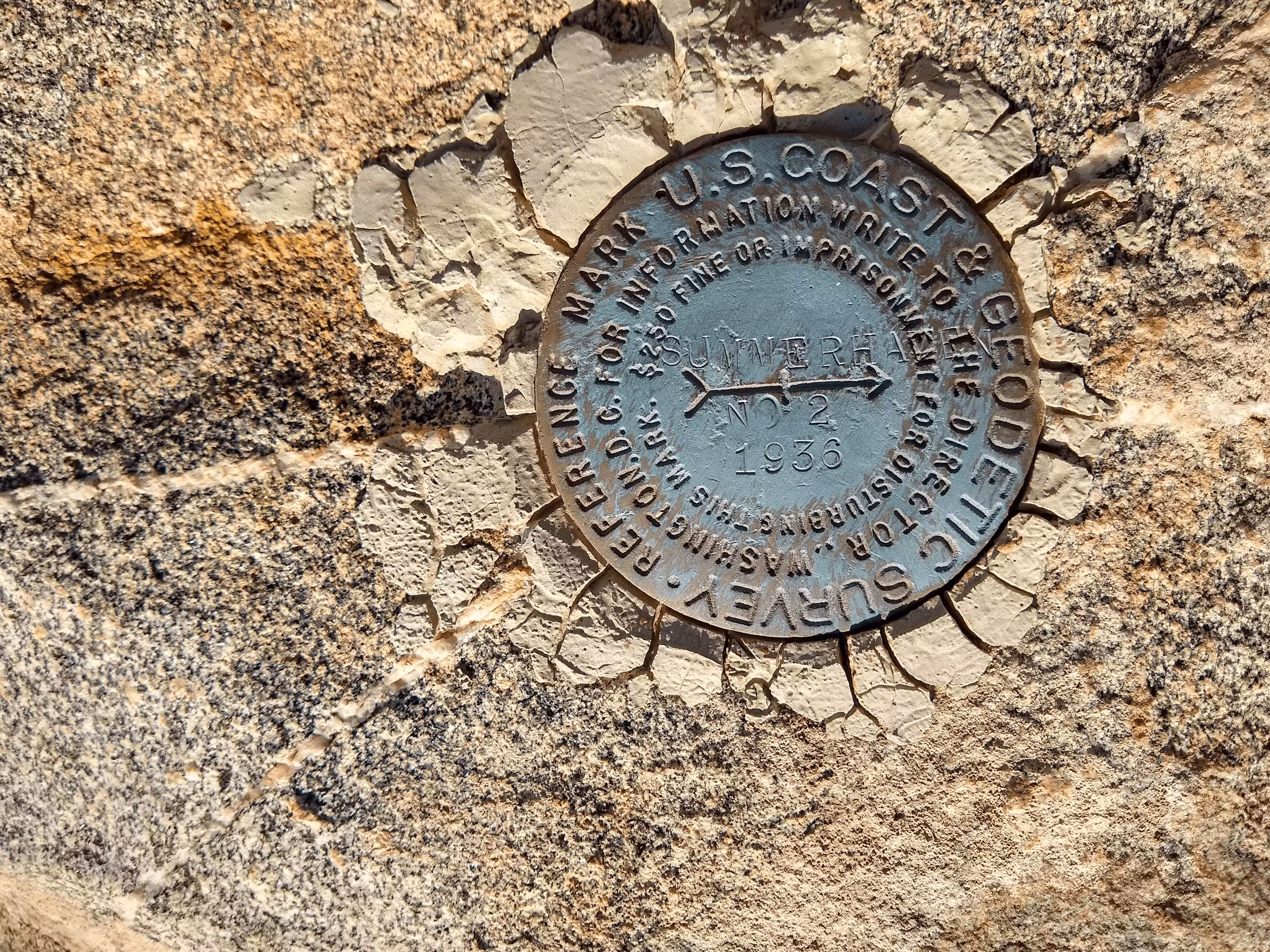
| Reference Benchmarks: | SUMMERHAVEN NO 1, SUMMERHAVEN NO 2, |
| Azimuth Benchmark: | SUMMERHAVEN AZ MK |
| Condition: | Ware is present. |
| Stamping: | SUMMERHAVEN 1936 |
| Coordinates: | 32.453509, -110.753638 |
| Elevation: | 8077.4 ft (2462.0 m) |
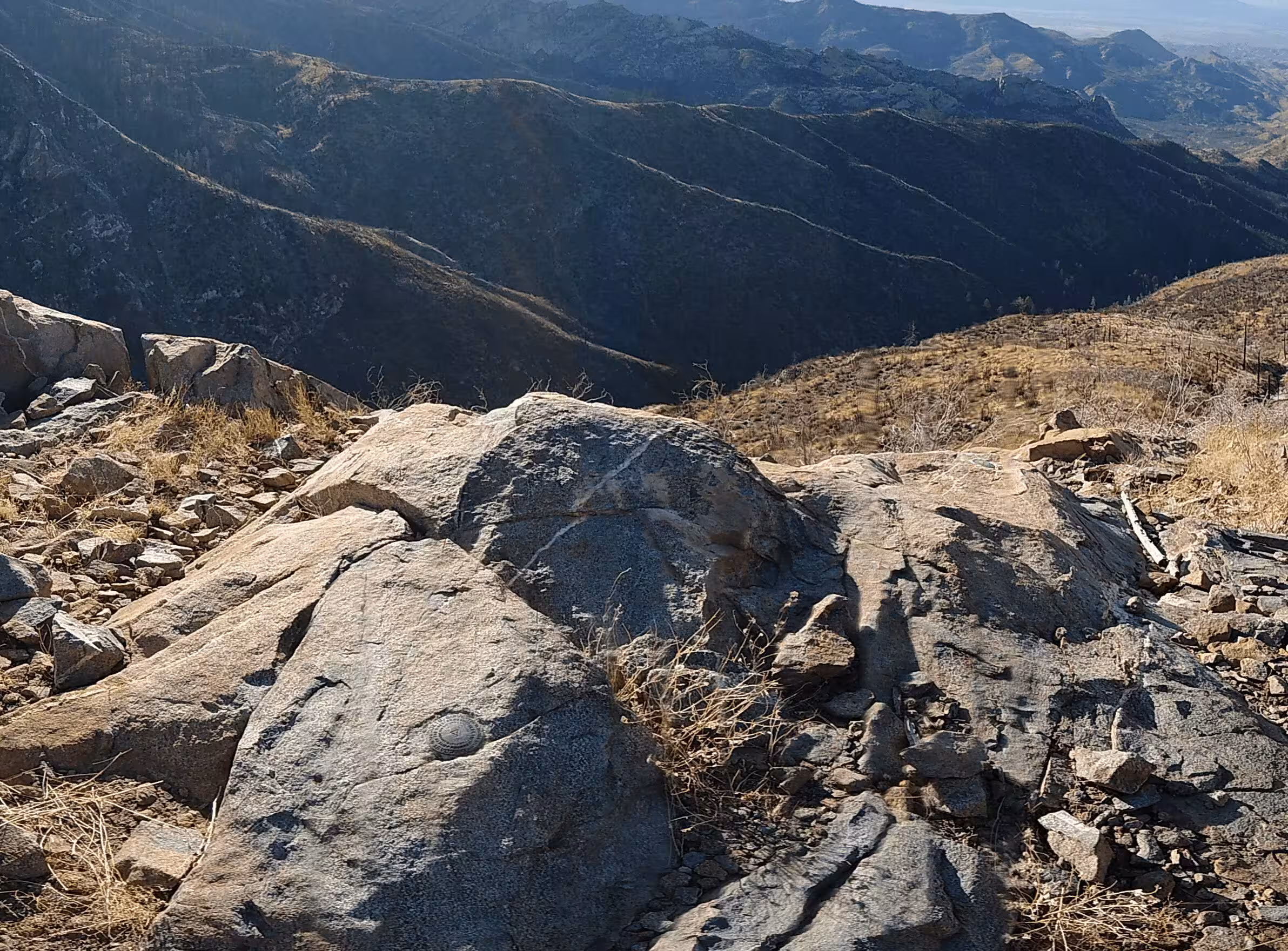
| Setting: | A rock outcrop |
| Monumentor: | USC&GS |
Datasheet Description:
The station is on the S and highest end of the Oracle Ridge, 11 miles S and 1/2 mile E of the town of Oracle. R.M. No. 1 Is WSW of the station and projects about 3 feet above ground. R.M. No. 2 Is NNW of the station and is flush with the ground. The azimuth mark is about 0.3 mile SSW of the station, on the w slope of a ridge about 30 yards E of a spruce tree with a square blaze on it. This tree is about 0.1 mile S of a cattle guard and 0.3 mile S of a pine tree with a triangle blazed on it and 60 feet E of the Summerhaven Road in a boulder projecting about 2 feet above the ground. All objects visible from a 4-foot stand. Station can be reached from Oracle by going on the Summerhaven Road for about 20 miles to the danger arch on the controlled mountain road. Continue on this road for 6.1 miles to a 10-inch triangular blaze on a 30-inch pine tree which is very near the top of a saddle on the ridge. This is the end of truck travel. The station is on the first rocky hill to the n of the saddle, about a 20-minute pack. The station is on the s end of the hill on the W side of the ridge falling rapidly to the W.
"SUMMERHAVEN" is a benchmark monumented by the USC&GS in 1936 located in Pima County, Arizona. It has 2 dedicated reference marks and a dedicated azimuth, which has likely destroyed.
The best way to get to "SUMMERHAVEN" is to start at the Arizona Trail and Mount Lemmon Road. From there, pack north along the Arizona trail until a saddle. From here, follow the ridgeline to the station. There is a fence that runs along the ridge but does not need to be crossed.
"SUMMERHAVEN NO 1" is located 10.715 feet or 3.266 meters 239 degrees from the main benchmark. It is located at about the same elevation as the station.
"SUMMERHAVEN NO 2" is located 8.353 feet or 2.546 meters 337 degrees from the main benchmark. It is located at about the same elevation as the station.
"SUMMERHAVEN AZ MK" is located about 0.3 miles or 0.5 kilometers 197 degrees from the main benchmark. It has likely been destroyed although no major search was made to recover the azimuth.