|
|
Main benchmarks recovered in good or poor condition. |
|
|
Main benchmarks that have been destroyed. |
|
|
Reference benchmarks recovered in good or poor condition. |
|
|
Reference benchmarks that have been destroyed. |
|
|
Azimuth benchmarks recovered in good or poor condition. |
|
|
Azimuth benchmarks that have been destroyed. |
|
|
A main, reference, or azimuth benchmark not searched for. |
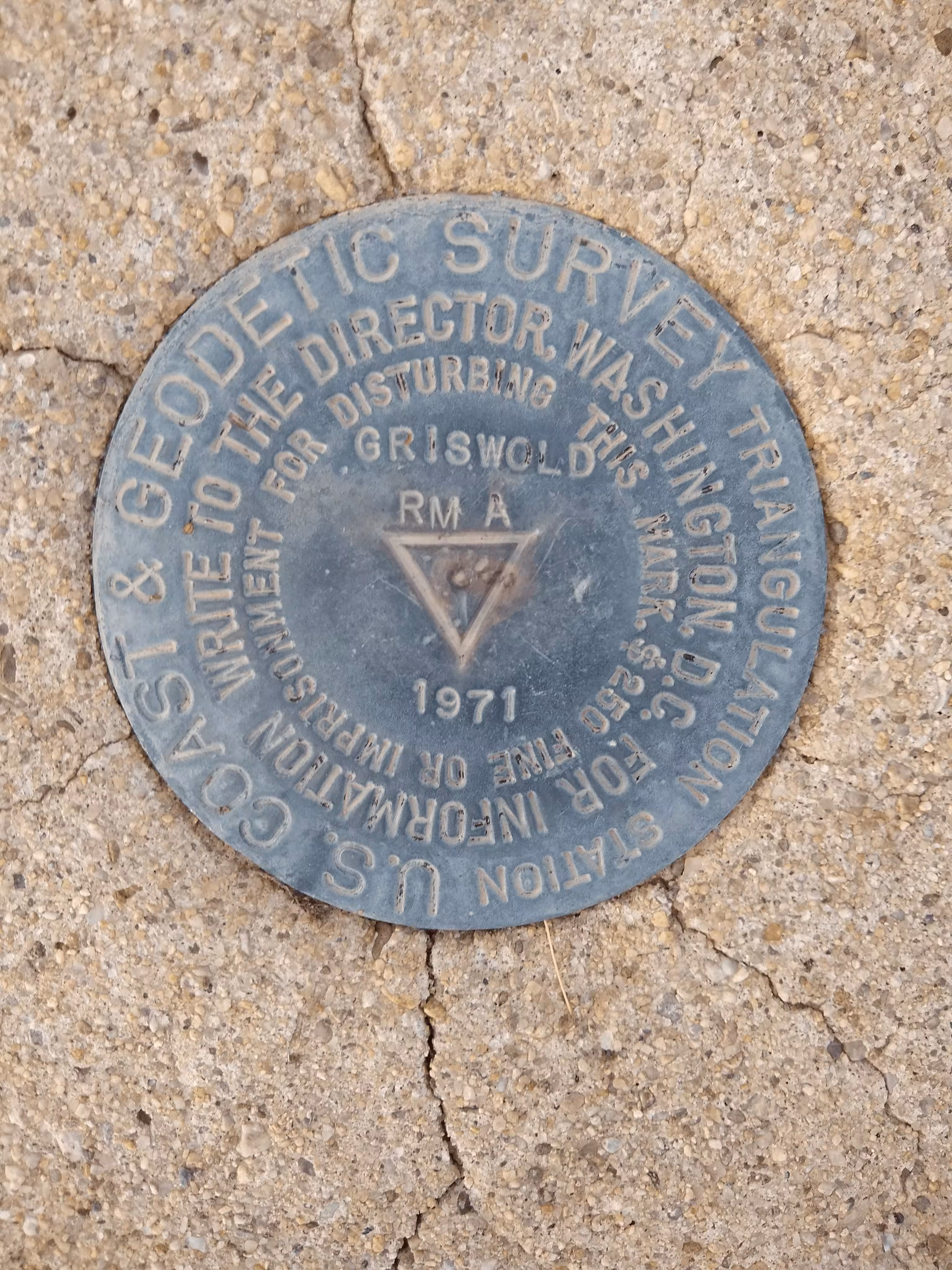
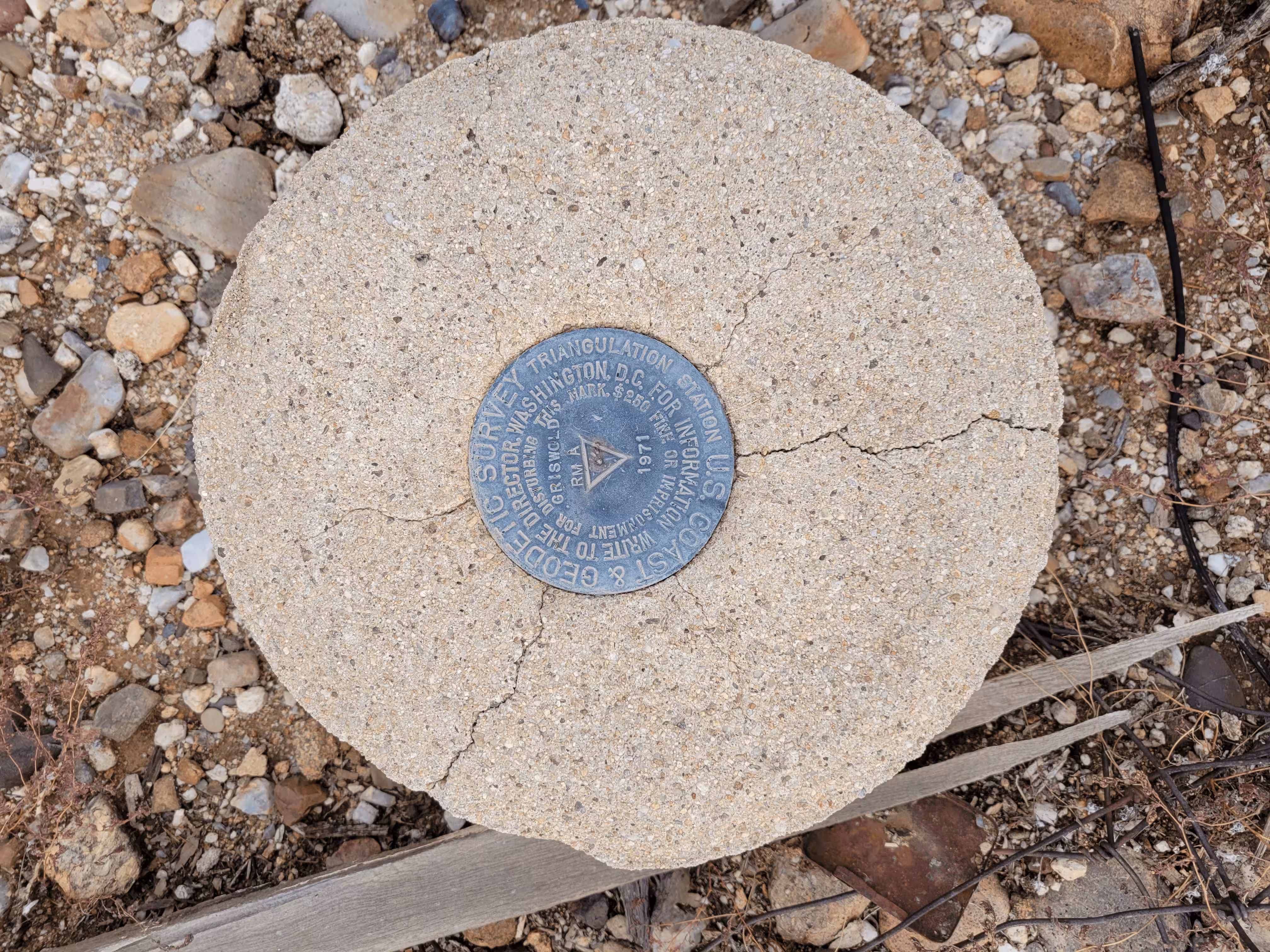
"GRISWOLD RM A"
| NGS PointID: | CZ1957 |
| Reference Benchmarks: | GRISWOLD, GRISWOLD NO 1, GRISWOLD NO 2 |
| Azimuth Benchmark: | CORTARO RAD STA KUAT MAST |
| Condition: | Ware present along with minor scratches. |
| Stamping: | GRISWOLD RM A 1972 |
| Coordinates: | 32.382406, -111.080696 |
| Elevation: | 2308.68 ft (703.69 m) |
| Setting: | A circular concrete monument |
| Monumentor: | USC&GS |
Datasheet Description:
The station is located about 13 miles northwest of Tucson, 4-1/2 miles southeast of Rillito, 1-1/2 miles northeast of interstate highway 10 and on property owned by the Friswold Eealty Company, 3711 Palo Verde Avenue, Tucson, phone 327-6621. The station marks are standard disks stamped GRISWOLD RM A 1971, the surface mark is a round concrete monument that is 12 inches in diameter and projects 3 inches above the ground surface. It is 120 feet west of the center of the bladed road, 84.5 feet north of a metal witness post with sign attached and 64 feet east of a fence corner. The underground mark was set about 42 inches below the ground surface. A traverse connection was made to triangulation station GRISWOLD 1971, the distance, reduced to sea level, and the direction are noted below. To reach GRISWOLD from Interstate 10 and Cortaro exit northwest of Tucson go northwest on frontage road for 1.55 miles to a side road right and sign Camino de Manana. Turn right and go northeast on Camino de Manana Road for 1.2 miles to Oasis Toad. Turn right and go east on Oasis Road for 0.65 mile to a fork. Keep right fork on main graveled road and go east for 0.25 mile to Jimmy Road. Turn right and go south on Jimmy Road for 0.4 mile to the station on the right.
"GRISWOLD RM A" is a benchmark monumented by the USC&GS in 1972 located in Pima County, Arizona. It is a dedicated reference mark for GRISWOLD.
"GRISWOLD RM A" is located 83.054 feet or 25.315 meters 17 degrees from the main benchmark.