|
|
Main benchmarks recovered in good or poor condition. |
|
|
Main benchmarks that have been destroyed. |
|
|
Reference benchmarks recovered in good or poor condition. |
|
|
Reference benchmarks that have been destroyed. |
|
|
Azimuth benchmarks recovered in good or poor condition. |
|
|
Azimuth benchmarks that have been destroyed. |
|
|
A main, reference, or azimuth benchmark not searched for. |
"GRISWOLD NO 2"
| NGS PointID: | CH5263 |
| Reference Benchmarks: | GRISWOLD, GRISWOLD NO 1, GRISWOLD RM A |
| Azimuth Benchmark: | CORTARO RAD STA KUAT MAST |
| Condition: | Ware present along with minor scratches. |
| Stamping: | GRISWOLD NO 2 1972 |
| Coordinates: | 32.382372, -111.080828 |
| Elevation: | 2311.61 ft (704.58 m) |
| Setting: | A circular concrete monument |
| Monumentor: | USC&GS |
Datasheet Description:
Reference mark 2 is a standard disk stamped GRISWOLD NO 2 1971, set in the top of a 12-inch round concrete monument that projects 4 inches above the ground surface. It is 152 feet northwest of the center of the bladed road, and 71 feet north of the metal witness post with sign attached.
"GRISWOLD NO 2" is a benchmark monumented by the USC&GS in 1972 located in Pima County, Arizona. It is a dedicated reference mark for GRISWOLD.
"GRISWOLD NO 2" is located 68.537 feet or 20.890 meters 346 degrees from the main benchmark.
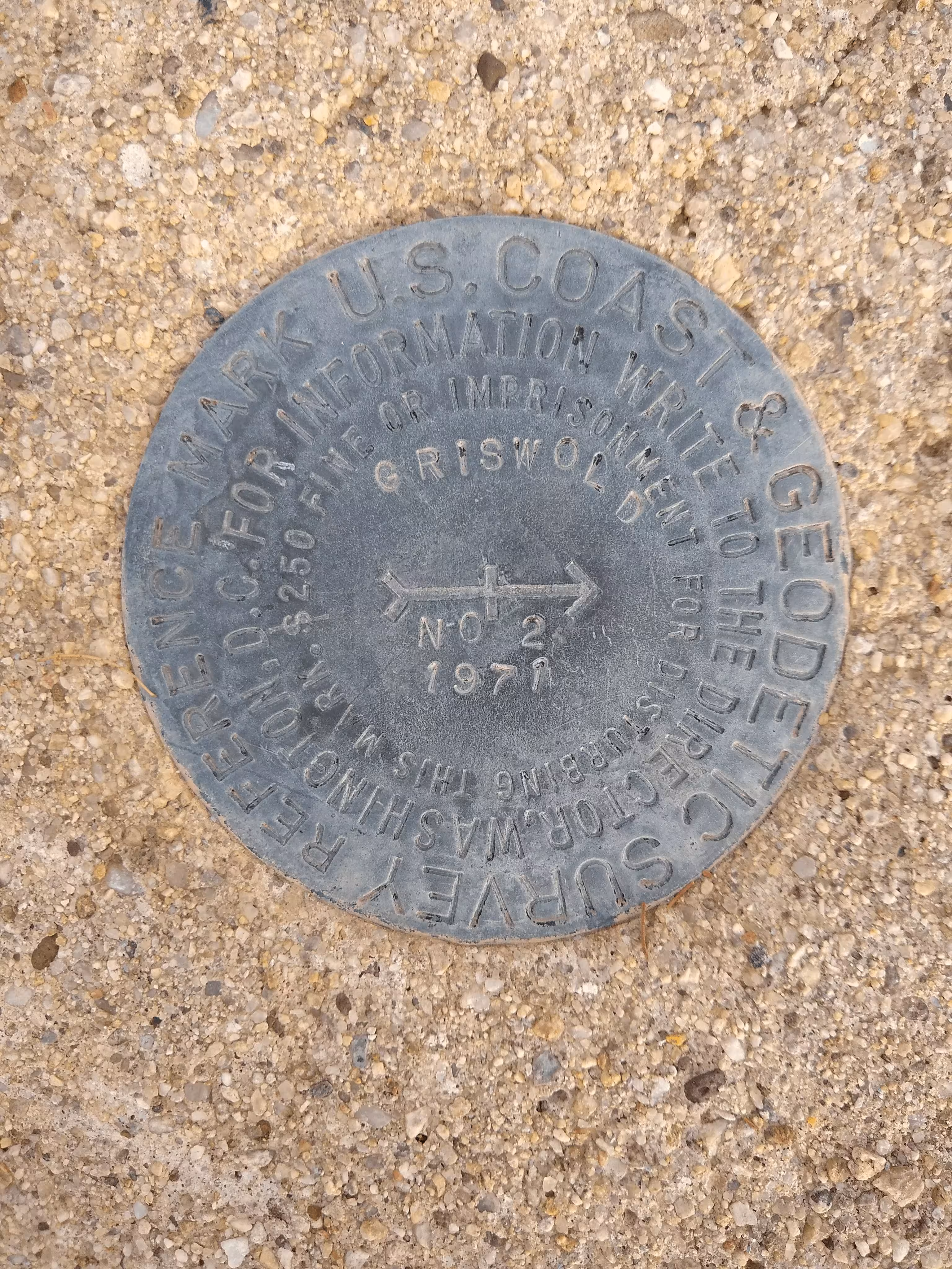
A closeup of GRISWOLD reference 2.