|
|
Main benchmarks recovered in good or poor condition. |
|
|
Main benchmarks that have been destroyed. |
|
|
Reference benchmarks recovered in good or poor condition. |
|
|
Reference benchmarks that have been destroyed. |
|
|
Azimuth benchmarks recovered in good or poor condition. |
|
|
Azimuth benchmarks that have been destroyed. |
|
|
A main, reference, or azimuth benchmark not searched for. |
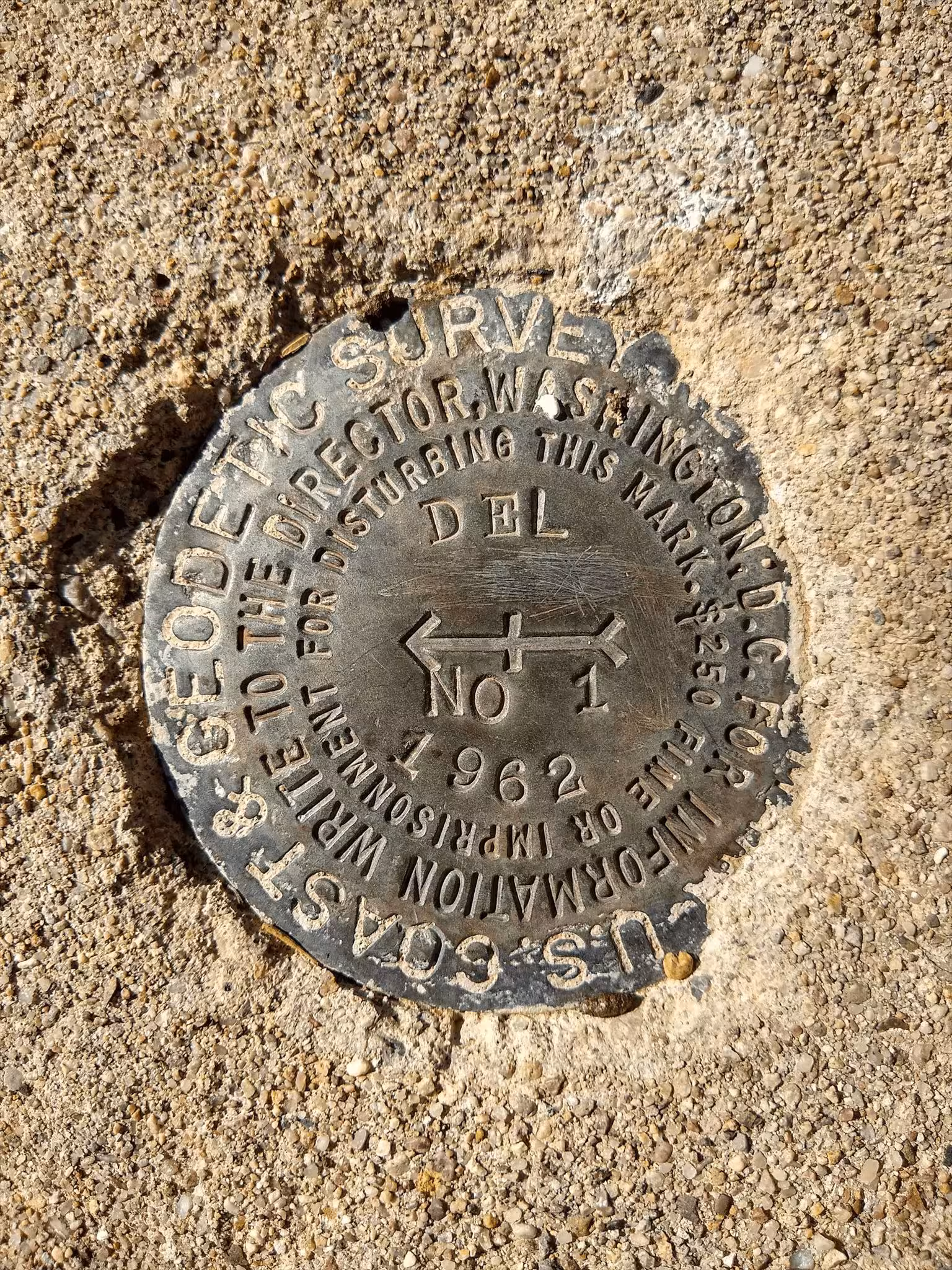
"DEL NO 1"
| NGS PointID: | CZ1694 |
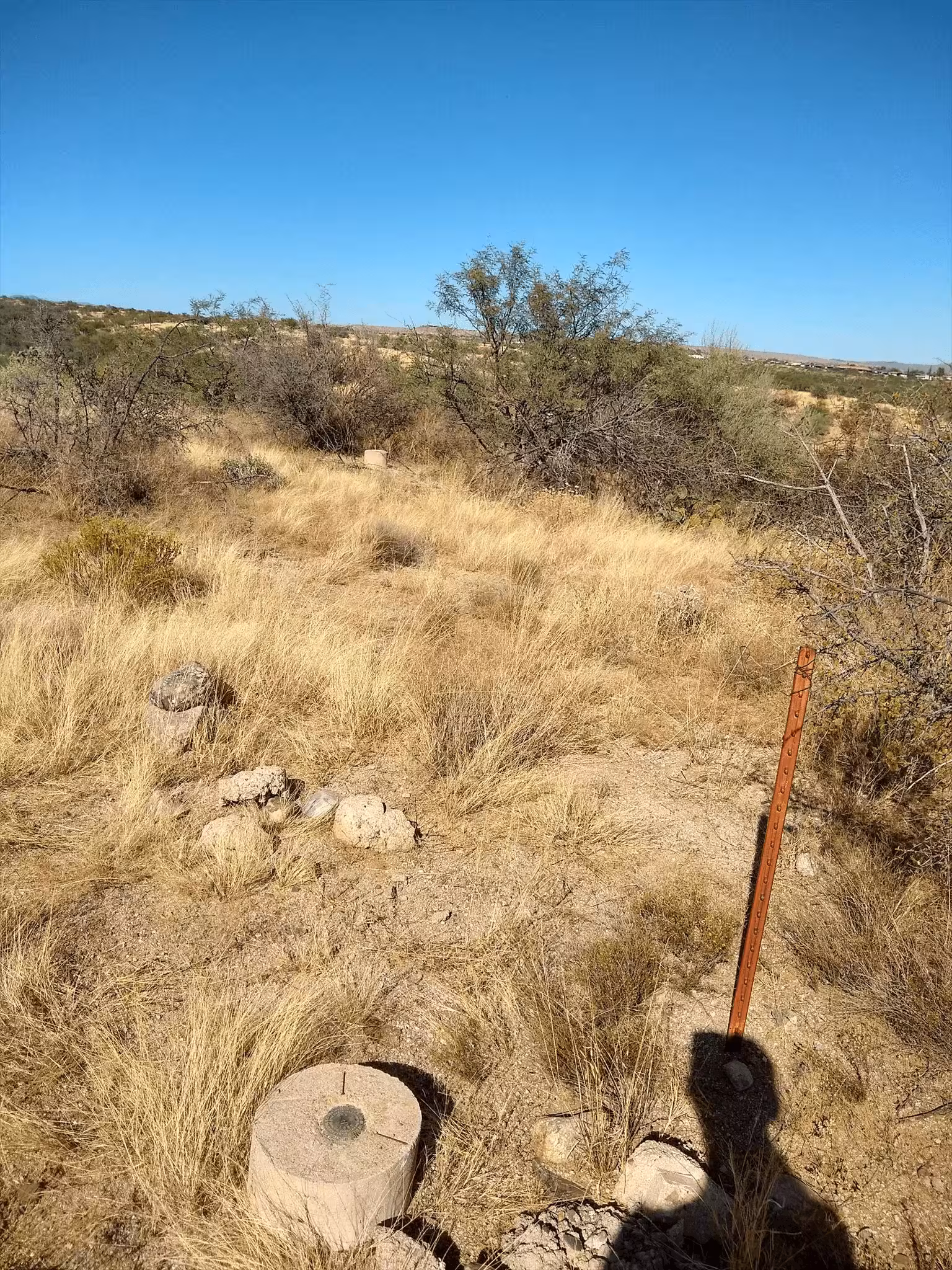
| Reference Benchmarks: | DEL, DEL NO 2 |
| Azimuth Benchmark: | E 399 |
| Condition: | Ware present, especially at the edges of the disc. Above the arrow there are many scratches. |
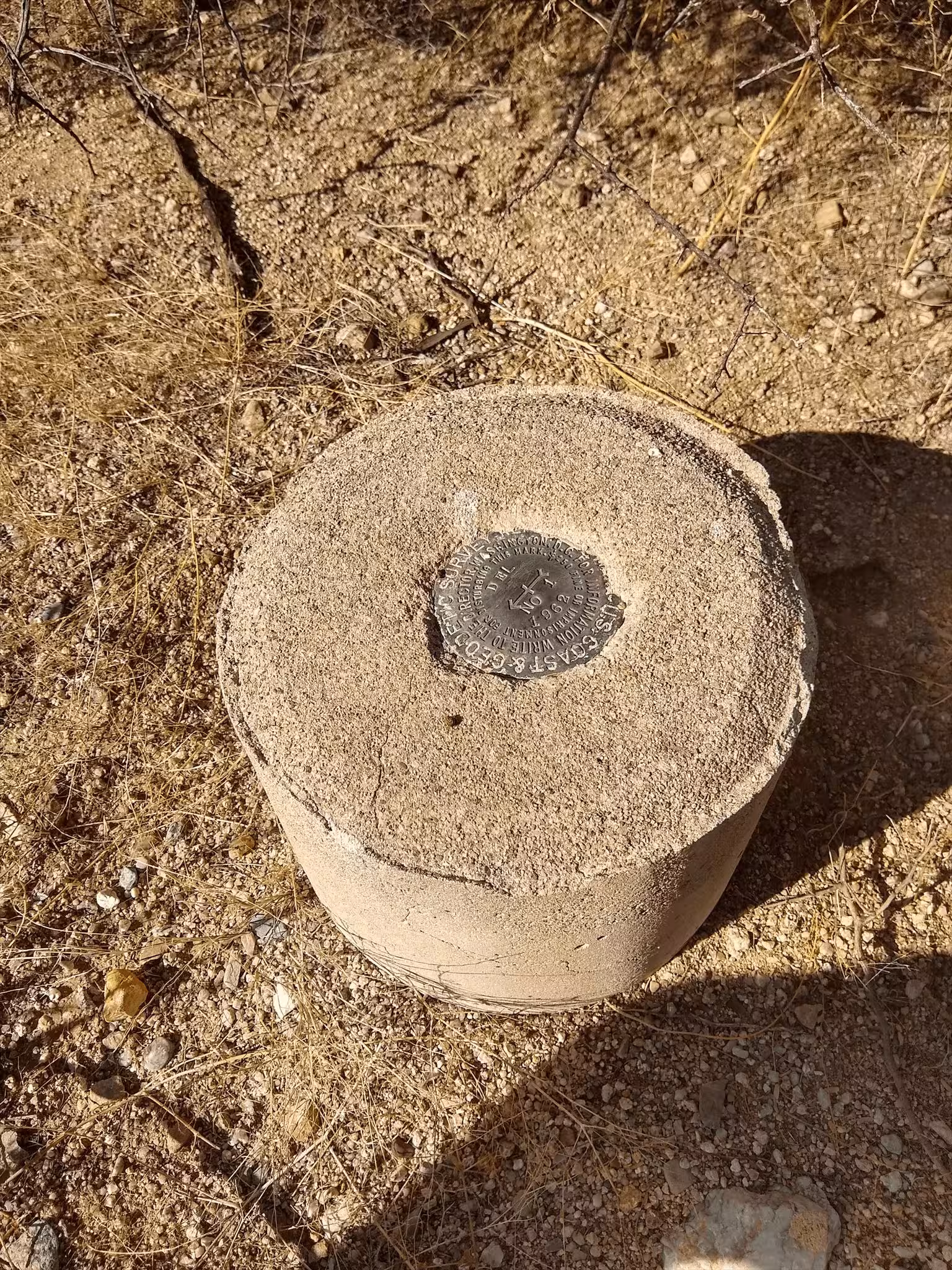
| Stamping: | DEL NO 1 1962 |
| Coordinates: | 32.479747, -110.936617 |
| Elevation: | 3040.7 ft (926.81 m) |
| Setting: | A circular concrete monument |
| Monumentor: | USC&GS |
Datasheet Description:
Reference mark number one is a standard disk stamped DEL NO 1 1962 set in the top of a 12-inch-diameter cylindrical concrete monument projecting 3 inches above ground. It is at about the same elevation as the station at the top of the north slope of the hill.
"DEL NO 1" is a benchmark monumented by the USC&GS in 1962 located in Pima County, Arizona. It is a dedicated reference mark for DEL.
The best way to get to "DEL" is to start at the west side of the right of way fence on the west side of AZ 77 and Miravista Lane. Park in the church parking lot and go to the barbed wire fence at 32.479436, -110.929645. There will be a carabiner holding together the middle wire. You can unclip it and maneuver through the fence easily. From here, pack down the ridge and follow a pack trail to full cow watering tanks (32.477428, -110.933979). Pack north along mountain bike trail to a junction of a pack trail and the mountain bike trail (32.478781, -110.935086). Follow the pack trail to the a ridge (32.479388, -110.935718). Pack up the ridge and to station.
"ORO NO 1" is located 37.014 feet or 11.282 meters 13 degrees from the main benchmark. It is located at about the same elevation as the station.