|
|
Main benchmarks recovered in good or poor condition. |
|
|
Main benchmarks that have been destroyed. |
|
|
Reference benchmarks recovered in good or poor condition. |
|
|
Reference benchmarks that have been destroyed. |
|
|
Azimuth benchmarks recovered in good or poor condition. |
|
|
Azimuth benchmarks that have been destroyed. |
|
|
A main, reference, or azimuth benchmark not searched for. |
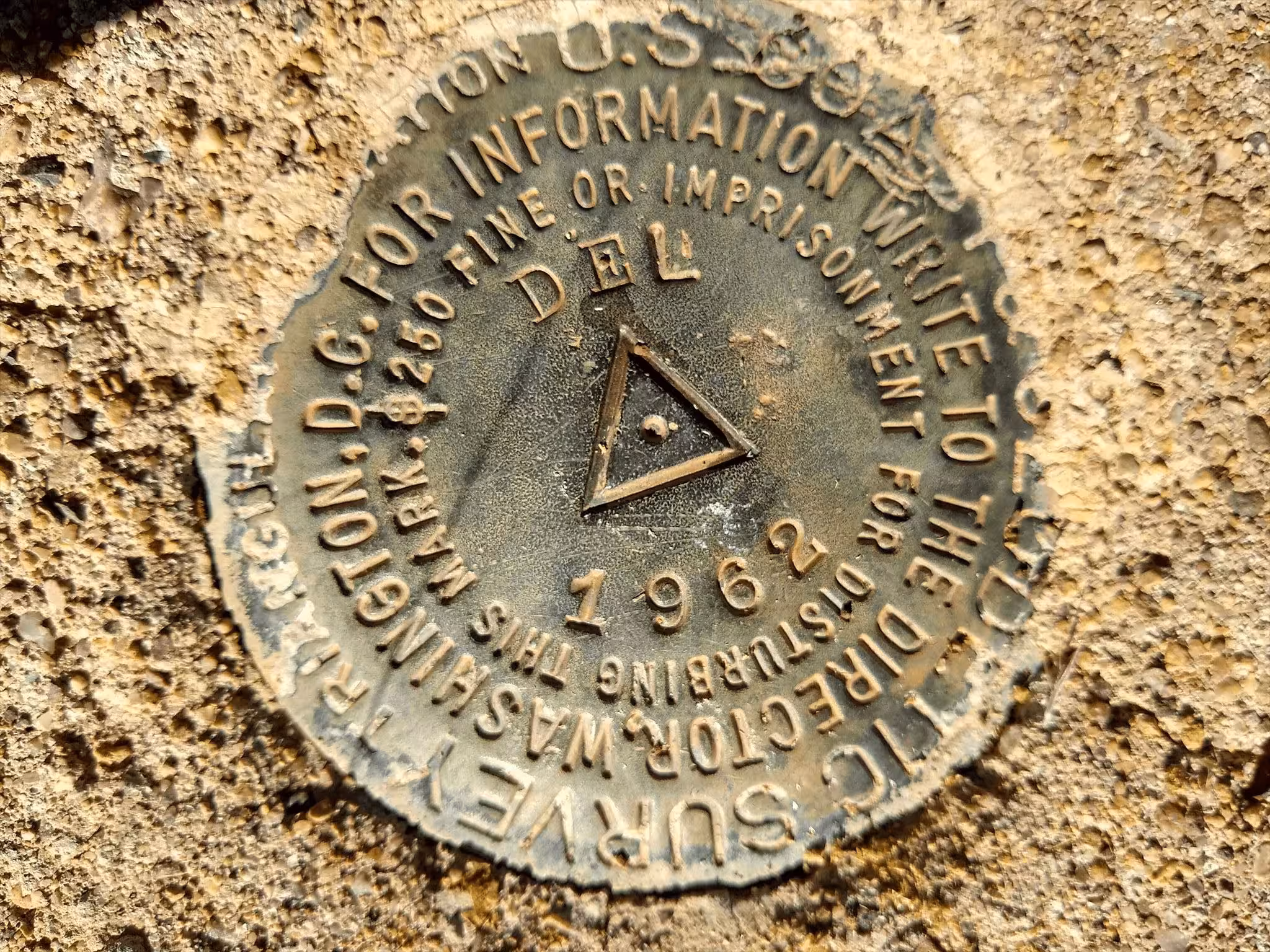
"DEL"
| NGS PointID: | CZ1693 |
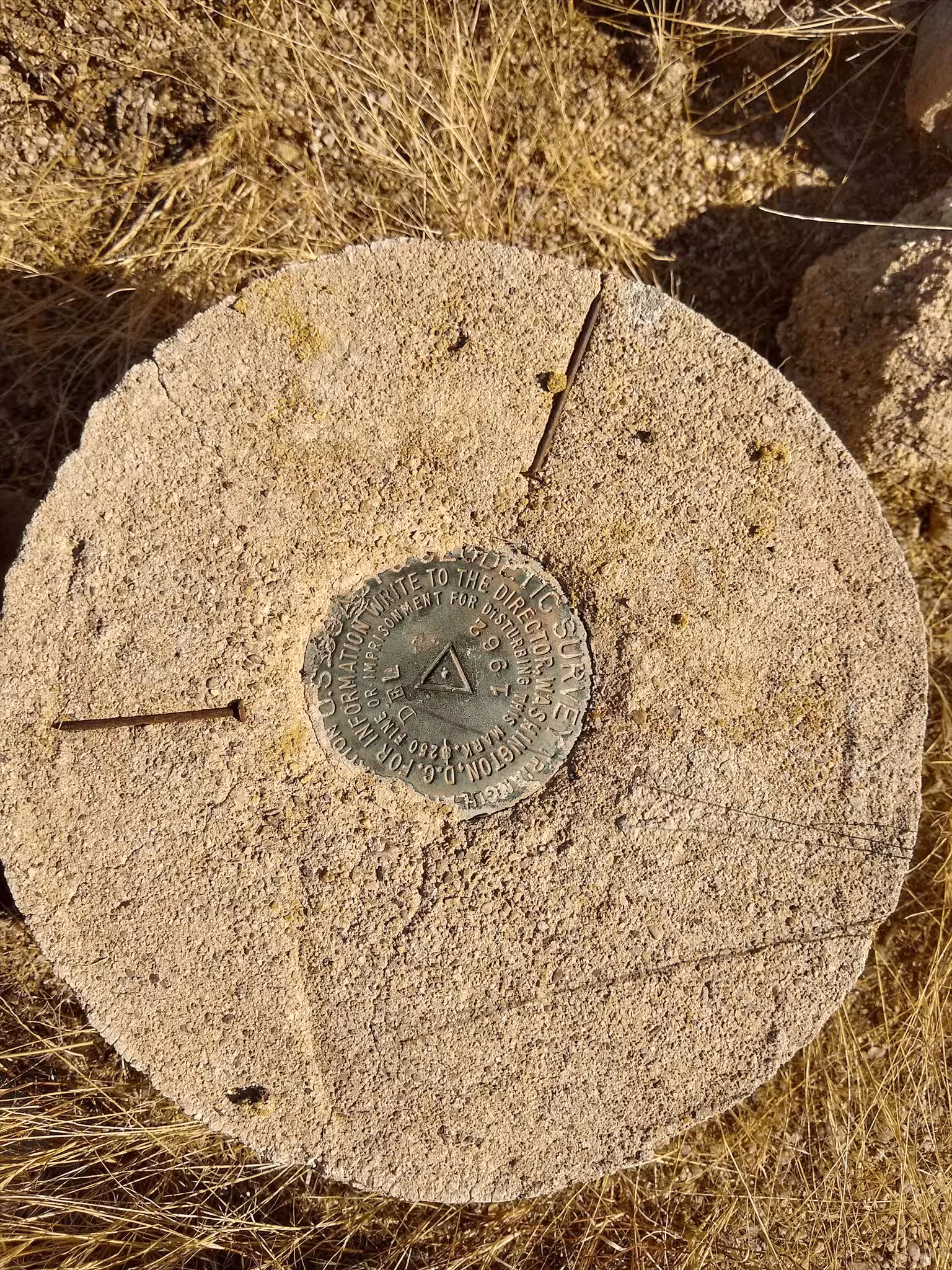
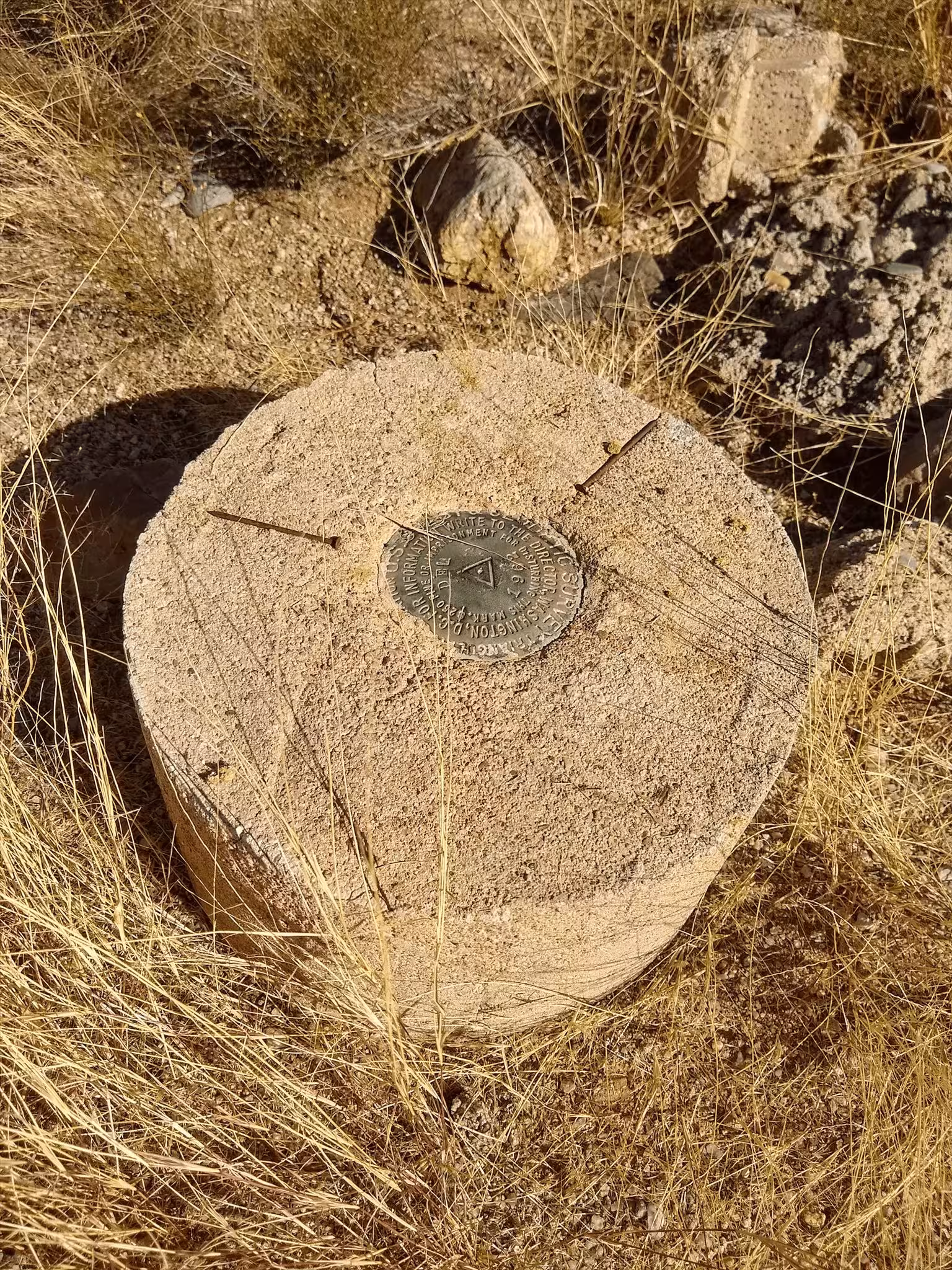
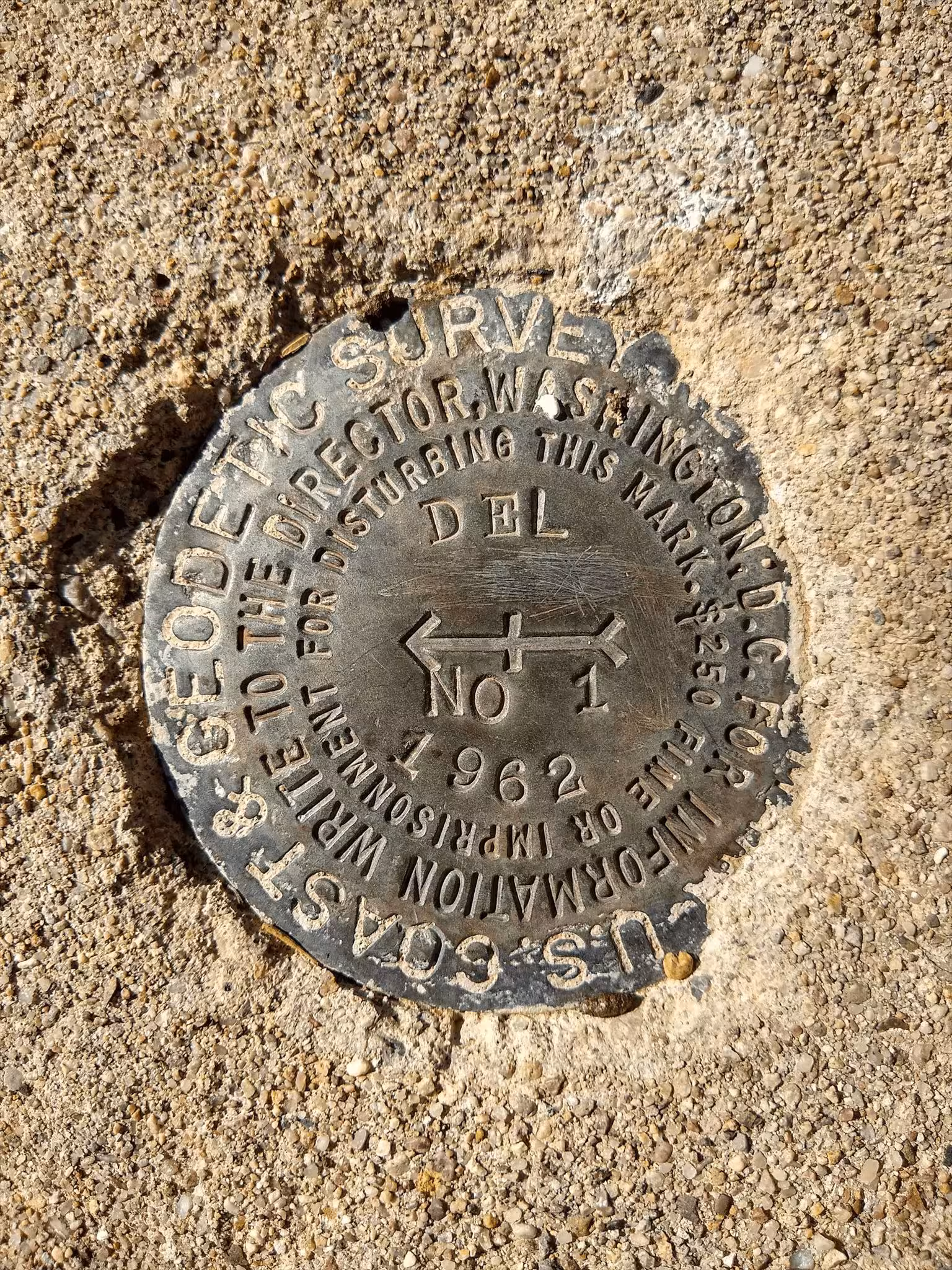
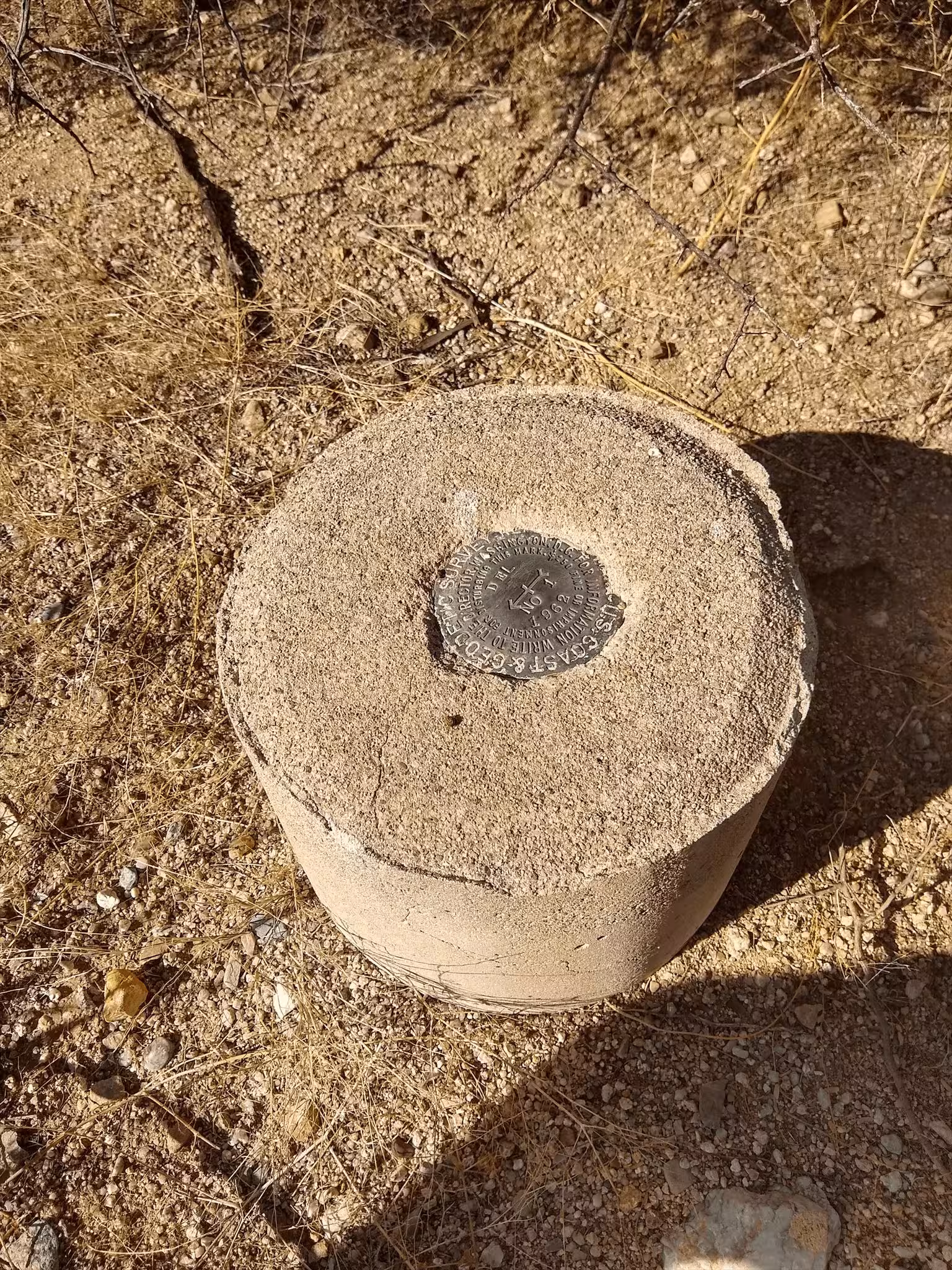
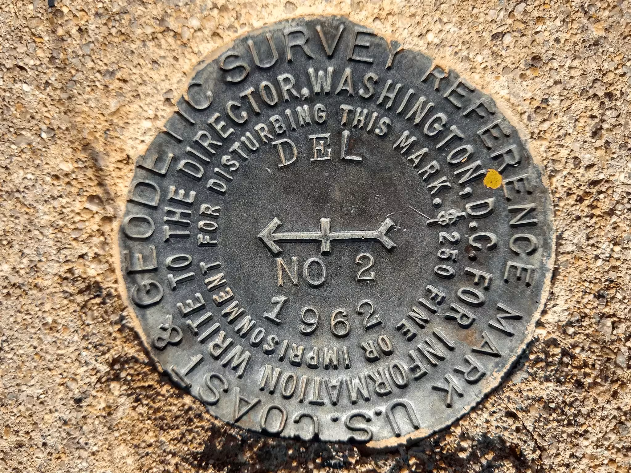
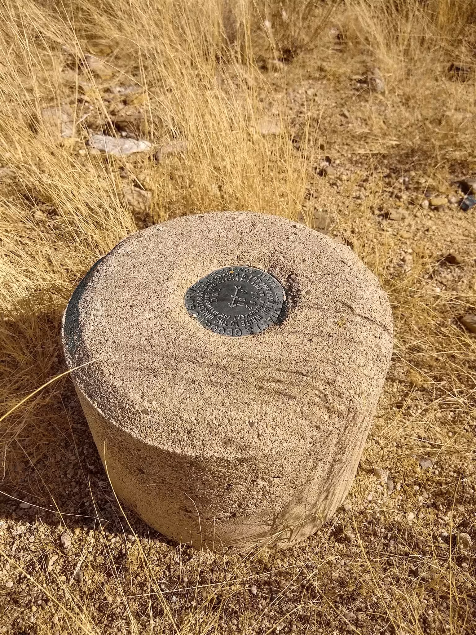
| Reference Benchmarks: | DEL NO 1, DEL NO 2 |
| Azimuth Benchmark: | E 399 |
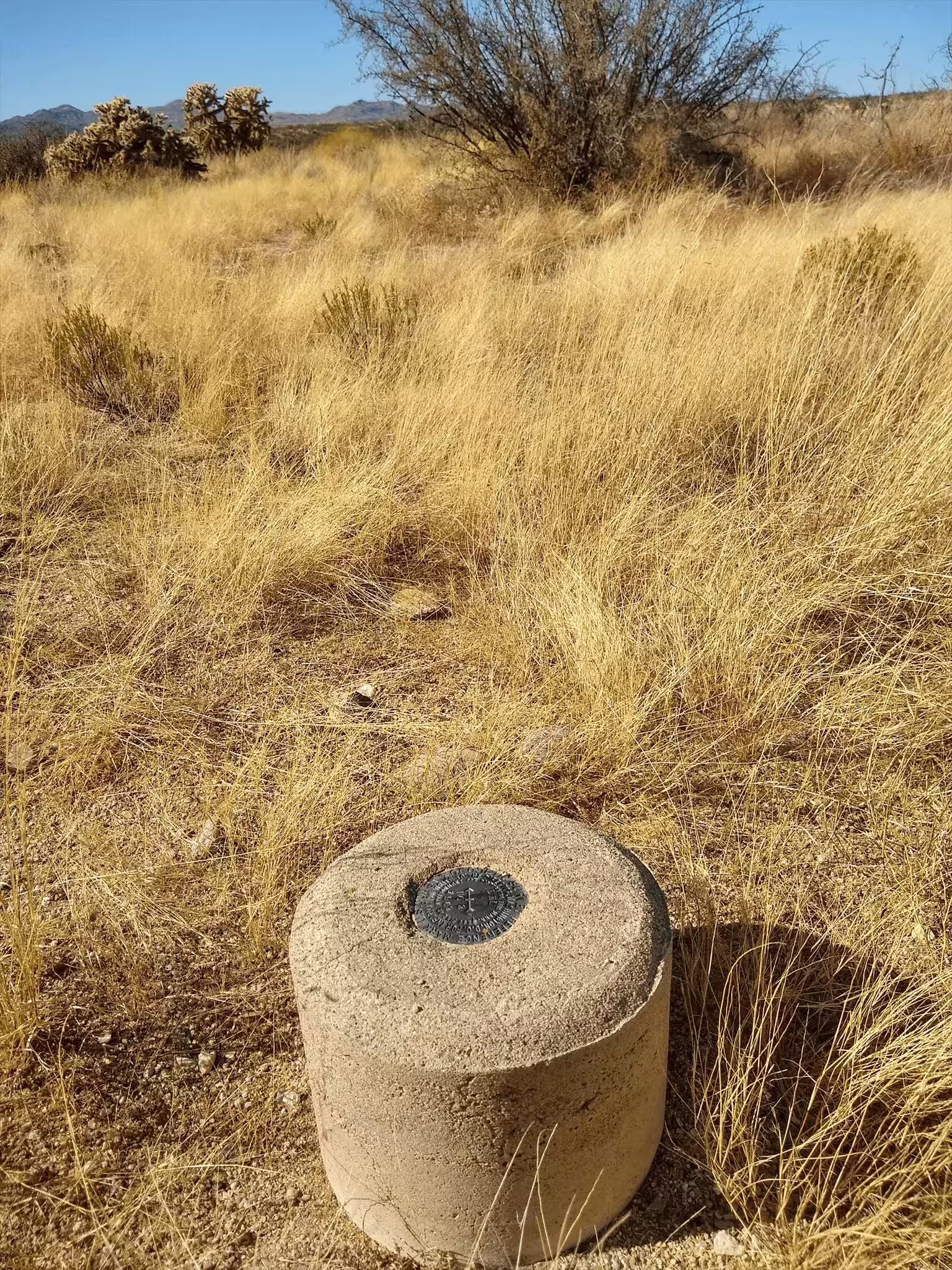
| Condition: | Very minor scratches and ware. |
| Stamping: | DEL 1962 |
| Coordinates: | 32.479648, -110.936644 |
| Elevation: | 3041.0 ft (926.89 m) |
| Setting: | A circular concrete monument |
| Monumentor: | USC&GS |
Datasheet Description:
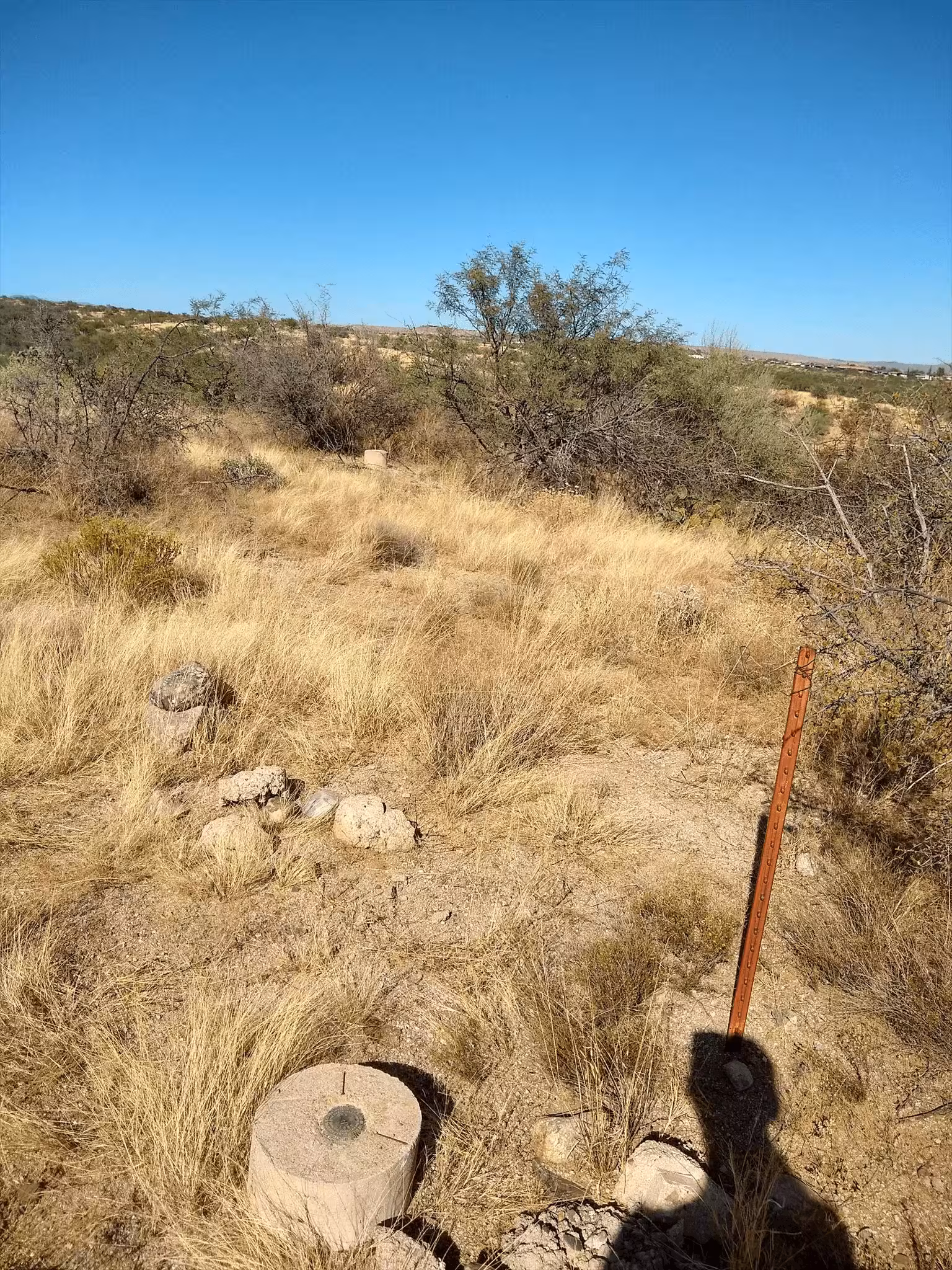
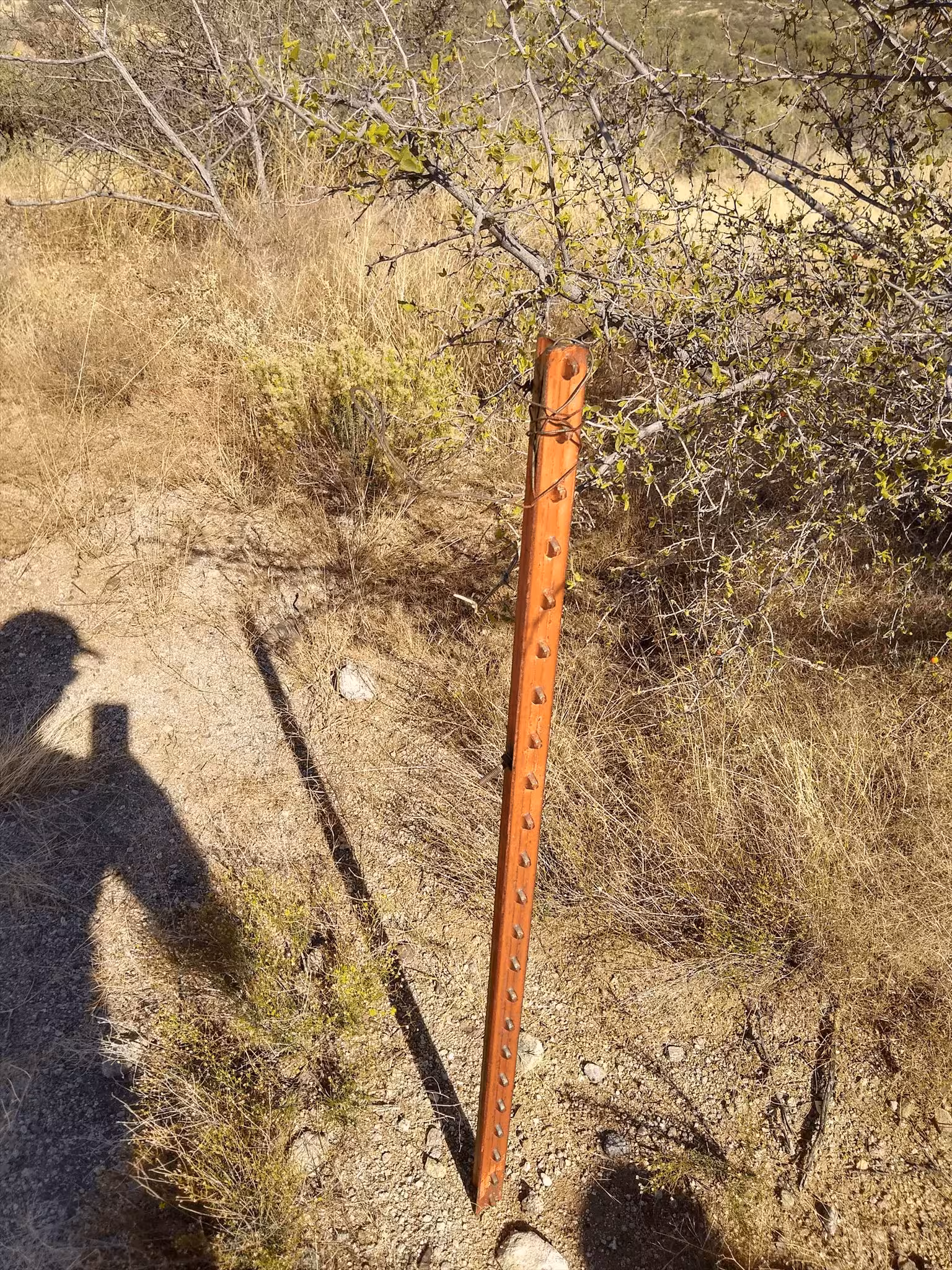
Station is located about 17 miles north of Tucson, 16 miles east of Marana, and 6 miles south of Oracle Junction, on a low ridge running north and south between two dry washes. To reach from the east entrance to Evergreen Cemetery on Oracle Road in the north part of Tucson, go north on U.S. Highway 80, 89, and State Highway 789 for 15.1 miles to a side road on the left and bench mark W 399 which serves as the azimuth mark. Turn left and go west across cattleguard on oiled road 0.2 mile to a bladed road on left just after crossing a culvert over a wash. Follow bladed road south and west 0.6 mile to a wire gate on the west side of a sandy wash (Big Wash). Pass through gate and proceed west 0.2 mile. At this mileage leave bladed road and pick way north through brush and cactus, and across a wash 0.4 mile to the station on top of a low ridge between two washes. A four-wheel-drive vehicle is advised to cross washes. The station mark is a standard disk stamped DEL 1962 set in the top of a 12-inch-diameter cylindrical concrete monument projecting 2 inches above ground. It is 3 feet west of a metal witness post and sign. Reference mark number one is a standard disk stamped DEL NO 1 1962 set in the top of a 12-inch-diameter cylindrical concrete monument projecting 3 inches above ground. It is at about the same elevation as the station at the top of the north slope of the hill. Reference mark number two is a standard disk stamped DEL NO 2 1962 set in the top of a 12-inch-diameter cylindrical concrete monument projecting 5 inches above ground. It is at about the same elevation as the station at the top of a stubby east ridge off the station ridge. Bench mark E 399 which serves as the azimuth mark is a standard disk stamped E 399 1962 set in the top of a 12-inch-diameter concrete cylinder projecting 3 inches above ground. It is 97.5 feet west of the center line of U.S. Highway 80, 42 feet north of the center of a cattleguard, 2 feet south of a metal witness post and sign, and 1.5 feet east of the west right-of-way fence.
"DEL" is a benchmark monumented by the USC&GS in 1962 located in Pima County, Arizona. It has 2 dedicated reference marks and a non dedicated azimuth, which has been destroyed.
The best way to get to "DEL" is to start at the west side of the right of way fence on the west side of AZ 77 and Miravista Lane. Park in the church parking lot and go to the barbed wire fence at 32.479436, -110.929645. There will be a carabiner holding together the middle wire. You can unclip it and maneuver through the fence easily. From here, pack down the ridge and follow a pack trail to full cow watering tanks (32.477428, -110.933979). Pack north along mountain bike trail to a junction of a pack trail and the mountain bike trail (32.478781, -110.935086). Follow the pack trail to the a ridge (32.479388, -110.935718). Pack up the ridge and to station.
"ORO NO 1" is located 37.014 feet or 11.282 meters 13 degrees from the main benchmark. It is located at about the same elevation as the station.
"ORO NO 2" is located 34.777 feet or 10.600 meters 132 degrees from the main benchmark. It is located at about the same elevation as the station.
"E 399" is located approximately 0.9 miles or 1.4 kilometers 94 degrees from the main benchmark. It has been destroyed.