|
|
Main benchmarks recovered in good or poor condition. |
|
|
Main benchmarks that have been destroyed. |
|
|
Reference benchmarks recovered in good or poor condition. |
|
|
Reference benchmarks that have been destroyed. |
|
|
Azimuth benchmarks recovered in good or poor condition. |
|
|
Azimuth benchmarks that have been destroyed. |
|
|
A main, reference, or azimuth benchmark not searched for. |
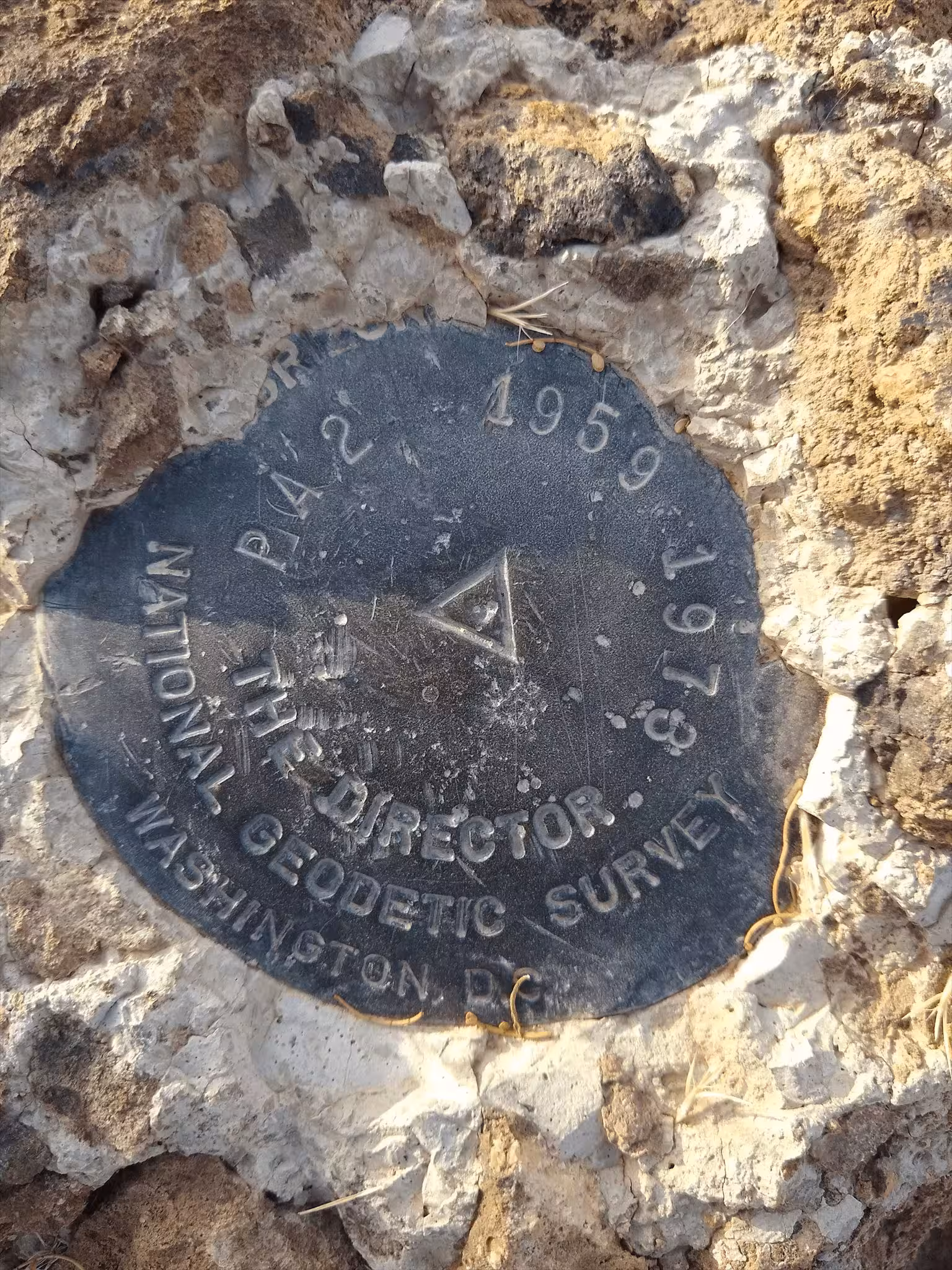
"PA 2"
| NGS PointID: | CZ1835 |
| Reference Benchmarks: | PA 2 NO 1, PA 2 NO 2, PA 2 NO. 3 |
| Azimuth Benchmark: | SAN XAVIER MISSION CROSS |
| Condition: | Intact, 2 small 1 centimeter long gashes. Small "punchholes" present. |
| Stamping: | PA 2 1959 1973 |
| Coordinates: | 32.106518, -110.988285 |
| Elevation: | 2858 ft (871.1 m) |
| Setting: | A rock outcrop |
| Monumentor: | USC&GS |
Datasheet Description:
The station is located on the west end of a prominent ridge between San Xavier del Bac Mission and the San Xavier Indian Hospital, east of and partly within a bow of the Santa Cruz River.
To reach the station from the post office at emery park, go south on U. S. Highway 89 for 1. 4 miles to a road right at sign San Xavier del Bac Mission, turn right and go 0. 5 mile to a crossroad, turn left and go 0. 9 mile to a fork, take the right fork and go 0. 2 mile to a road left, turn left and go 0. 1 mile to end of truck travel. Pack southwesterly for about 15 minutes to the top of the hill and the station.
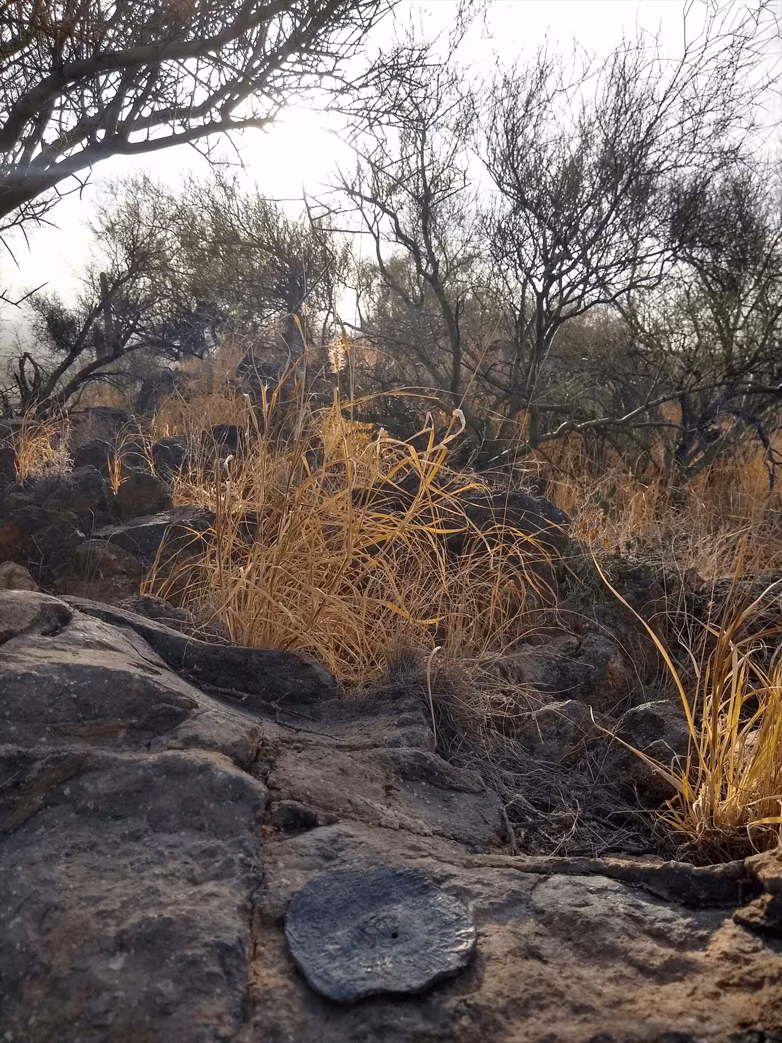
The station mark is a standard disk stamped PA 2 1959, set in a drill hole in bedrock that projects 6 inches.
R. M. 1 is a standard disk stamped PA 2 NO 1 1959, set in a drill hole in bedrock that is about 2 feet lower than the station mark.
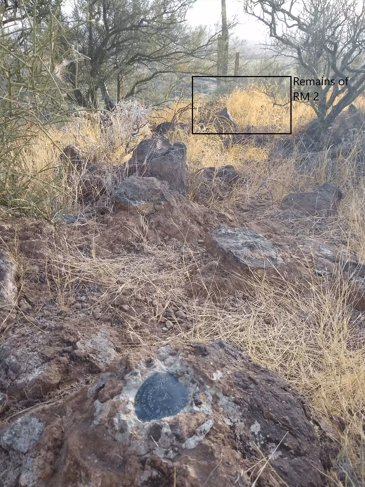
R. M. 2 is a standard disk stamped PA 2 no 2 1959, set in a drill hole in bedrock that is about the same elevation as the station mark.
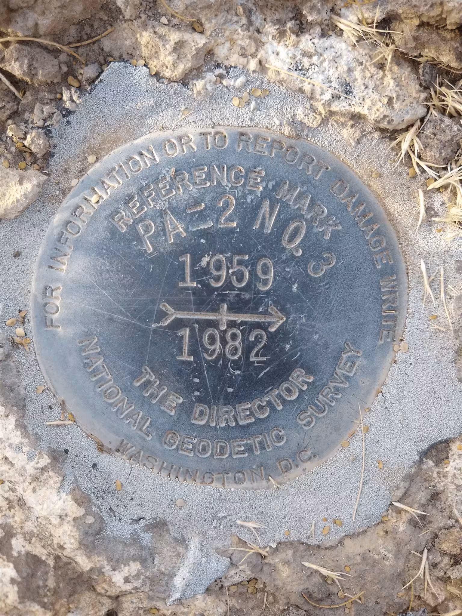
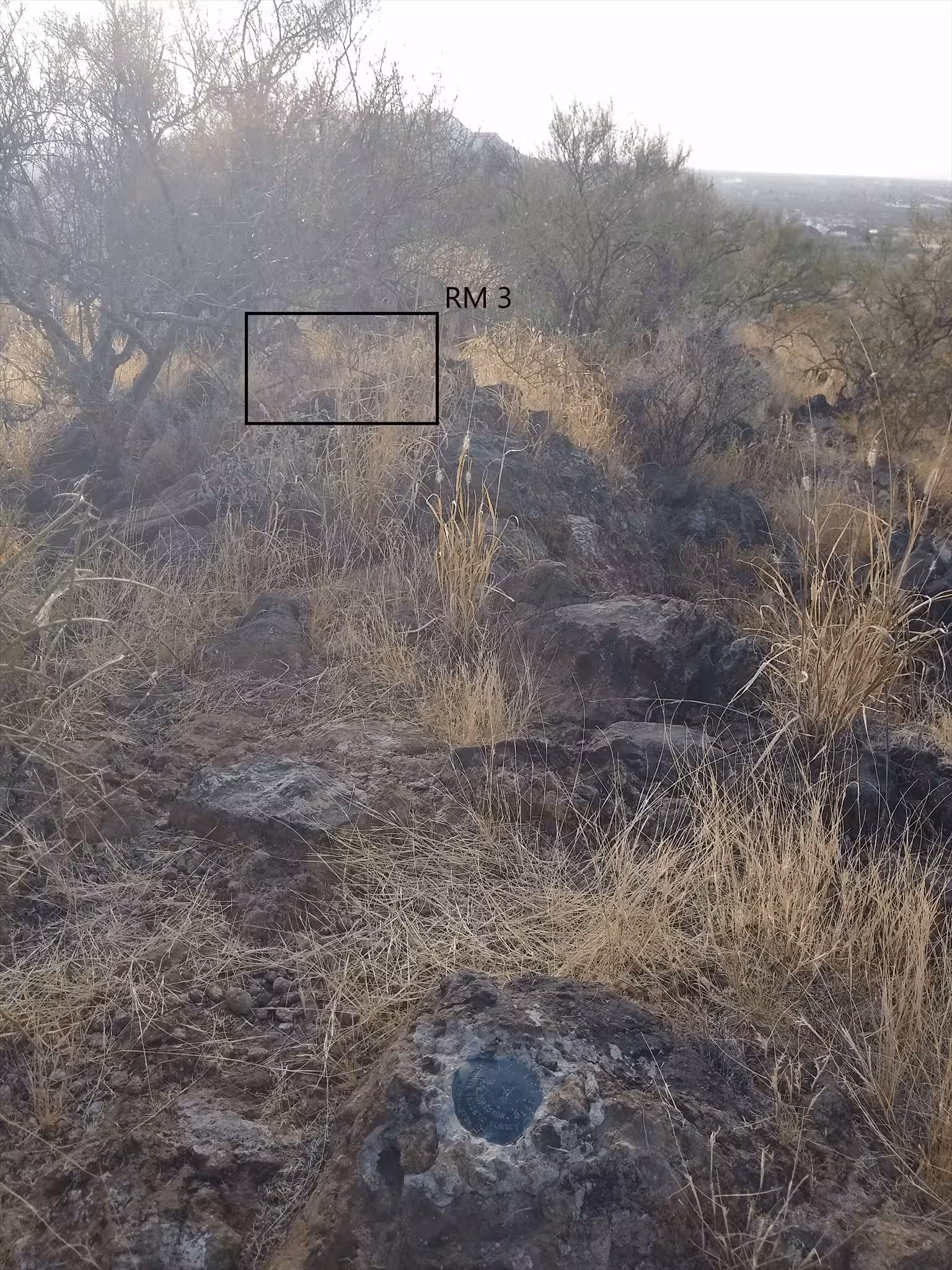
R. M. 3 is a standard disk stamped PA 2 1959 NO 3 1982. It is set in a drill hole in a boulder.
The azimuth mark is the vertical shaft of the large white cross standing alone on the hill just east of San Xavier del Bac Mission.
"PA 2" is a benchmark originally monumented by the USC&GS in 1959 and remonumented in 1973 located in Pima County, Arizona. It has 3 reference marks and a non-dedicated azimuth.
The best way to get to "PA 2" is to start at the end of Martinez Drive and heading along a power line trail until a water tank at a higher elevation than the other water tank. From here there is a trail that heads up most of the hill. From the end of the trail, bushwhack to the summit and station.
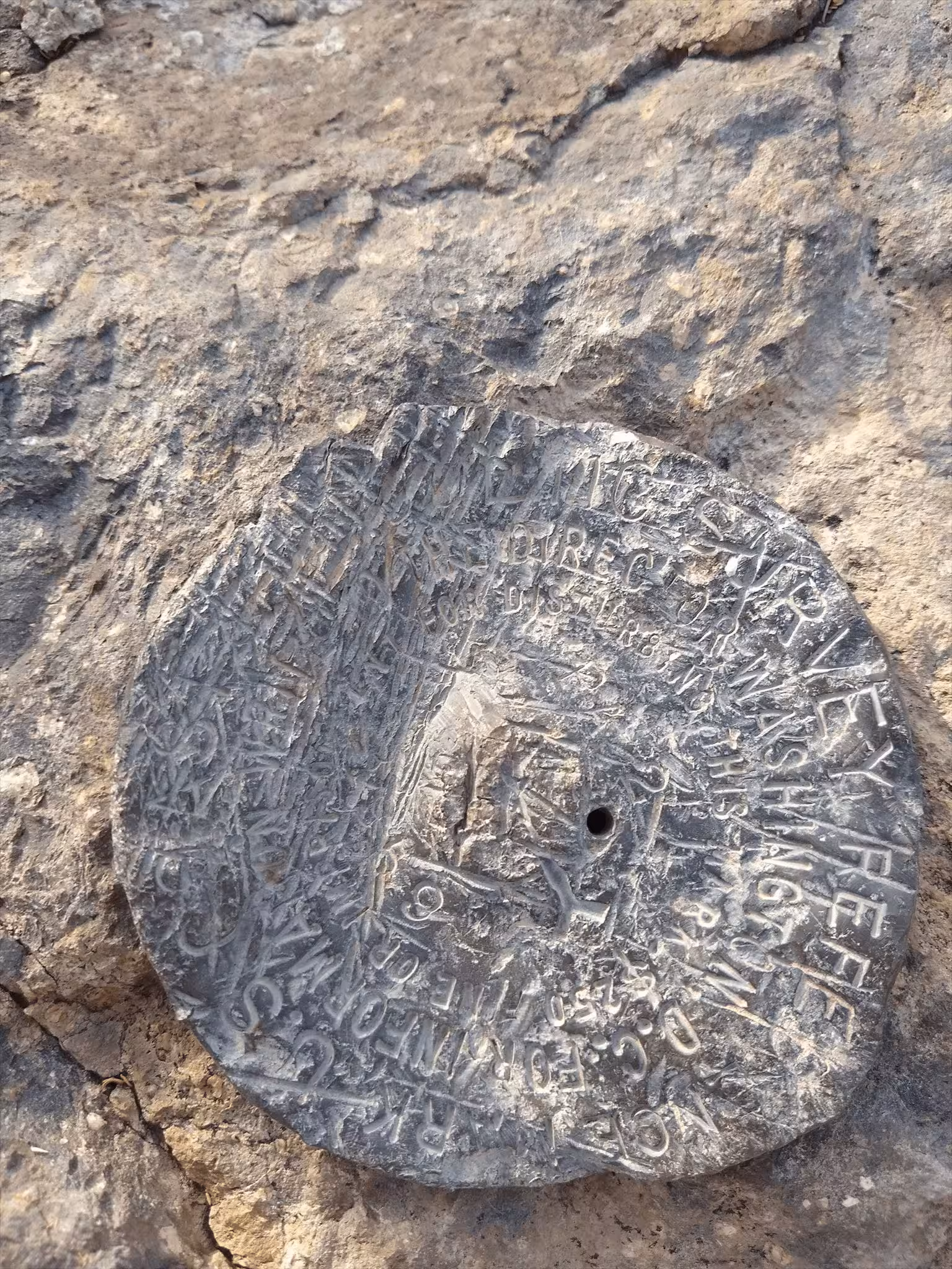
"PA 2 NO 1" is located 30.764 feet or 9.377 meters 68 degrees from the main benchmark. It is located about 2 feet below the station, on an a prominent rock outcrop. The disk is heavily scared, scratched, and gashed, leaving many parts of it unreadable.
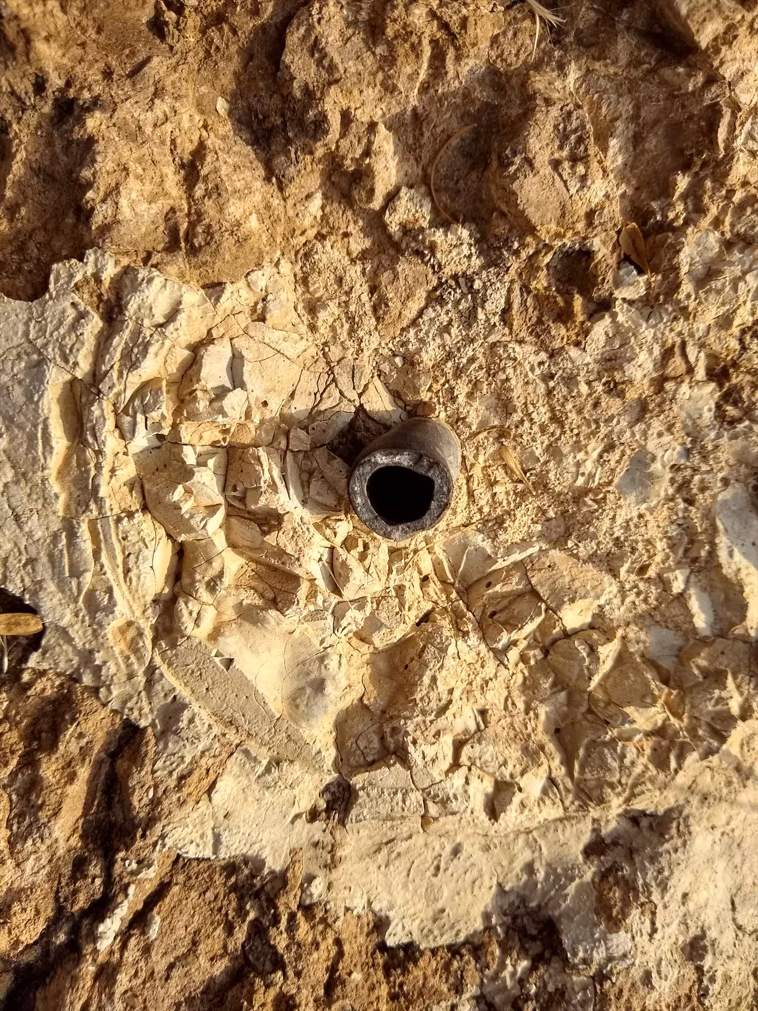
"PA 2 NO 2" is located 23.350 feet or 7.117 meters 218 degrees from the main benchmark. It is located at below the elevation as the main benchmark and is on a rock outcrop. This disk has been destroyed and only the stem remains.
"PA 2 NO. 3" is located 16.273 feet or 4.960 meters 271 degrees from the main benchmark. It is located at about the same elevation as the main benchmark in a rock outcrop. The disk is in good condition with only very minor scratches.
"SAN XAVIER MISSION CROSS" is located 271 degrees from the main benchmark. It is the stem of the white cross located on top of the hill just east of the San Xavier del Bac Mission.