|
|
Main benchmarks recovered in good or poor condition. |
|
|
Main benchmarks that have been destroyed. |
|
|
Reference benchmarks recovered in good or poor condition. |
|
|
Reference benchmarks that have been destroyed. |
|
|
Azimuth benchmarks recovered in good or poor condition. |
|
|
Azimuth benchmarks that have been destroyed. |
|
|
A main, reference, or azimuth benchmark not searched for. |
"9795 VA"
| Reference Benchmarks: | None |
| Condition: | Scratching and strong ware. |
| Stamping: | 9795 VA 6-15 1916 |
| Coordinates: | 31.84588, -109.29128 |
| Elevation: | 9573 ft (2918 m) |
| Setting: | Boulder. |
| Monumentor: | USGS |
"9795 VA" is a benchmark monumented by the USGS on June 15, 1916 located in Cochise County, Arizona.
The mark is at the summit of Chiricahua Peak on the summit boulder.
To reach the benchmark from Rustler Park, get onto the Crest Trail #270 and head southward. Take this relatively flat trail for 6 miles to Junction Saddle. From here, turn onto the Chiricahua Peak Trail #270A and continue for 0.4 miles to the peak and benchmark.
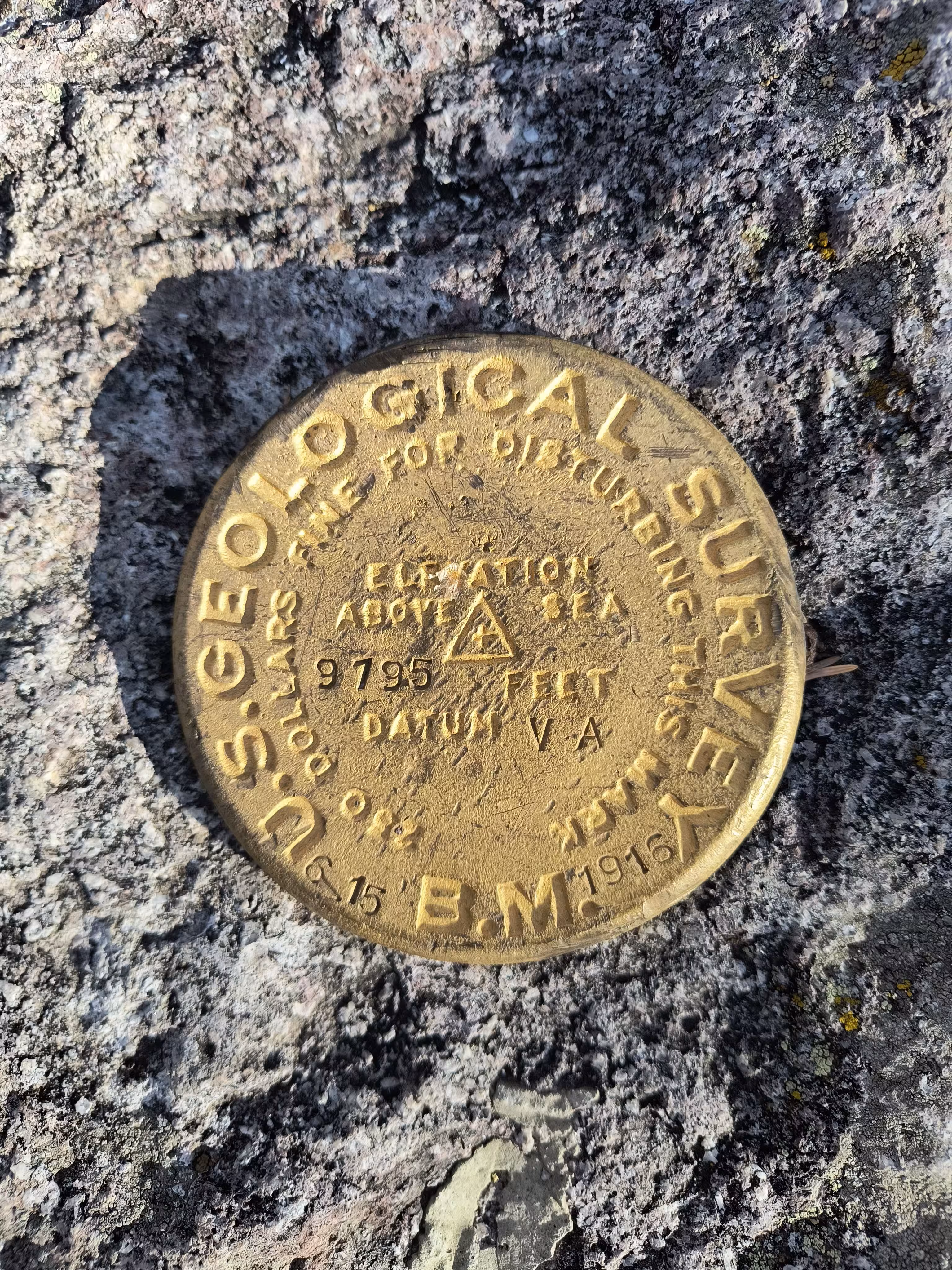
9795 VA close up.
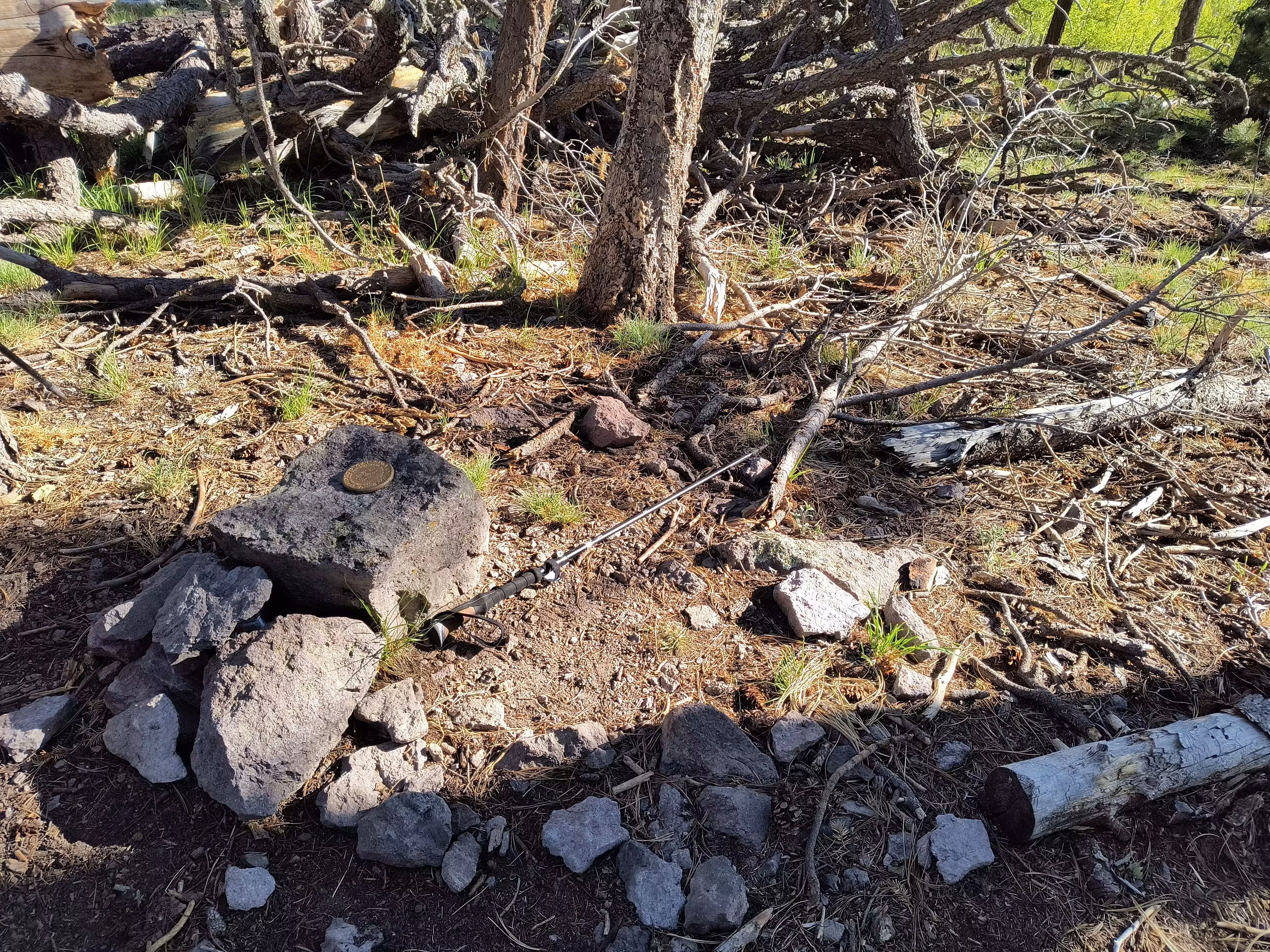
9795 VA from a distance.