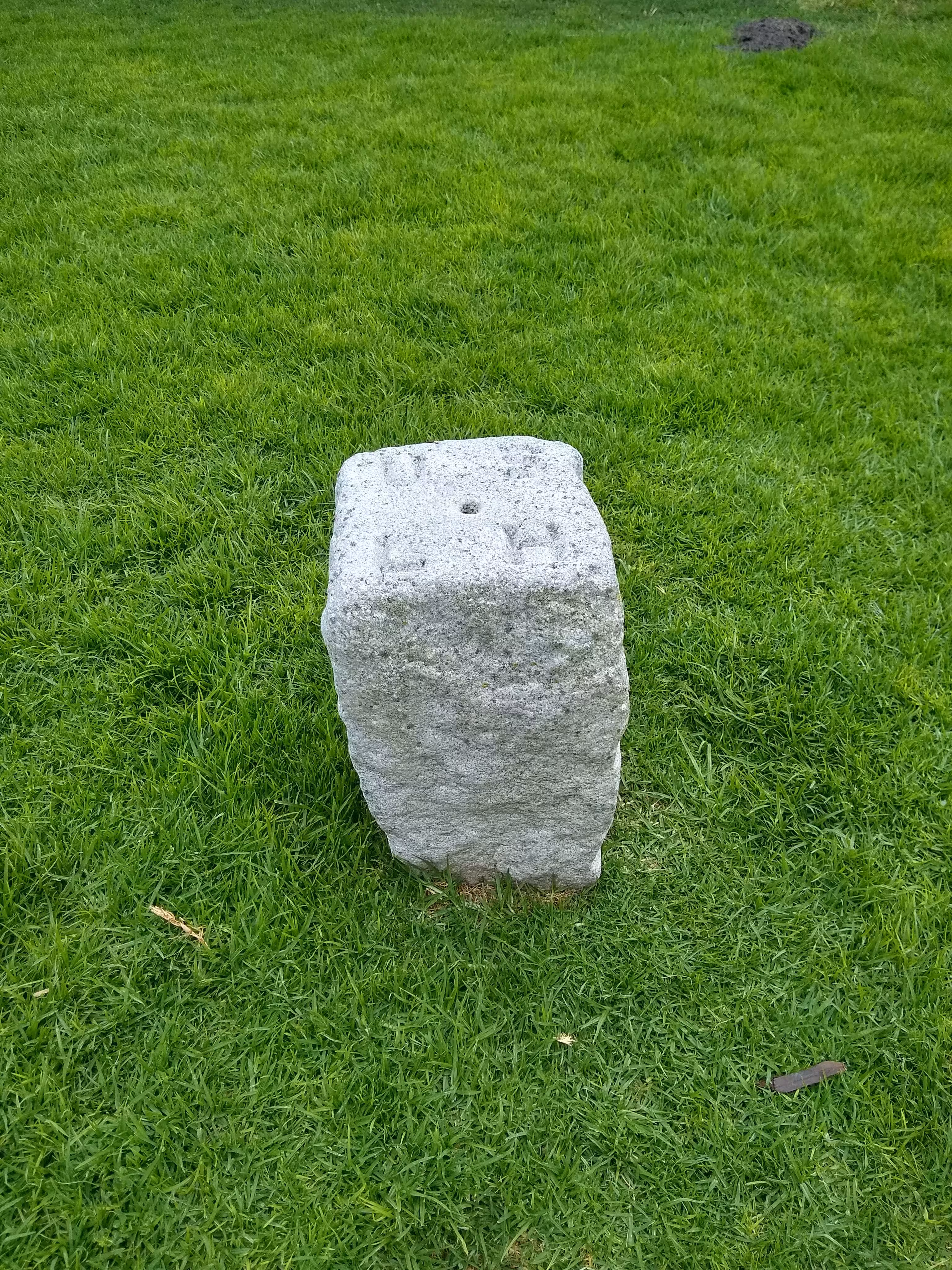
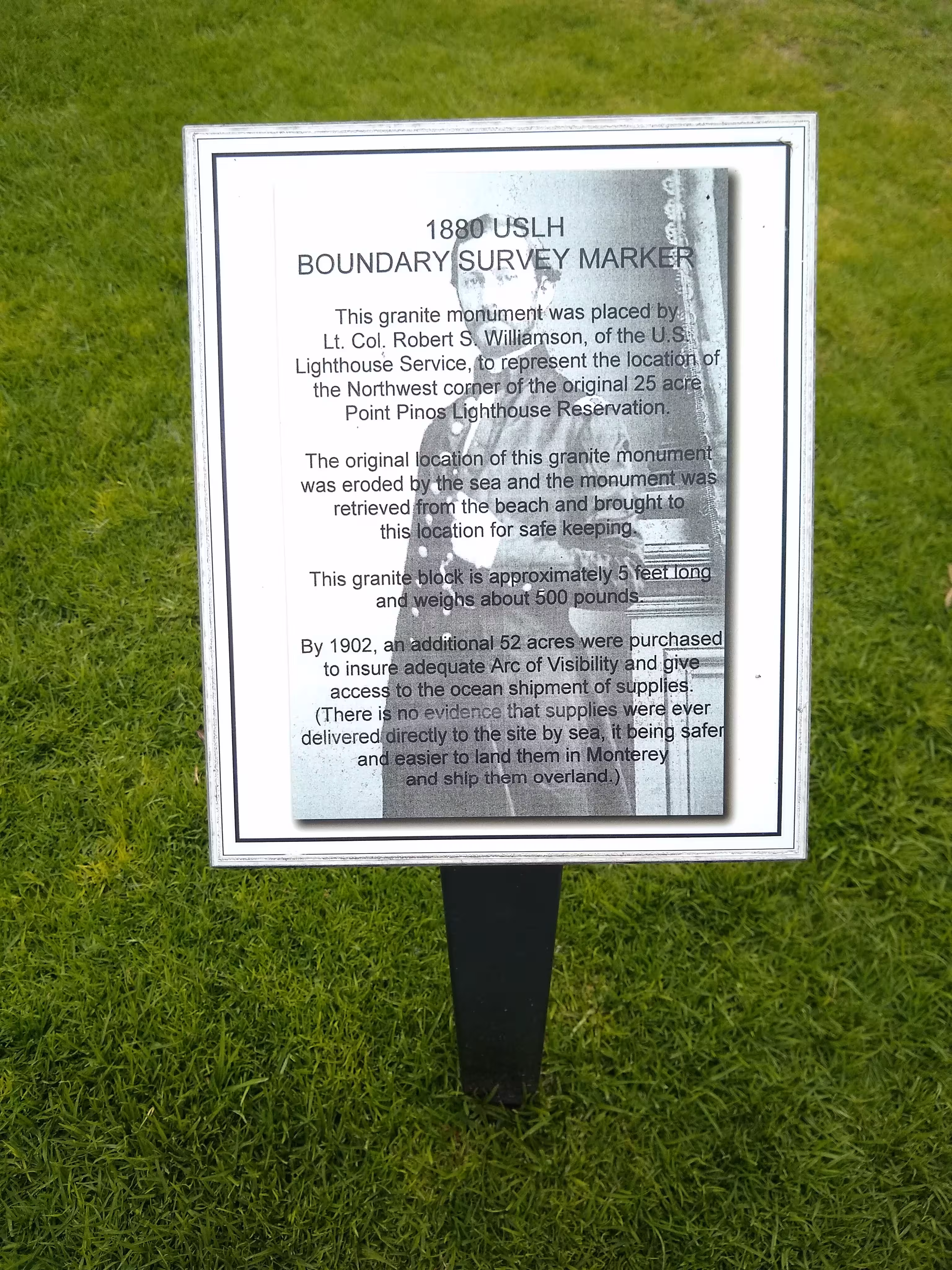
This boundary stone was planted in 1880 by the US Lighthouse Service. It is located at Point Pinos, California. Nearby is a sign, reading this:
|
1880 USLH BOUNDARY SURVEY MARKER This granite monument was placed by Lt. Col. Rovert S. Williamson, of the U.S. Lighthouse Service, to represent the location of the Northwest corner of the original 25 acre Point Pinos Lighthouse Reservation. The original location of this granite monument was eroded by the sea and the monument was retrieved from the beach and brought to this location for safe keeping. This granite block is approximately 5 feet long and weighs about 500 pounds. By 1902, an additional 52 acres were purchased to insure adequate Arc of Visibility and give access to the ocean shipment of supplies. (There is no evidence that supplies were ever delivered directly to the site by sea, it being safer and easier to land them in Monterey and ship them overland.) |
|
|
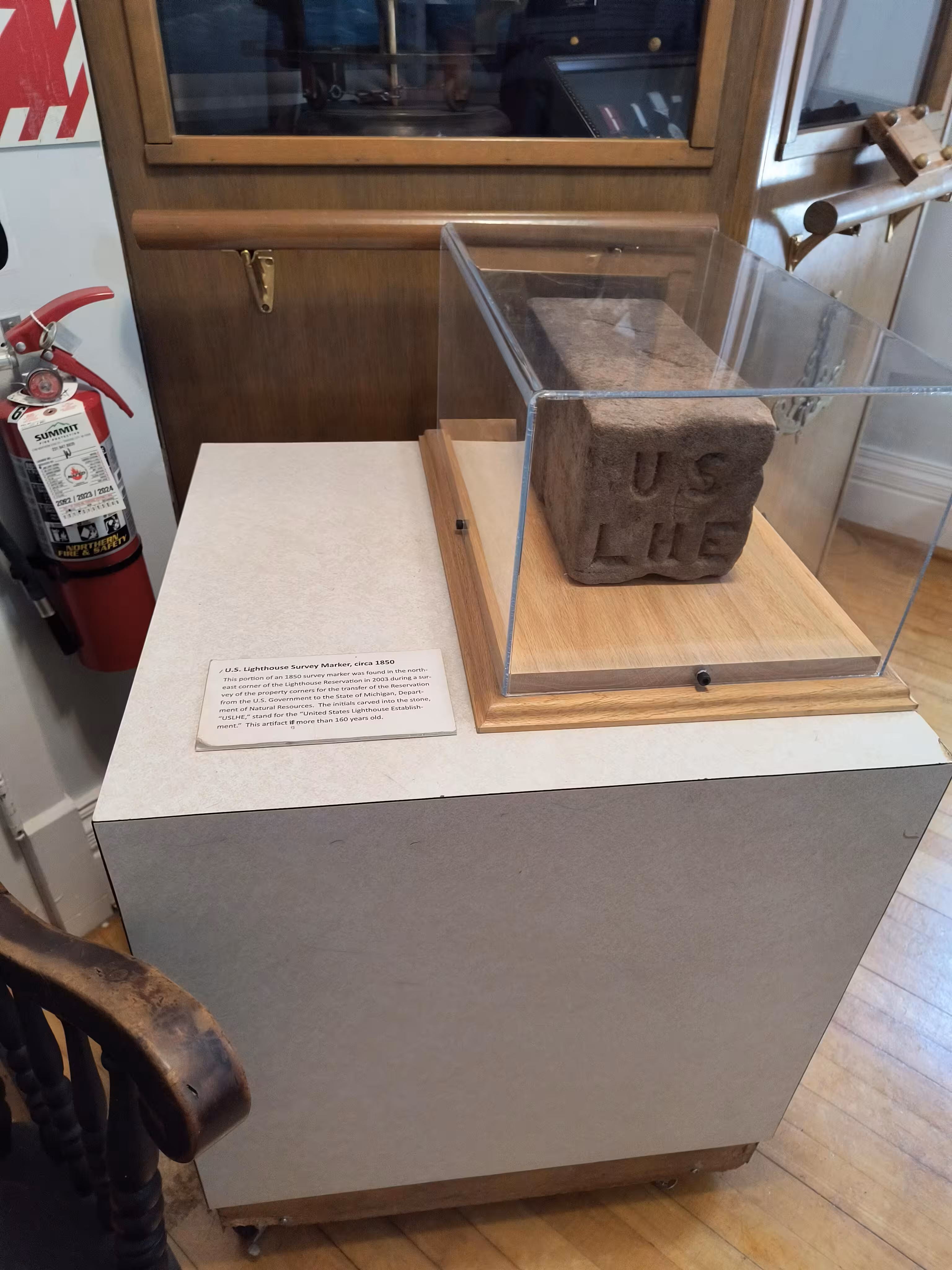
U.S. Lighthouse Survey Marker, circa 1850 This portion of an 1850 survey marker was found in the north-east corner of the Lighthouse Reservation in 2003 during a survey of the property corners for the transfer of the Reservation from the U.S. Government to the State of Michigan, Department of Natural Resources. The initials carved into the stone, "USLHE," stand for the "United States Lighthouse Establishment." This artifact is more than 160 years old. |
|