The United States Geological Survey or USGS, founded in 1879, is a governmental agency. It was originally created to explore and document the lands of the United States that had been relatively unexplored.
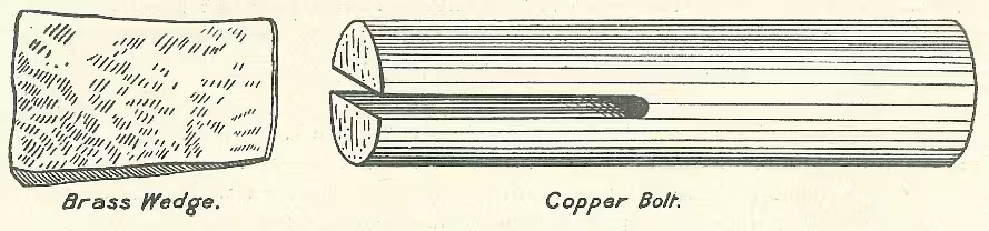
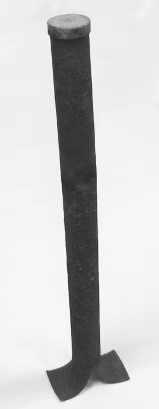
The first topographic maps were made in 1882. In order to triangulate, the first benchmarks developed by the USGS that predated the act were a wedge and bolt. The bolt was 4 inches long and 1 inch in diamteter. By driving it on a brass wedge placed in the bottom of a vertical hole the size of the bolt, so that the top of the bolt was horizontal, it formed the benchmark. This would then have sometimes been enscribed with "USGS", the elevation, and "B.M.". These were often used in triangulation on topographic maps before traditional benchmark designs were made.
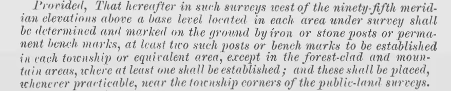
However, the agency changed June 11, 1896 because of the Sundry Civil Appropriation Act. The following was stated:
“Provided, that hereafter in such surveys west of the 95th meridian elevations above a base level located in each area under survey shall be determined and marked on the ground by iron, or stone, posts, or permanent bench marks, at least two such posts or bench marks to be established in each township or equivalent area, except in the forest-clad and mountain areas, where at least one shall be established, and these shall be placed whenever practicable, near the township corners of the public land surveys; and in the areas east of the 95th meridian at least one such post or bench mark shall be similarly established, in each area equivalent to the area of a township of the public land surveys.”
By this act passed by Congress, the USGS was to manage the task of establishing these permanent monuments in "Indian Lands". Earlier that year, designs were being made for triangulation networks planned in the great plains. This amounted to the first ever benchmark disks. Two designs were made, one for rock and building and the other for soft ground.
Initially, disks were made without datum stamping, as seen here: https://geodesy.noaa.gov/cgi-bin/get_image.prl?PROCESSING=get_image&PID=AY1149&filename=AY1149-1265-1-20230223.jpg.
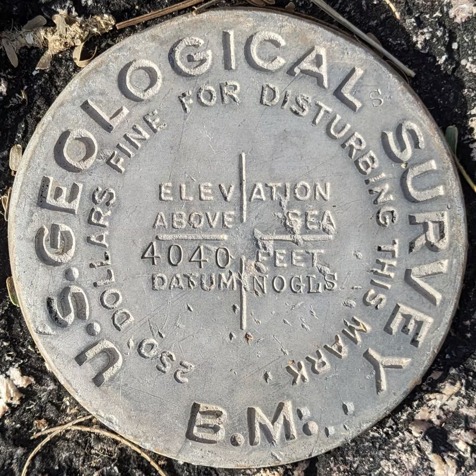
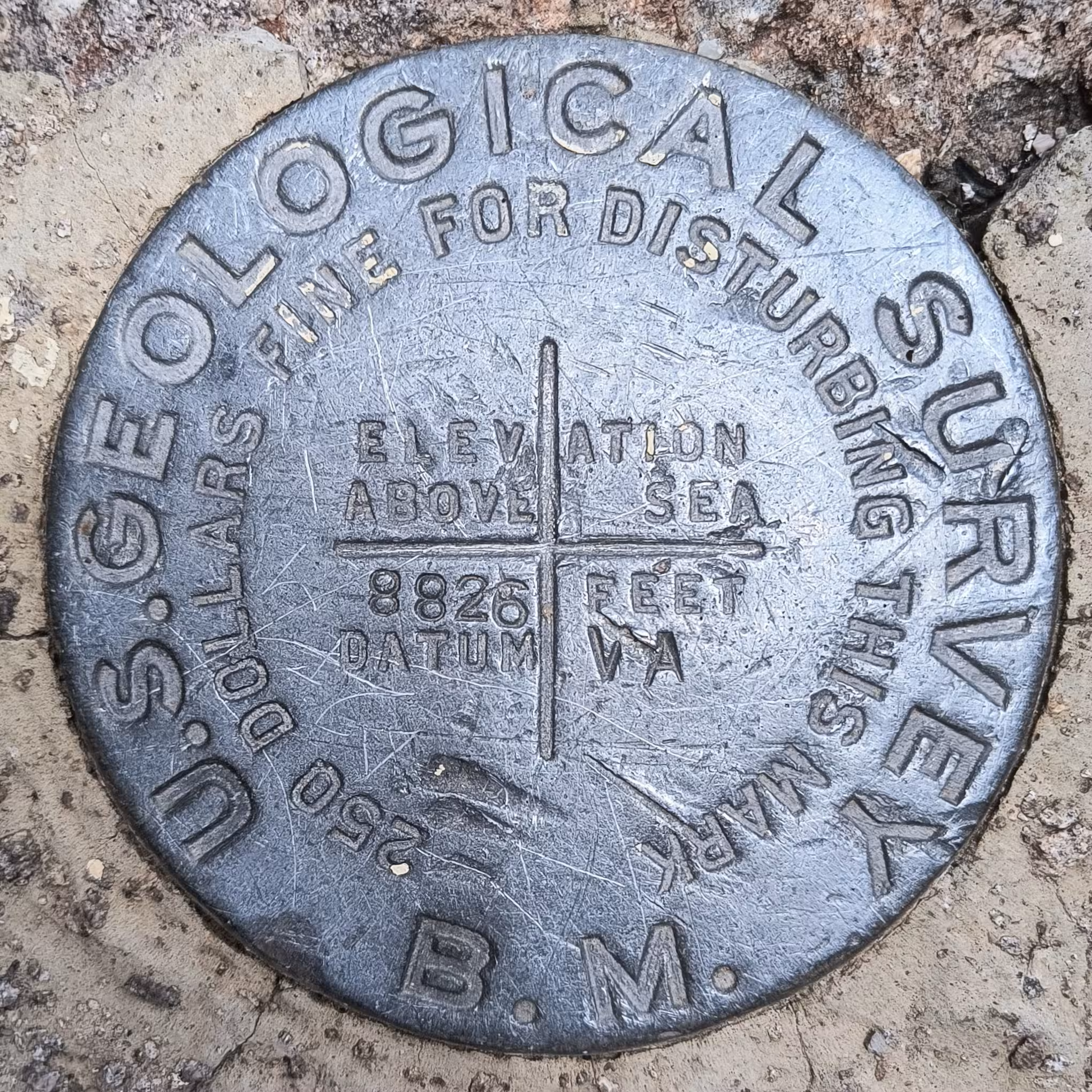
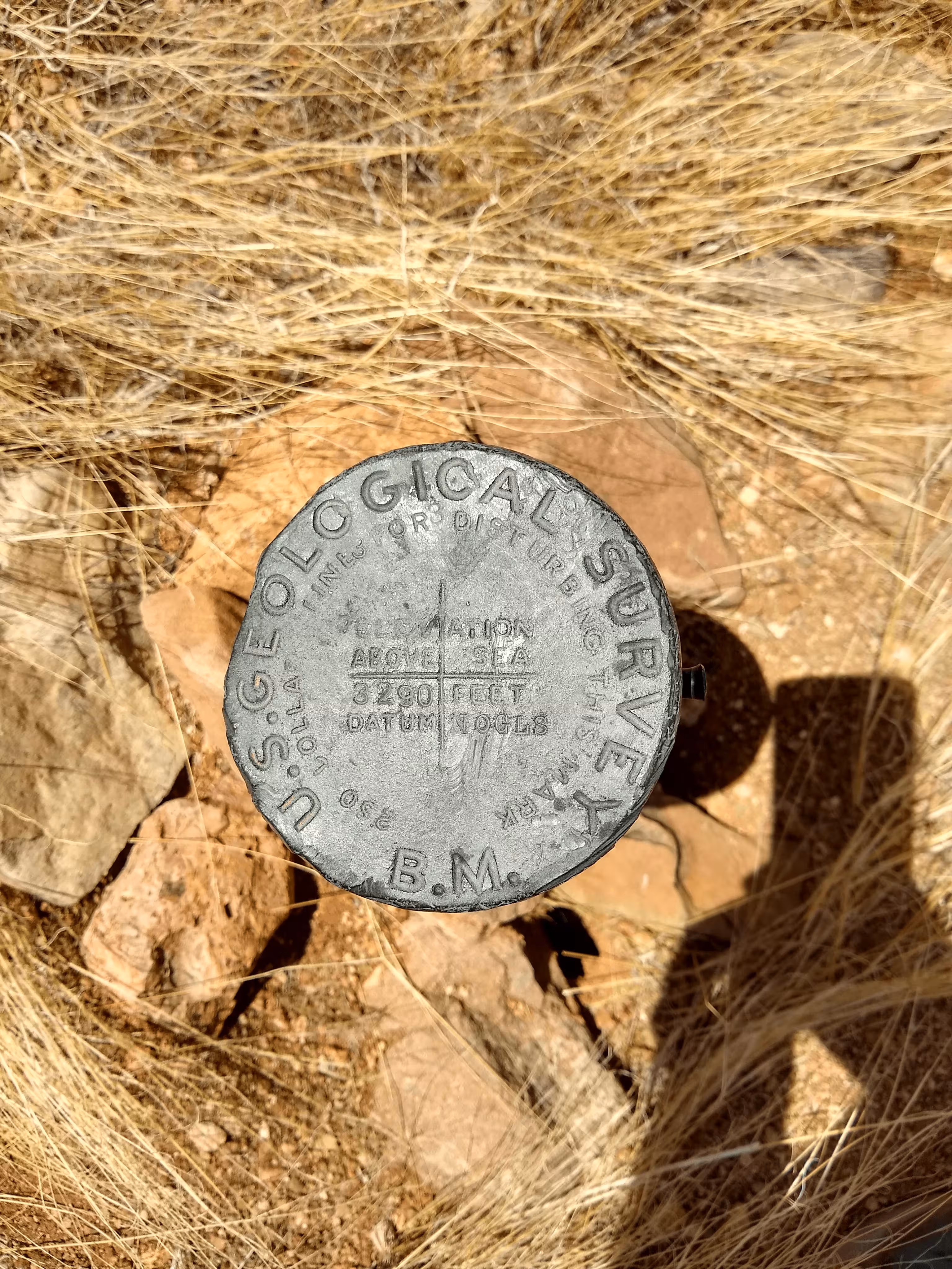
The one made for rock and buildings was a disk 3.5 inches in diameter and 1/4 of an inch thick. A 3 inch stem protruded from the bottom. This stem would be placed in a drill hole and cemented in. These disks were made out of copper and aluminum. Intresetingly, some disks have a full "plus" while others have a 4 lines not quite intersecting to make a plus. As far as I know, only these disks had different pluses while the pipe cap only featured complete pluses.
The one made for soft ground had the same disk was 1 inch think stead of 1/4 of an inch thich. This disk was the cap of a pipe 4 feet long. At the end of the pipe, the pipe split in half making 2 roots for the benchmark. These would be placed so that the disk would be close to ground level, if possible. These disks would be made out of copper or aluminum.
At this point, the bolts had not been completely phased out, still sometimes used as triangulation stations. Around 1899, a new style for triangulation stations was designed and started being used. What prompted this mark being created was the need for more permanent triangulation stations as trees or cairns were commonly used in many places as stations.
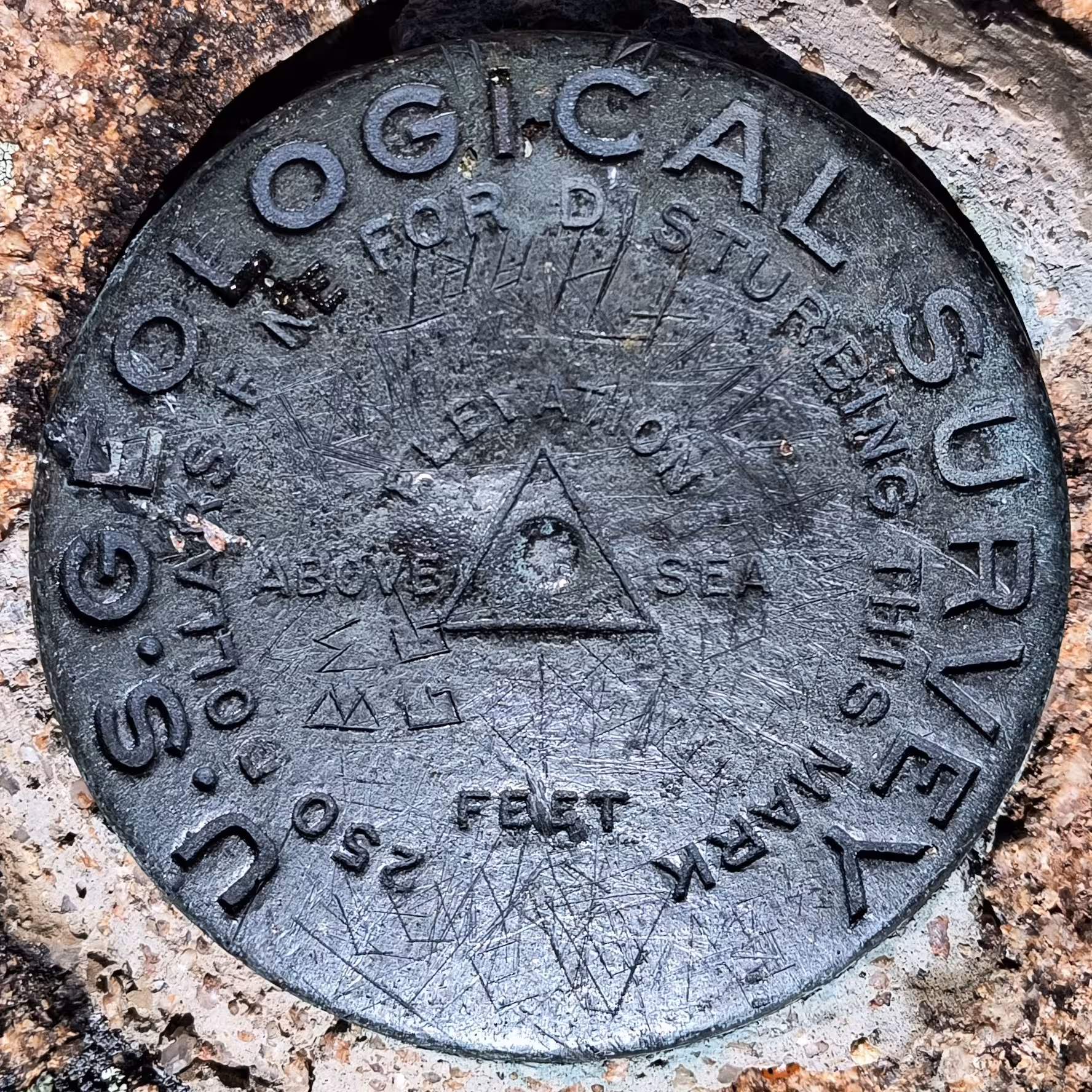
This design was exclusively made for placement in rock or buildings, as were the bolts. This design got rid of the "B.M." at the bottom of the benchmark and added the classic triangle with a point in the middle of the mark. There was no spot for a datum on these benchmarks, only an elevation. Most often than not these benchmarks were left unstamped or with simply the date printed on them. As time passed though, it became more common practice adding more stamping. It is noteworthy that many traingulation stations did not use these disks, instead their vertical counterparts.
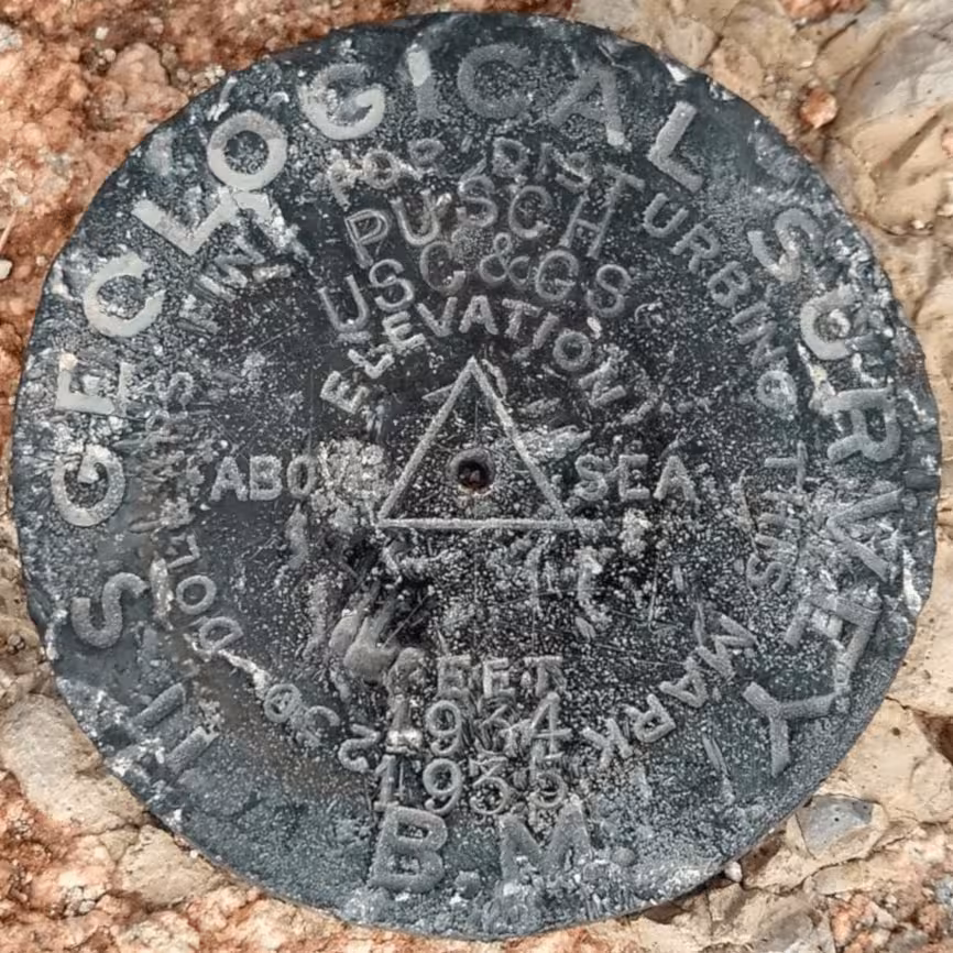
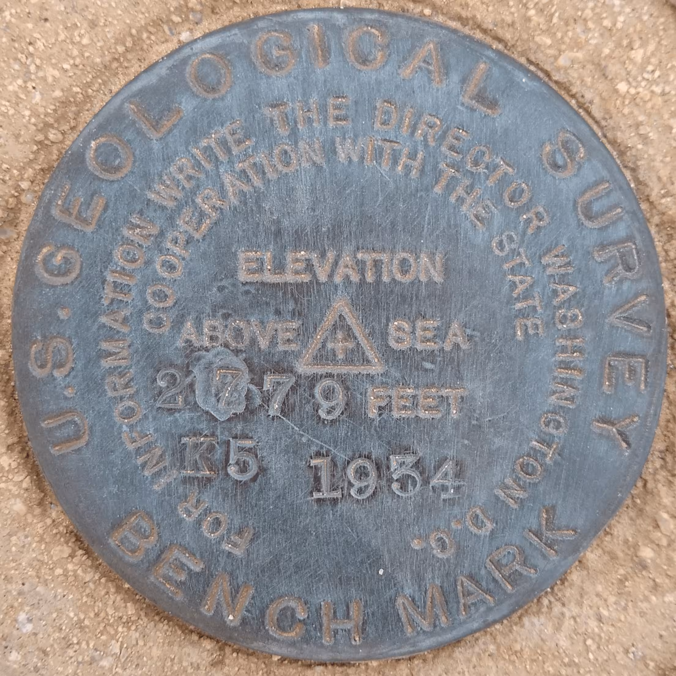
In 1903, a small revision was made adding the "B.M" back from the typical elevation markers to the triangulation disks. The old version was still used past 1903 but became much rarer, especially over time as missions sent out in 1903 starting placing the remaining disks.
Some triangulation disks and vertical control disks had the state they were in pre-printed across the top of the disk. These were likely concepted in the very early 1900s.
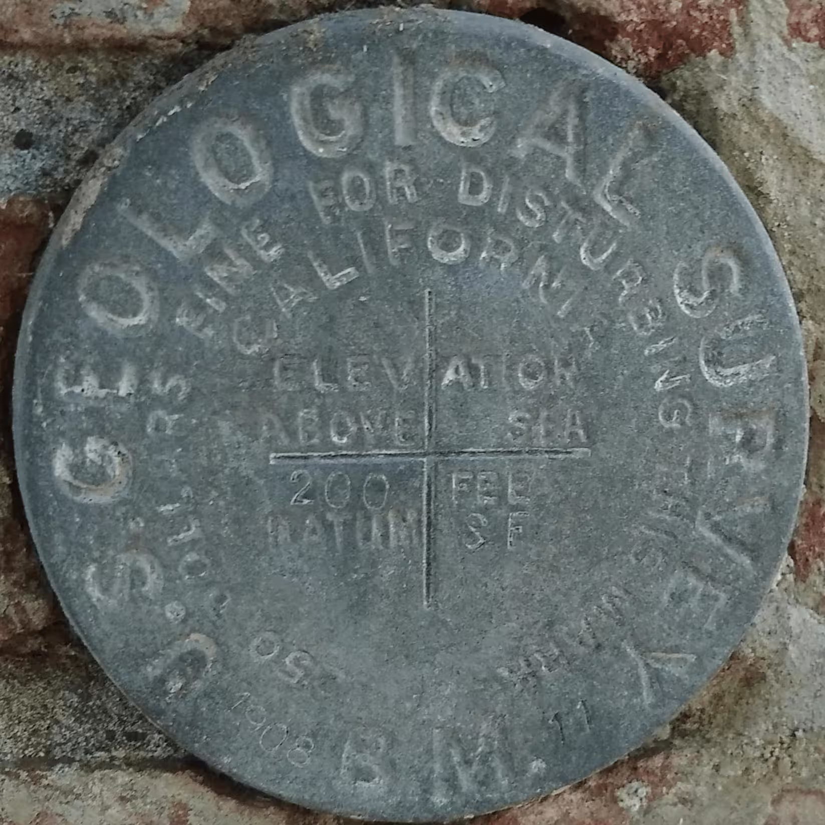
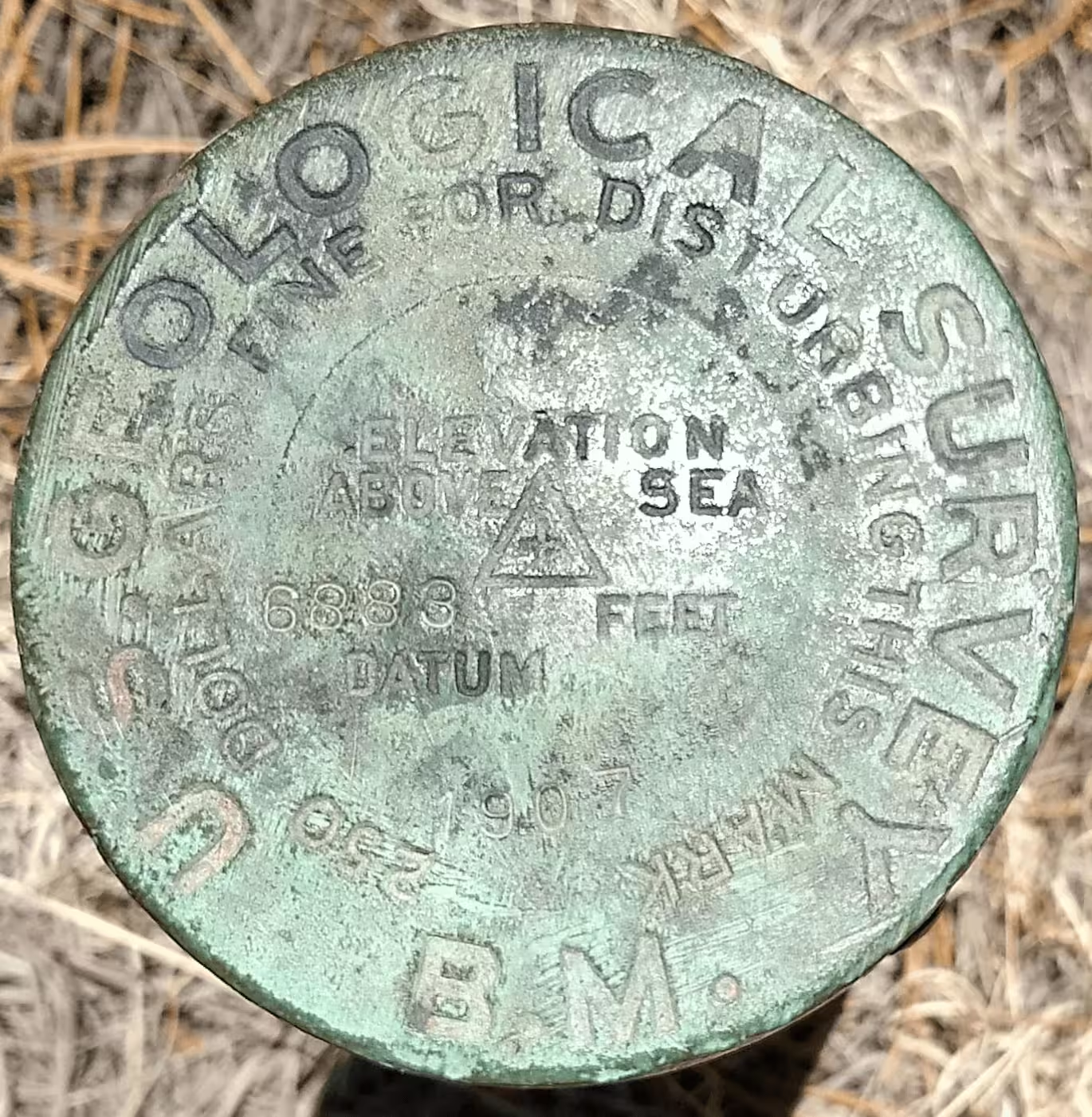
In 1907, a new design of benchmark was made. This removed the "plus" from the old design and added a small triangle with a plus inside of it. The old design for triangulation and vertical control was used rarely after 1908.
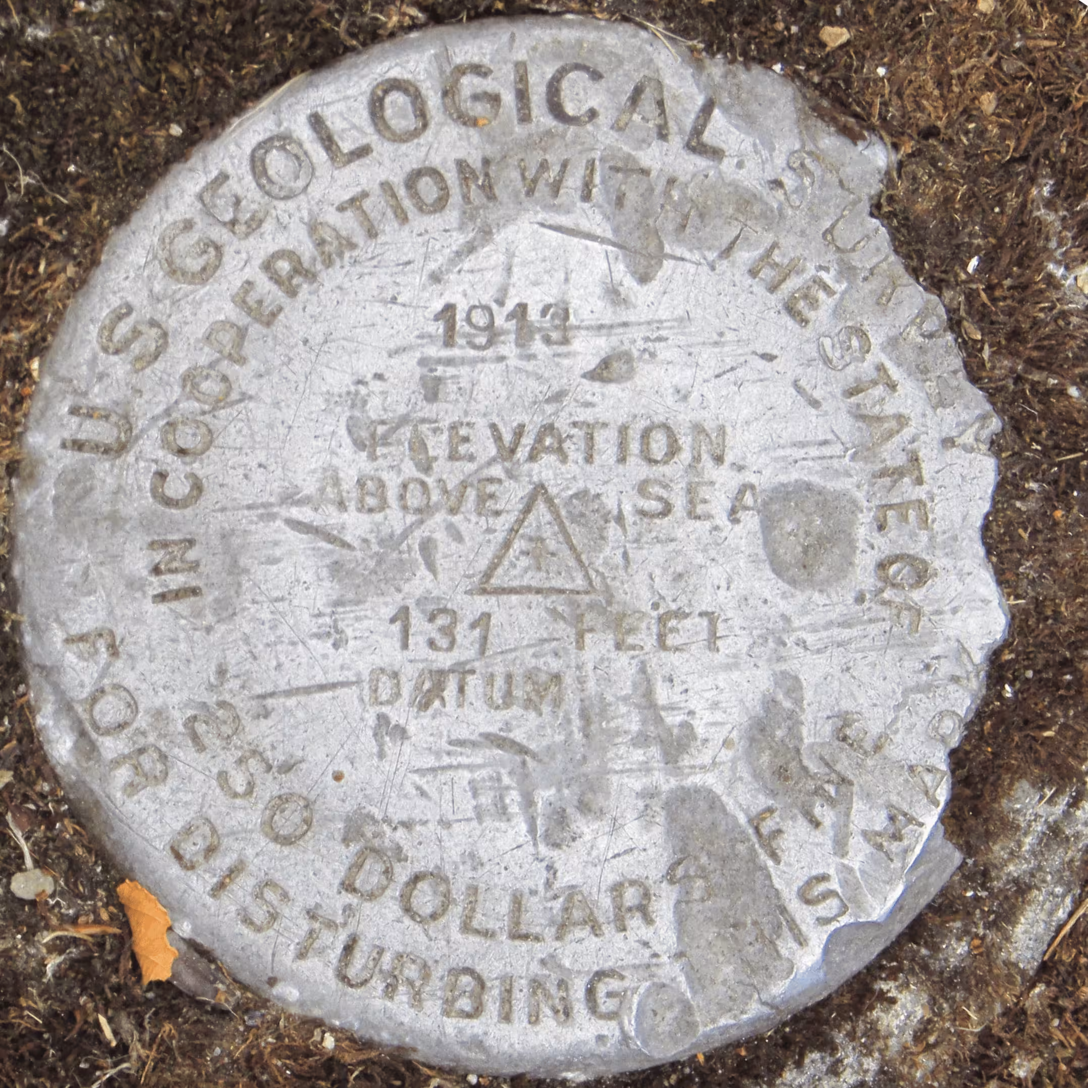
An alternate design of this featured the 1907 design but without the big "UNITED STATES GEOLOGICAL SURVEY" and said "IN COOPERATION WITH THE STATE OF". One much rarer version had no "DATUM" printed on it.
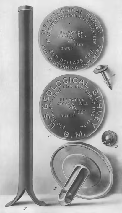
The next change came in 1932 when the "IN COOPERATION WITH THE STATE" design became fully embraced. These new benchmarks did not feature the $250 fine warning for disturbing the mark. They had no datum label.
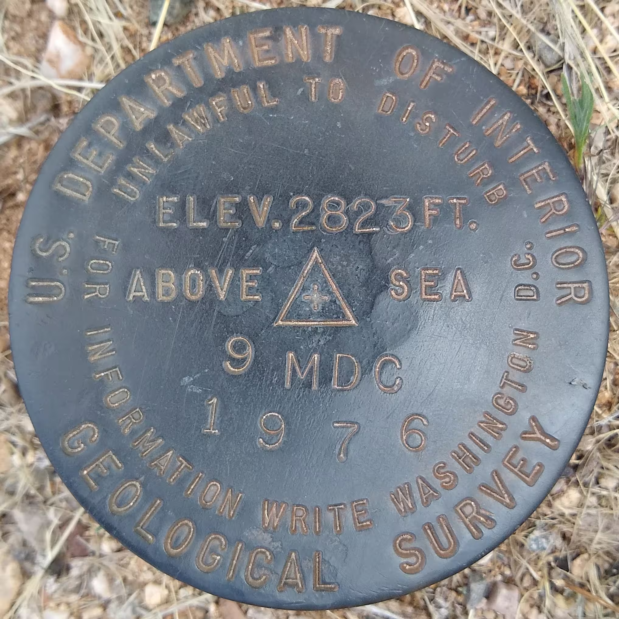
In 1962 the next change embraced "U.S. Department of Interior", the parent agency of the USGS. It now warned that it is unlawful to distrub. From what I have found, this was the last change made to the markers. Benchmarks in the disk form have been phased out from modern surveying for the most part. While survey points are still used, they are typically not as formal as these disks, though exceptions do exist.