|
|
Main benchmarks recovered in good or poor condition. |
|
|
Main benchmarks that have been destroyed. |
|
|
Reference benchmarks recovered in good or poor condition. |
|
|
Reference benchmarks that have been destroyed. |
|
|
Azimuth benchmarks recovered in good or poor condition. |
|
|
Azimuth benchmarks that have been destroyed. |
|
|
A main, reference, or azimuth benchmark not searched for. |
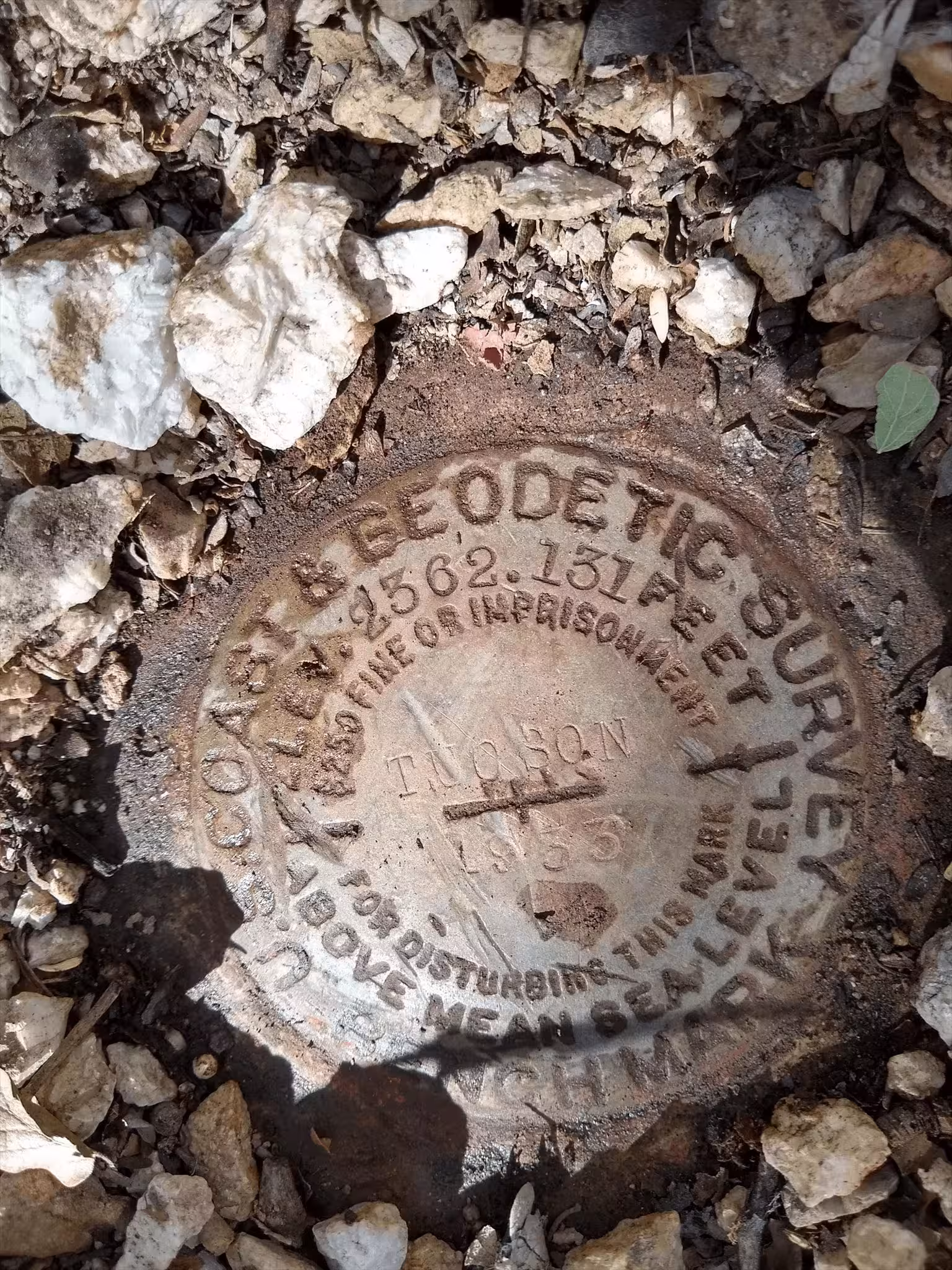
"TUCSON"
| NGS PointID: | CZ0276 |
| Condition: | Minor, long gashes across the disk. |
| Stamping: | 2362.131 TUCSON 1933 |
| Coordinates: | 32.222842, -110.975189 |
| Elevation: | 2362.131 ft (719.978 m) |
| Setting: | A concrete monument, 8 centimeters under the surface level. |
| Monumentor: | USC&GS |
Datasheet Description:
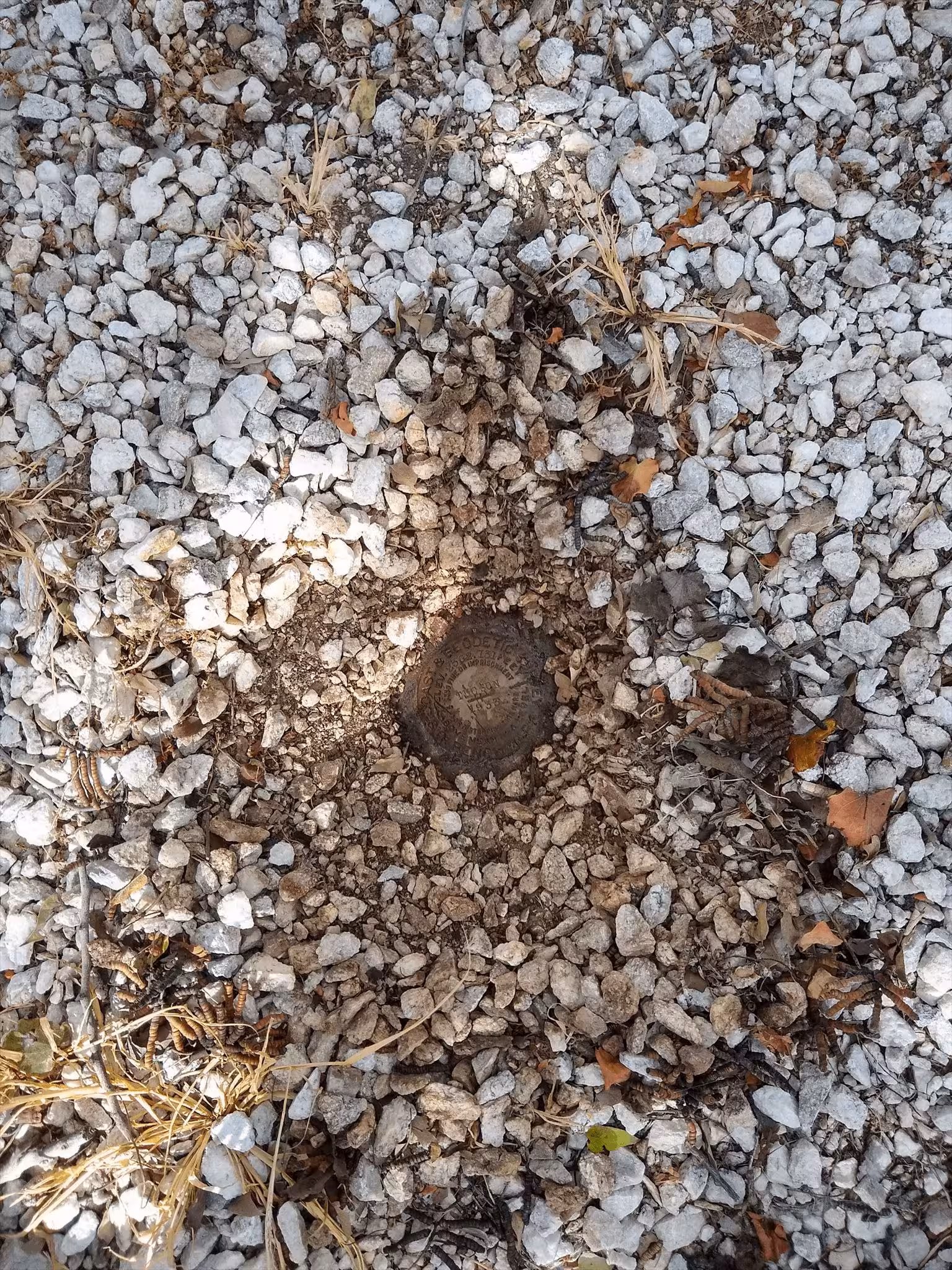
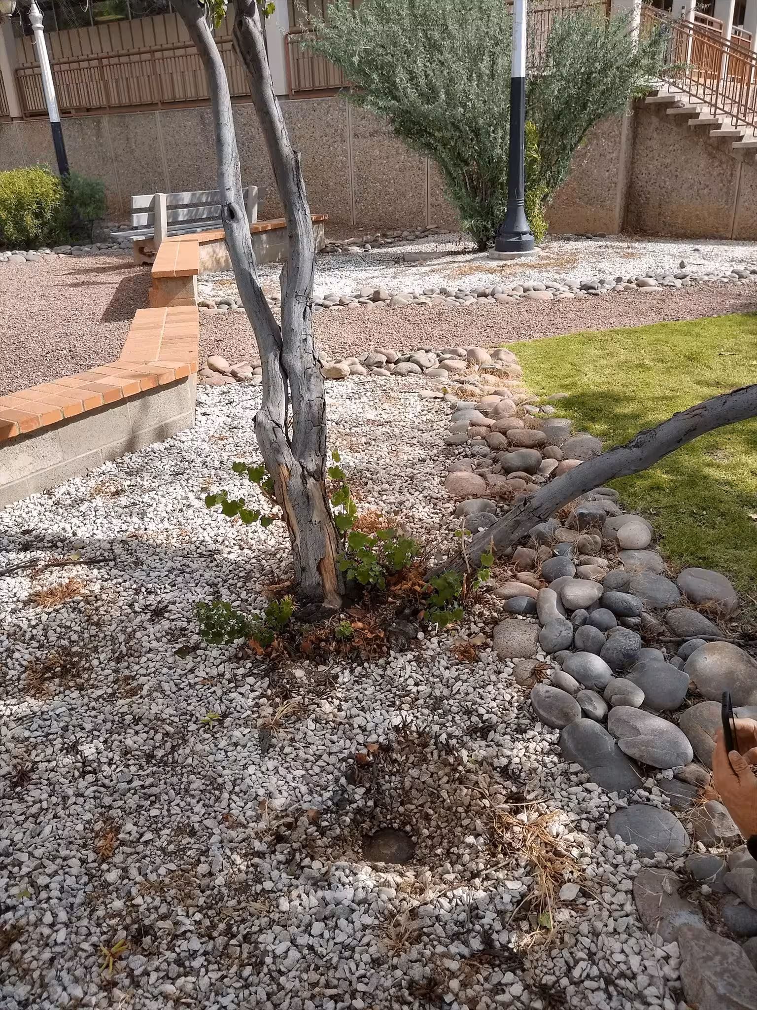
In Tucson, at the intersection of Alameda Street and Nain Avenue, 21.0 m (68.9 ft) east of the extended street center, 16.7 m (54.8 ft) south of the center of the eastbound lanes of the street, 11.9 m (39.0 ft) north of the northwest corner of a concrete walkway around city hall, 7.7 m (25.3 ft) west of the Padre Euserio Francisco Kino Monument, 1.0 m (3.3 ft) above the level of the street, and the monument is recessed 0.1 m (0.3 ft) below the ground surface.
"TUCSON A" is a benchmark monumented by the USC&GS in 1933 located in Pima County, Arizona.
The benchmark is under white gravel. There should be a depression of gravel where the benchmark is.