|
|
Main benchmarks recovered in good or poor condition. |
|
|
Main benchmarks that have been destroyed. |
|
|
Reference benchmarks recovered in good or poor condition. |
|
|
Reference benchmarks that have been destroyed. |
|
|
Azimuth benchmarks recovered in good or poor condition. |
|
|
Azimuth benchmarks that have been destroyed. |
|
|
A main, reference, or azimuth benchmark not searched for. |
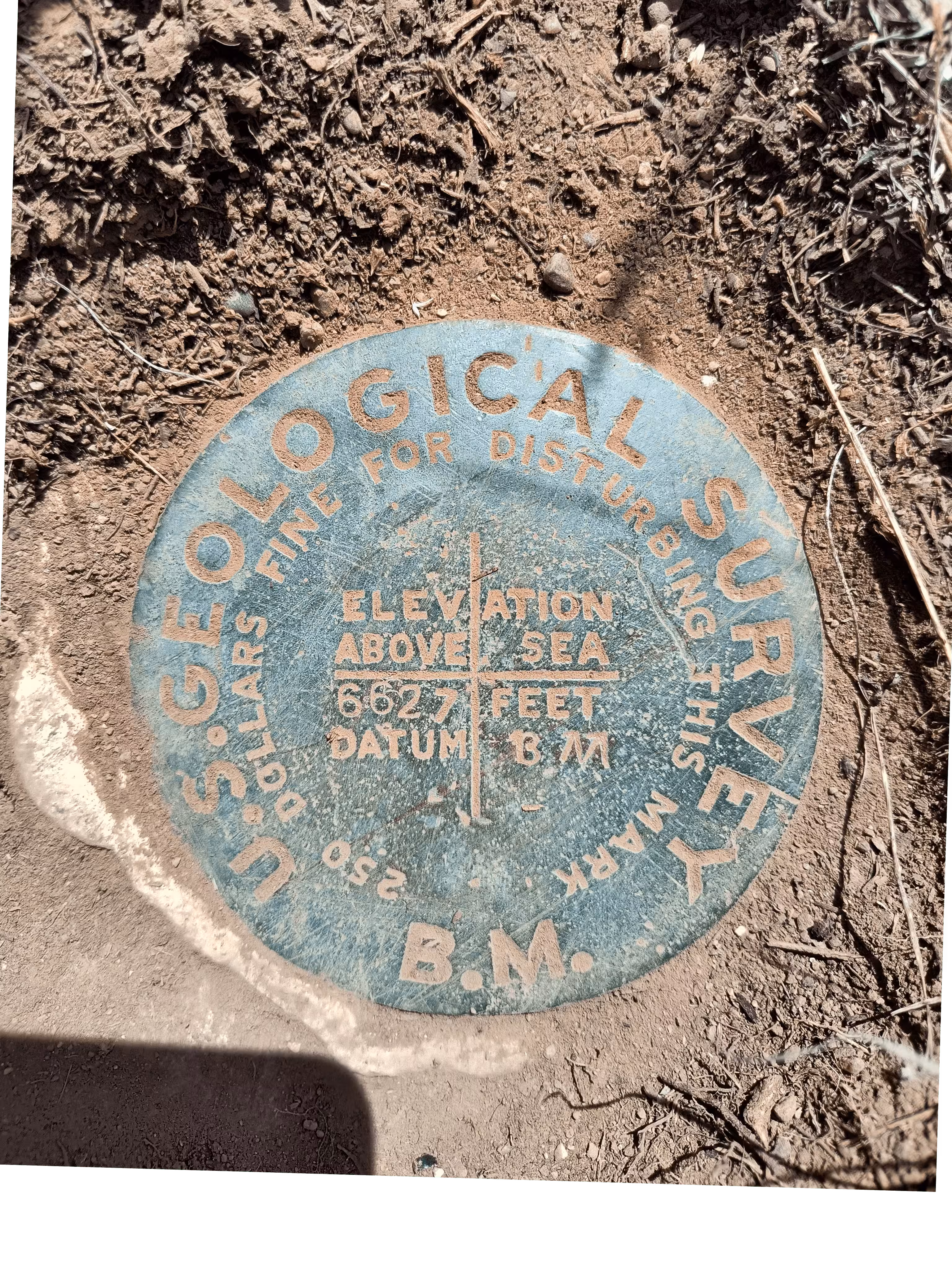
"TETON SOUTH BASE"
| NGS PointID: | OX0832 |
| Reference Benchmarks: | TETON SOUTH BASE NO 1, TETON SOUTH BASE NO 2, TETON SOUTH BASE RP NORTH, TETON SOUTH BASE RP EAST, TETON SOUTH BASE RP SOUTH, TETON SOUTH BASE RP WEST |
| Azimuth Benchmark: | D 41 |
| Condition: | Scratches and ware present. |
| Stamping: | 6627 BM |
| Coordinates: | 43.692475, -110.723503 |
| Elevation: | 6631 ft (2021 m) |
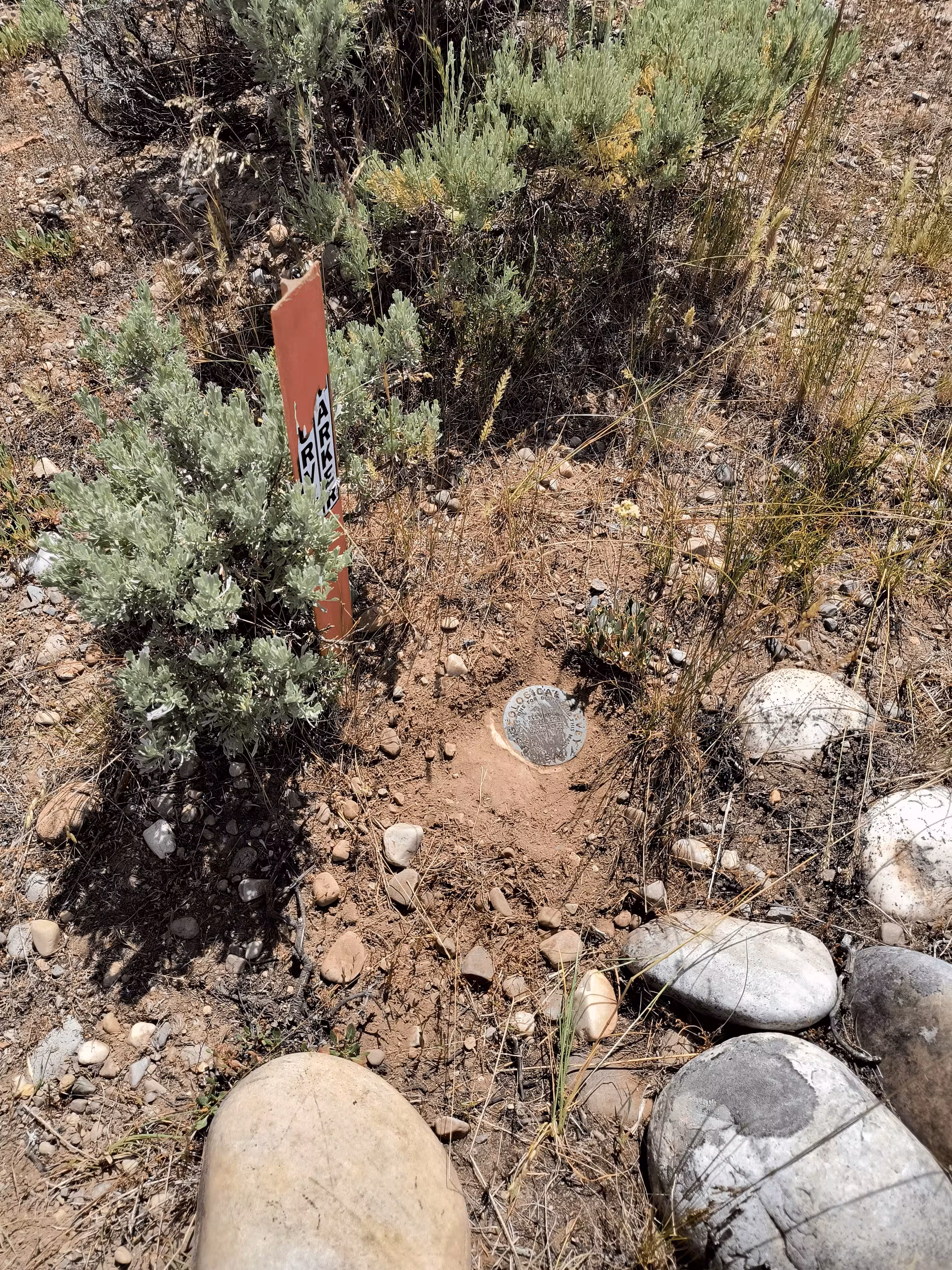
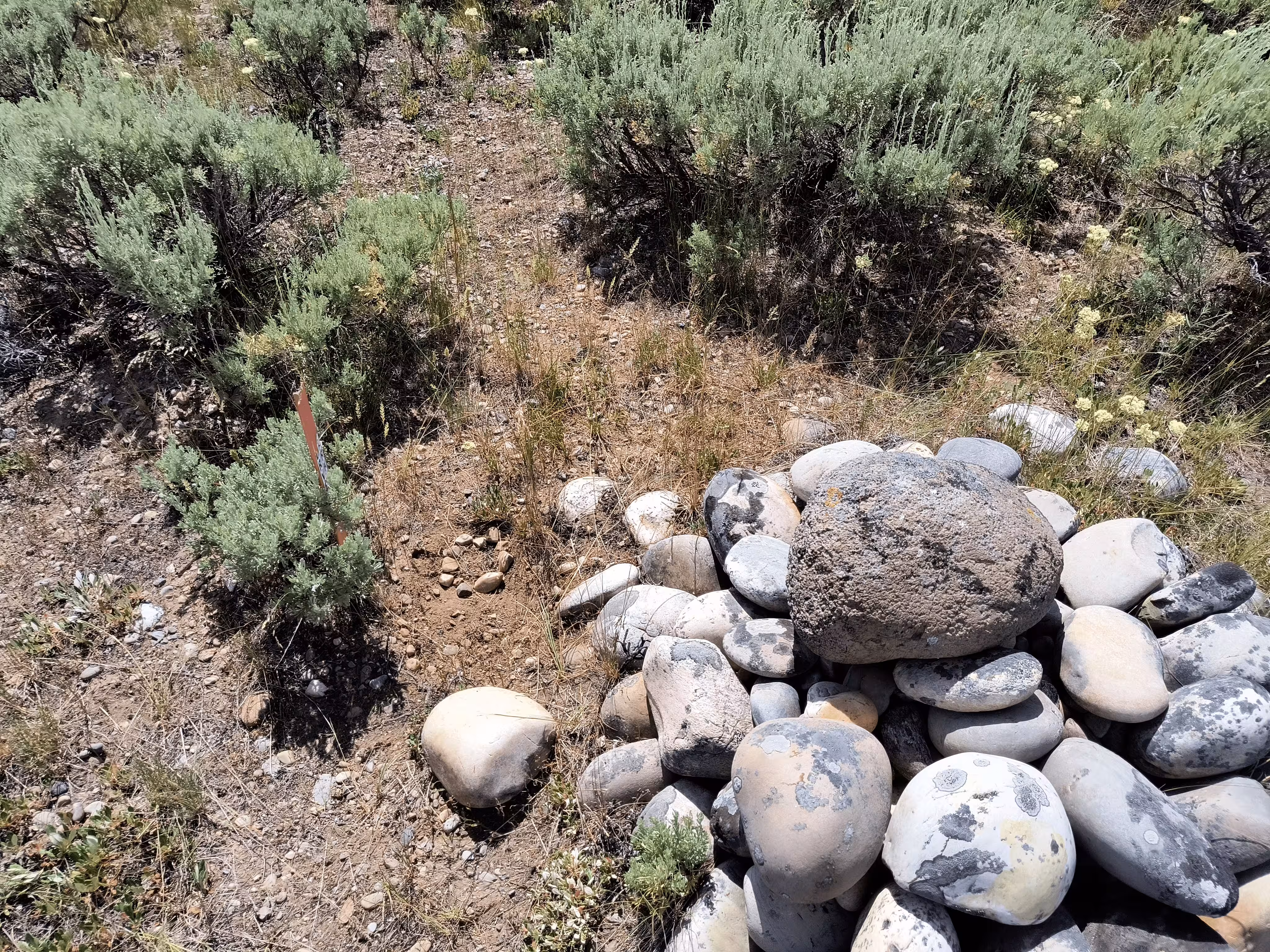
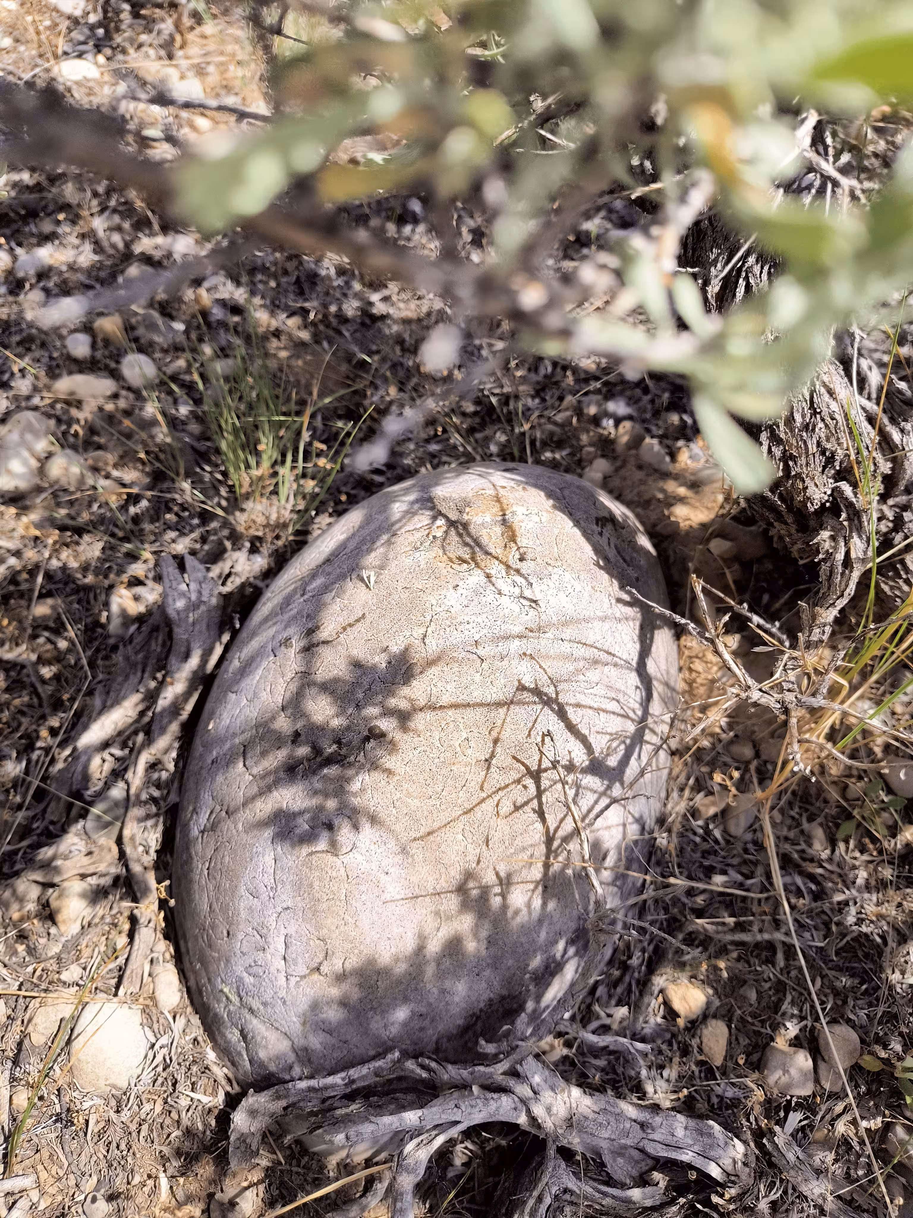
| Setting: | Boulder. |
| Monumentor: | USGS |
USGS Datasheet Description (1898):
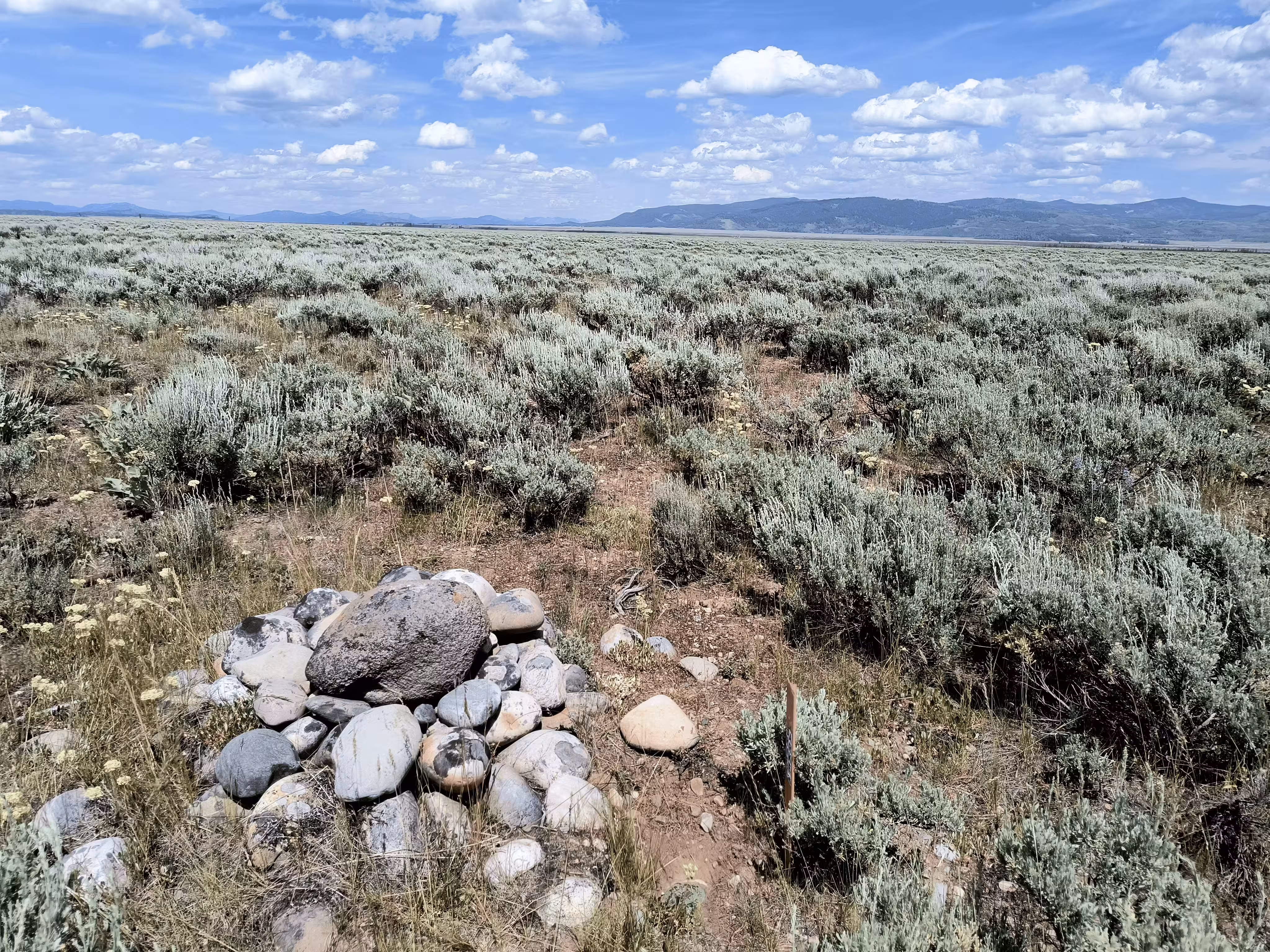
Is located about one-fourth mile northeast of the wagon road crossing Cottonwood Creek, about one-half mile northwest of two tall pine trees that grow on the north bank of Cottonwood Creek, 3 miles north of Menor's ferry, 1½ miles southeast of the south end of the long island of timber situated southeast of Jennys Lake.
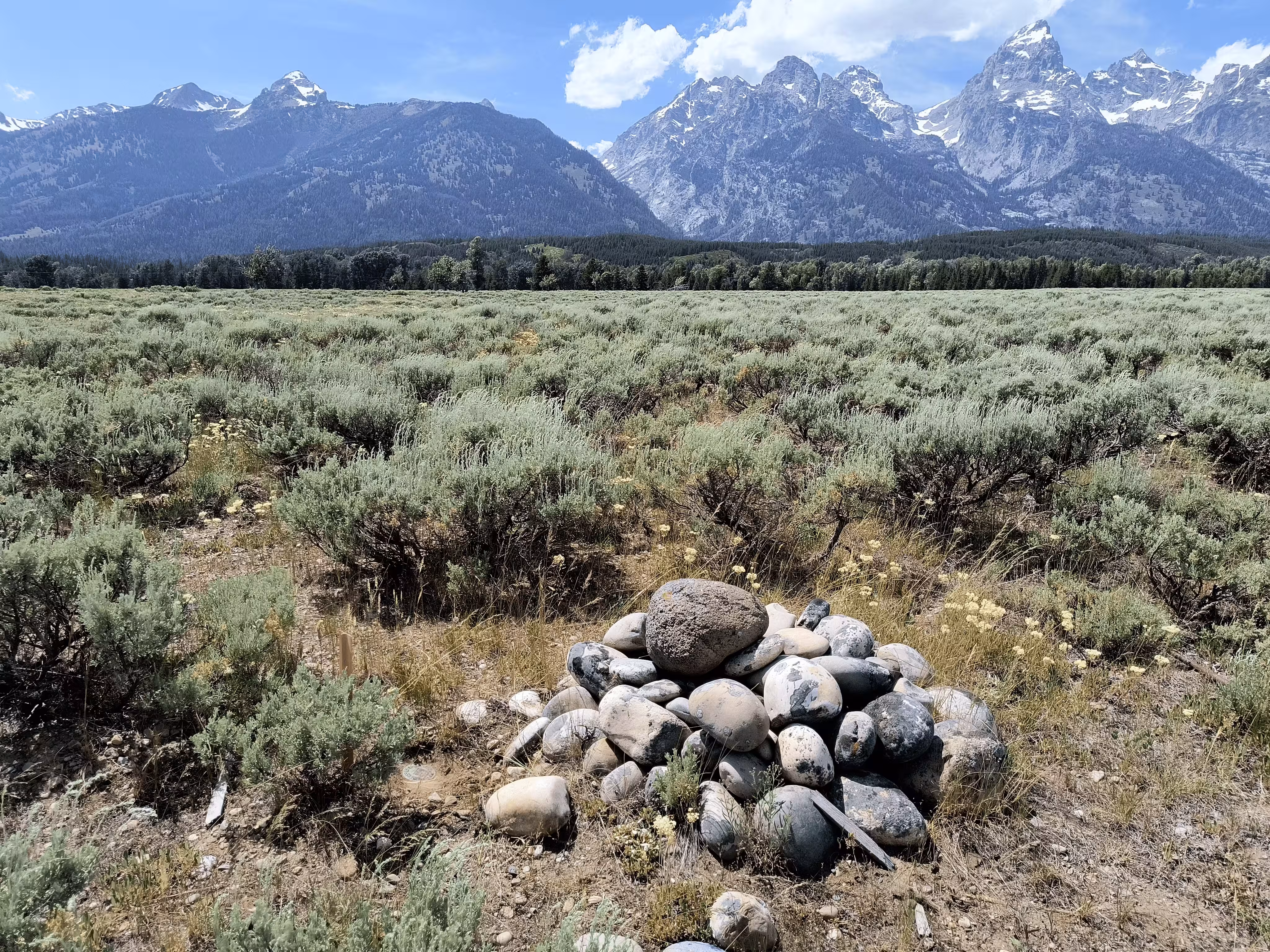
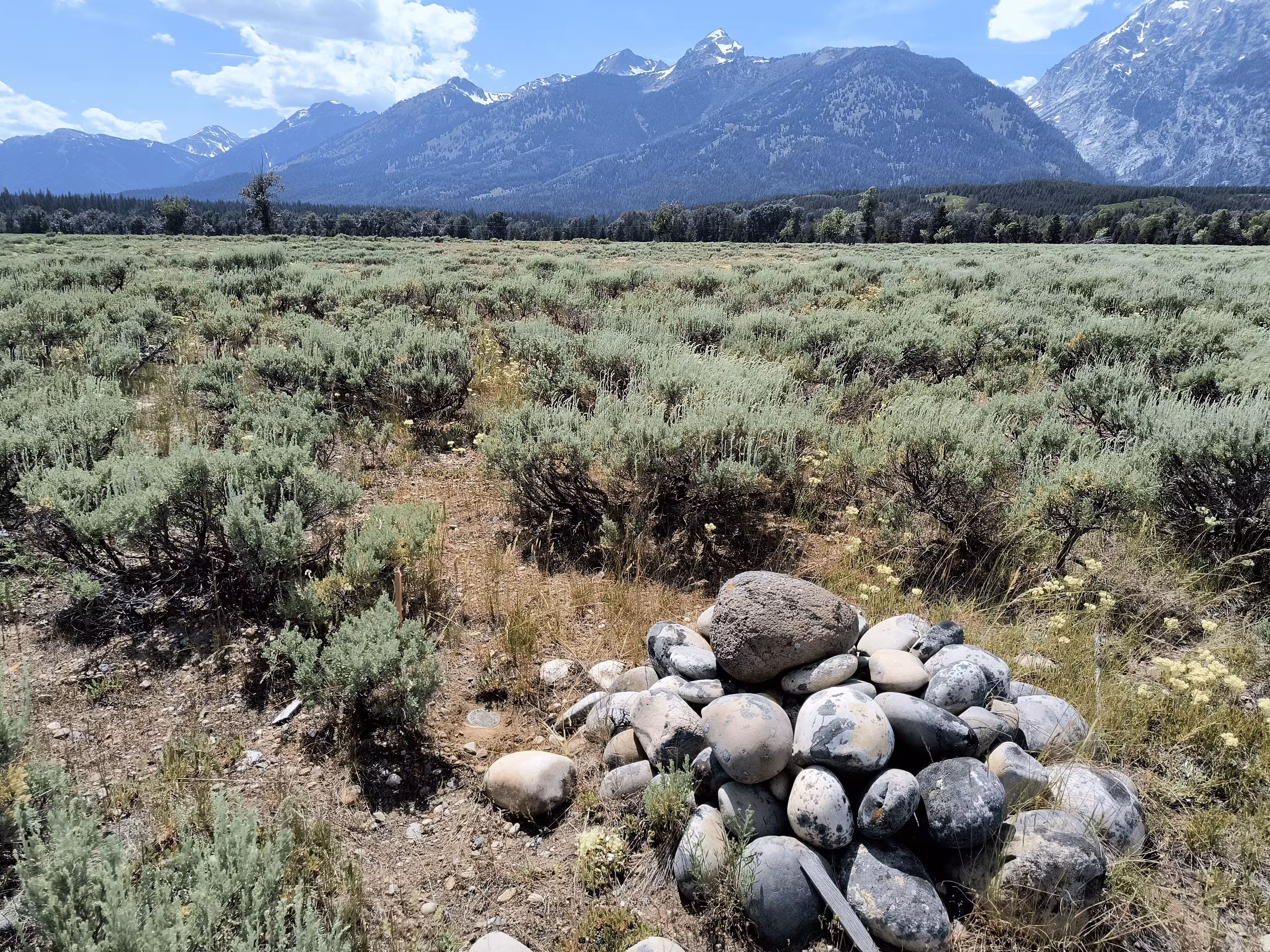
Station mark: A bronze tablet leaded into a large bowlder buried flush with the ground.
Reference marks: On each side of the tablet, on, and in the prolongation of the base line, is buried flush with the ground a stone with a cross (+) chiseled on it.
Reference marks are standard bronze disks set in concrete.
Truncated NGS Datasheet Description (1946):
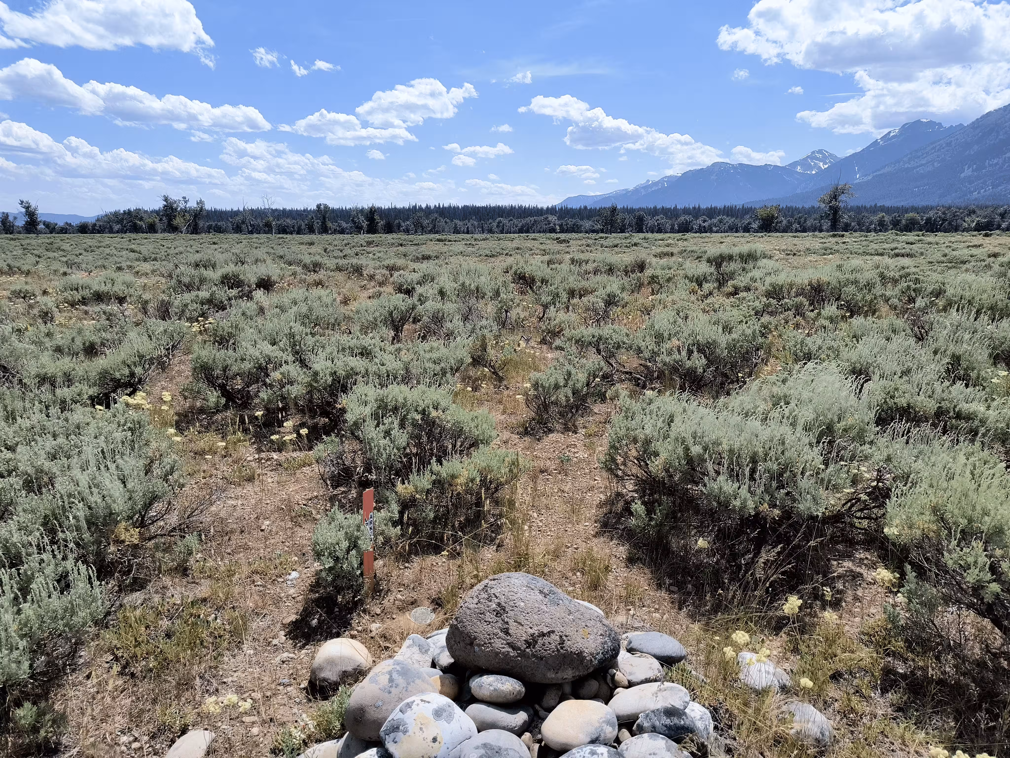
The station is located on a low flat gravelly bench 3 miles north by east of Moose and the bridge over the Snake River, 0.4 mile east of where U.S. Highway No. 187 crosses Cottonwood Creek and 1-1/2 miles southeast of the south end of the island of timber situated southeast of Jenny Lake. It is a U.S. Geological Survey bench mark disk leaded into the top of a large buried boulder flush with the surface of the ground, 27 feet east of the center of a track road and is stamped 6627 (ft.).
Four reference marks, (boulders with chiseled crosses, set north, south, east and west of the station, the north and south boulders being on the base line and prolongation thereof), established by the U.S. Geological survey were recovered and found in good condition. The north boulder is flush with the ground, the east boulder is about 6 inches in diameter and and projects about 1 inch, the south boulder is about 4 inches in diameter and projects about 1 inch and the west boulder is about 8 inches in diameter and projects about 4 inches.
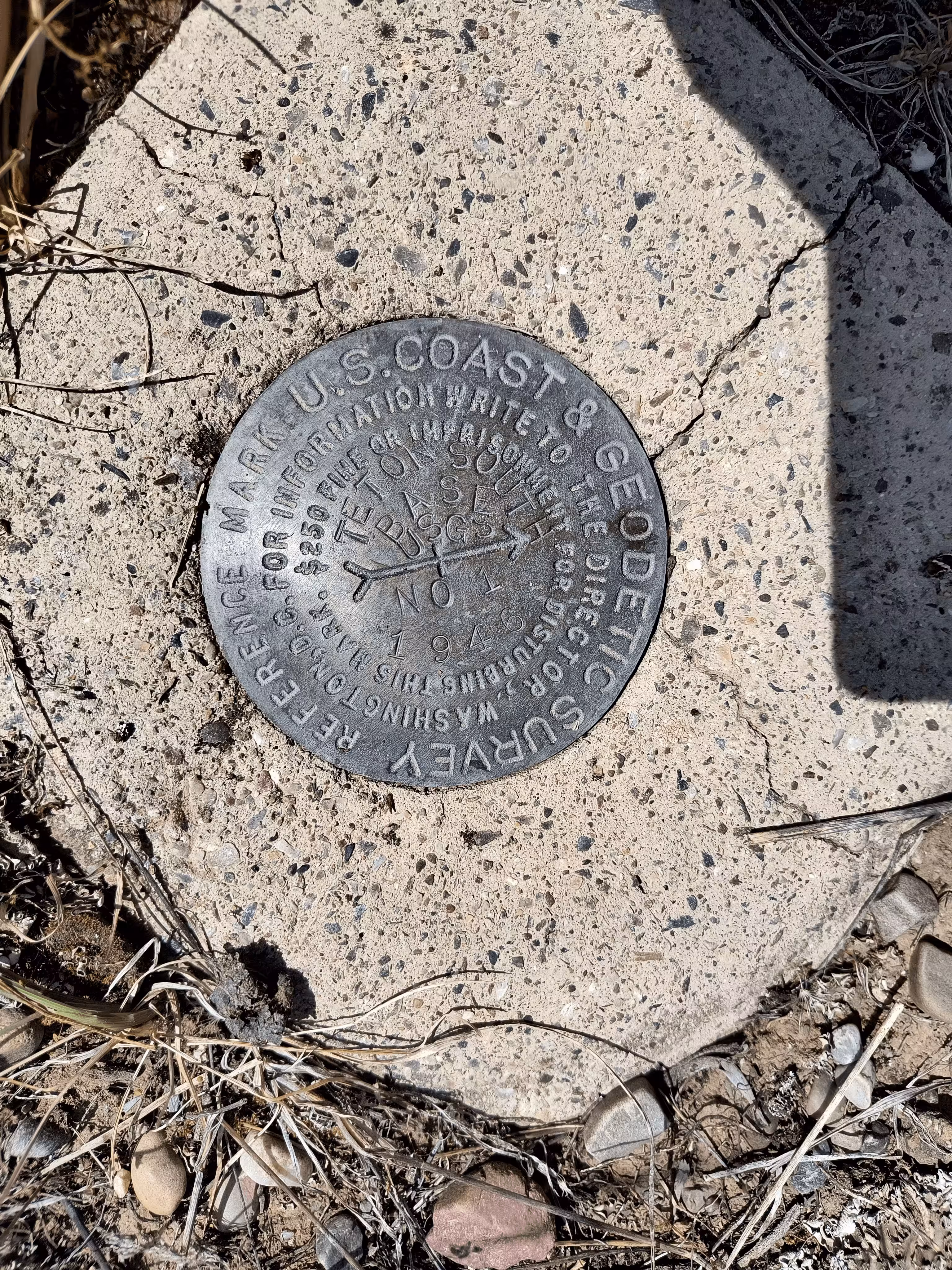
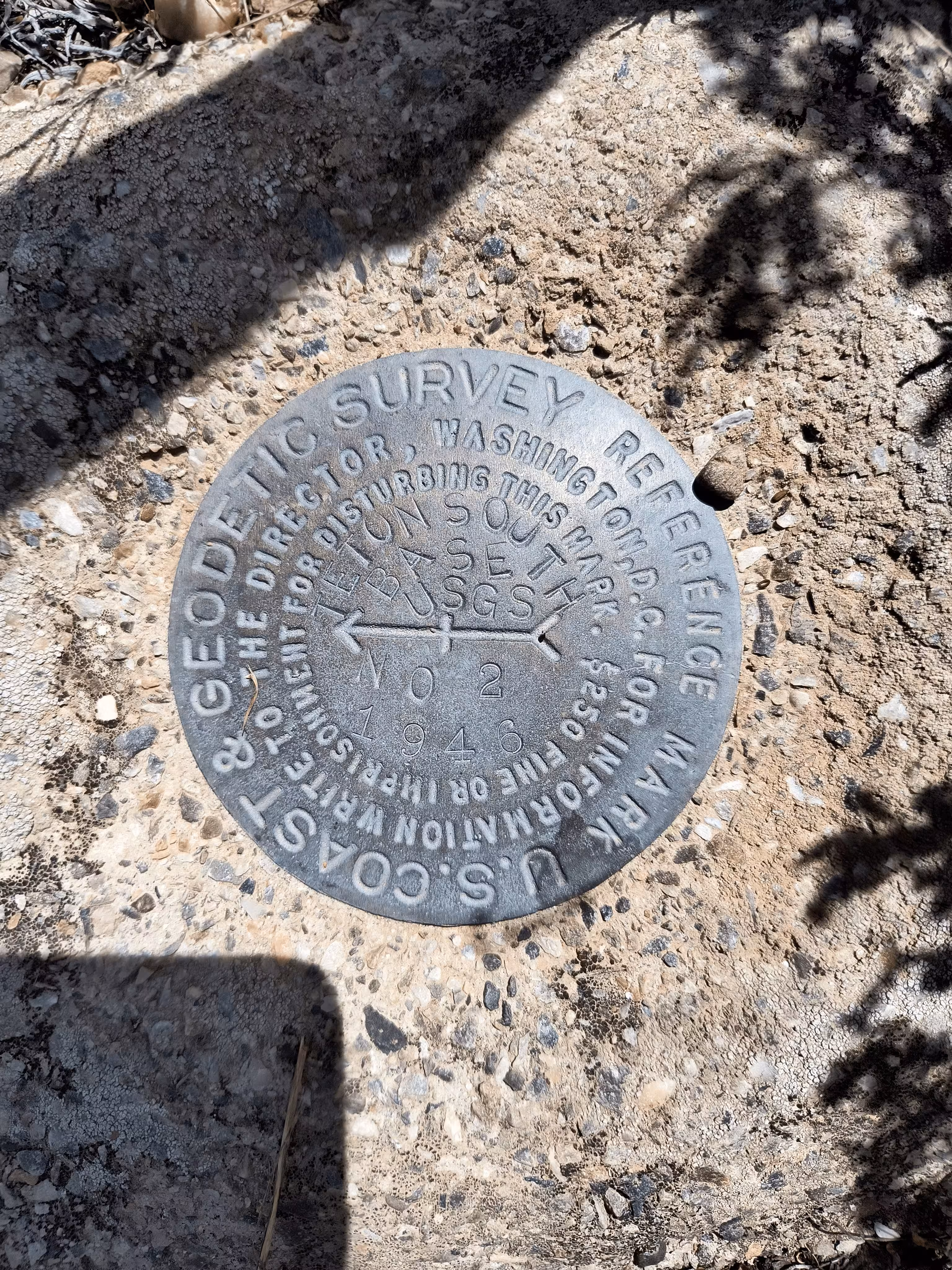
Reference Mark No. 1 is a disk set in a concrete monument projecting about 3 inches, southwest of the station, 13 feet east of the center of the track road and is stamped TETON S BASE USGS NO 1 1946.
Reference Mark No. 2 is a disk set in a concrete monument flush with the ground, west northwest of the station, in the west rack of the road and is stamped TETON S BASE USGS NO 2 1946.
The azimuth mark is about 0.7 mile north by west of the station. It is a coast and geodetic survey bench mark disk set flush in the head of a concrete culvert 15 feet west of the center of U.S. Highway No. 187, 3 feet north of the south end of the culvert and is stamped D41 1934. To reach from the station go west 0.4 mile to Highway No. 187, turn right on the highway and go north for 0.7 mile to the mark on the left as described.
"TETON SOUTH BASE" is a benchmark monumented by the USGS in 1896 located in Teton County, Wyoming. It had six reference marks and an non-dedicated azimuth mark.
Nowadays, there are no roads going to the benchmark, just a .5 mile bushwhack through sagebrush steppe.
This benchmark is particularly notable because of its age, being placed in the first year that the USGS began placing benchmark disks/pipes. USGS datasheets for the quad signify this benchmark being placed in 1896 by Frank Tweedy, an accomplished surveyor for the USGS. Looking at USGS annual reports, it is more likely Tweedy was in this region in 1897, when he placed this benchmark. This prominence is further exemplified for the measurement of the TETON baseline accurate to 8 inches to the modern measurement. Not to mention, this was measured using a 300 foot steel tape. Measuring was done at night and with the aid of thermometers to avoid the expansion and contraction of the tape. The distance was also measured using the measurements from Sheridan to the baseline. This benchmark was also linked to Sheridan, a town 200 miles away over several 11-thousand-foot mountain ranges. However, it can be considered one of the most obscure of the set because the measurement was from the north base to Sheridan. The measurement of the north base to Sheridan however was done only being 25 meters or 82 feet off of the modern measurement of 319,772 meters, 0.008% of the distance. It's impressive.
Interestingly, this benchmark has "DATUM" on the disk, when most 1896 disks lack "DATUM" and "ABOVE SEA LEVEL". See The Evolution of USGS Benchmarks.
This benchmark is stamped as apart of the BM or B&M datum, the Burlington and Missouri Railroad datum. This was most likely done by T. M. Bannon The railroad extended to Sheridan.
Please read more about some of the history surrounding this benchmark here: https://geologistsofjacksonhole.org/wp-content/uploads/2016/11/The-1899-USGS-Grand-Teton-Quad.compressed.pdf & https://www.plsw.org/wp-content/uploads/2022/11/28-4-Oct2017.pdf (Beginning on pdf page 10, document page 9) & https://wyofile.com/wyoming-monument-middle-nowhere/.