|
|
Main benchmarks recovered in good or poor condition. |
|
|
Main benchmarks that have been destroyed. |
|
|
Reference benchmarks recovered in good or poor condition. |
|
|
Reference benchmarks that have been destroyed. |
|
|
Azimuth benchmarks recovered in good or poor condition. |
|
|
Azimuth benchmarks that have been destroyed. |
|
|
A main, reference, or azimuth benchmark not searched for. |
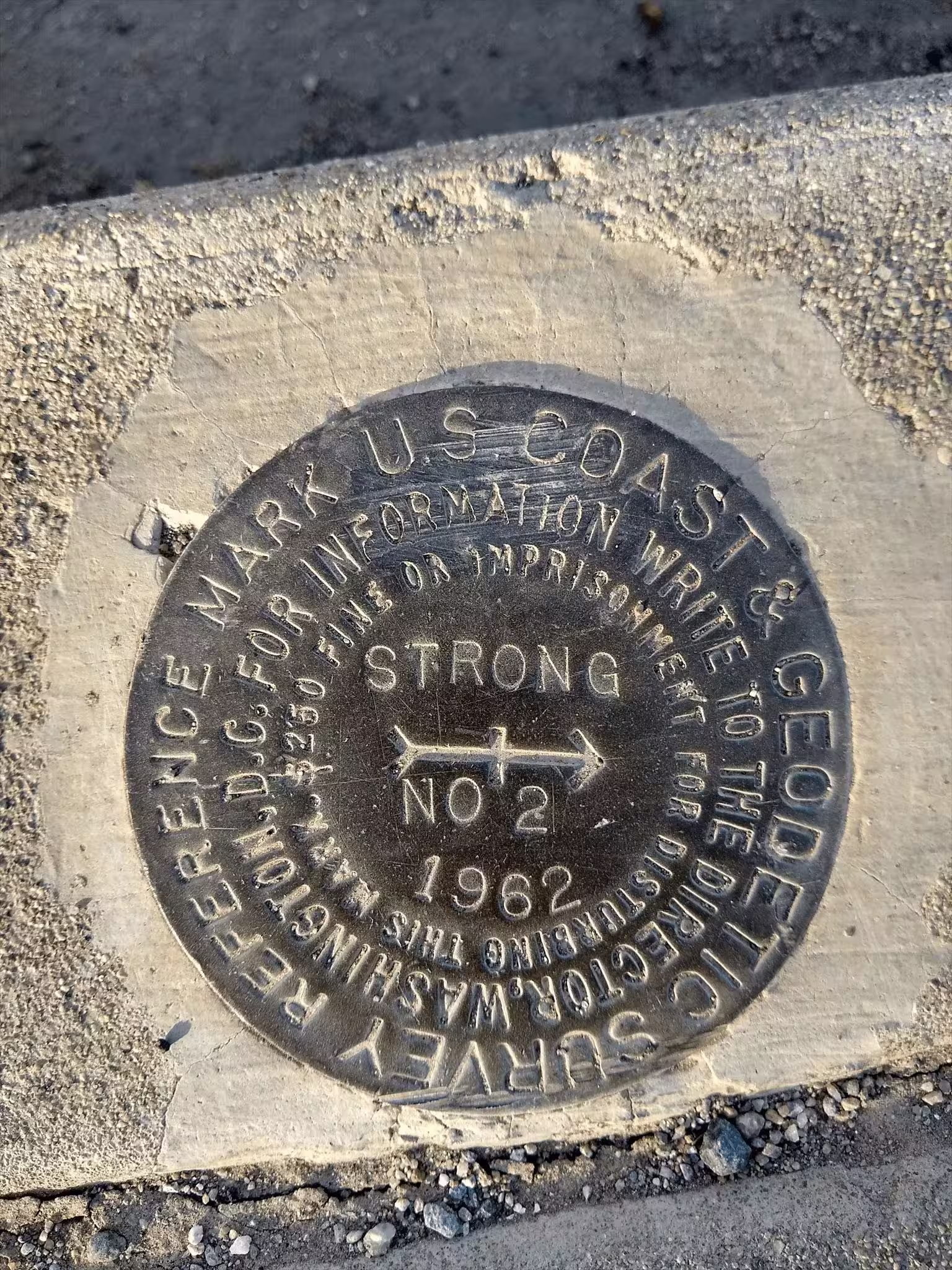
"STRONG NO 2"
| NGS PointID: | DV0651 |
| Reference Benchmarks: | STRONG, STRONG NO 1 |
| Azimuth Benchmark: | STRONG AZ MK |
| Condition: | Ware along with major scratches present at top of disc and a gash at the bottom of the disk. |
| Stamping: | STRONG NO 2 1962 |
| Coordinates: | 33.458594, -112.039414 |
| Elevation: | 1108.0 ft (337.7 m) |
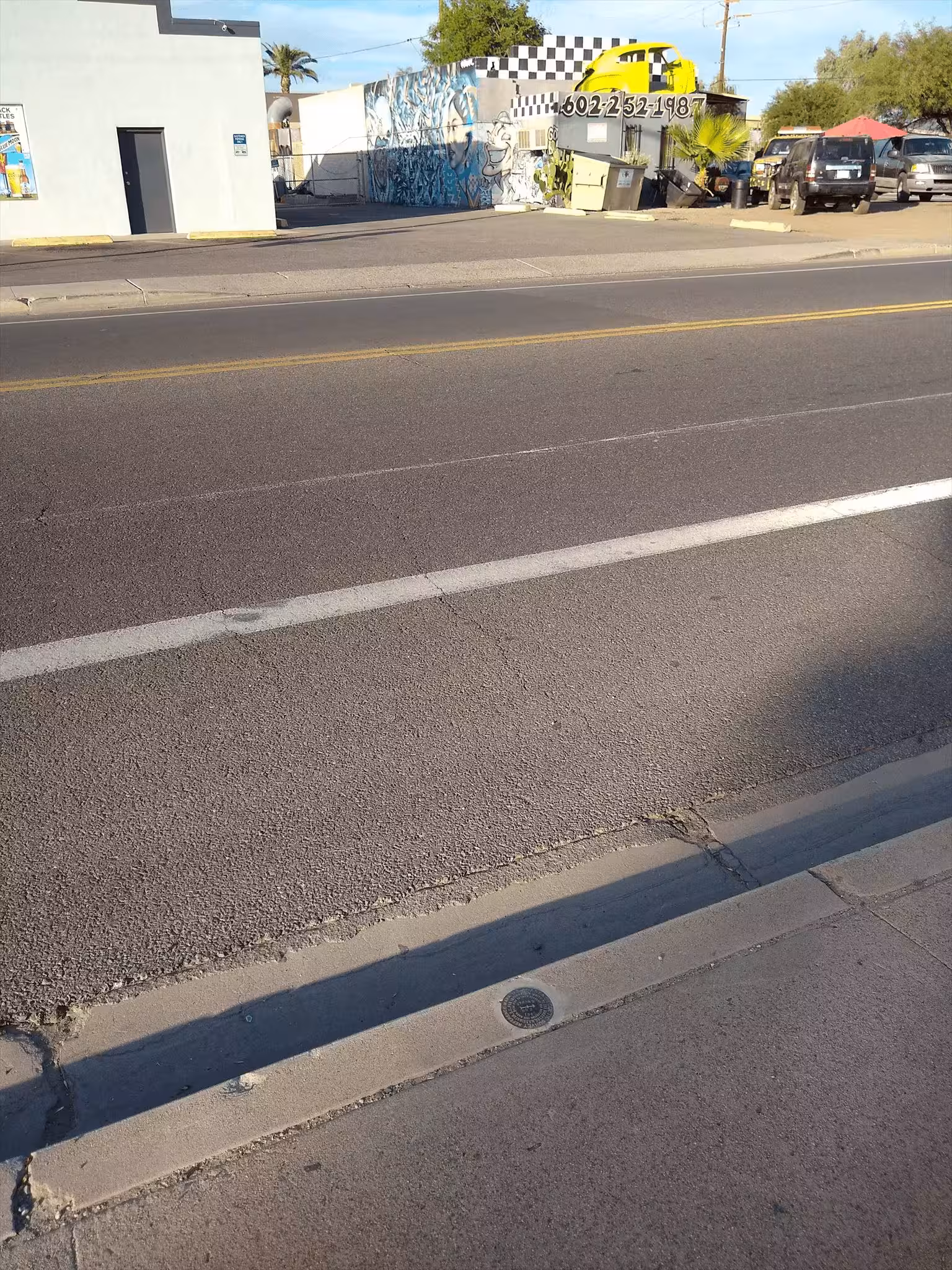
| Setting: | A concrete curb |
| Monumentor: | USC&GS |
Datasheet Description:
Reference mark 2, a standard reference disk stamped STRONG NO 2 1962, is set in a drill hole in the south curb of E Roosevelt Street, 22.5 feet south of the center of E Roosevelt street and 5.1 feet north of the south side of sidewalk.
"STRONG NO 2" is a benchmark monumented by the USC&GS in 1962 located in Maricopa County, Arizona. It is a dedicated reference mark for STRONG.
The best way to get to "STRONG" is, starting at the intersection of Jefferson Street and Central Avenue in the Pheonix city center, head east for 1.5 miles along Jefferson Street. Then, head north on 16th Street for 0.8 miles to Roosevelt Street. Then, head east along Roosevelt Street for 0.5 miles to station on right.
"STRONG NO 2" is located 70.216 feet or 21.402 meters 290 degrees from the main benchmark. It is located on a concrete curb.