|
|
Main benchmarks recovered in good or poor condition. |
|
|
Main benchmarks that have been destroyed. |
|
|
Reference benchmarks recovered in good or poor condition. |
|
|
Reference benchmarks that have been destroyed. |
|
|
Azimuth benchmarks recovered in good or poor condition. |
|
|
Azimuth benchmarks that have been destroyed. |
|
|
A main, reference, or azimuth benchmark not searched for. |
"SOTOL"
| NGS PointID: | CZ1887 |
| Reference Benchmarks: | NOGLS RESET, SOTAL NO: 2 |
| Condition: | Intact, many gashes and scratches present |
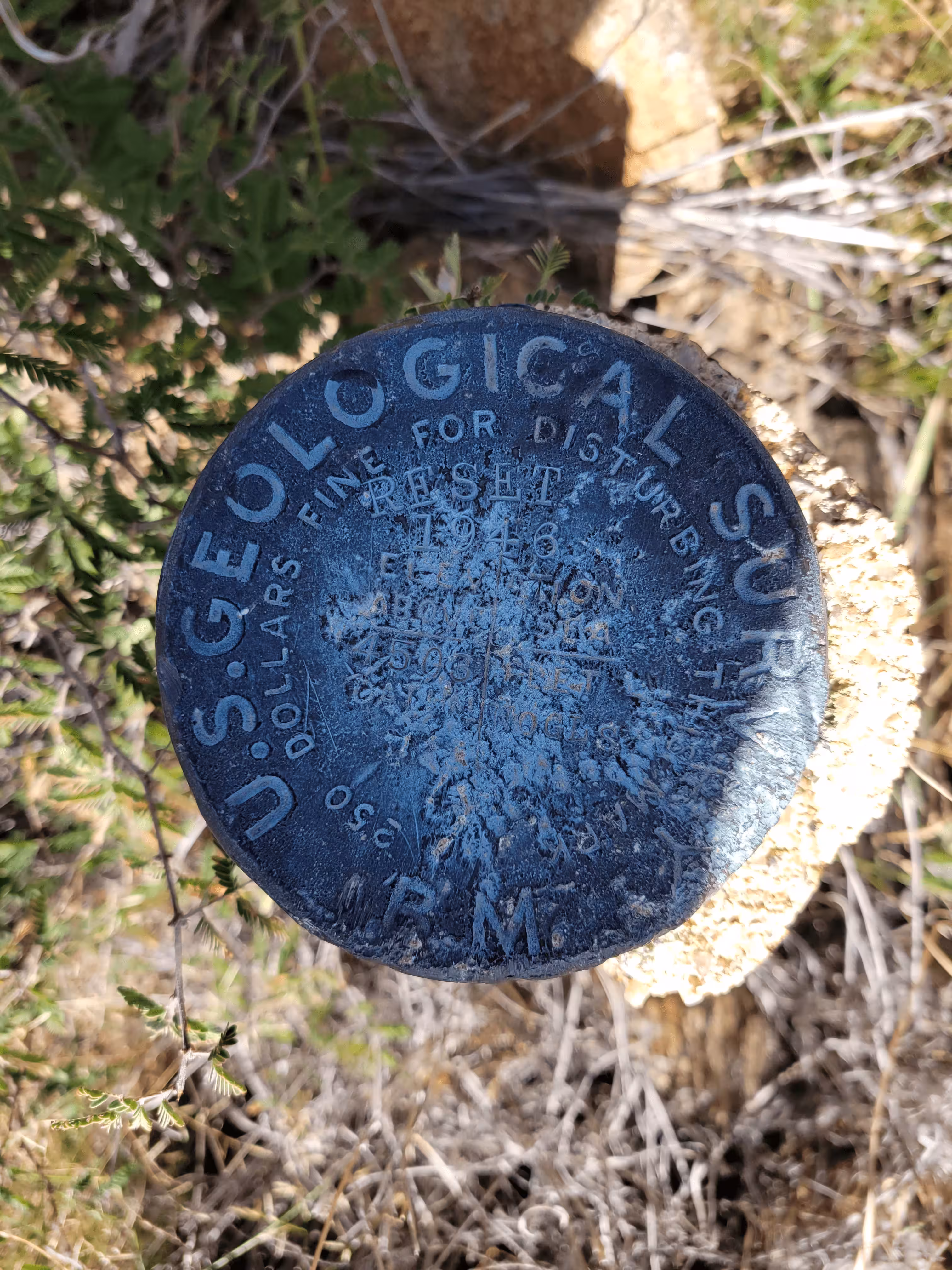
| Stamping: | SOTOL 1946 |
| Coordinates: | 32.594586, -110.728854 |
| Elevation: | 4539 ft (1383.5 m) |
| Setting: | A rock outcrop |
| Monumentor: | USGS |
Datasheet Description:
The station is about 3 miles southeast of Oracle on a sharp rocky hill about 200 feet north of Mt. Lemmon Rd.
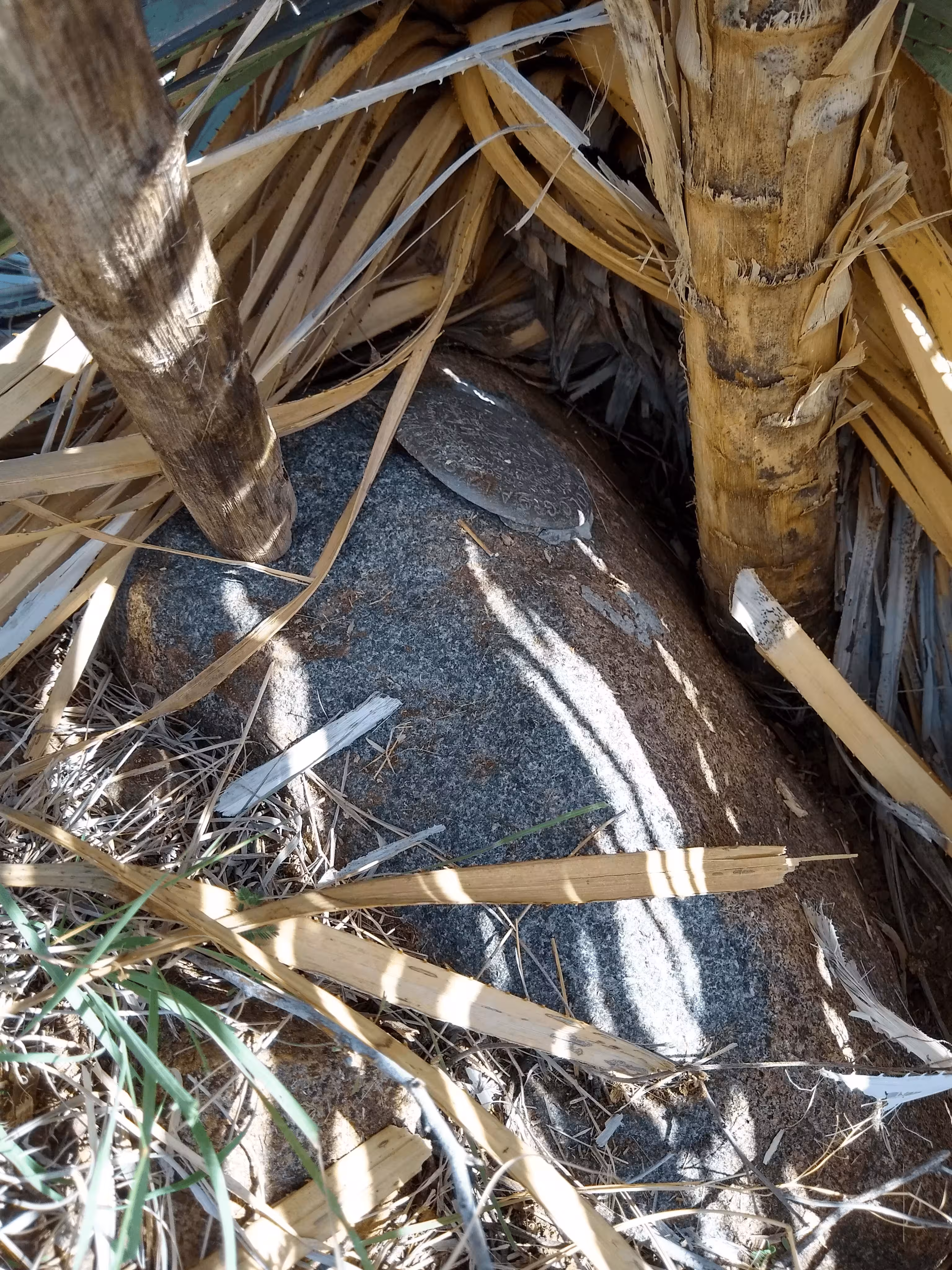
The station is a standard U.S.G.S. disk stamped SOTOL 1946 and is set in a small boulder outcrop at highest point of hill.
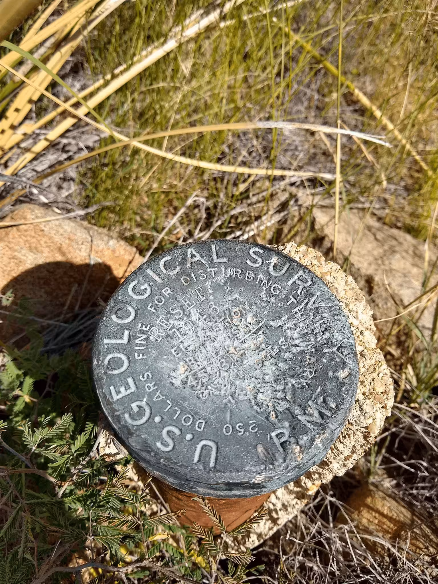
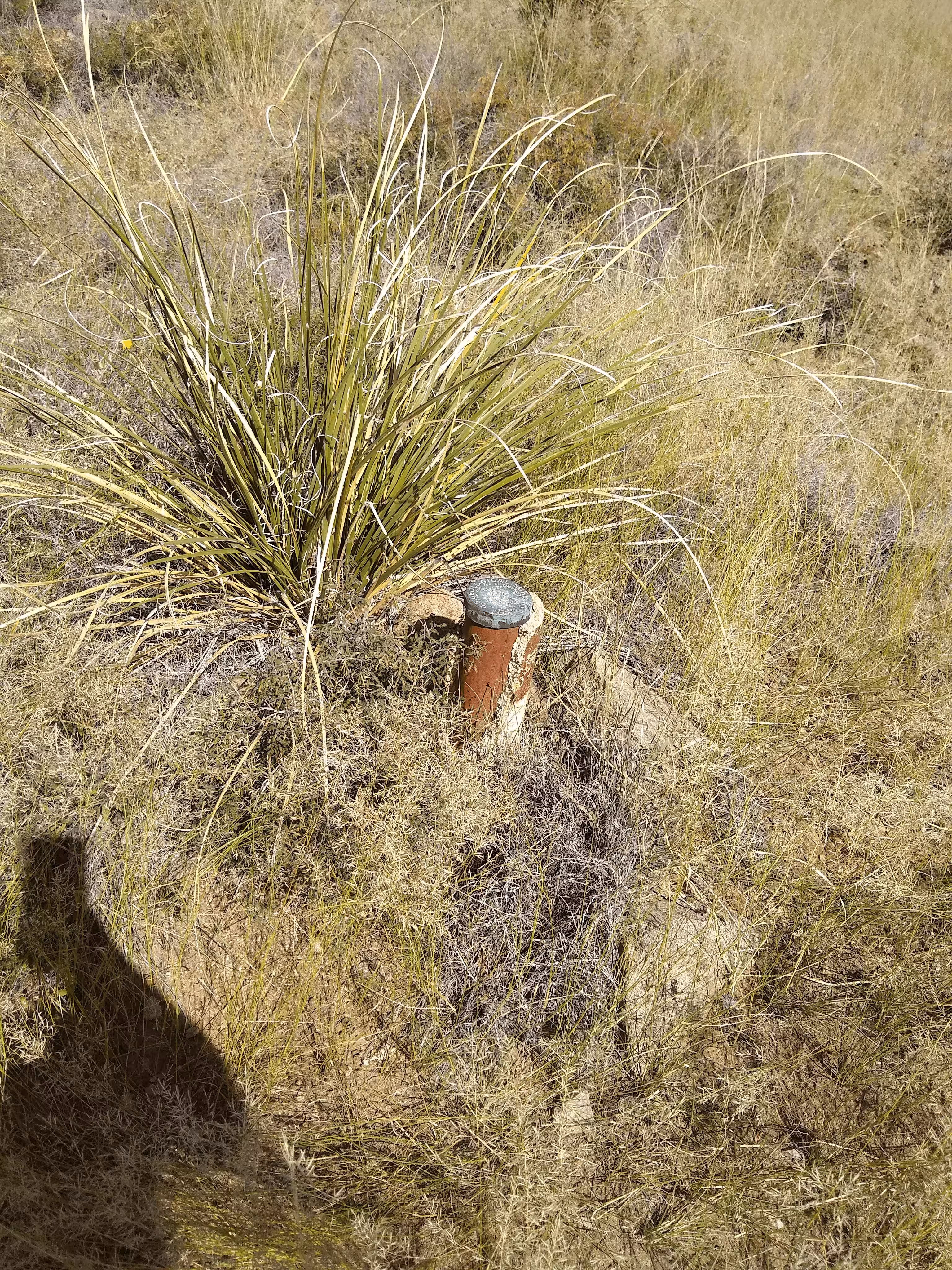
Reference Mark 1 is a standard USGS pipe cap stamped RESET 1946 4503 NOGLS and is set in a 5 inch diameter concrete monument projecting 1.4 feet and is marked with a wooden staff. The disk is badly beaten but in firm condition and is located 30 feet north of dirt road leading to triangulation station, about 58 paces southwest of the station mark and about 30 feet lower.
Reference Mark 2 is a standard USGS reference mark tablet stamped SOTAL NO 2 1946, set in rock.
To reach the station from the post office in Oracle, drive south on the Mt. Lemmon Rd. for 3.2 miles to a fork left (ne), take dirt road left for 50 yards to Reference Mark 1, left, continue on dirt road around hill and to the top and the station. height of light above station mark 1.5 meters.
"SOTOL" is a benchmark monumented by the USGS in 1946 located in Pinal County, Arizona. It has 2 reference marks, one being dedicated and the other not being dedicated.
The best way to get to "SOTOL" is, starting at American Avenue and AZ 77, head on American Avenue to the junction of Mount Lemmon Highway. Turn right onto Mount Lemmon Highway. Continue down Mount Lemmon Highway until the track road to the top of a hill. Follow the track for 190 feet. Then, pack 30 feet at 300° to Reference Mark 1, NOGLS 4503 RESET.
From Reference Mark 1 you can continue to the station. Head to the top of the hill. The station is located on a black rock with white specks located under the southwest side of the sotol plant. To access the benchmark pry back the dead leaves of the sotol using a stick.
Reference Mark 2 was not recovered and is thought to be destroyed.