|
|
Main benchmarks recovered in good or poor condition. |
|
|
Main benchmarks that have been destroyed. |
|
|
Reference benchmarks recovered in good or poor condition. |
|
|
Reference benchmarks that have been destroyed. |
|
|
Azimuth benchmarks recovered in good or poor condition. |
|
|
Azimuth benchmarks that have been destroyed. |
|
|
A main, reference, or azimuth benchmark not searched for. |
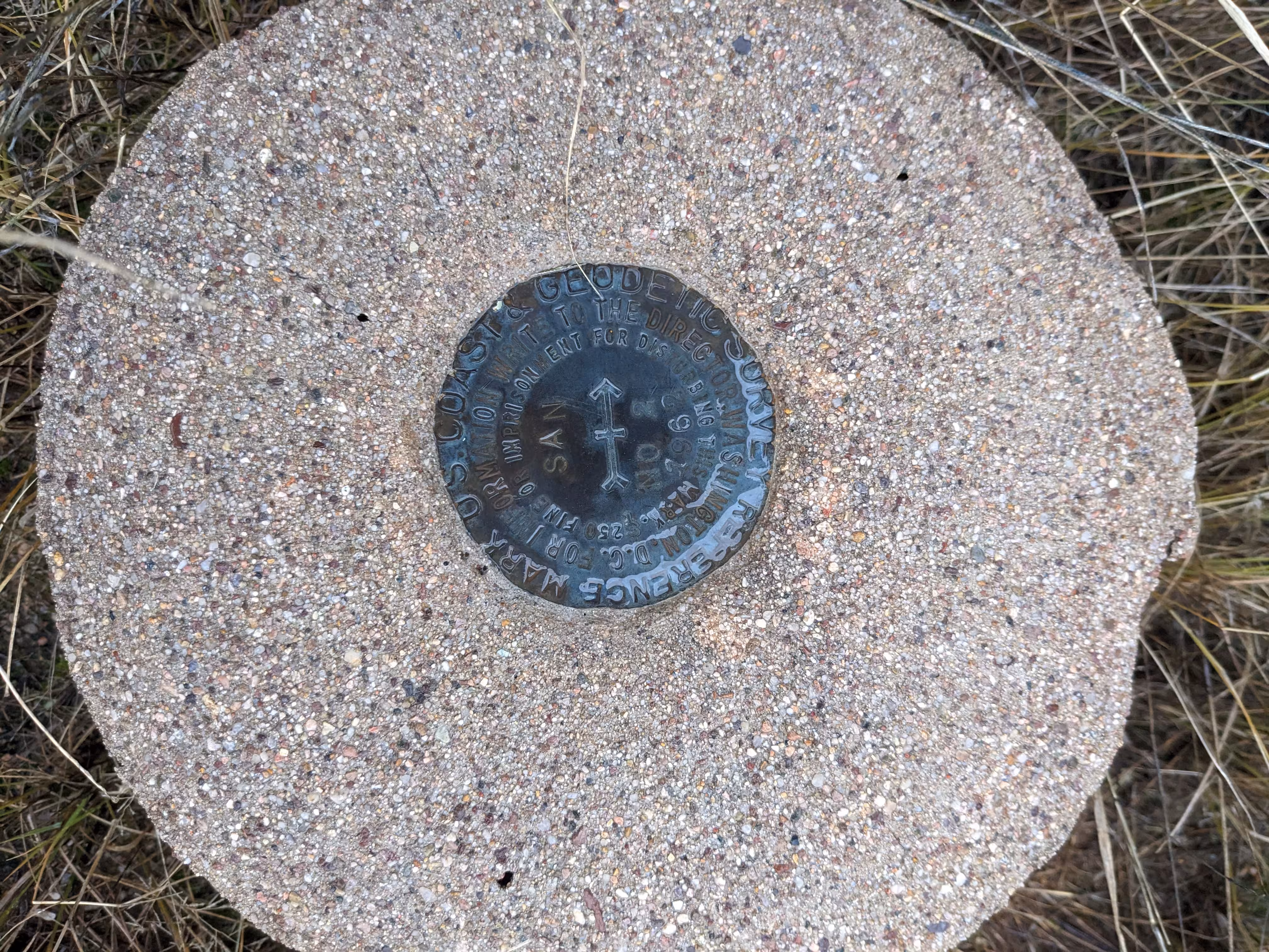
"SAN"
| NGS PointID: | CZ1644 |
| Reference Benchmarks: | SAN NO 1, SAN NO 2 |
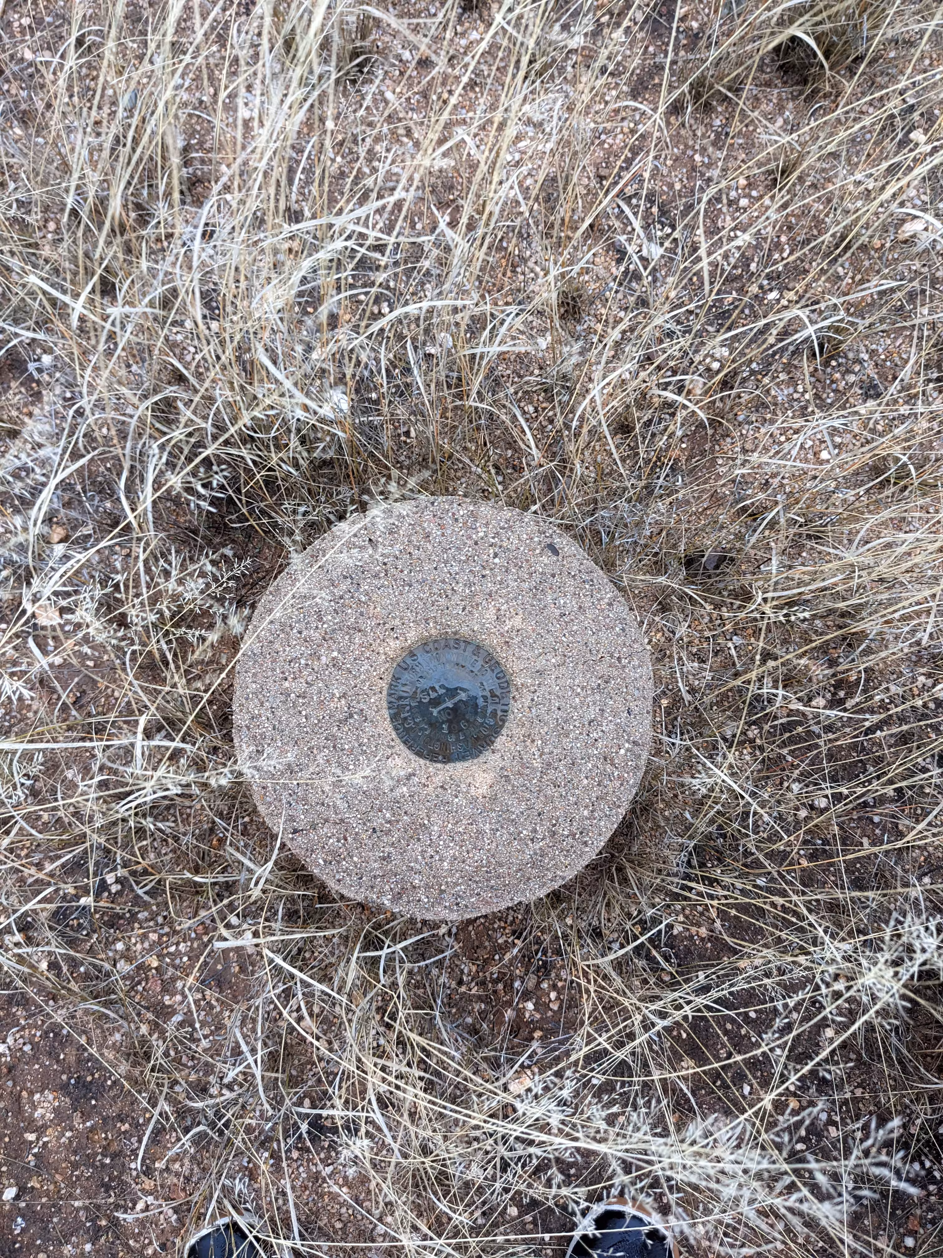
| Condition: | Minor ware. |
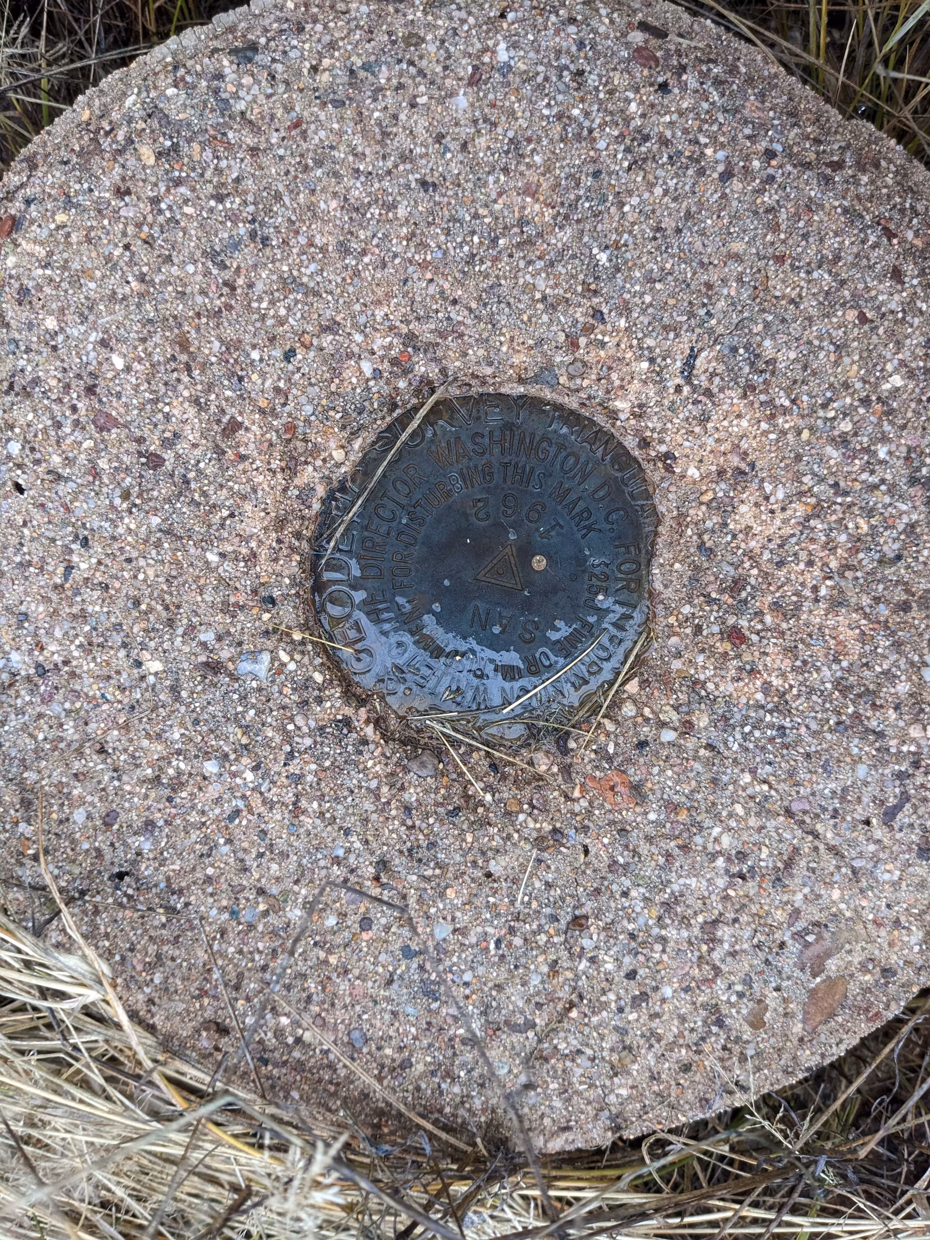
| Stamping: | SAN 1962 |
| Coordinates: | 32.599568, -110.891644 |
| Elevation: | 3648.79 ft (1112.15 m) |
| Setting: | Circular conrete monument |
| Monumentor: | USC&GS |
Datasheet Description:
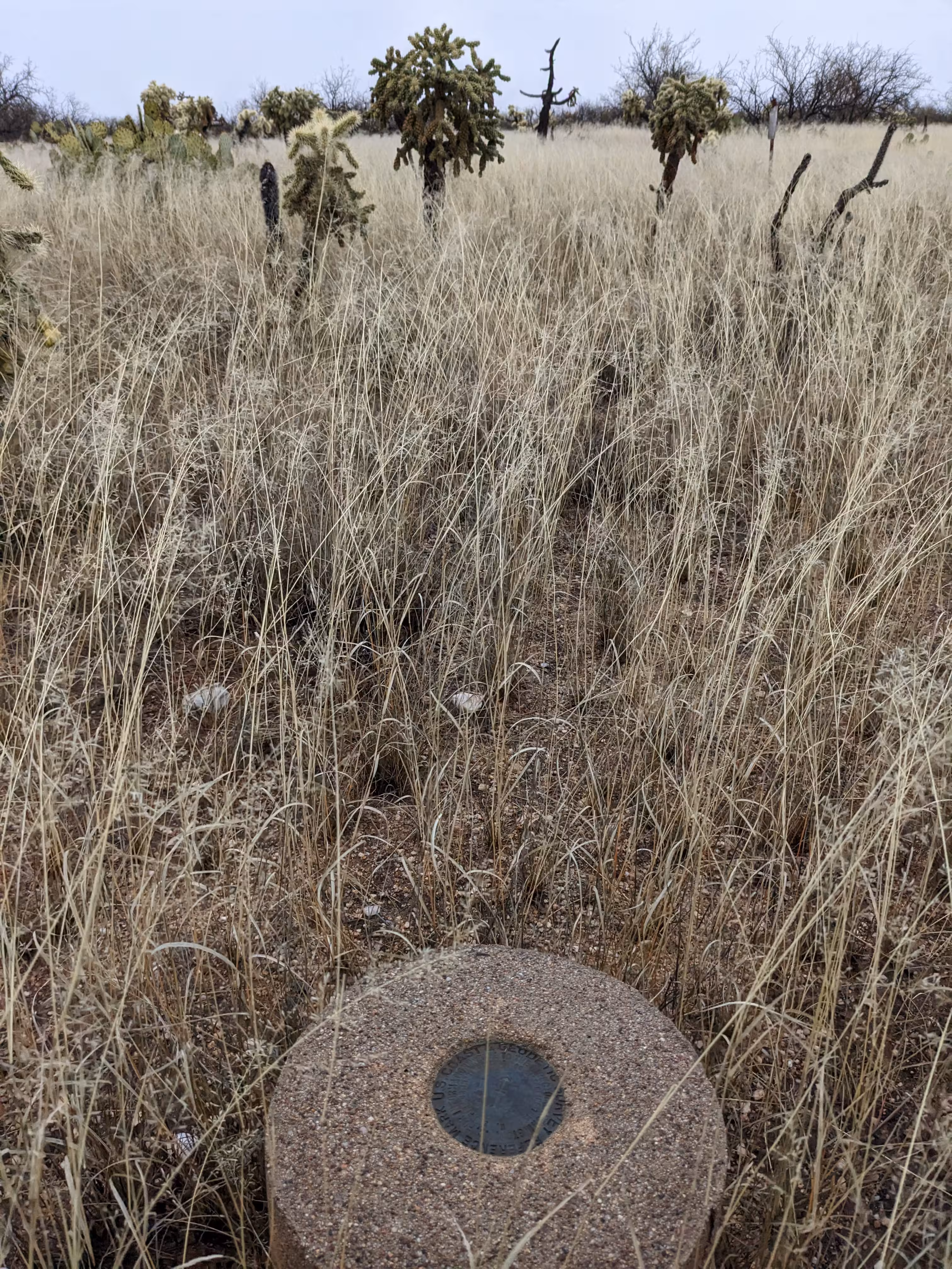
The station is located about 26 miles north of Tucson, 7 miles west of Oracle, 4 miles northeast of Oracle Junction, and 3/4 mile north of State Highway 77, on a low, flat ridge dotted with brush and cactus, running east-northeast to south-southwest, between two fairly deep washes.
To reach the station from the intersection of U.S. Highways 80, 89 and State Highways 77, 79 at oracle junction, go northeast on State Highway 77 for 3.8 miles to a paved side road on the left. Continue northeast 1.0 mile to a graded gravel road on the left. (Willow Springs Ranch Road) turn left, cross cattle guard, and go north 0.3 mile to a fork. Take the left fork and go west on the track road 0.45 mile to a fork. Take the left fork and continue southwest 0.55 mile to an earthen dam. Turn north 100 yards across the head of a small wash then turn left and go west, across country, 0.5 mile down the ridge to the station.
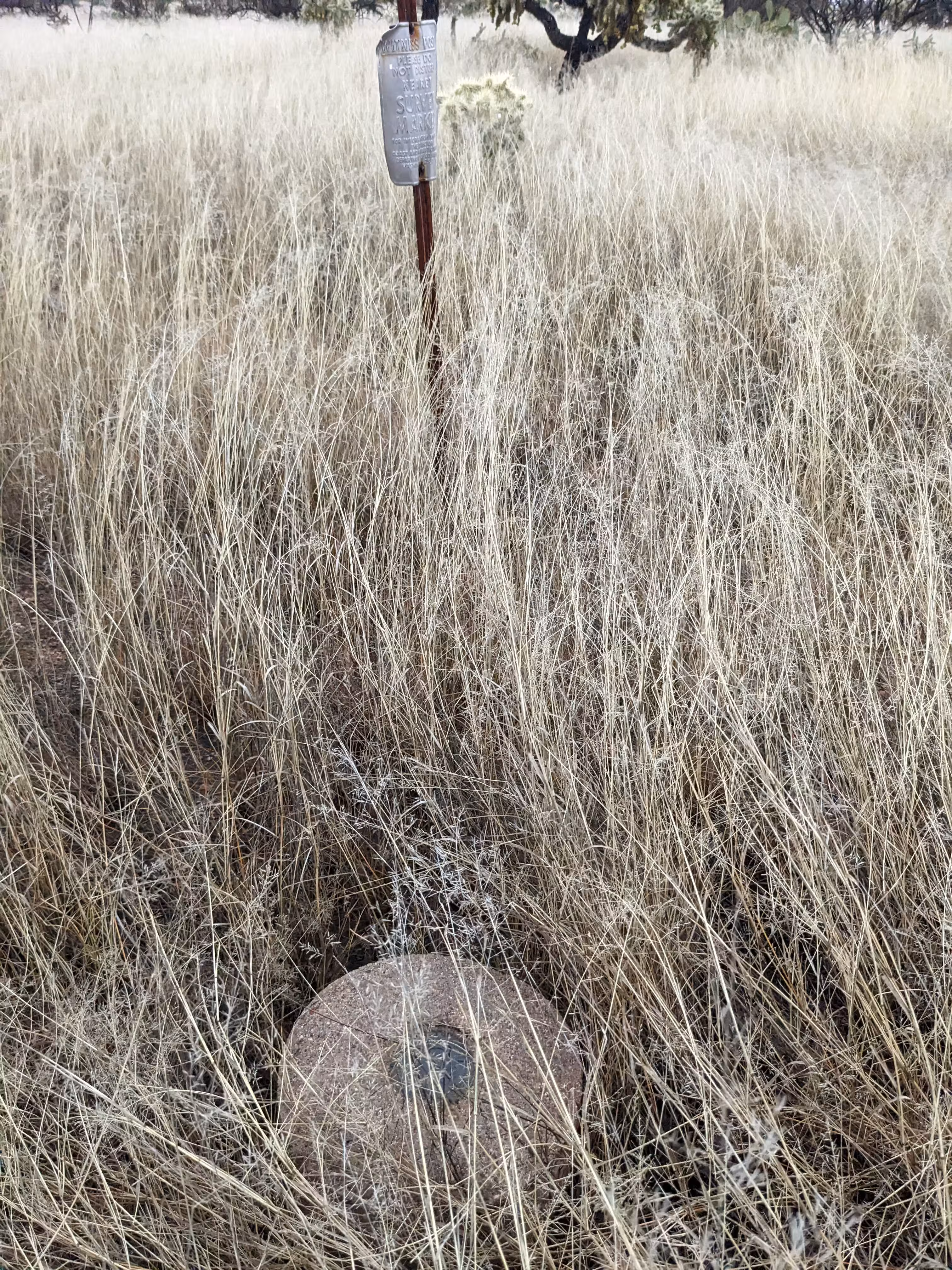
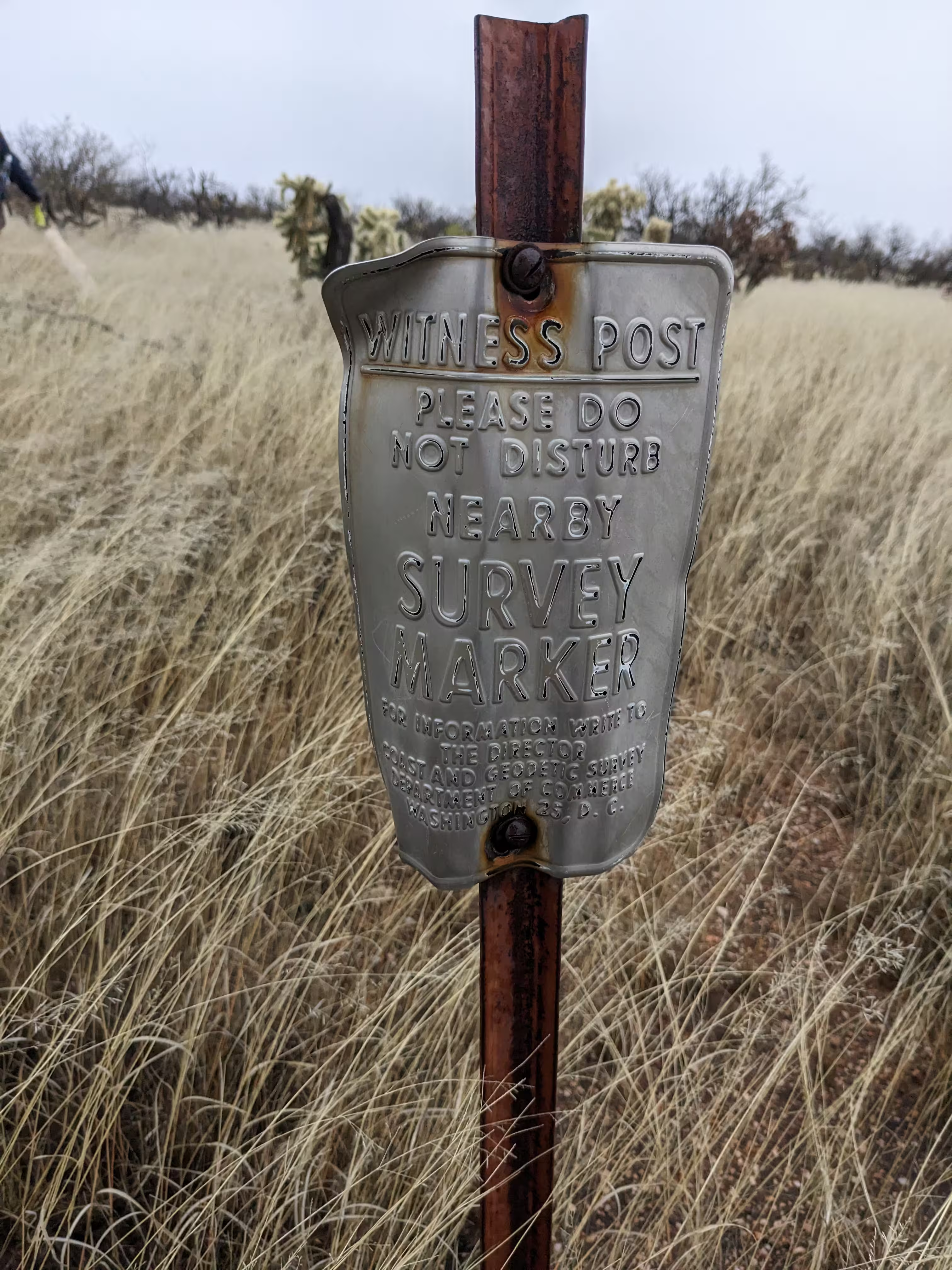
The station mark, a standard disk stamped SAN 1962 cemented in the top of a 12-inch-diameter cylindrical concrete monument projecting 10 inches above ground, is 5.2 feet south-southwest of a metal witness sign.
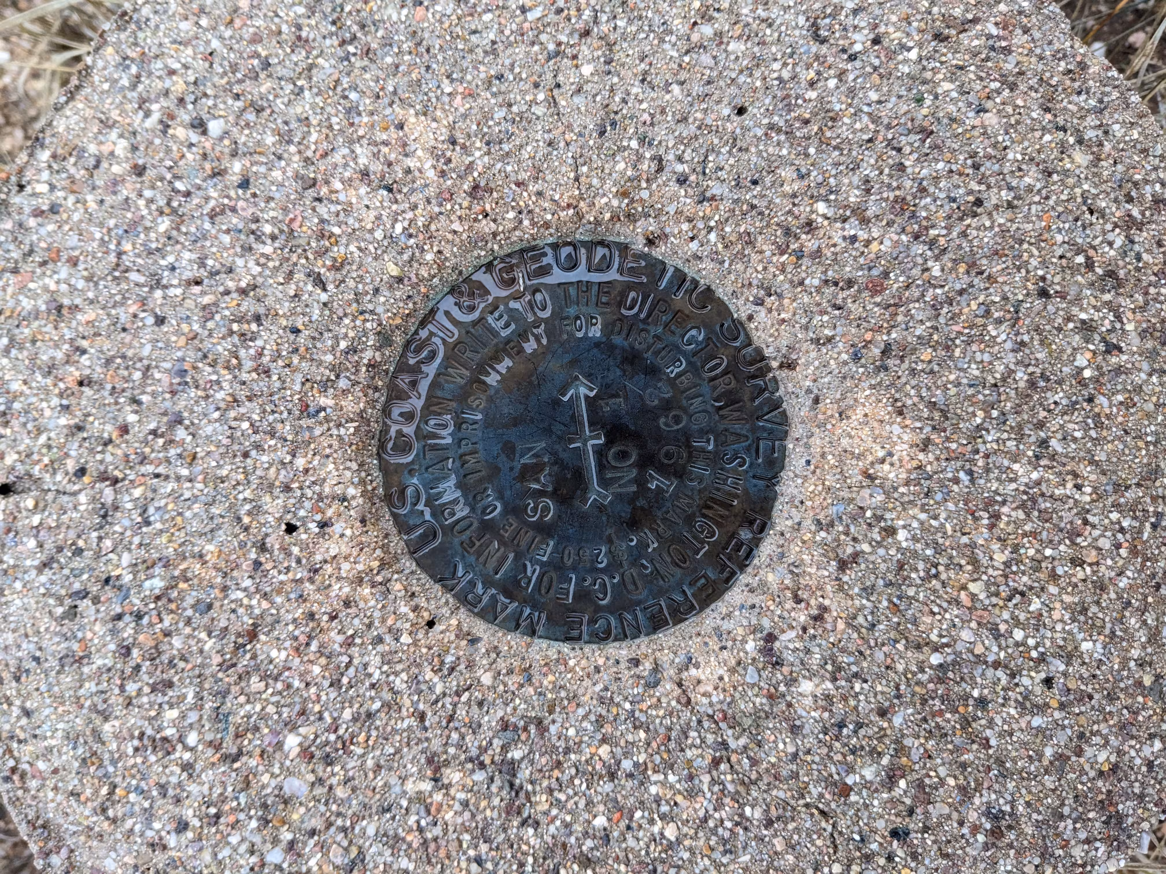
Reference mark number one, a standard disk stamped SAN NO 1 1962 cemented in the top of a 12-inch-diameter cylindrical concrete monument projecting 10 inches above ground, is at the same elevation as the station.
Reference mark number two, a standard disk stamped SAN NO 2 1962 cemented in the top of a 12-inch-diameter cylindrical concrete monument projecting 8 inches above ground, is at the same elevation as the station. It is at the north edge of a 10-foot-diameter sandy area in the grass.
"SAN" is a benchmark monumented by the USGS in 1946 located in Pinal County, Arizona. It has 2 dedicated reference marks.
The best way to get to "SAN" is to enter the Saddlebrooke Ranch community and turn right onto Robson Circle. Stop at the end of the pavement and embark on the gravel "emergency road". There will be a gate but it was not locked. Continue from the gate for 1,700 feet along the road. Then head south to the the benchmark. A height of light from the 1977 recovery of the station was found nearby the station.
"SAN NO 1" is located 29.583 feet or 9.017 meters 218 degrees from the main benchmark. It is located at about the same elevation than the station.
"SAN NO 2" is located 30.233 feet or 9.215 meters 313 degrees from the main benchmark. It is located at about the same elevation than the station.