|
|
Main benchmarks recovered in good or poor condition. |
|
|
Main benchmarks that have been destroyed. |
|
|
Reference benchmarks recovered in good or poor condition. |
|
|
Reference benchmarks that have been destroyed. |
|
|
Azimuth benchmarks recovered in good or poor condition. |
|
|
Azimuth benchmarks that have been destroyed. |
|
|
A main, reference, or azimuth benchmark not searched for. |
"PASS"
| NGS PointID: | CG1046 |
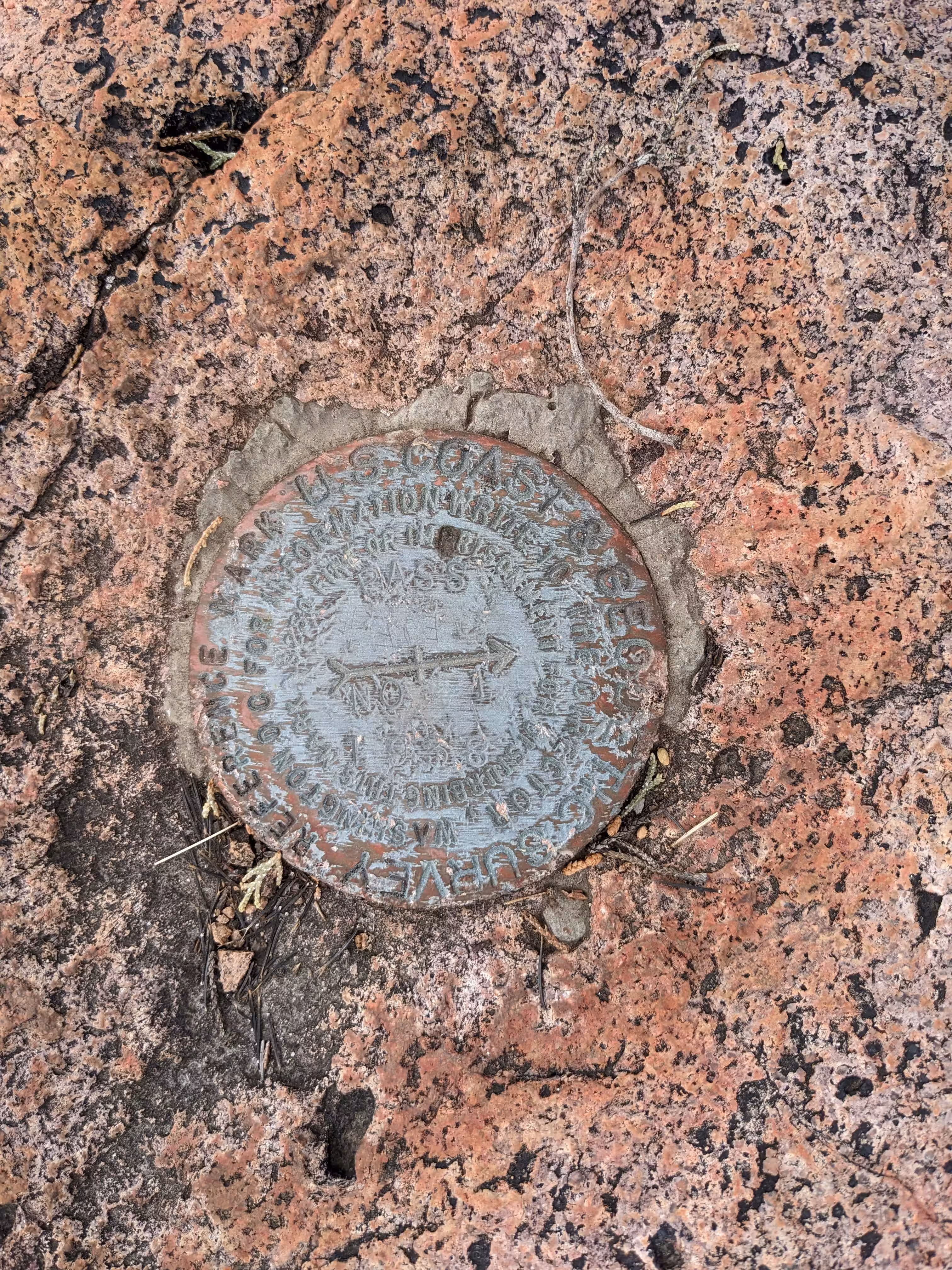
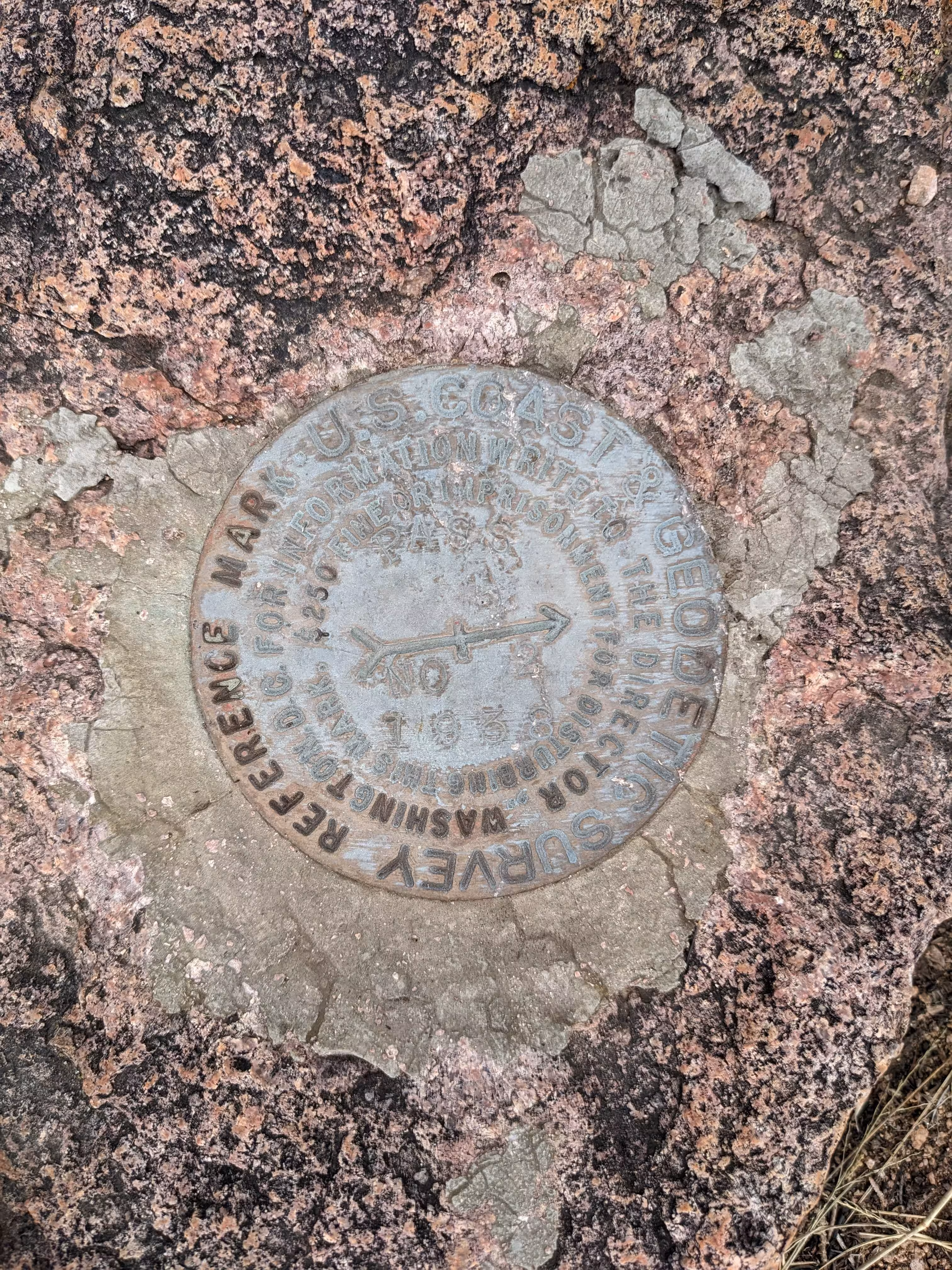
| Reference Benchmarks: | PASS NO 1, PASS NO 2 |
| Azimuth Benchmark: | CANELO |
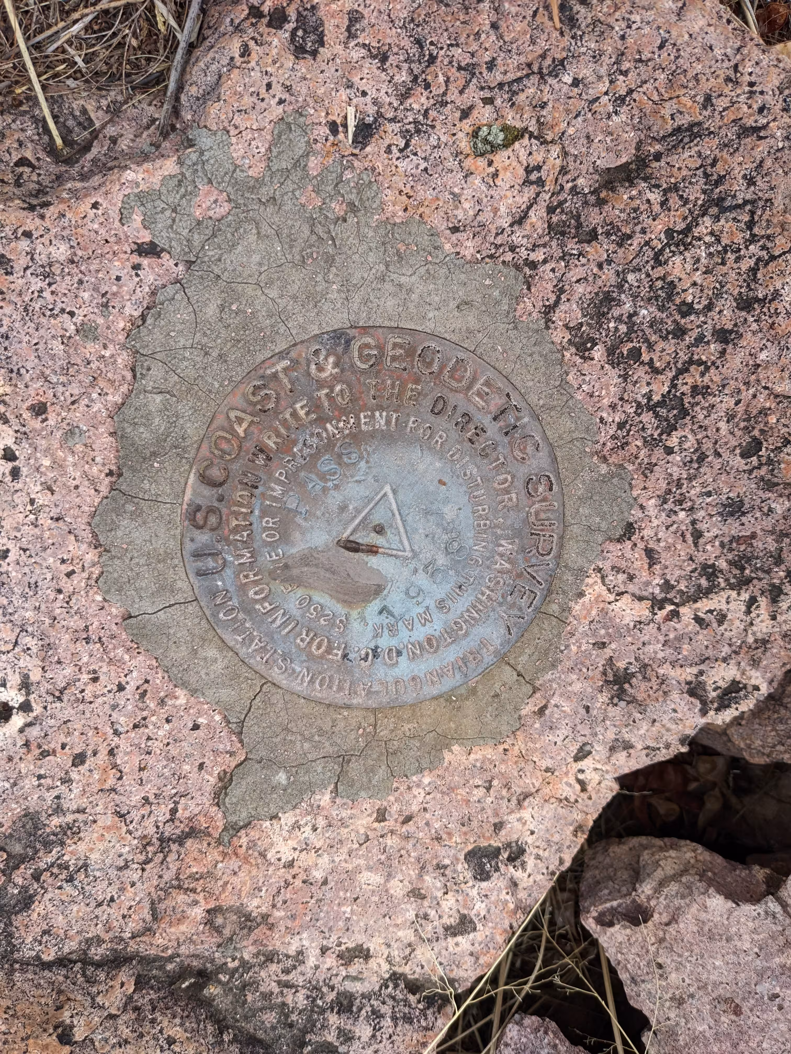
| Condition: | Medium ware and discoloring |
| Stamping: | PASS 1938 |
| Coordinates: | 31.506728, -110.570696 |
| Elevation: | 6112 ft (1863 m) |
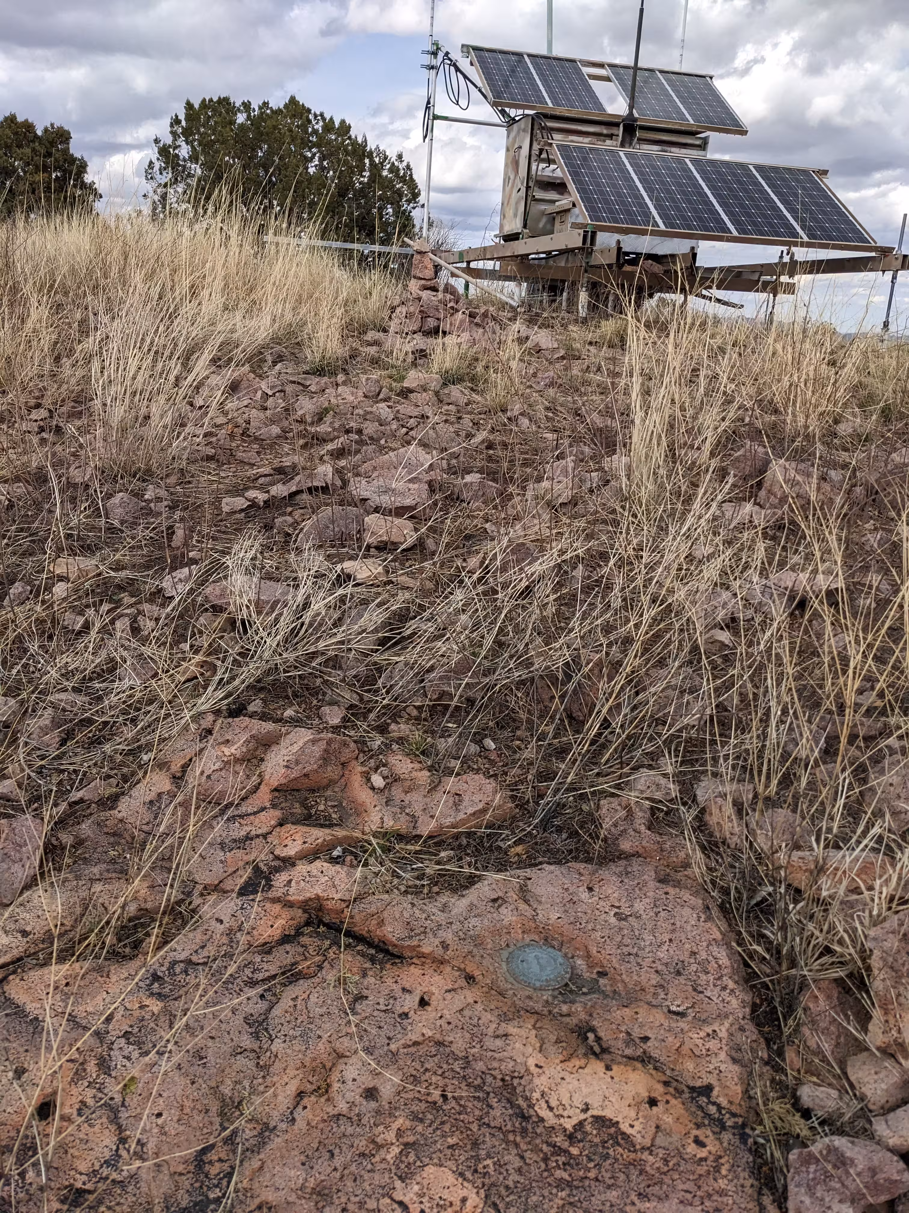
| Setting: | A rock outcrop |
| Monumentor: | USC&GS |
Datasheet Description:
Station is located on a prominent round top ridge, the highest point in the vicinity, about 11.0 miles S of the town of Elgin and 3.0 miles SW of Canille Store on the third and highest point NW of Canelo Pass about 1-1/4 miles NW of the pass-Elgin Road.
Station and reference marks are standard bronze disks set in rock.
To reach from Elgin go S on the Canelo Road 15.0 miles to Canille Store. Continue S on the Pass Road 3.8 miles to a cattle guard and line fence at the highest point on the road which is Canelo pass. End of truck travel. Pack NW and N along the main ridge to the third and highest point and station.
Station Canelo about 3.0 miles SE used as azimuth mark. It is the first prominent point SE of the pass.
Station San Rafael USGS bench mark is about 4.0 miles SSW on the S side of the main road.
Station and reference marks are on bare hill top and easily located.
"PASS" is a benchmark monumented by the USC&GS in 1938 in Santa Cruz County, Arizona. It has 2 reference marks and a non-dedicated azimuth.
The best way to get to "PA 2" from Canelo Pass is to follow jeep road west for 400 ft (120 m). From here follow trail up ridge. Follow trail, ridge, and fenceline for 3200 ft (1000 m) at which point it becomes necessary to cross the fence. Follow the trail up steep hill to top. Both sides of the fence are on national forest land.
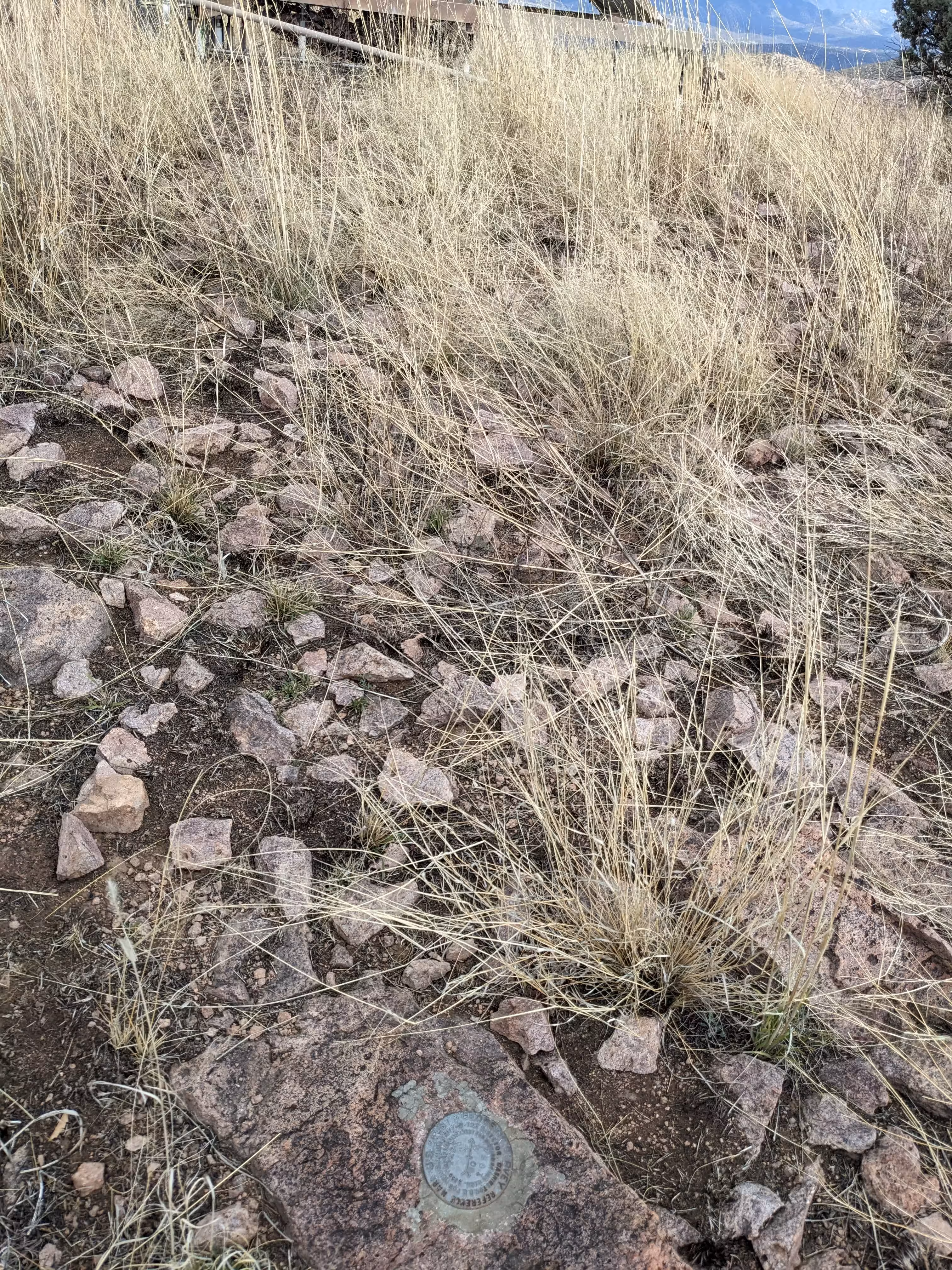
The benchmark is on a rock outcrop (as are the references) and next to the fire relay device.
"PASS NO 1" is located 19.022 feet or 5.798 meters 186 degrees from the main benchmark.
"PA 2 NO 2" is located 23.350 feet or 7.117 meters 218 degrees from the main benchmark.
"CANELO" is located 271 degrees from the main benchmark. It is located on Lookout Knoll about 2.5 miles (4 kilometers) southwest of the mark.