|
|
Main benchmarks recovered in good or poor condition. |
|
|
Main benchmarks that have been destroyed. |
|
|
Reference benchmarks recovered in good or poor condition. |
|
|
Reference benchmarks that have been destroyed. |
|
|
Azimuth benchmarks recovered in good or poor condition. |
|
|
Azimuth benchmarks that have been destroyed. |
|
|
A main, reference, or azimuth benchmark not searched for. |
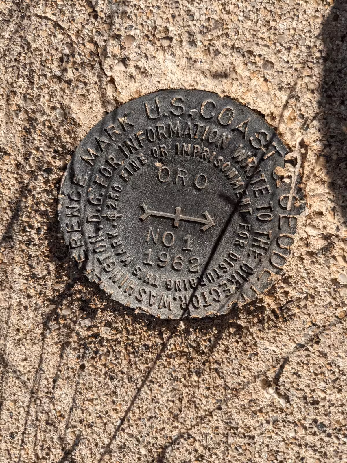
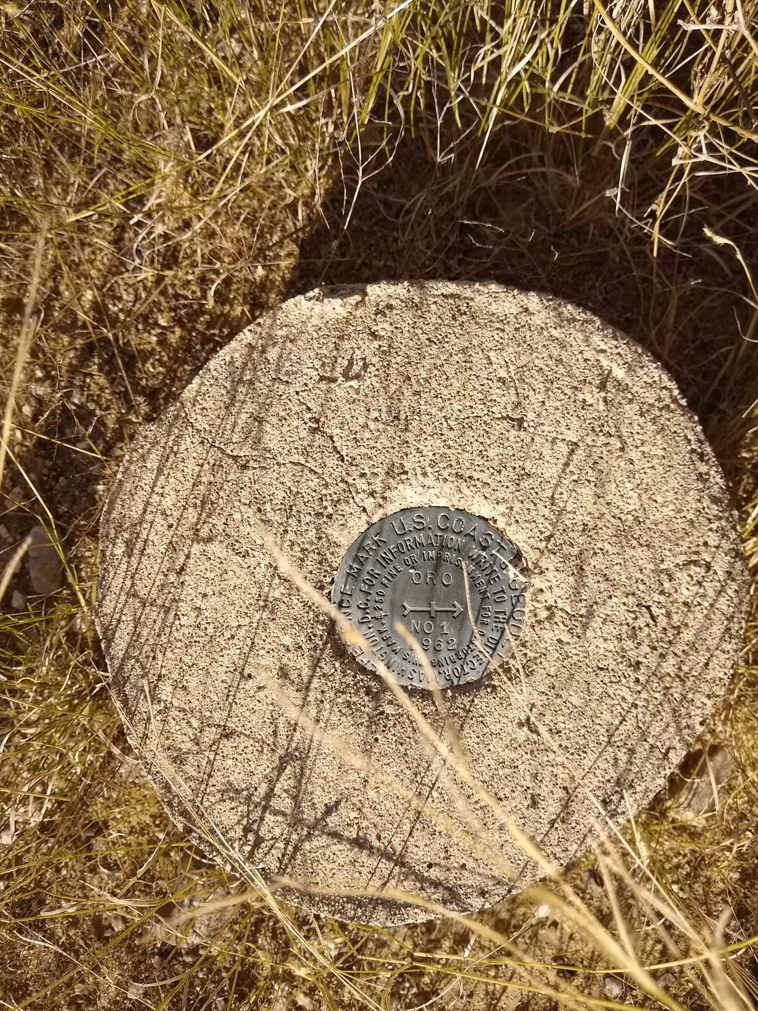
"ORO NO 1"
| NGS PointID: | CZ0119 |
| Reference Benchmarks: | ORO, ORO NO 2, |
| Azimuth Benchmark: | E 399 |
| Condition: | Very minor scratches and ware. |
| Stamping: | ORO NO 1 1962 |
| Coordinates: | 32.476108, -110.923417 |
| Elevation: | 3046.9 ft (928.69 m) |
| Setting: | A circular concrete monument |
| Monumentor: | USC&GS |
Datasheet Description:
Reference mark 1, a standard disk stamped ORO NO 1 1962, is set in the top of a cylindrical concrete monument, 12 inches in diameter, projecting 2 inches above the surface of the ground. It is about the same elevation as the station.
"ORO NO 1" is a benchmark monumented by the USC&GS in 1962 located in Pima County, Arizona. It is a dedicated reference mark for ORO.
The best way to get to "ORO" is to start at the west side of the right of way fence on the west side of AZ 77 and Miravista Lane. Head south along the right of way fence to reach the station. Bushwhack when needed.
"ORO NO 1" is located 27.841 feet or 8.486 meters 177 degrees from the main benchmark. It is located at about the same elevation as the station.