|
|
Main benchmarks recovered in good or poor condition. |
|
|
Main benchmarks that have been destroyed. |
|
|
Reference benchmarks recovered in good or poor condition. |
|
|
Reference benchmarks that have been destroyed. |
|
|
Azimuth benchmarks recovered in good or poor condition. |
|
|
Azimuth benchmarks that have been destroyed. |
|
|
A main, reference, or azimuth benchmark not searched for. |
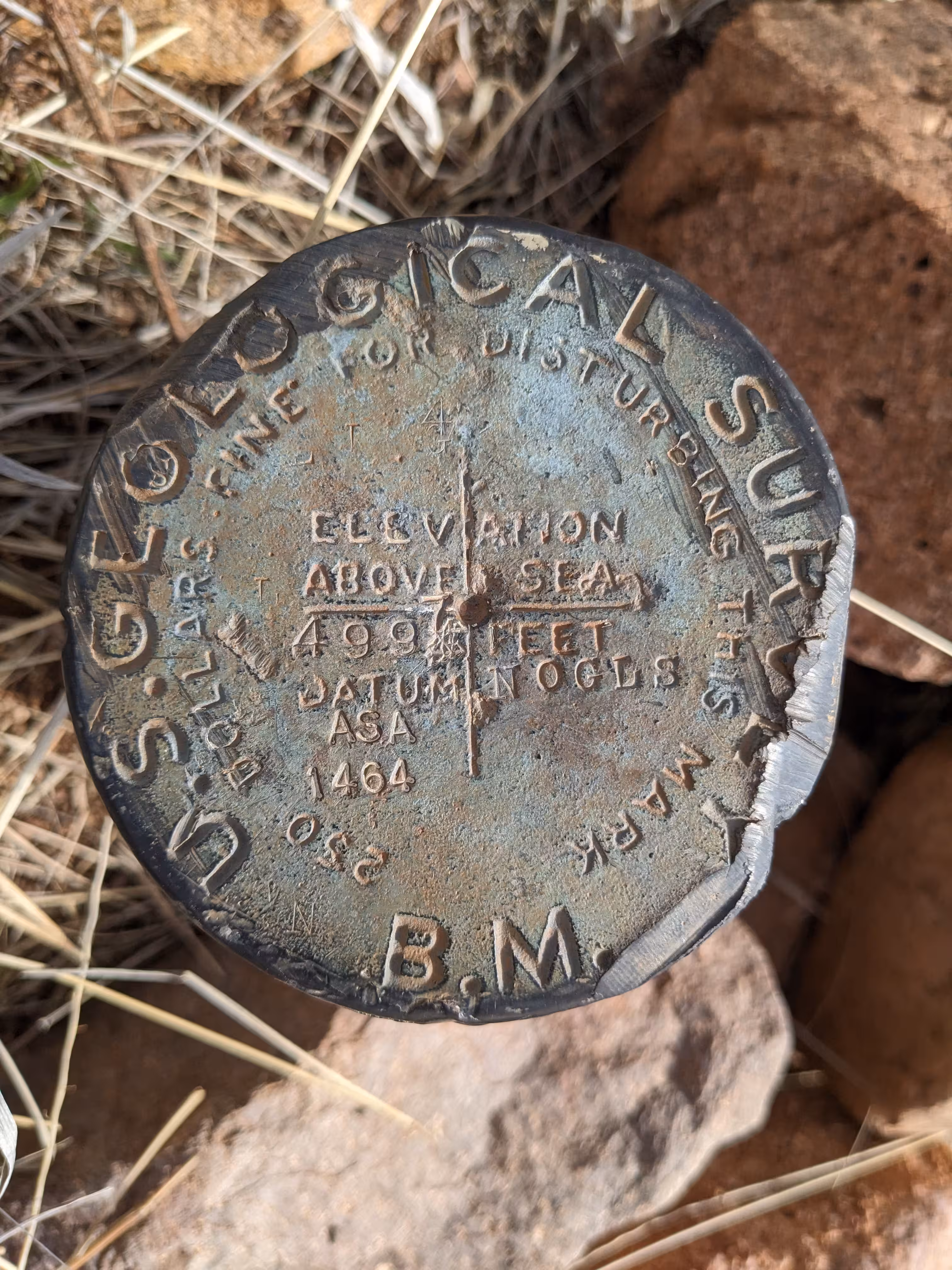
"NOGLS 4997"
| NGS PointID: | CG1001 |
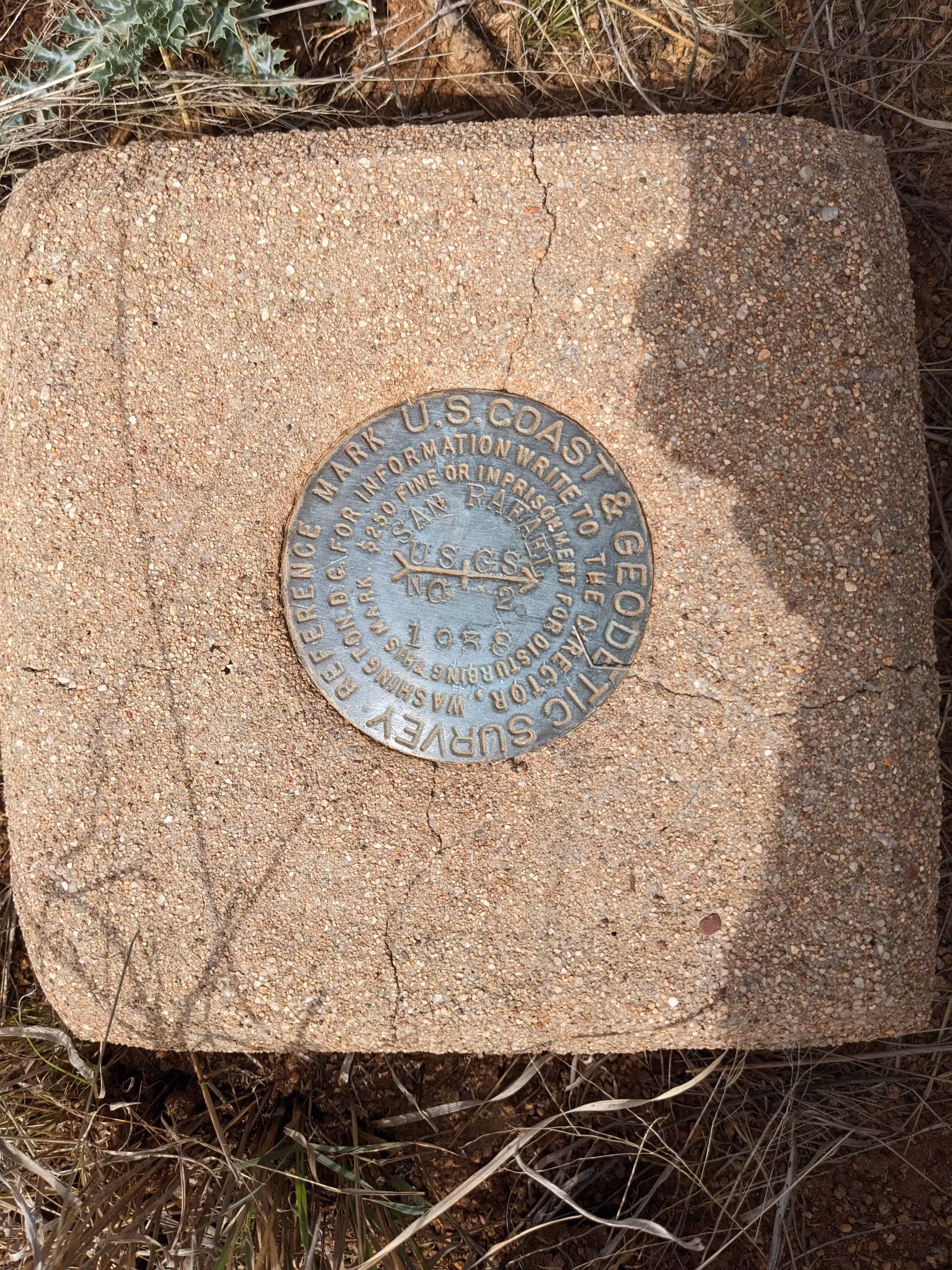
| Reference Benchmarks: | SAN RAFAEL NO 1, SAN RAFAEL NO 2 |
| Azimuth Benchmark: | SAN RAFAEL AZIMUTH |
| Condition: | At a 45 degree angle with the ground. Ware and gashes around the edge of the disk present. |
| Stamping: | 4997 NOGLS ASA 1464 |
| Coordinates: | 31.46600, -110.57809 |
| Elevation: | 5009.497 ft (1526.895 m) |
| Setting: | Pipe cap. |
| Monumentor: | USGS |
USGS Datasheet Description:
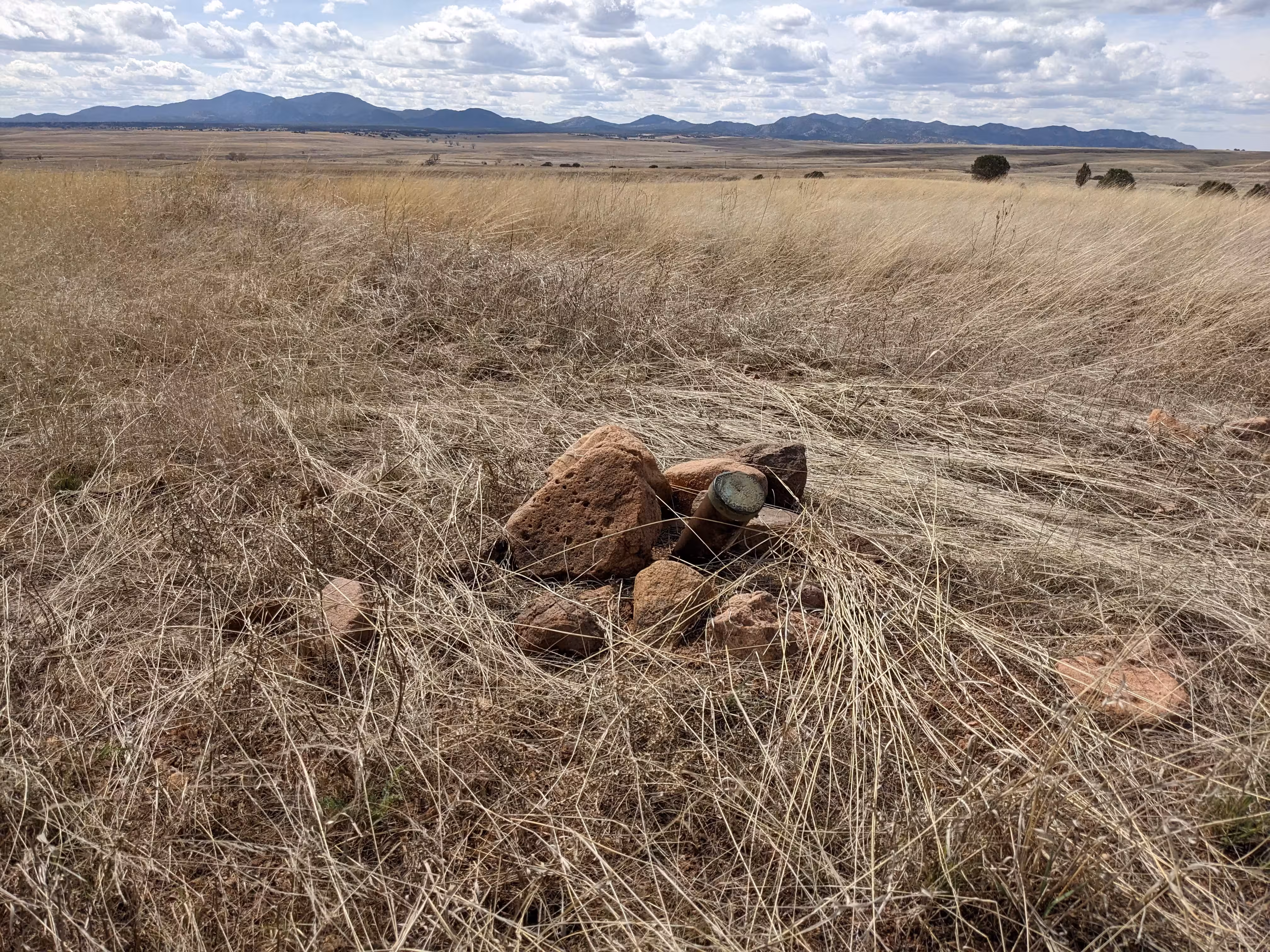
Little ranch house, 1 mile north of, top of north-south ridge, 15 feet southeast of road; iron post stamped "4997 NOGLS"
NGS Datasheet Description:
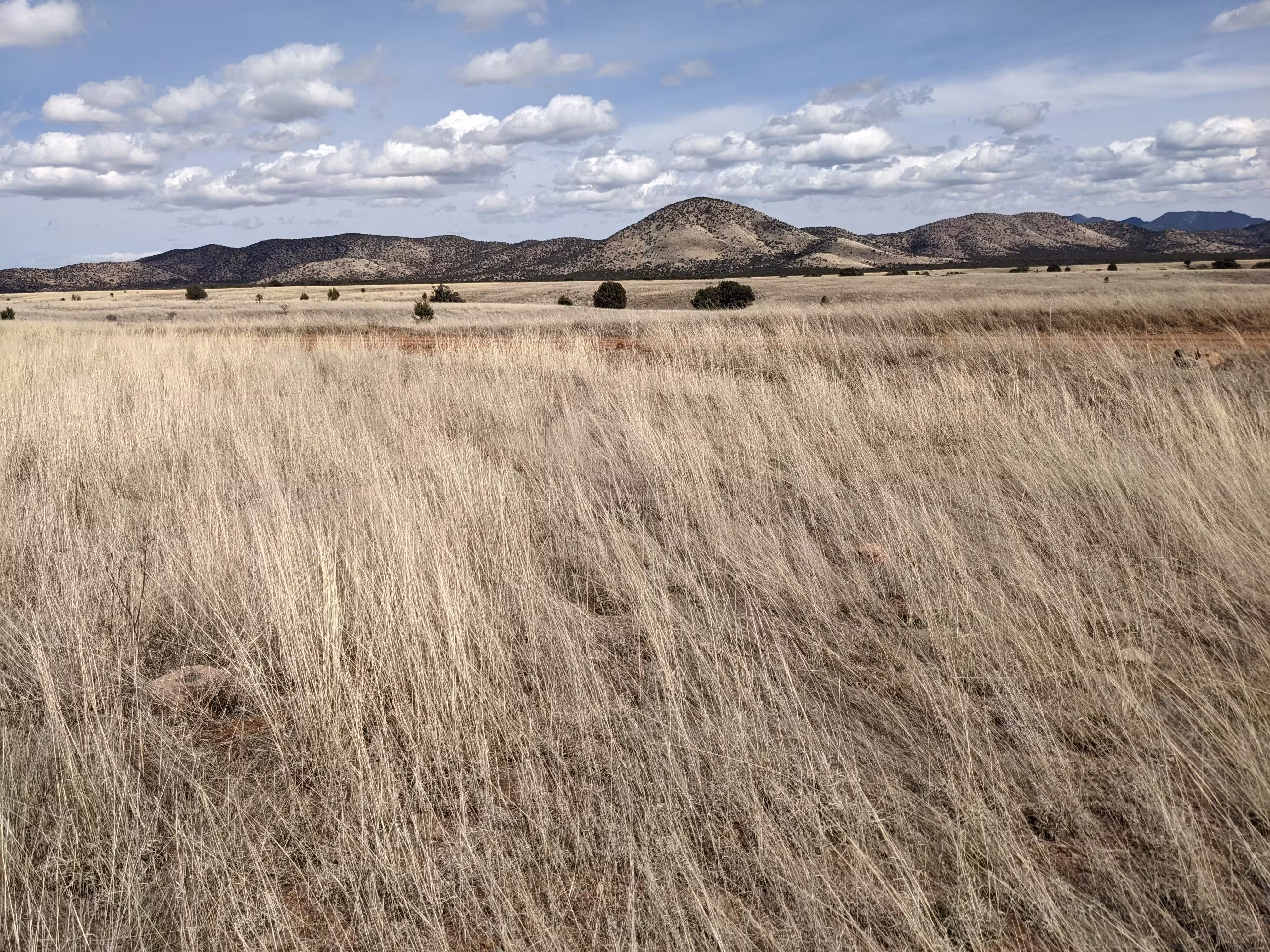
Station is a standard U.S.G.S. bench mark pipe and cap, stamped datum NOGLS, elevation 4997 feet, at the W side of the graded county road over canelo pass and is about 12 miles ESE of Patagonia and 2 miles ENE of the San Rafael schoolhouse. It is on a grassy flat in the triangle formed by track road westerly and the main Canelo-Patagonia road. It is 29.1 meters S of the intersection of the track road and the main road, 6.53 meters W of main road center line and 3.80 meters E of track road center line.
Reference marks are standard bronze disks set in concrete.
To reach from Fort Huachuca, at the intersection of the Canelo Pass Road and the main paved road N from Fort [Huachuca], at the Q M C Filling Station, take the graded dirt road (Canelo Pass Road), generally W and southwesterly for 5.3 miles to a y-fork. Take left fork, westerly, and at 2.2 miles pass over cattle guard and entrance to Coronado National Forest. Continue 4.85 miles to t-road. Continue on main road right 0.25 mile and at sign Sunnyside 17, Canelo 2, Elgin 13 after passing schoolhouse, take right fork, westerly, passing entrance to Canelo Ranger Station at 0.2 mile. Continue 0.95 mile to road intersection at Canille Mercantile Store. Turn left, S, and continue 3.8 miles to the summit of Canelo Pass. Continue 3.25 miles to fork of track road right and station to S of this intersection, and W of main road.
Azimuth mark is passed on this road 0.3 mile before reaching station. It is set in a concrete abutment at W end of a cattle guard 0.3 mile N of station, stamped SAN RAFAEL U.S.G.S. 1938, a standard U.S.C. and G.S. azimuth mark.
Reference mark NO. 1 is stamped SAN RAFAEL U.S.G.S, 1938 as is reference mark NO. 2.
Reference mark NO. 1 is 4.35 meters W of main road, center line. Reference mark NO. 2 is 8.08 meters WNW of track road, center line.
Note--reconnaissance description describes this station from Patagonia, but triangulation party came in from the E so that the description from Patagonia was not checked.
"NOGLS 4997" is a benchmark monumented by the USGS in 1903 located in Santa Cruz County, Arizona. It had two reference marks and an azimuth mark. Only one reference mark is still present.
This disc is apart of the NOGLS vertical datum conducted during 1903, 1904, and 1905 across the Tucson area. To learn more about the NOGLS datum see this page.
The disk is just on the side of the road. It is bent over at a 45 degree angle. RM 2 is in good condition. I couldn't find RM 1. The azimuth mark is gone, as there is a new cattle grid.