|
|
Main benchmarks recovered in good or poor condition. |
|
|
Main benchmarks that have been destroyed. |
|
|
Reference benchmarks recovered in good or poor condition. |
|
|
Reference benchmarks that have been destroyed. |
|
|
Azimuth benchmarks recovered in good or poor condition. |
|
|
Azimuth benchmarks that have been destroyed. |
|
|
A main, reference, or azimuth benchmark not searched for. |
"NOGLS 4835"
| Reference Benchmarks: | None |
| Condition: | Strong ware present |
| Stamping: | 4835 NOGLS |
| Coordinates: | 31.671117, -110.573919 |
| Elevation: | 4847.158 ft (1477.414 m) |
| Setting: | Pipe cap. |
| Monumentor: | USGS |
Datasheet Description:
Eigin, 3.25 miles west of, 50 feet south of track, top of cut near wire fence; iron post stamped "4835 NOGLS"
"NOGLS 4835" is a benchmark monumented by the USGS in 1903 or 1904 located in Pima County, Arizona.
This disc is apart of the NOGLS vertical datum conducted during 1903, 1904, and 1905 across the Tucson area. To learn more about the NOGLS datum see this page.
The benchmark is accessable from Wildlife Lane. Walking east along the old railroad grade should lead to the mark on a ridge.
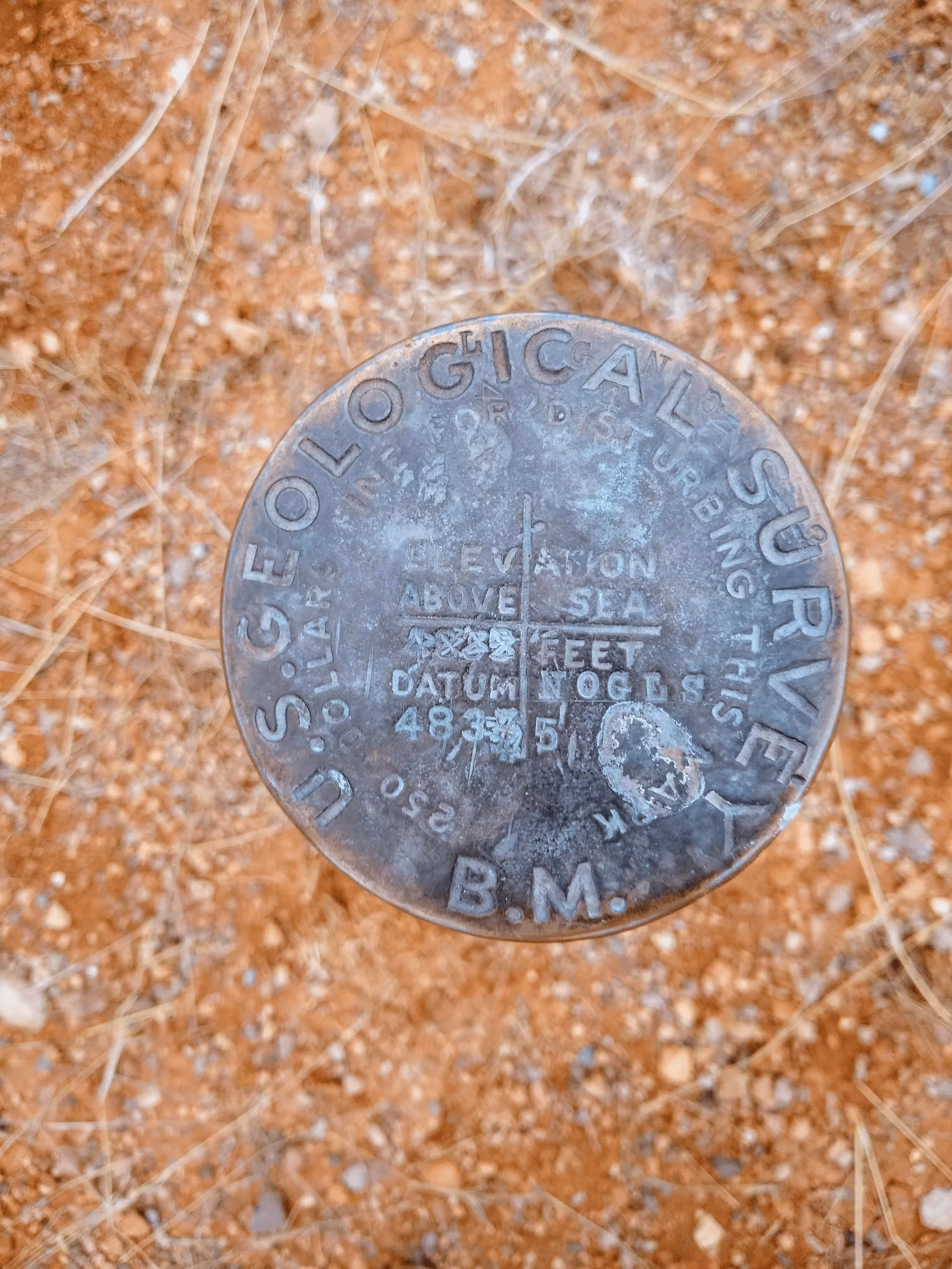
NOGLS 4835 close up.

NOGLS 4835 looking east.
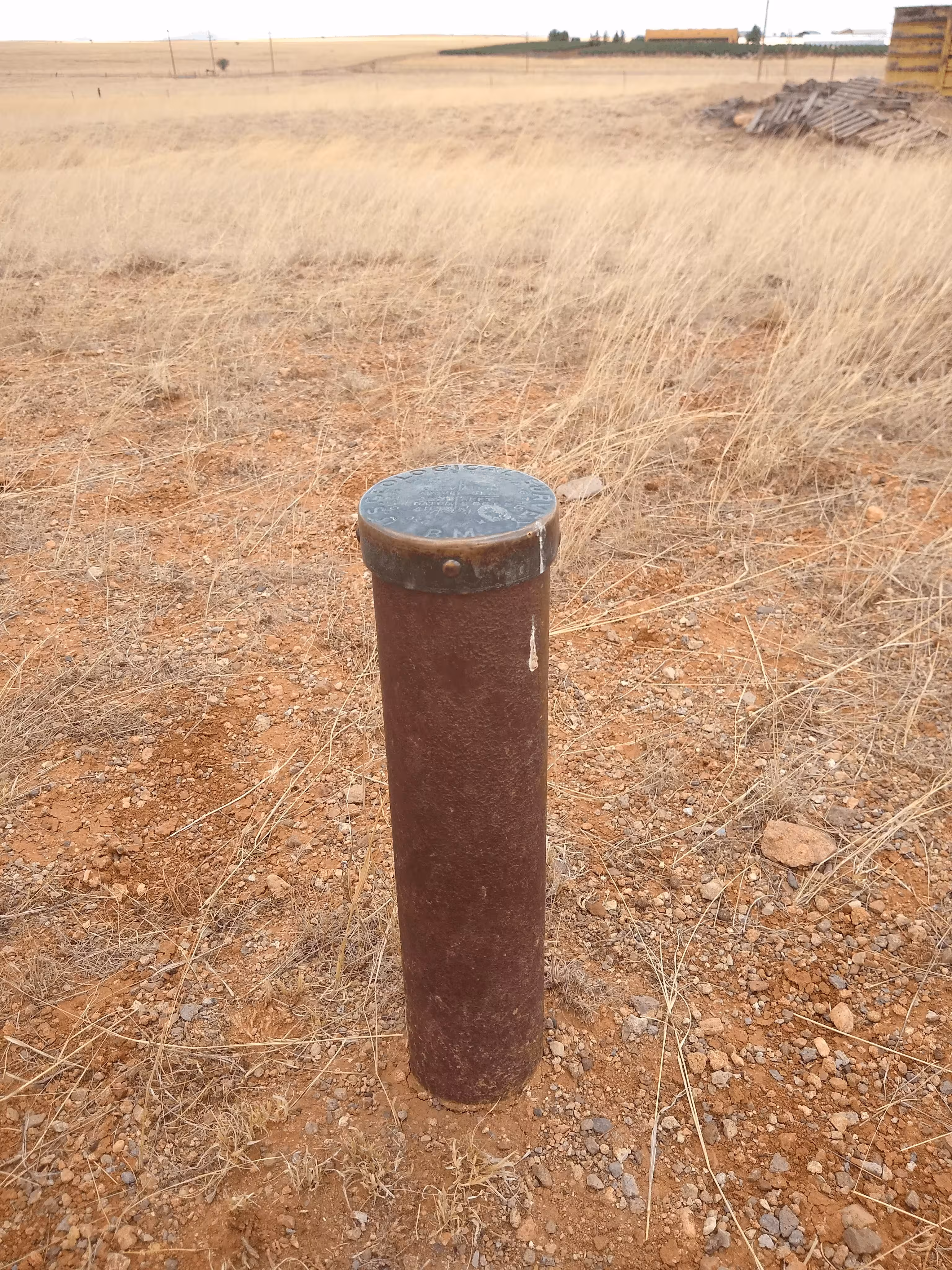
NOGLS 4835 looking north.