|
|
Main benchmarks recovered in good or poor condition. |
|
|
Main benchmarks that have been destroyed. |
|
|
Reference benchmarks recovered in good or poor condition. |
|
|
Reference benchmarks that have been destroyed. |
|
|
Azimuth benchmarks recovered in good or poor condition. |
|
|
Azimuth benchmarks that have been destroyed. |
|
|
A main, reference, or azimuth benchmark not searched for. |
"NOGLS 4526"
| NGS PointID | CG0166 |
| Reference Benchmarks: | None |
| Condition: | Ware and minor scratching. |
| Stamping: | 4526 NOGLS |
| Coordinates: | 31.712356, -110.068903 |
| Elevation: | 4538.259 ft (1383.261 m) |
| Setting: | Vertically in building wall. |
| Monumentor: | USGS |
Datasheet Description:
In Tombstone. At Tombstone, Cochise County, at the old courthouse building, in the north wall, 8 feet east of the center of the main entrance, and 3 feet above the ground. A United States Geological Survey standard disk, stamped 4526 NOGLS and set vertically.
Old Datasheet Description:
Tombstone, in north wall of county courthouse, 4 feet east of north entrance; aluminum tablet stamped "4526 NOGLS"
"NOGLS 4526" is a benchmark monumented by the USGS in 1903 located in Cochise County, Arizona.
The benchmark is on the old courthouse building. The 1935 description is adequate.
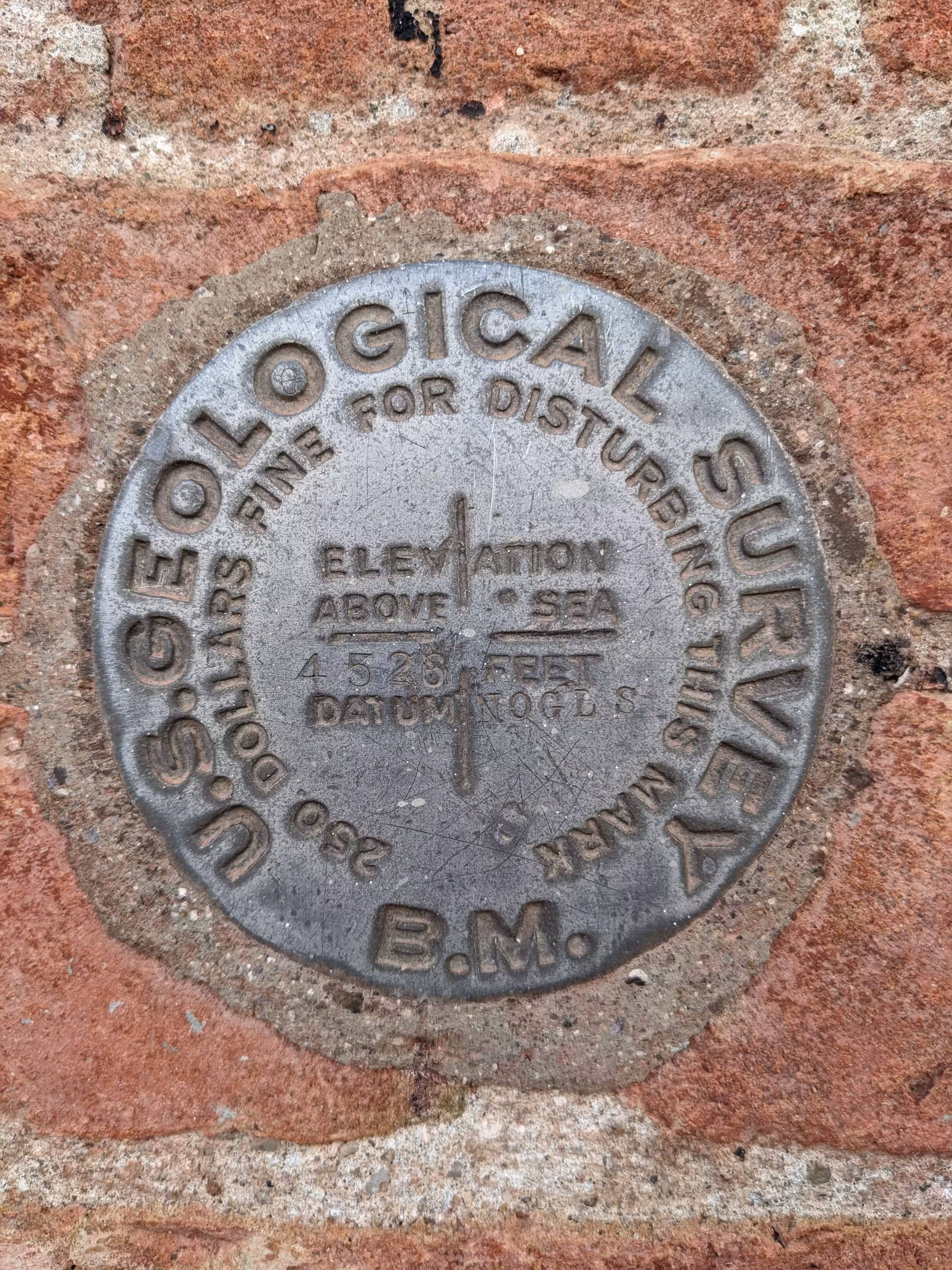
NOGLS 4526 close up.