|
|
Main benchmarks recovered in good or poor condition. |
|
|
Main benchmarks that have been destroyed. |
|
|
Reference benchmarks recovered in good or poor condition. |
|
|
Reference benchmarks that have been destroyed. |
|
|
Azimuth benchmarks recovered in good or poor condition. |
|
|
Azimuth benchmarks that have been destroyed. |
|
|
A main, reference, or azimuth benchmark not searched for. |
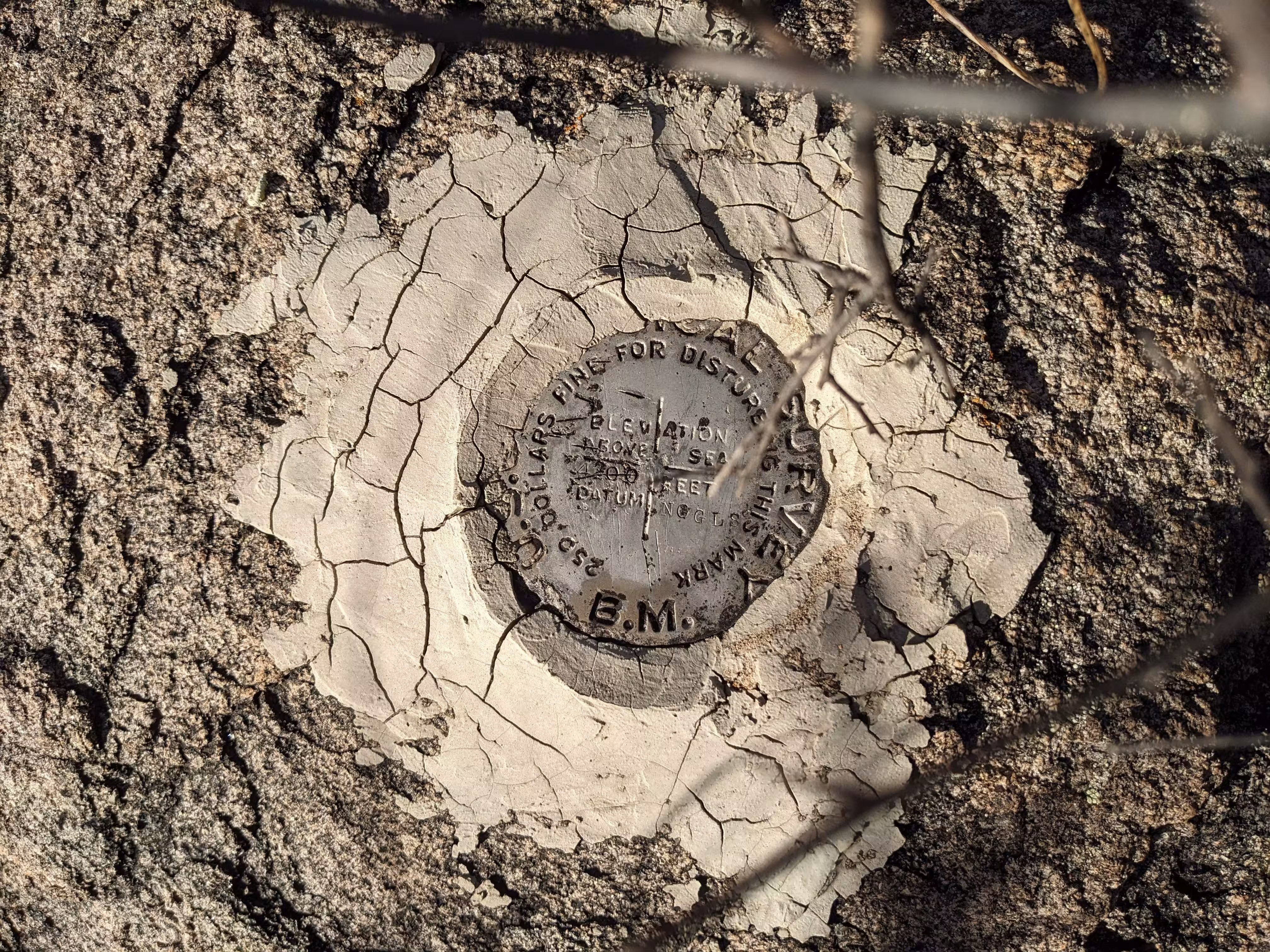
"NOGLS 4200"
| NGS PointID | CG0163 |
| Reference Benchmarks: | None |
| Condition: | Ware and scratching. |
| Stamping: | 4200 NOGLS |
| Coordinates: | 31.735250, -110.106717 |
| Elevation: | 4212.257 ft (1283.896 m) |
| Setting: | Boulder or rock outcrop. |
| Monumentor: | USGS |
Datasheet Description:
3.2 miles west along the Southern Pacific Co. Railroad from the station at Tombstone, Cochise County, about 300 feet west of trestle 1054.31 over Tombstone Gulch, 23 feet south of the centerline of the track, and in the top of a granite boulder. A United States Geological Survey standard disk, stamped 4200 NOGLS.
Old Datasheet Description:
Tombstone, 3 miles west of, 300 feet west of trestle over Tombstone Gulch, 23 feet south of railroad track, in granite outcrop; bronze tablet stamped "4200 NOGLS"
"NOGLS 4200" is a benchmark monumented by the USGS in 1903 located in Cochise County, Arizona.
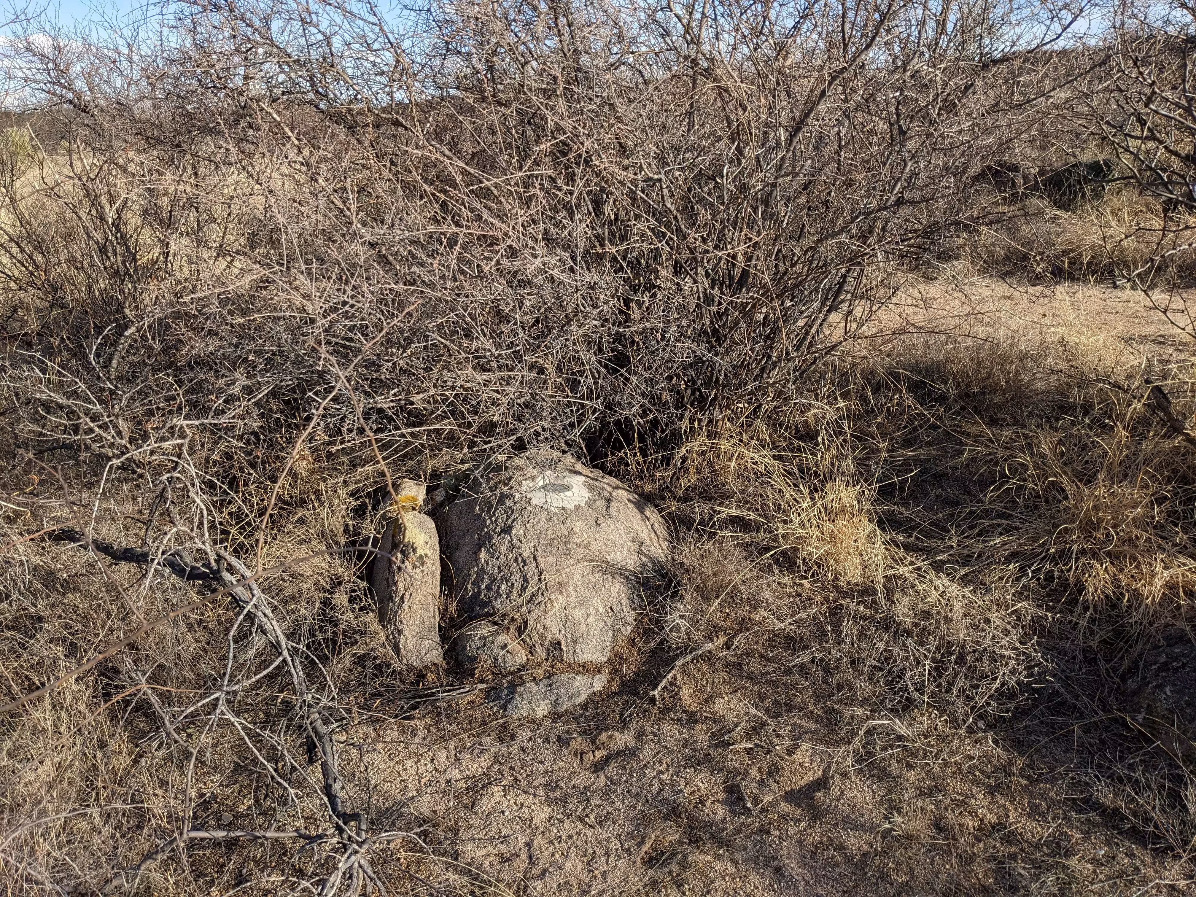
The benchmark is along the old railroad grade, in a promient boulder under a low-lying tree.
To reach the benchmark from Tombstone, follow Alan Street to a power substation. Turn right (northwest) to the Ed Schieffelin Monument. The road after the monument requires a high clearance vehicle. Parking at the monument is suitable for low clearance vehicles. Follow the main road to a track road to the right. Follow this road to a bridle path along the old railroad grade. Follow this path to the benchmark on the right.