|
|
Main benchmarks recovered in good or poor condition. |
|
|
Main benchmarks that have been destroyed. |
|
|
Reference benchmarks recovered in good or poor condition. |
|
|
Reference benchmarks that have been destroyed. |
|
|
Azimuth benchmarks recovered in good or poor condition. |
|
|
Azimuth benchmarks that have been destroyed. |
|
|
A main, reference, or azimuth benchmark not searched for. |
"NOGLS 3531"
| Reference Benchmarks: | None |
| Condition: | Strong ware present |
| Stamping: | 3531 NOGLS |
| Coordinates: | 31.993078, -110.684701 |
| Elevation: | 3543.540 ft (1080.071 m) |
| Setting: | Pipe cap. |
| Monumentor: | USGS |
Datasheet Description:
Vail, 4 miles southeast of, on ridge, 5 feet west of road; iron post stamped "3531 NOGLS"
"NOGLS 3531" is a benchmark monumented by the USGS in 1903 or 1904 located in Pima County, Arizona.
This disc is apart of the NOGLS vertical datum conducted during 1903, 1904, and 1905 across the Tucson area. To learn more about the NOGLS datum see this page.
South east of the benchmark, at a power line road, there is a gravel area to pull out into. From here, cross the street. Follow the fence line northwest to the mark.
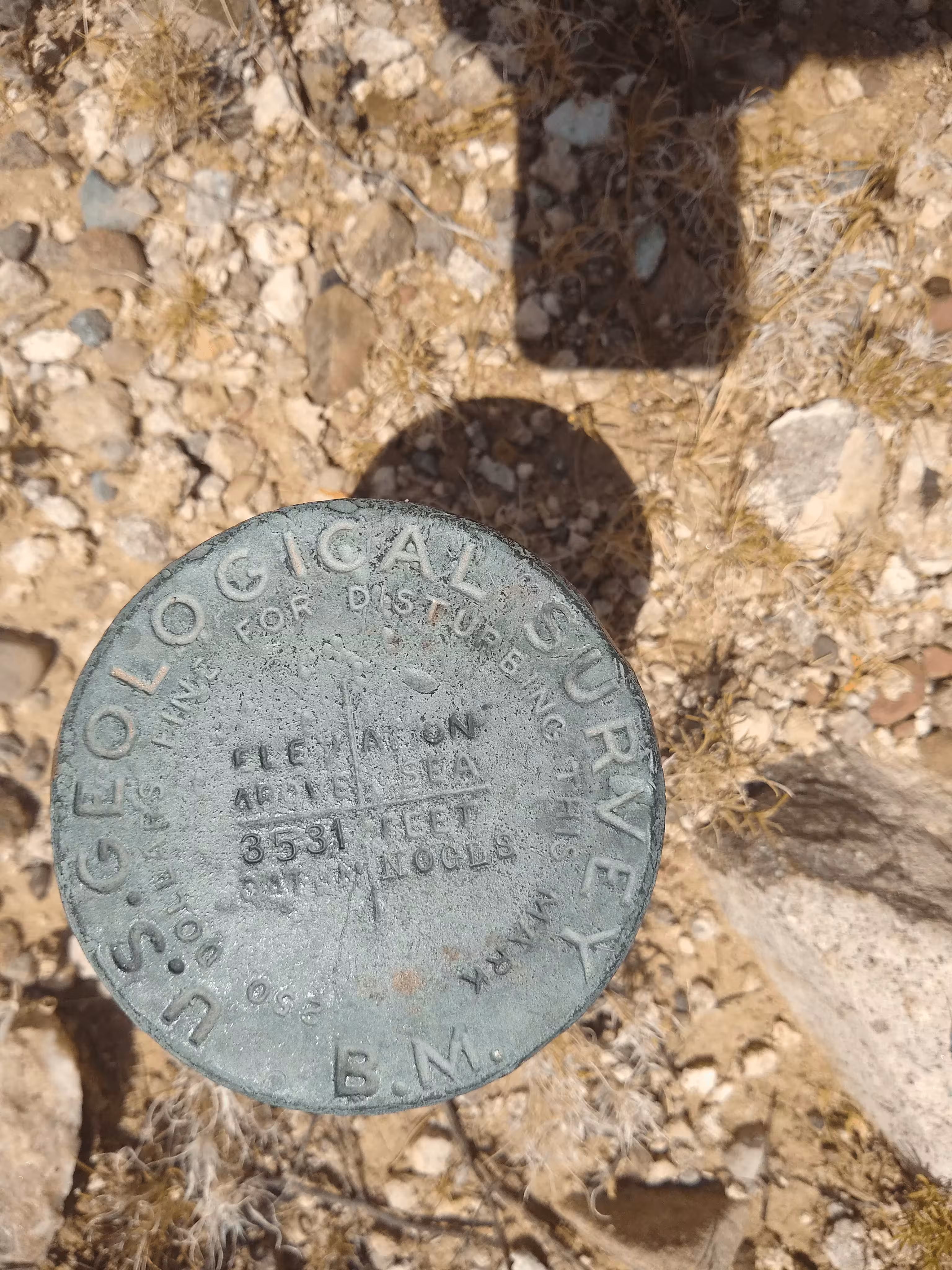
NOGLS 3531 close up.
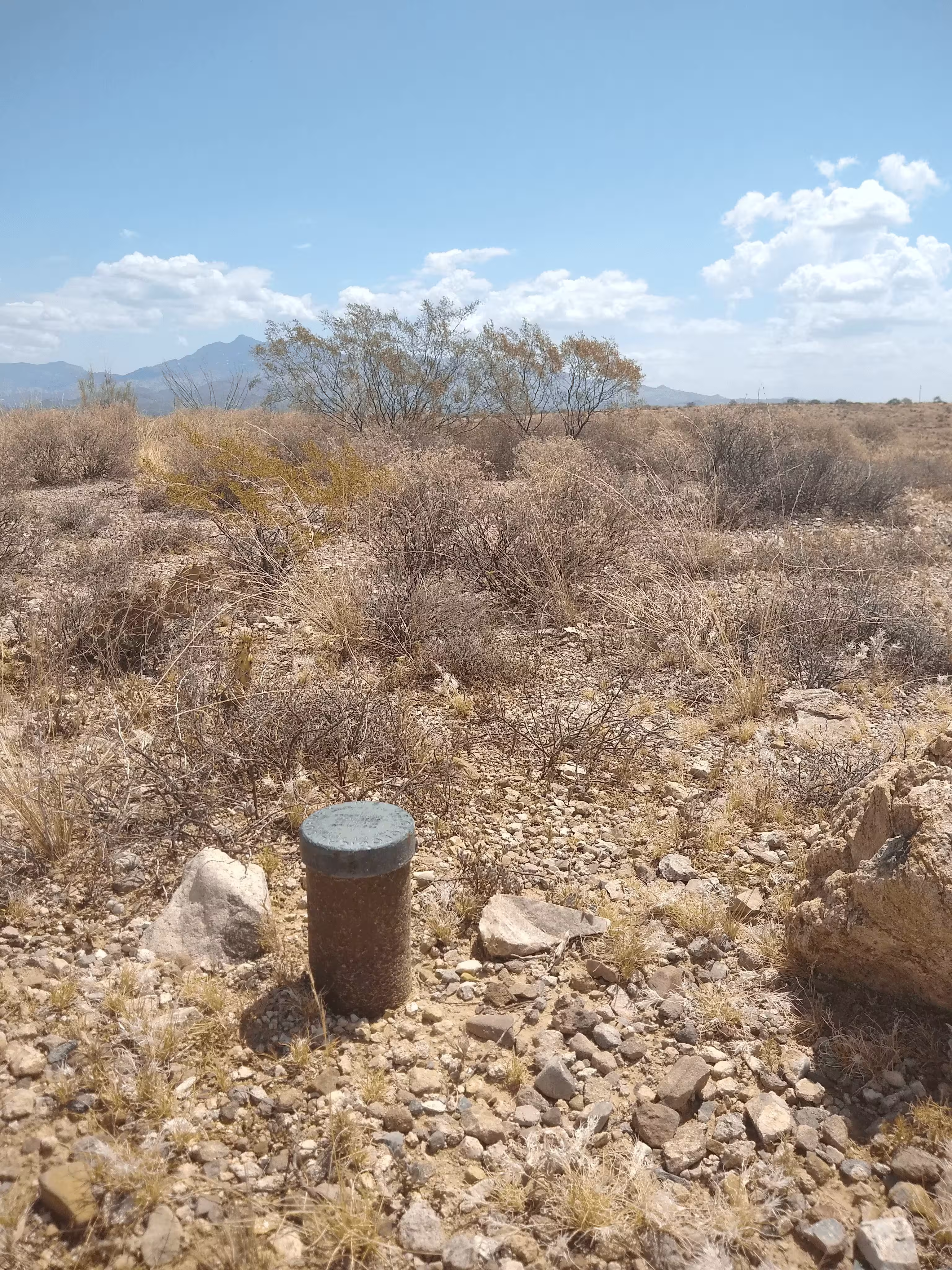
NOGLS 3531 from further back.