|
|
Main benchmarks recovered in good or poor condition. |
|
|
Main benchmarks that have been destroyed. |
|
|
Reference benchmarks recovered in good or poor condition. |
|
|
Reference benchmarks that have been destroyed. |
|
|
Azimuth benchmarks recovered in good or poor condition. |
|
|
Azimuth benchmarks that have been destroyed. |
|
|
A main, reference, or azimuth benchmark not searched for. |
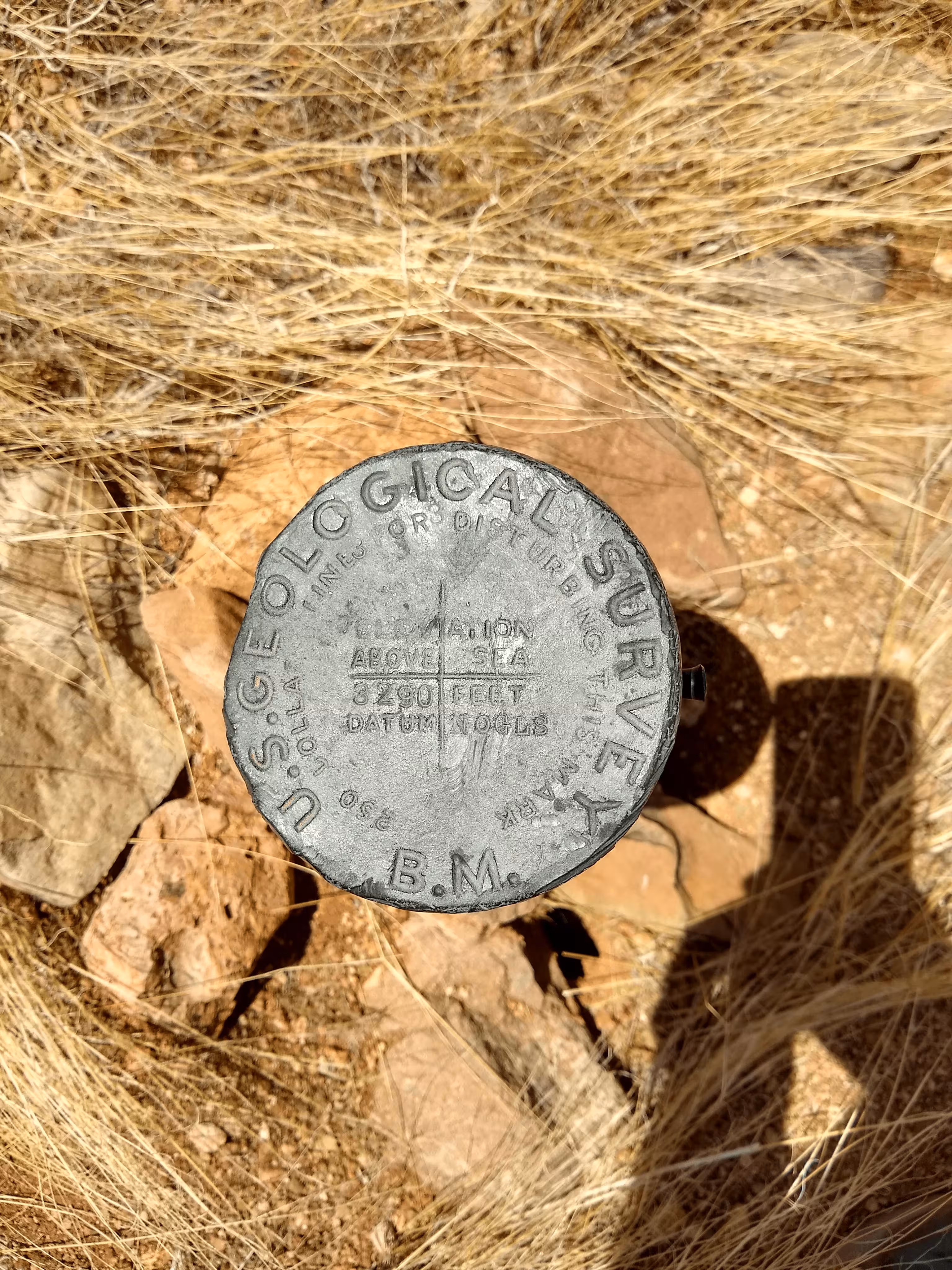
"NOGLS 3290"
| Reference Benchmarks: | None |
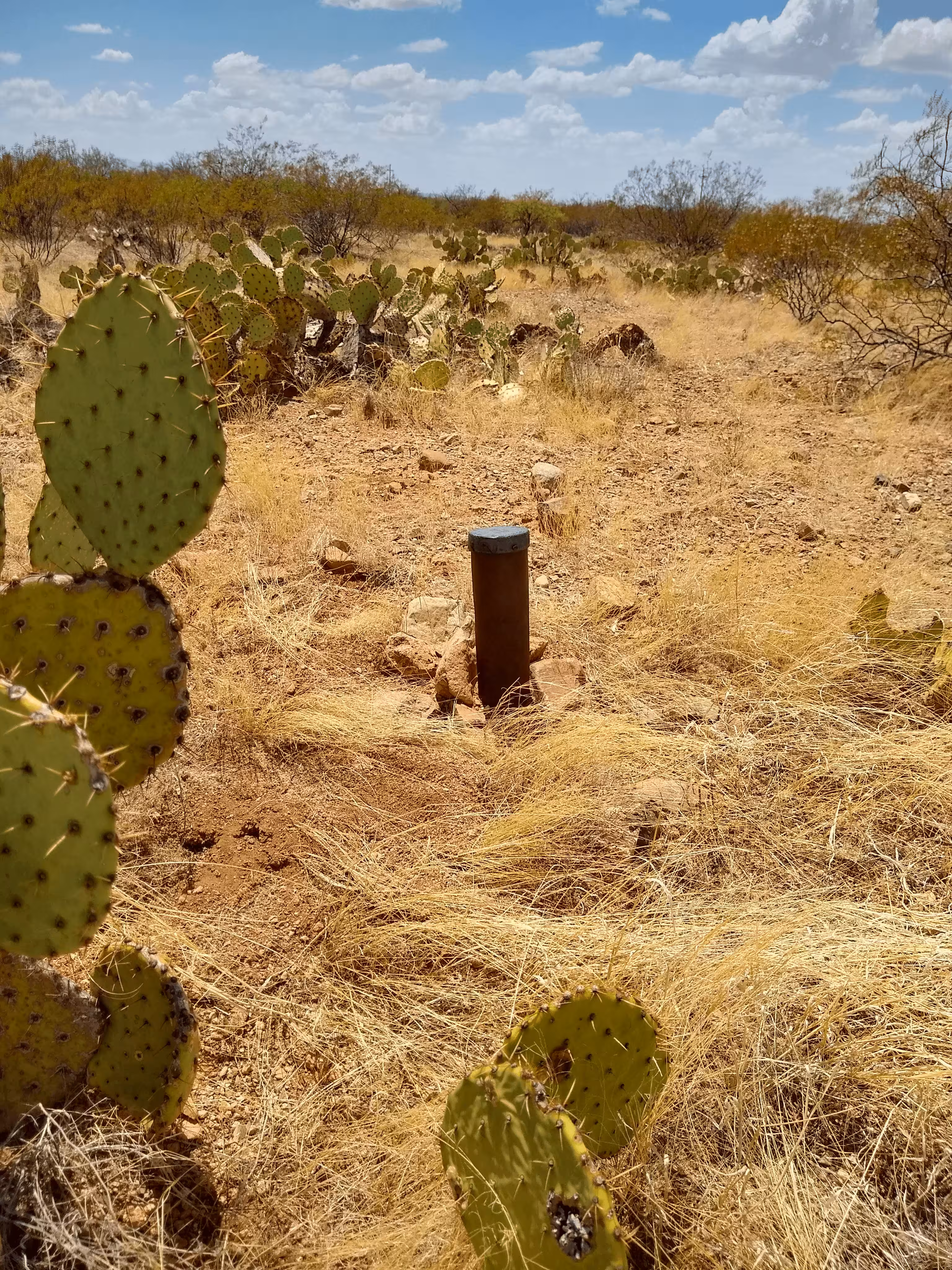
| Condition: | Strong ware and scratching present. The post is no longer vertical. |
| Stamping: | 3290 NOGLS |
| Coordinates: | 32.01242, -110.72927 |
| Elevation: | 3302.681 ft (1006.657 m) |
| Setting: | Pipe cap. |
| Monumentor: | USGS |
Datasheet Description:
Jct. of I-Hwy. 10 and Vail Rd. (N.)-Wentworth Rd. (S.), 0.9 mi S. of, along Wentworth Rd. from south end of overpass bridge that spans eastbound lane of freeway, thence 0.3 mi NW. along track rd. that follows pair of double wooden pole power lines, thence 0.20 mi SW. along track rd.; on northwest edge of rd.; 11 ft NW. of centerline of rd. inside a cairn; set on 3 1/2-inch iron pipe that projects 1.2 ft; standard brass cap stamped "3290 NOGLS"
Old Datasheet Description:
Vail, 2.5 miles south of, crossing of Andrade-Tucson and Vail-Helvetia roads, southwest side; iron post stamped "3290 NOGLS"
"NOGLS 3290" is a benchmark monumented by the USGS in 1903 or 1904 located in Pima County, Arizona.
This disc is apart of the NOGLS vertical datum conducted during 1903, 1904, and 1905 across the Tucson area. To learn more about the NOGLS datum see this page.
From Wentworth Road and a powerline road, head northwest along the power line road. A medium clearance vehicle can be driven down the power line road. Follow the road through a gate and then turn left on a dirt road heading southwest. Continue for a thousand feet to the benchmark on the right of the road.