|
|
Main benchmarks recovered in good or poor condition. |
|
|
Main benchmarks that have been destroyed. |
|
|
Reference benchmarks recovered in good or poor condition. |
|
|
Reference benchmarks that have been destroyed. |
|
|
Azimuth benchmarks recovered in good or poor condition. |
|
|
Azimuth benchmarks that have been destroyed. |
|
|
A main, reference, or azimuth benchmark not searched for. |
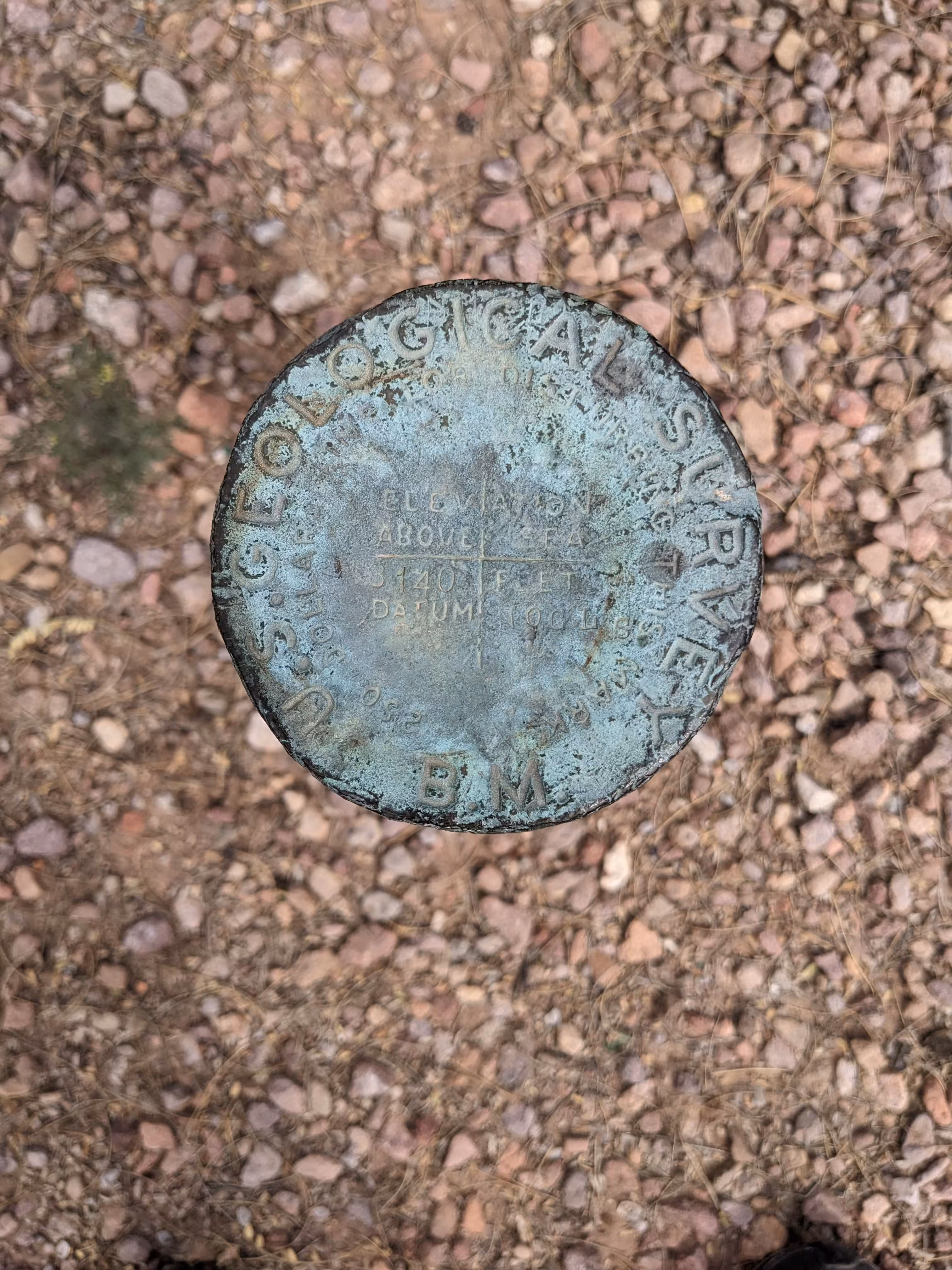
"NOGLS 3140"
| Reference Benchmarks: | None |
| Condition: | Strong ware |
| Stamping: | 3140 NOGLS |
| Coordinates: | 31.64330, -111.04874 |
| Elevation: | 3152.156 ft (960.777 m) |
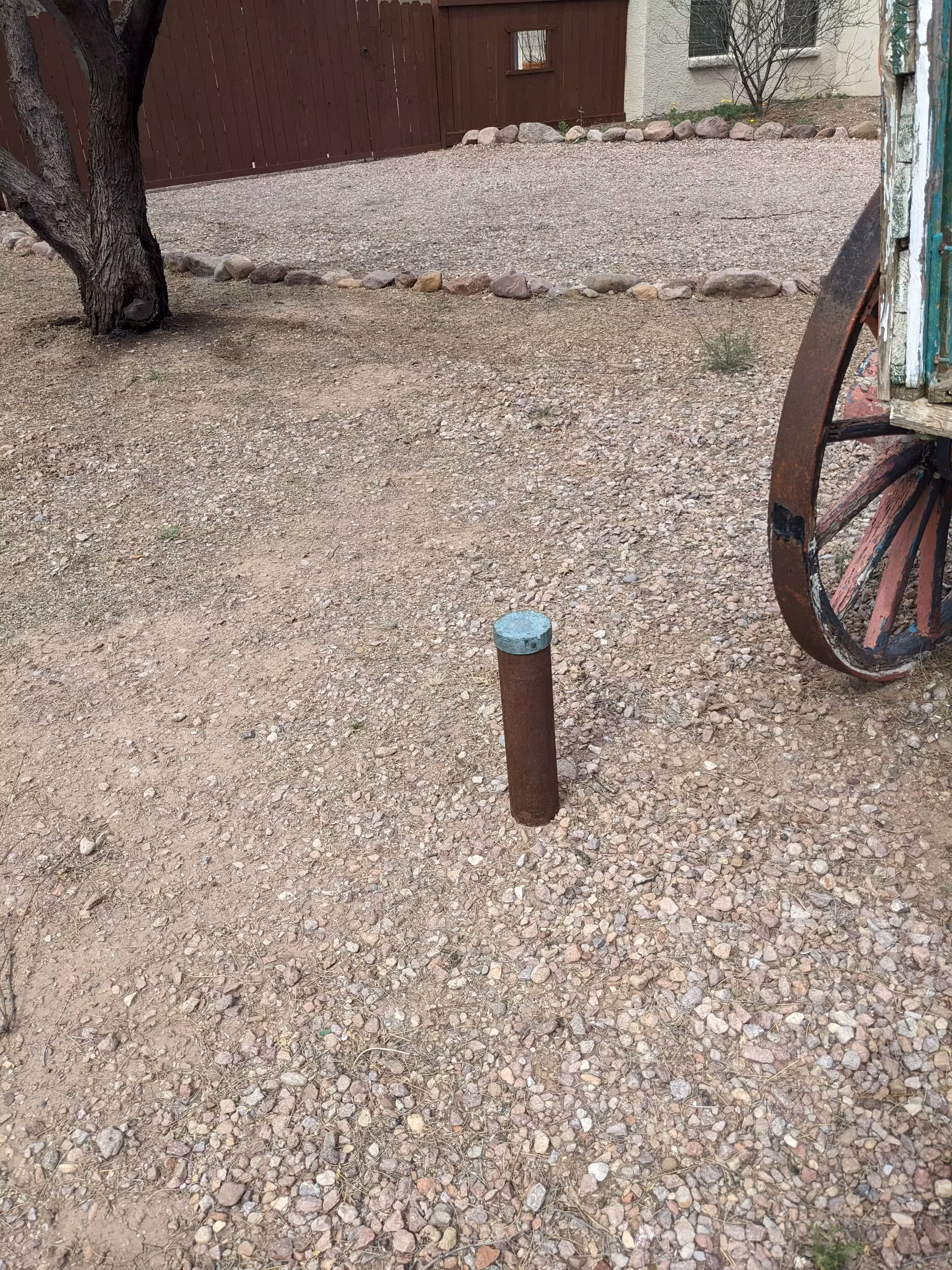
| Setting: | Pipe cap. |
| Monumentor: | USGS |
Datasheet Description:
Tubac 2.2 mi N. of; 0.5 mi E. of Interstate 19; 0.2 Mi. S. of P-M Ranch; 700 ft SW. of Santa Cruz River; 20 ft E. of small drain; 50 ft NW of a road. 57 ft SSW. of SW. corner of house, at west edge of yard .... A standard iron post with a bronze cap stamped "3140 NOGLS".
Old Datasheet Description:
Tubac, 2.25 miles north of, 7 feet east of road, 2 feet south of 18- inch leaning mesquite tree at angle in road to northwest; iron post stamped "3140 NOGLS"
"NOGLS 3140" is a benchmark monumented by the USGS in 1903 or 1904 located in Santa Cruz County, Arizona.
This disc is apart of the NOGLS vertical datum conducted during 1903, 1904, and 1905 across the Tucson area. To learn more about the NOGLS datum see this page.
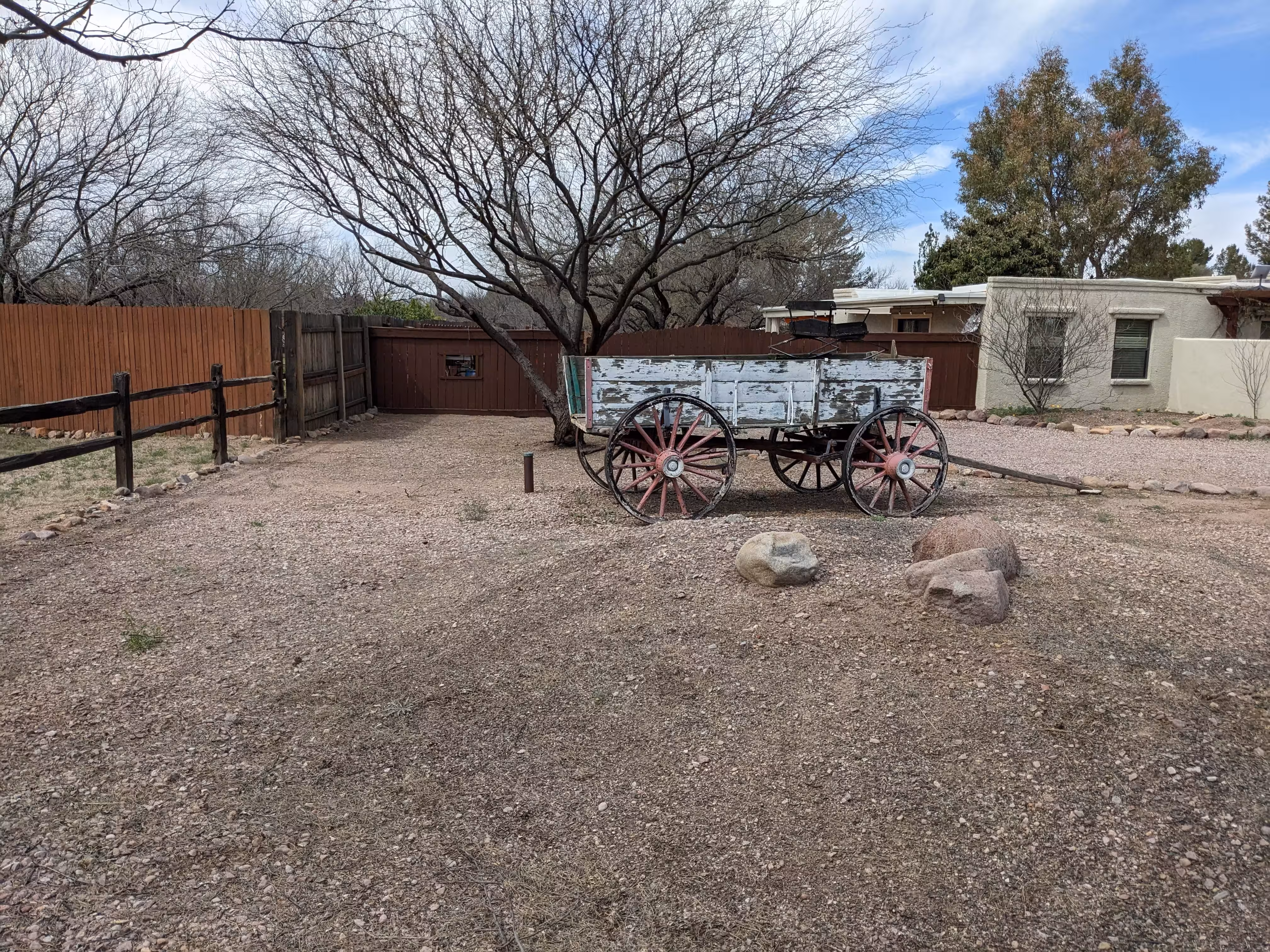
From Tubac, follow the I-19 frontage road north to Chavez Siding. Turn right, eastwards, and follow the road to Camino Shangrila. Turn right, southwards, and follow the road to Calle Poqito. Turn left, eastwards and follow the road to 2360 Calle Poqito. The benchmark is in the front yard near a wagon used as decoration.