|
|
Main benchmarks recovered in good or poor condition. |
|
|
Main benchmarks that have been destroyed. |
|
|
Reference benchmarks recovered in good or poor condition. |
|
|
Reference benchmarks that have been destroyed. |
|
|
Azimuth benchmarks recovered in good or poor condition. |
|
|
Azimuth benchmarks that have been destroyed. |
|
|
A main, reference, or azimuth benchmark not searched for. |
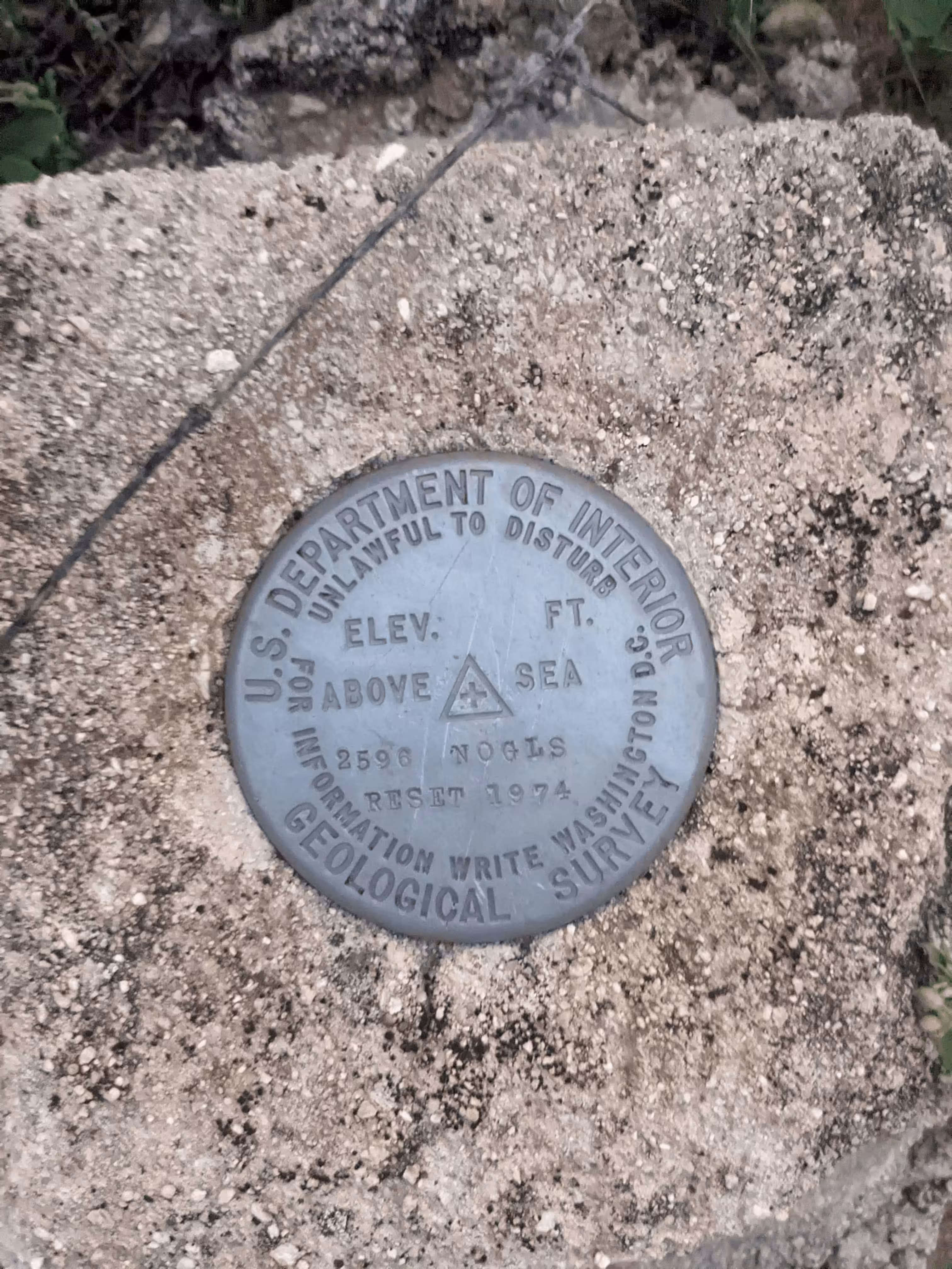
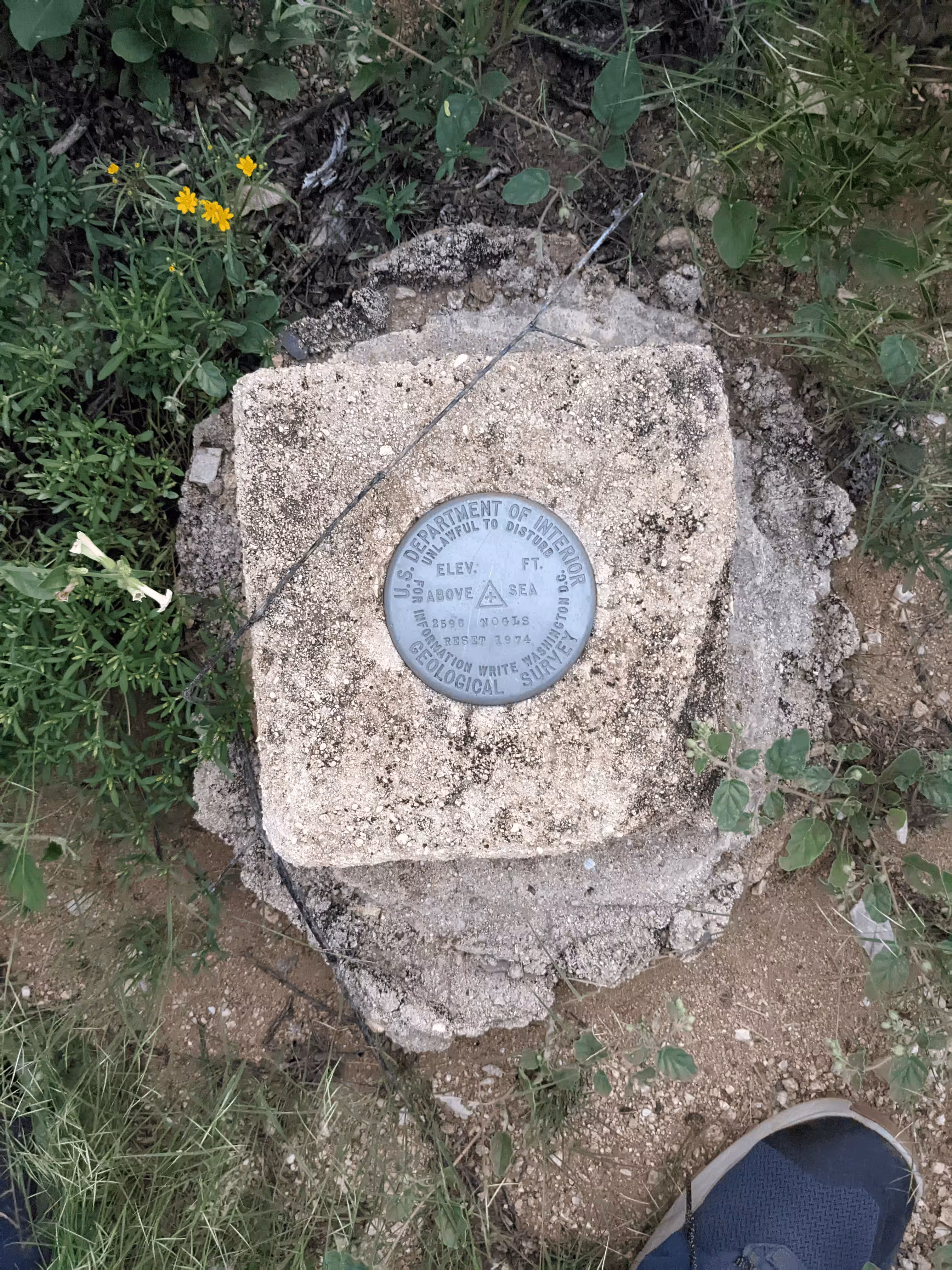
"NOGLS 2596 RESET"
| Reference Benchmarks: | None |
| Condition: | Long minor scratches |
| Stamping: | 2596 NOGLS RESET 1974 |
| Coordinates: | 32.29699, -110.81121 |
| Elevation: | 2610.77 ft (795.76 m) |
| Setting: | A concrete mass/post. |
| Monumentor: | USGS |
Datasheet Description:
Intersection of Tanque Verde Rd. and Sabino Canyon Rd. in NE. Tucson, 3.2 mi N. on Sabino Canyon Rd. to Snyder Rd., turn E. on Snyded Rd. for 0.8 mi to Hidden Valley Rd., turn N. for 0.2 mi to Rawhide St., approx. 125 ft N. of Rawhide St., 20 ft S. of property line, 2 ft E. of lot line on W. side of Hidden Valley Rd., in a concrete post projecting 3 inches; Standard aluminum tablet stamped "2596 NOGL RESET 1974"
"NOGLS 2596 RESET" is a benchmark monumented by the USGS in 1976 located in Pima County, Arizona. The original benchmark was monumented in 1903 or 1904 but it was destroyed in the urbanization of the Tucson metro area.
This disc is apart of the NOGLS vertical datum conducted during 1903, 1904, and 1905 across the Tucson area. To learn more about the NOGLS datum see this page.
The best way to get to "NOGLS 2596 RESET" is, from Tanque Verde Road and Sabino Canyon Road, head north along Sabino Canyon Road until it turns into Kolb Road. Turn right to stay on Sabino Canyon Road. At Snyder Road, turn right to its terminus. Continue on Hidden Valley Road, 140 feet north of Rawhide Trail, the benchmark is on the left side of the road.