|
|
Main benchmarks recovered in good or poor condition. |
|
|
Main benchmarks that have been destroyed. |
|
|
Reference benchmarks recovered in good or poor condition. |
|
|
Reference benchmarks that have been destroyed. |
|
|
Azimuth benchmarks recovered in good or poor condition. |
|
|
Azimuth benchmarks that have been destroyed. |
|
|
A main, reference, or azimuth benchmark not searched for. |
"MIKE"
| Reference Benchmarks: | None |
| Condition: | Ware and pattering |
| Stamping: | MIKE 1969 |
| Coordinates: | 44.25089, -86.34428 |
| Elevation: | 559 ft (170 m) |
| Setting: | Concrete pier |
| Monumentor: | USACE |
"MIKE" is a benchmark monumented by the USACE in 1969 located in Manistee County, Michigan.
The benchmark is on the North Pier about opposite that of the smallest, middle pier of the Manistee River.
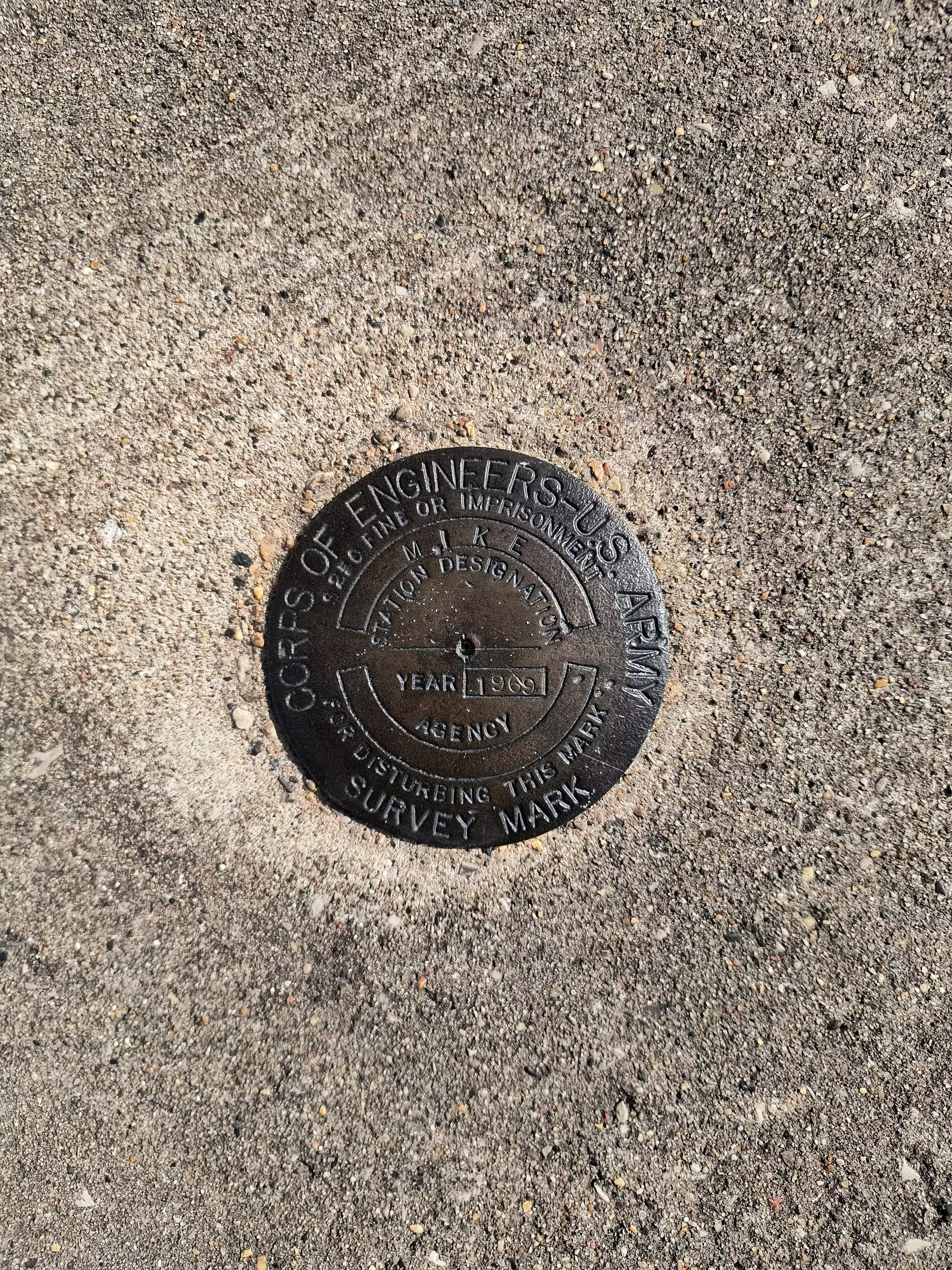
MIKE close up.
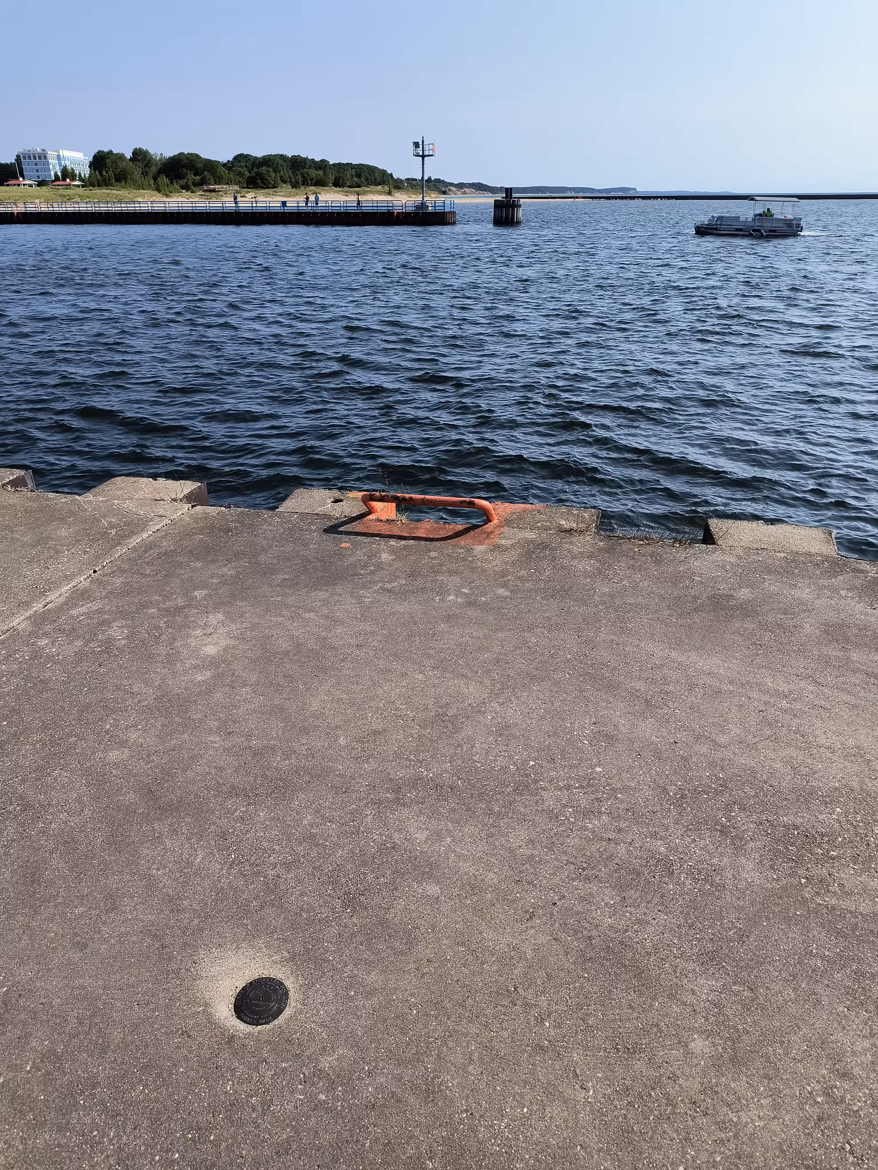
MIKE further back.