|
|
Main benchmarks recovered in good or poor condition. |
|
|
Main benchmarks that have been destroyed. |
|
|
Reference benchmarks recovered in good or poor condition. |
|
|
Reference benchmarks that have been destroyed. |
|
|
Azimuth benchmarks recovered in good or poor condition. |
|
|
Azimuth benchmarks that have been destroyed. |
|
|
A main, reference, or azimuth benchmark not searched for. |
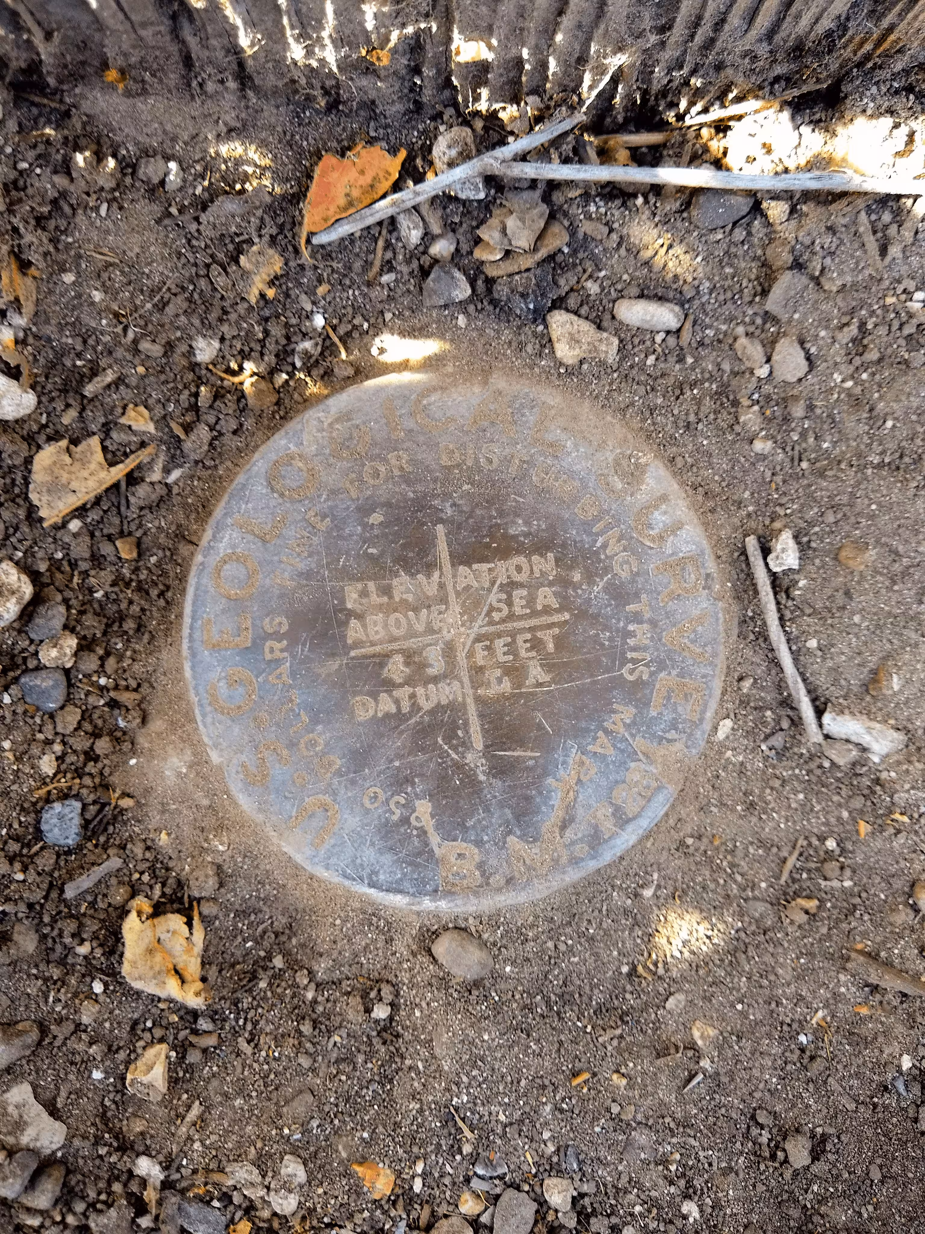
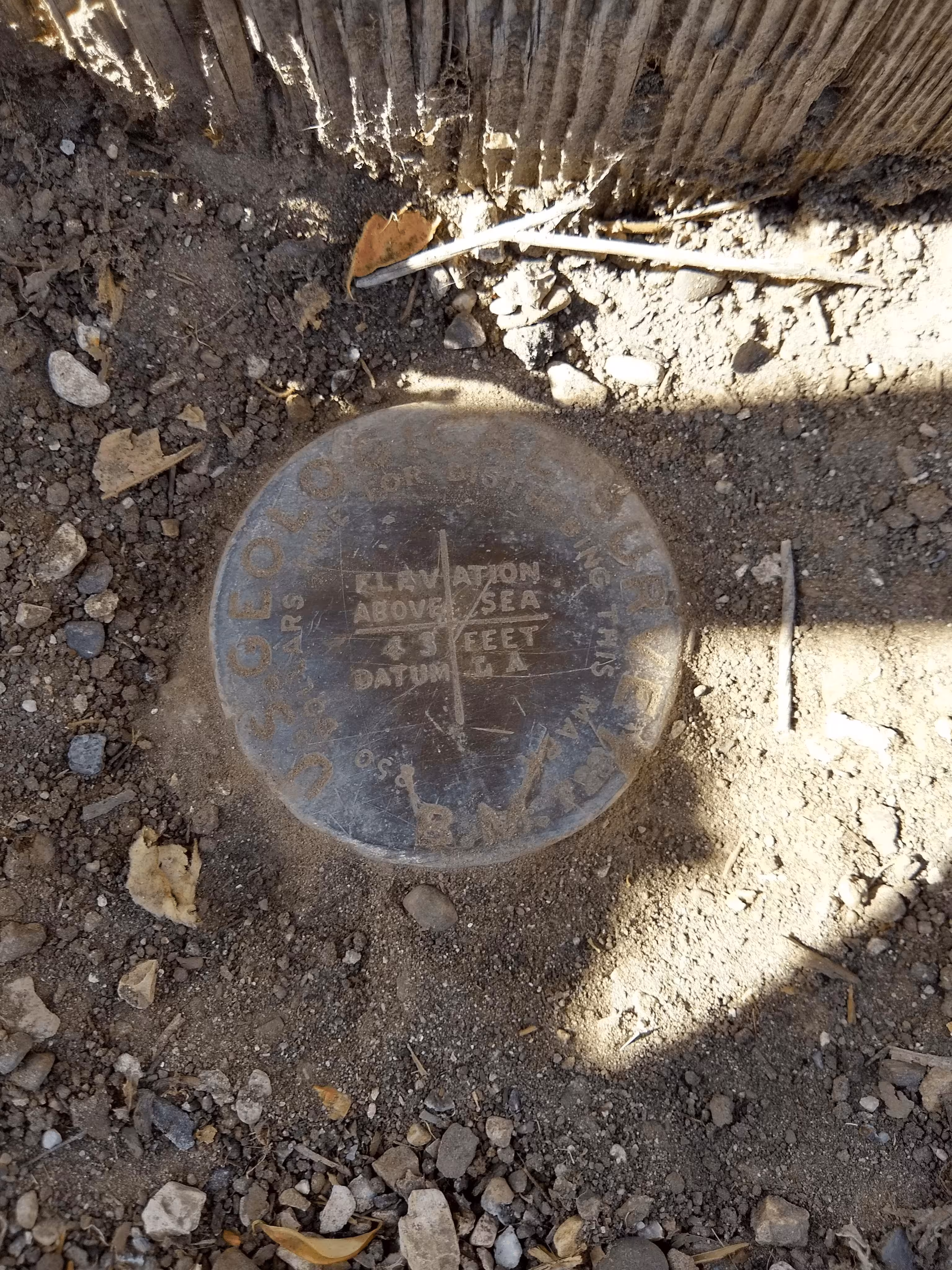
"LA 43"
| NGS PointID | EW3774 |
| Reference Benchmarks: | None |
| Condition: | Scratching. Ware. |
| Stamping: | 78 SF |
| Coordinates: | 34.439795, -119.819872 |
| Elevation: | 46.316 ft (14.117 m) |
| Setting: | Pipe cap. |
| Monumentor: | USGS |
Datasheet Description:
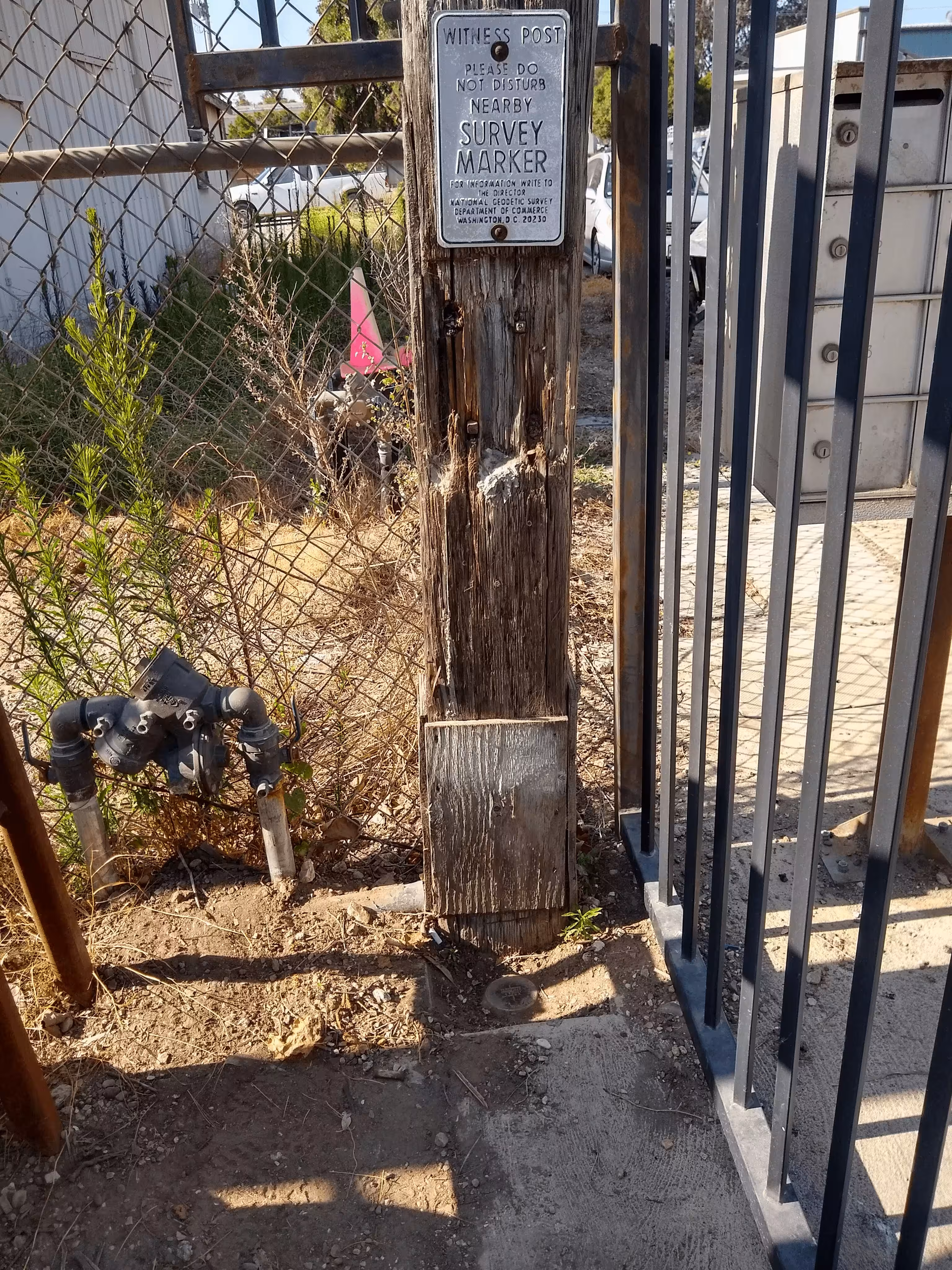
At Goleta, along the Southern Pacific Railroad, 199 feet east and across Kellogg Avenue from the southeast corner of the southern pacific station, 120 feet south-southeast of the center of the crossing of Kellogg Avenue and the track, 116.7 feet south of the south rail of the main track, 29 feet east of the center line of Kellogg Avenue, 15.4 feet northwest of the northwest corner of a galvanized building, 0.6 foot north of a buried cross tie which projects 5 feet above the ground, 7 feet east of power pole 1675667E, 1.3 feet north of the northwest corner of a cyclone fence, 1.2 feet south of a witness post, about level with the track, a cap riveted on the top of a 3 1/2-inch iron pipe flush with the ground.
Old Datasheet Description:
Goleta, 70 feet east of windmill frame, 120 feet south of center of track, 2 feet east of corner of fence, east side of road; iron post stamped "43 L. A."
"LA 43" is a benchmark monumented by the USGS in 1901 located in Santa Barbra County, California.
The benchmark is in an industrial area along the railroad, just off Kellogg Avenue. There is a fence and gate keeping the mark in but the gate is open basically during the daytime. Even if it is closed, the fence is wide enough for a phone to fit through it to take a picture.
The witness post is on a railroad tie set upright. The power pole number is the same since the 1970 description.