|
|
Main benchmarks recovered in good or poor condition. |
|
|
Main benchmarks that have been destroyed. |
|
|
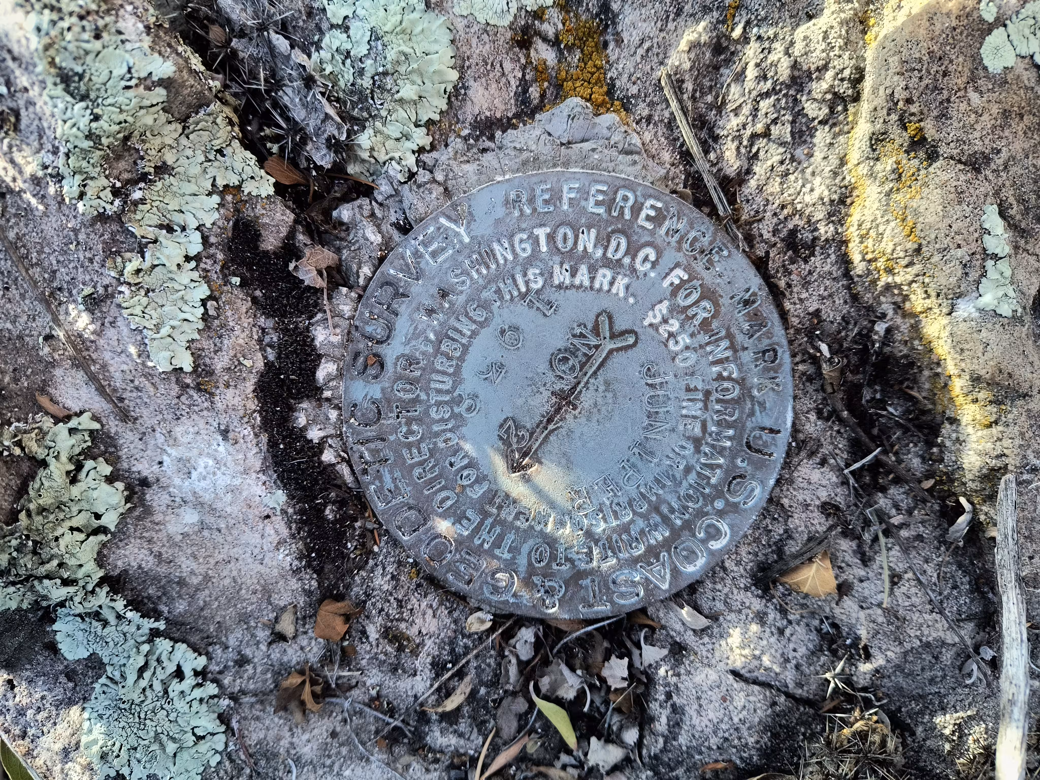
Reference benchmarks recovered in good or poor condition. |
|
|
Reference benchmarks that have been destroyed. |
|
|
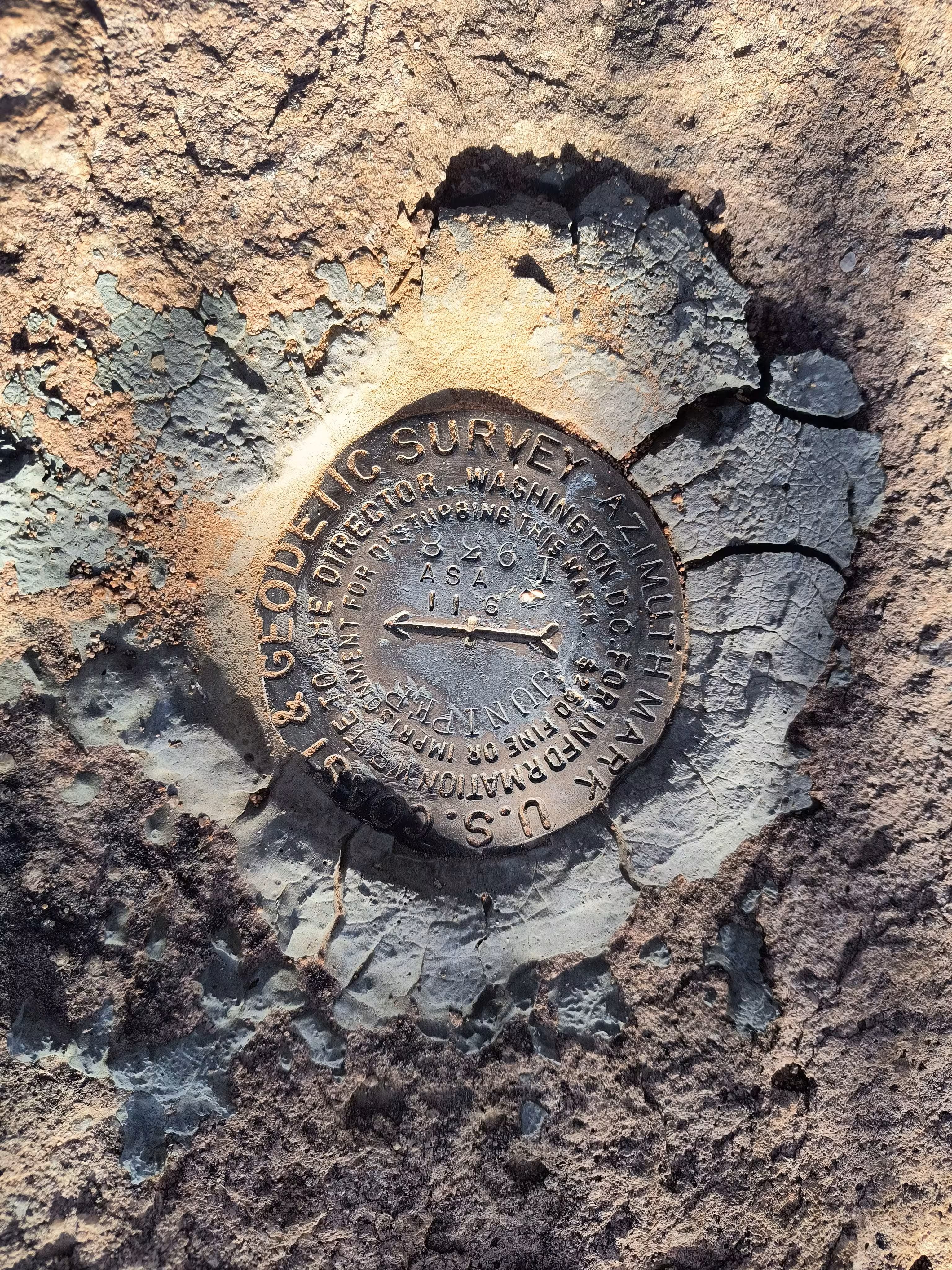
Azimuth benchmarks recovered in good or poor condition. |
|
|
Azimuth benchmarks that have been destroyed. |
|
|
A main, reference, or azimuth benchmark not searched for. |
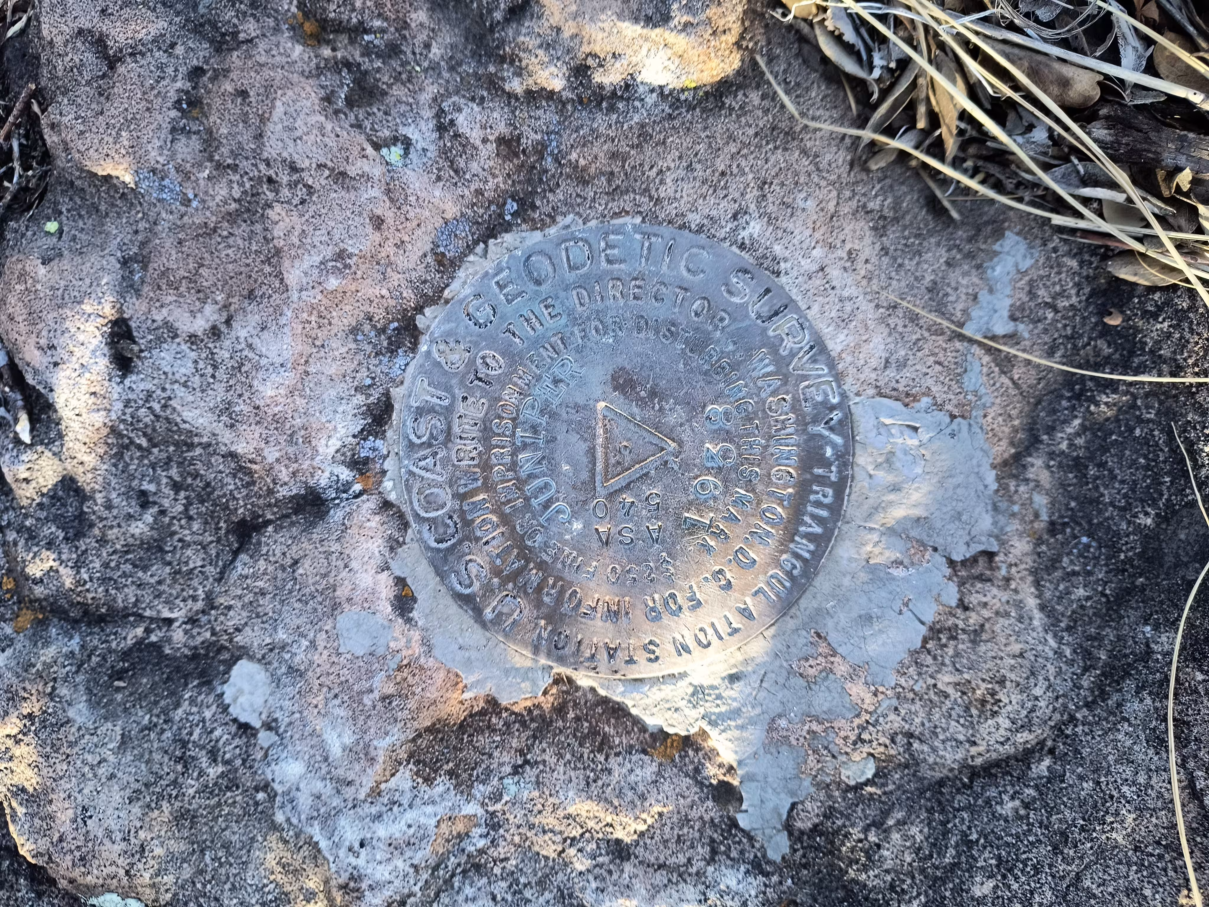
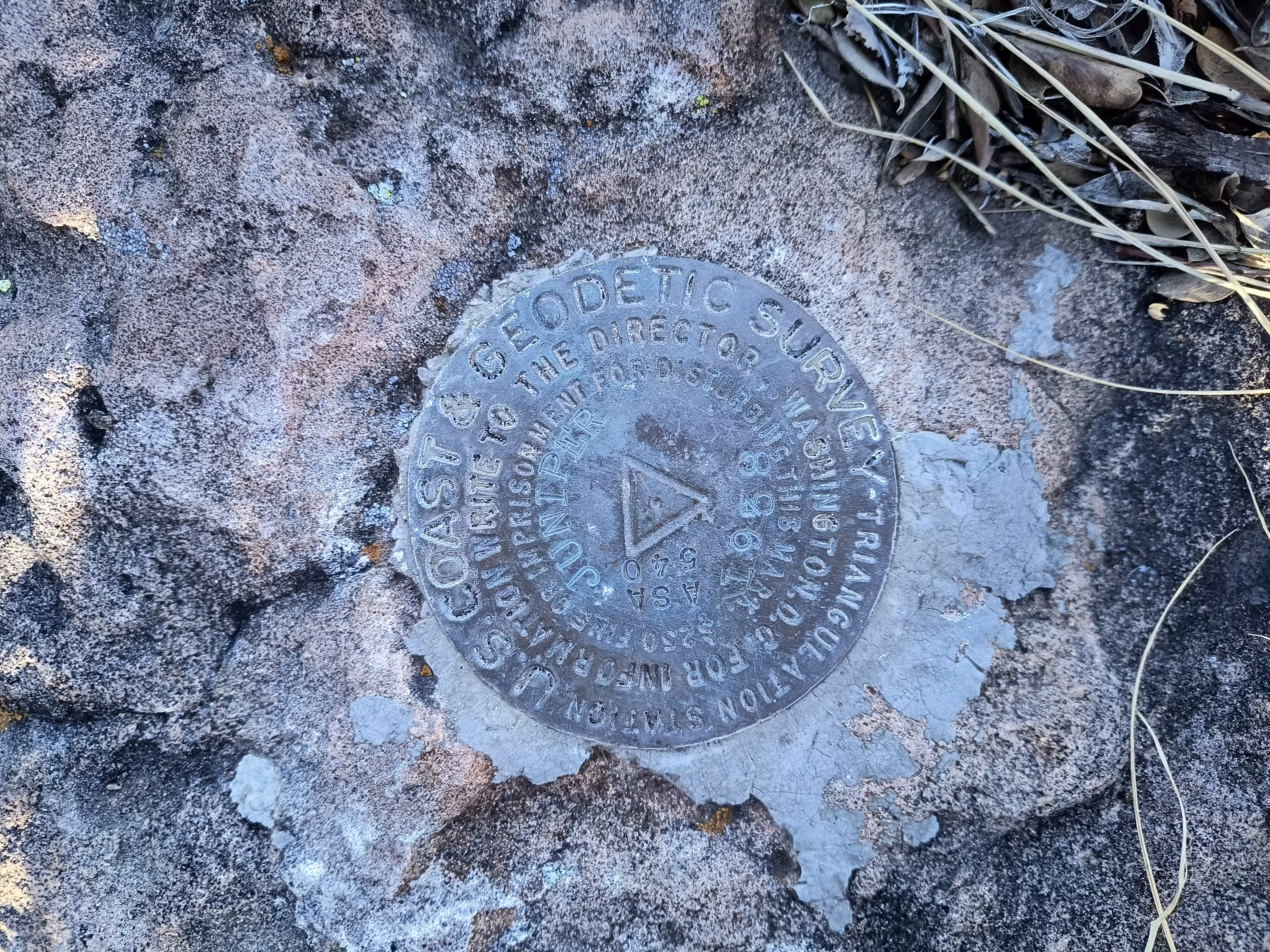
"JUNIPER"
| NGS PointID: | CF0356 |
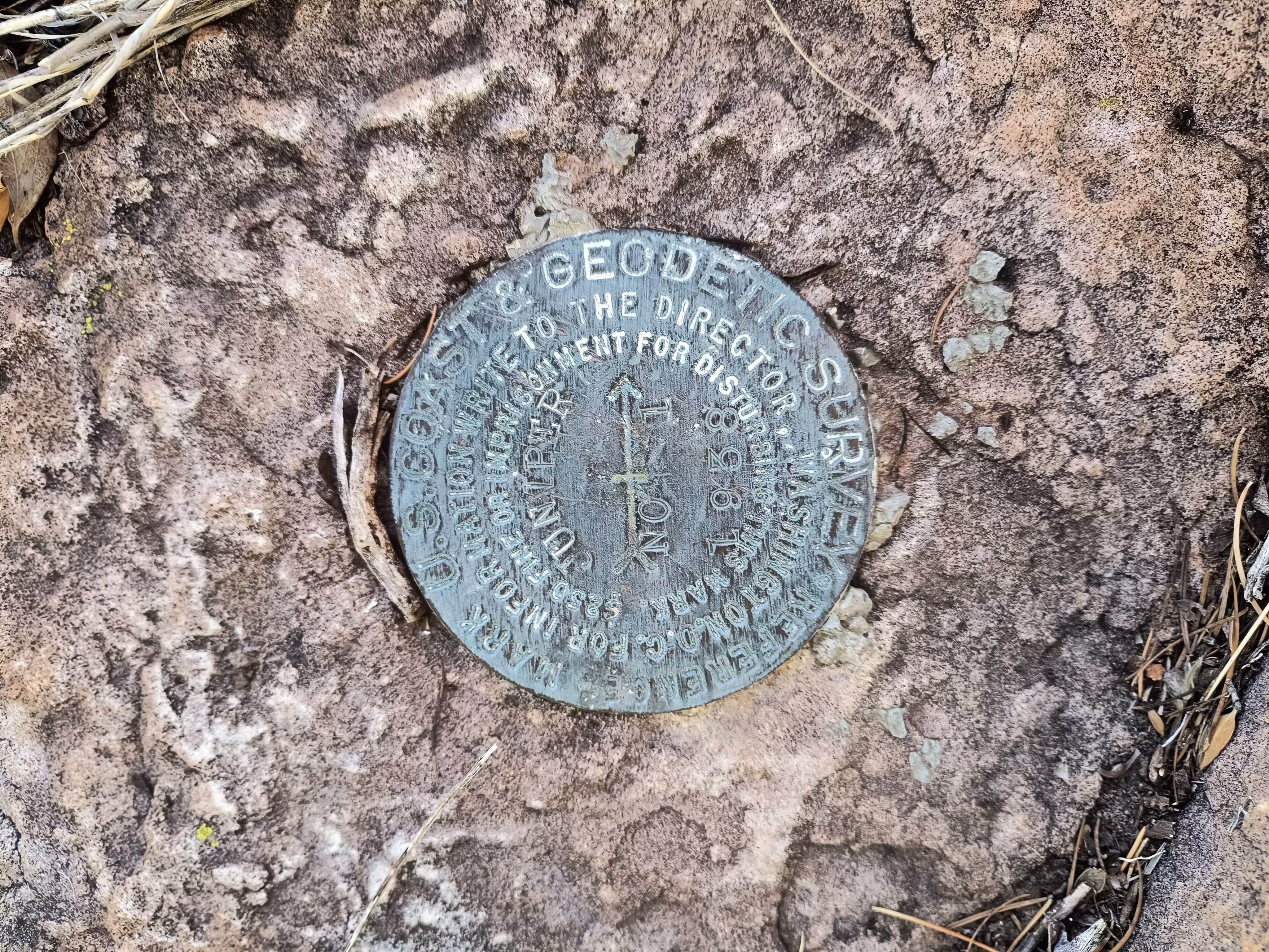
| Reference Benchmarks: | JUNIPER NO 1, JUNIPER NO 2 |
| Azimuth mark: | JUNIPER |
| Condition: | Considerable ware |
| Stamping: | JUNIPER ASA 540 1938 |
| Coordinates: | 31.485655, -109.956471 |
| Elevation: | 7111.55 ft (2167.60 m) |
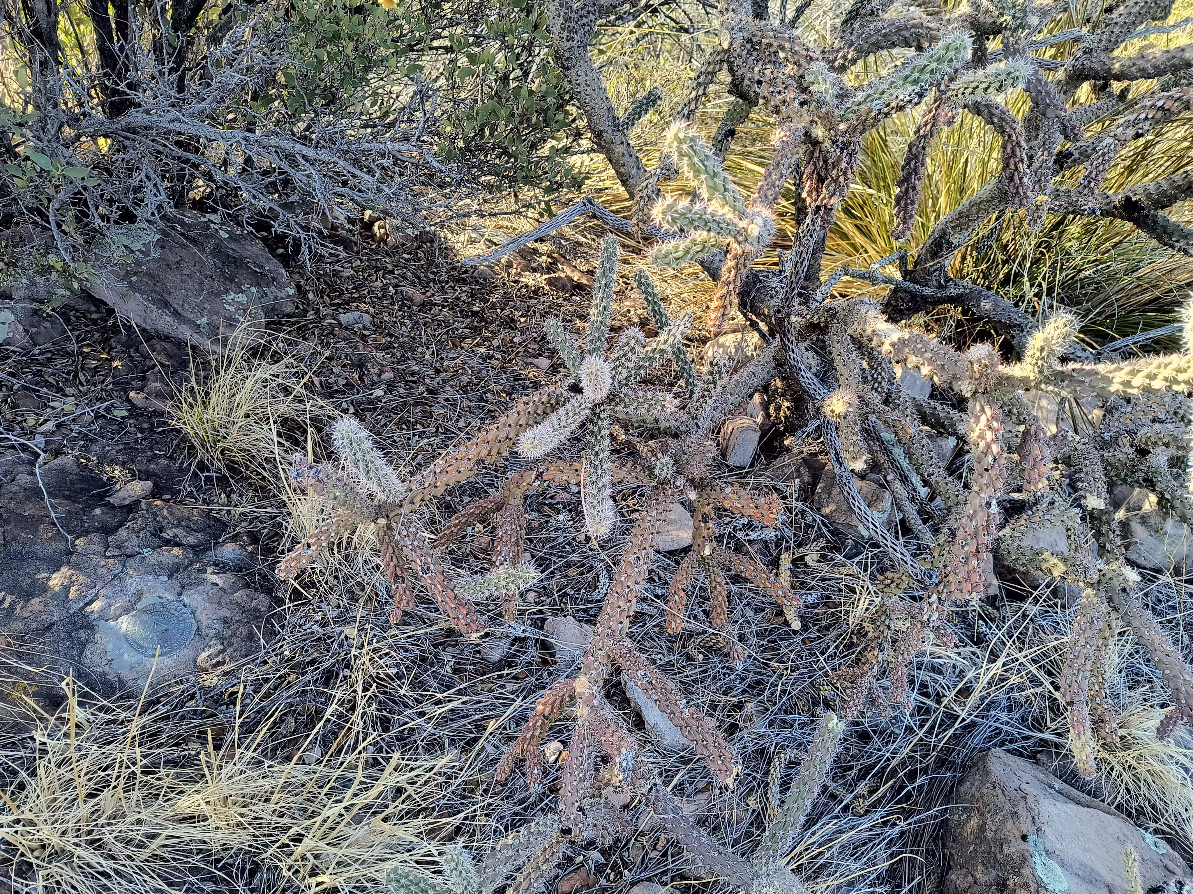
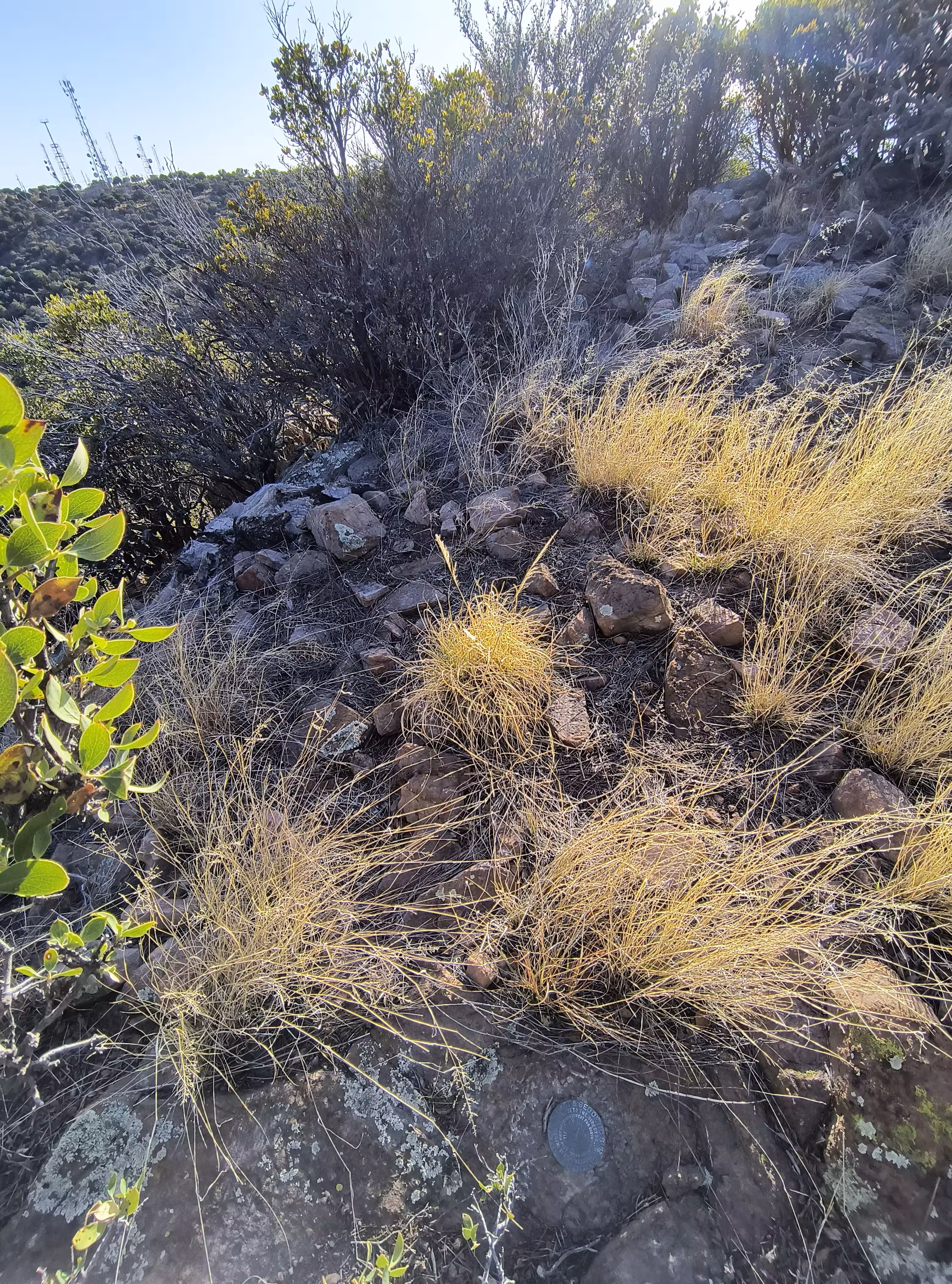
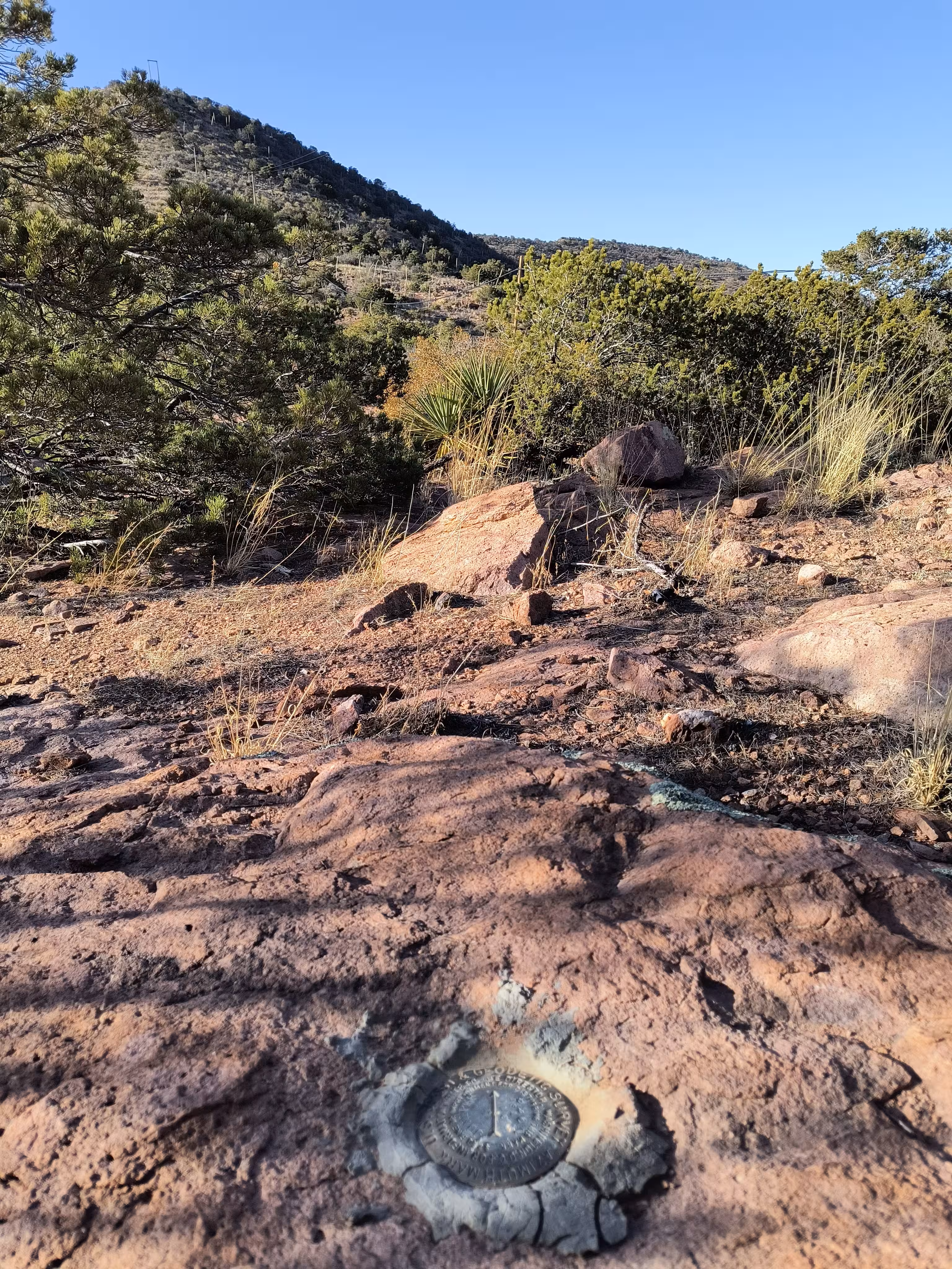
| Setting: | A rock outcrop |
| Monumentor: | USC&GS |
Datasheet Description:
Station is located about 4.0 miles NW of Bisbee and about 2.0 miles NW of the pass on U.S. Highway 80 and 1/4 mile NE of the highest peak in this vicinity on a rocky ridge which is the NE extension of the main peak and separated from it by a low saddle.
Station, reference and azimuth marks are standard bronze disks set in outcropping bedrock.
To reach from Bisbee go W from the post office on U.S. Highway 80, 2.7 miles to the top of the pass. At the highest point of U.S. Highway 80 in the pass there is an old road turning right, N, through a cattle guard. Go N on this road up steep grade 1.0 mile to the end of the graded road. Here there is a track road turning sharp left. Follow this rough track road (keeping main right hand track at forks) along the top of the ridge 1.5 miles to a saddle and old rock house on the hillside ahead - end of truck travel. Pick up trail 50 yards W of old rock house which skirts the E side of the peak ahead and comes into a saddle. At the saddle turn right ne along the ridge to the first high point and station. Station is about 1.0 mile from end of truck travel. Station and reference marks are in bare ledge rock and easily located.
Azimuth mark is at end of truck travel 70 paces S of an old loading platform and 20 feet E of road.
"JUNIPER" is a benchmark monumented by the CGS in 1938 located in Cochise County, Arizona. It has 2 dedicated reference marks and a dedicated azimuth mark.
The road now goes all the way up to the top of the highest peak. You can park at the saddle between the two peaks and hike from there for a short distance. The reference marks were found realtively easily and are pretty close to the station.
The azimuth mark is 150 feet southeast of the saddle on a rock outcrop about 20 feet east of the road.