|
|
Main benchmarks recovered in good or poor condition. |
|
|
Main benchmarks that have been destroyed. |
|
|
Reference benchmarks recovered in good or poor condition. |
|
|
Reference benchmarks that have been destroyed. |
|
|
Azimuth benchmarks recovered in good or poor condition. |
|
|
Azimuth benchmarks that have been destroyed. |
|
|
A main, reference, or azimuth benchmark not searched for. |
"CHIRICAQUA NO 2"
| NGS PointID: | CC7138 |
| Reference Benchmarks: | CHIRICAQUA, CHIRICAQUA NO 1 |
| Condition: | Ware |
| Stamping: | CHIRICAQUA NO 2 1934 |
| Coordinates: | 31.87314, -109.28394 |
| Elevation: | 9670.96 ft (2947.71 m) |
| Setting: | Rock |
| Monumentor: | USC&GS |
"CHIRICAQUA NO 2" is a benchmark monumented by the USC&GS in 1934 located in Cochise County, Arizona. It is a dedicated reference mark for CHIRICAQUA.
The best way to get to "CHIRICAQUA NO 2" is to start at Rustler Park and follow the Crest Trail #270 to Fly Saddle and Fly Peak Trail #337 to the summit of Fly Peak.
The mark is north of the summit, south of RM 1.
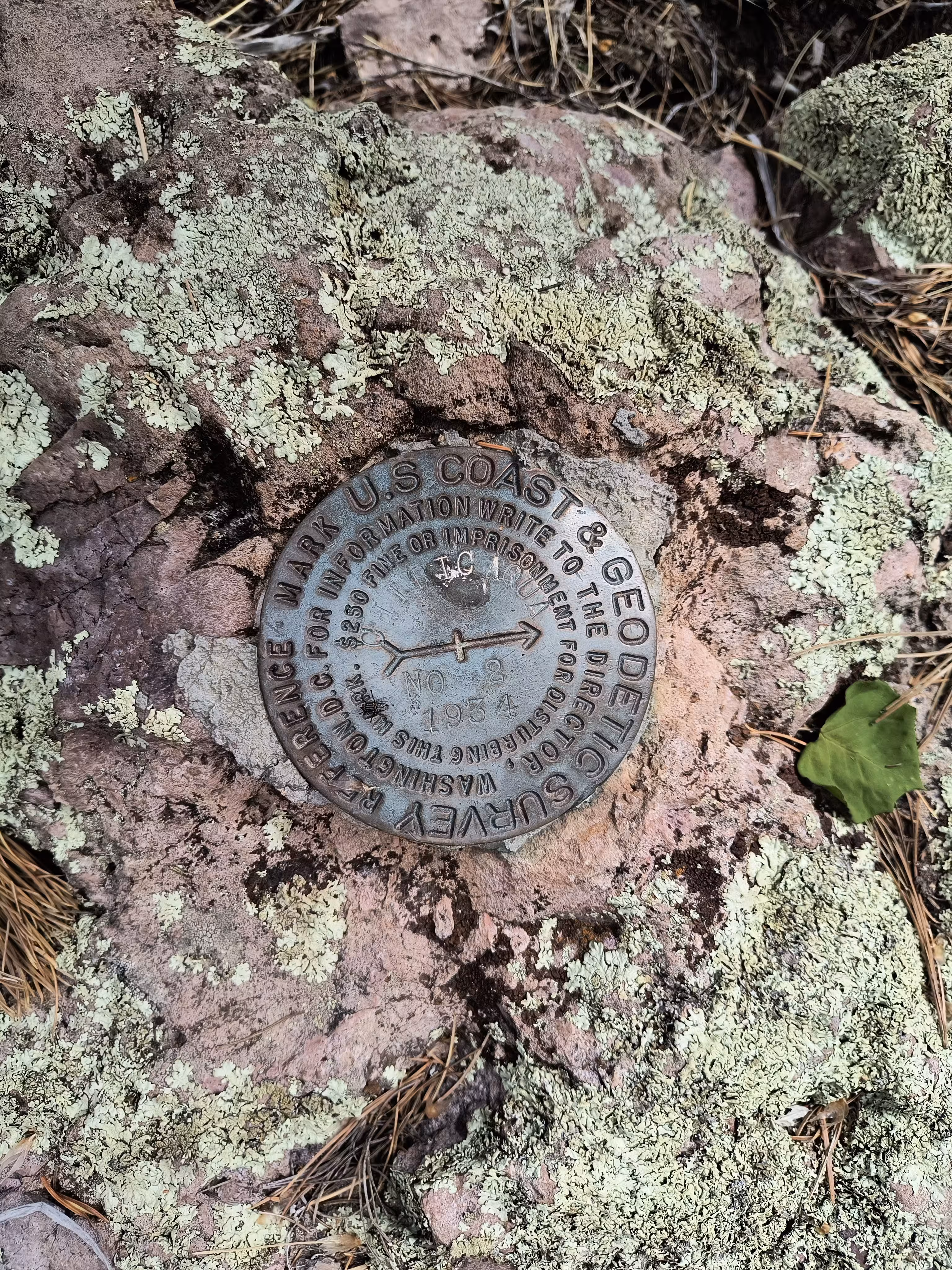
A closeup of CHIRICAQUA NO 2.