|
|
Main benchmarks recovered in good or poor condition. |
|
|
Main benchmarks that have been destroyed. |
|
|
Reference benchmarks recovered in good or poor condition. |
|
|
Reference benchmarks that have been destroyed. |
|
|
Azimuth benchmarks recovered in good or poor condition. |
|
|
Azimuth benchmarks that have been destroyed. |
|
|
A main, reference, or azimuth benchmark not searched for. |
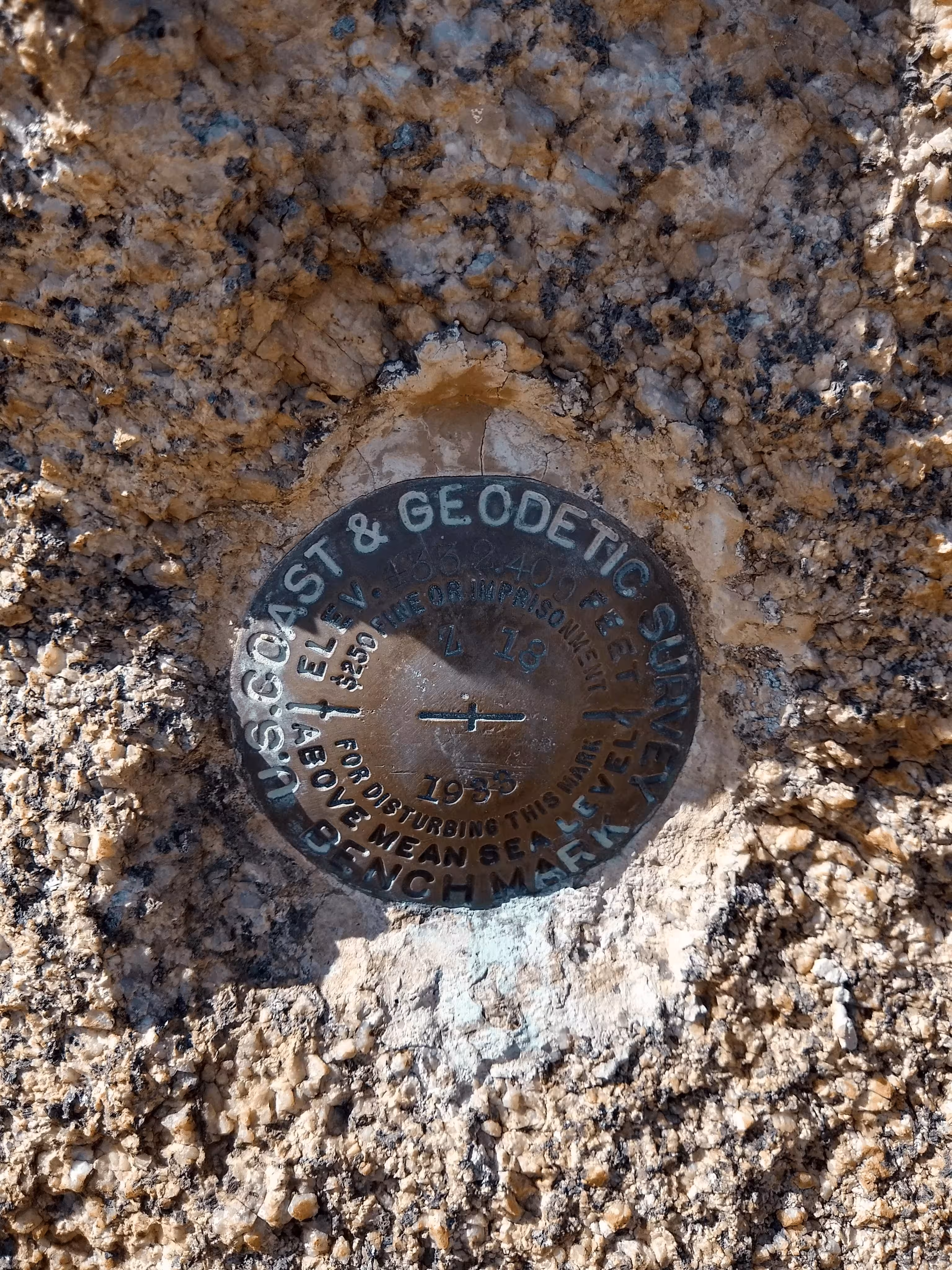
"Z 18"
| NGS PointID | CZ0301 |
| Reference Benchmarks: | None |
| Condition: | Minor scratches and ware present. |
| Stamping: | 4332.490 Z 18 1933 |
| Coordinates: | 32.62108, -110.74911 |
| Elevation: | 4332.490 ft (1320.543 m) |
| Setting: | Rock outcrop. |
| Monumentor: | USC&GS |
Datasheet Description:
1.7 mi NE from Oracle. 1.7 miles northeast along State Highway 77 from Oracle, Pinal County, 105 feet west of the centerline of the highway, and in the east face of a cone-shaped 4-foot-high granite rock outcrop. A standard disk, stamped 4332.409 Z 18 1933 and set vertically.
"Z 18" is a benchmark monumented by the USC&GS in 1933 located in Pinal County, Arizona.
The mark is guarded by spikey plants. To get to the mark, head north along the old state highway, from the American Avenue Trailhead driveway, for 200 feet. Then pack up a steep slope to the west for 100 feet and to the mark. The vegetation here has many thorns. Strong pants are advized.
The rock the mark is in is very distinct. The mark is set vertically in it.