|
|
Main benchmarks recovered in good or poor condition. |
|
|
Main benchmarks that have been destroyed. |
|
|
Reference benchmarks recovered in good or poor condition. |
|
|
Reference benchmarks that have been destroyed. |
|
|
Azimuth benchmarks recovered in good or poor condition. |
|
|
Azimuth benchmarks that have been destroyed. |
|
|
A main, reference, or azimuth benchmark not searched for. |
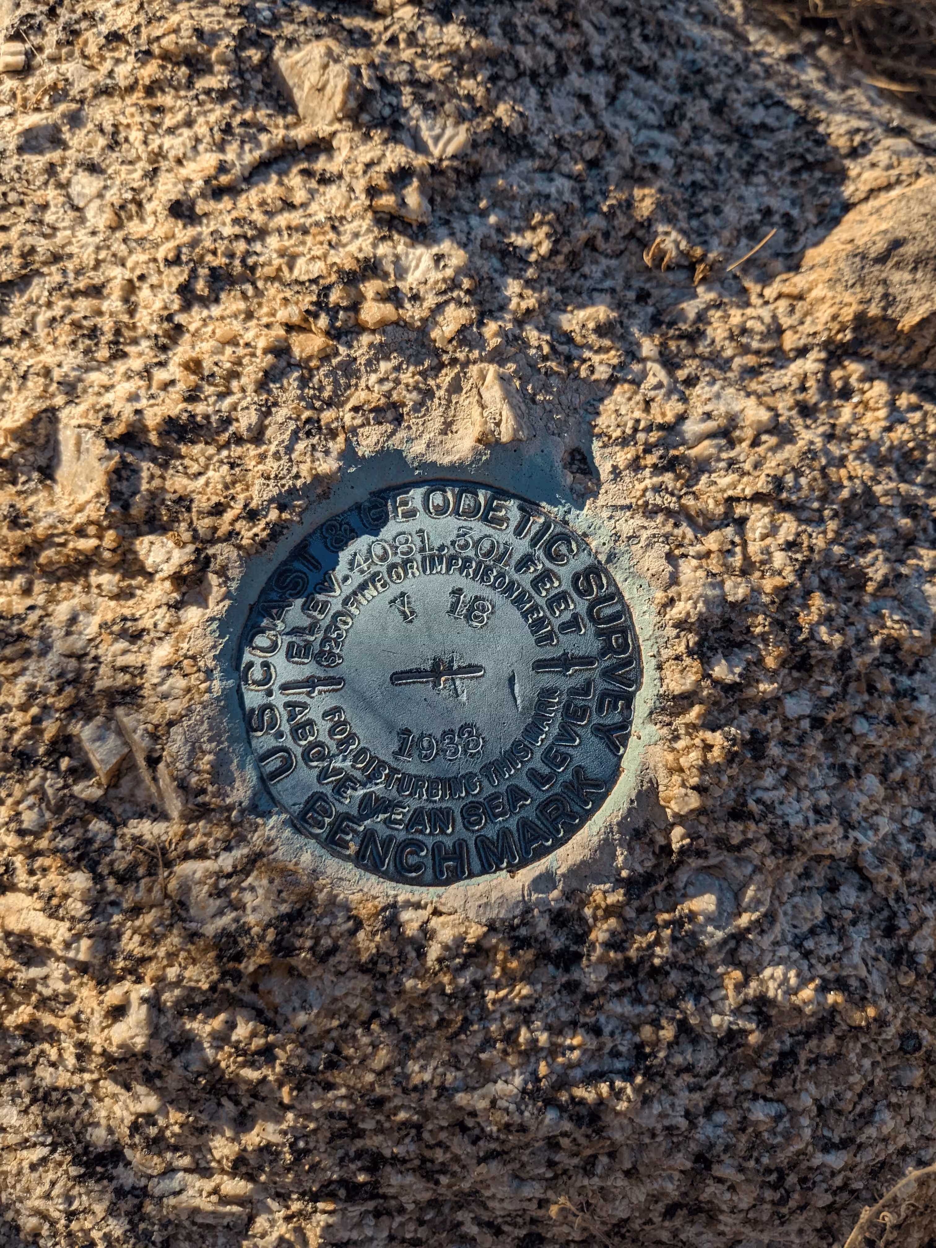
"Y 18"
| NGS PointID: | CZ0300 |
| Reference Benchmarks: | None |
| Azimuth Benchmark: | None |
| Condition: | 2 Large scratches/gashes, Minor ware |
| Stamping: | 4081.301 Y 18 1933 |
| Coordinates: | 32.649192, -110.732533 |
| Elevation: | 4081.301 ft (1243.981 m) |
| Setting: | Rock outcrop |
| Monumentor: | USC&GS |
Datasheet Description:
4.1 miles northeast along State Highway 77 from Oracle, Pinal County, on a west slope on the north side of the first ravine north of a sharp curve, 62 yards southwest of a low pole at the head of the ravine, 45 feet west of the centerline of the highway, in the top of a 3-foot granite outcrop, about 1 foot above the ground, and about 2 feet lower than the highway. A standard disk, stamped 4081.301 Y 18 1933.
"Y 18" is a benchmark monumented by the USC&GS in 1933 located in Pinal County, Arizona.
The best way to get to "Y 18" is to drive north on old State Route 77 from State Route 77 for 1.2 miles. This road is passable with most-all passenger vehicles. From here, walk to the coordinates of the benchmark which is west of the road down a slope. It is placed horizontally in a boulder.