|
|
Main benchmarks recovered in good or poor condition. |
|
|
Main benchmarks that have been destroyed. |
|
|
Reference benchmarks recovered in good or poor condition. |
|
|
Reference benchmarks that have been destroyed. |
|
|
Azimuth benchmarks recovered in good or poor condition. |
|
|
Azimuth benchmarks that have been destroyed. |
|
|
A main, reference, or azimuth benchmark not searched for. |
"T20S R17E S24 S25 T20S R18E S19 SC"
| Condition: | Ware present |
| Stamping: | T20S R17E S24 S25 T20S R18E S19 1989 |
| Coordinates: | 31.670722, -110.596556 |
| Elevation: | 4804.53 ft (1464.43 m) |
| Setting: | A square concrete post. |
| Monumentor: | USC&GS |
"T20S R17E S24 S25 T20S R18E S19 SC" is a benchmark monumented by the USGS in 1989 located in Santa Cruz County, Arizona.
The benchmark is under a fenceline projecting an inch above ground. It's where the middle of the dirt road would converge with the north-south fenceline.
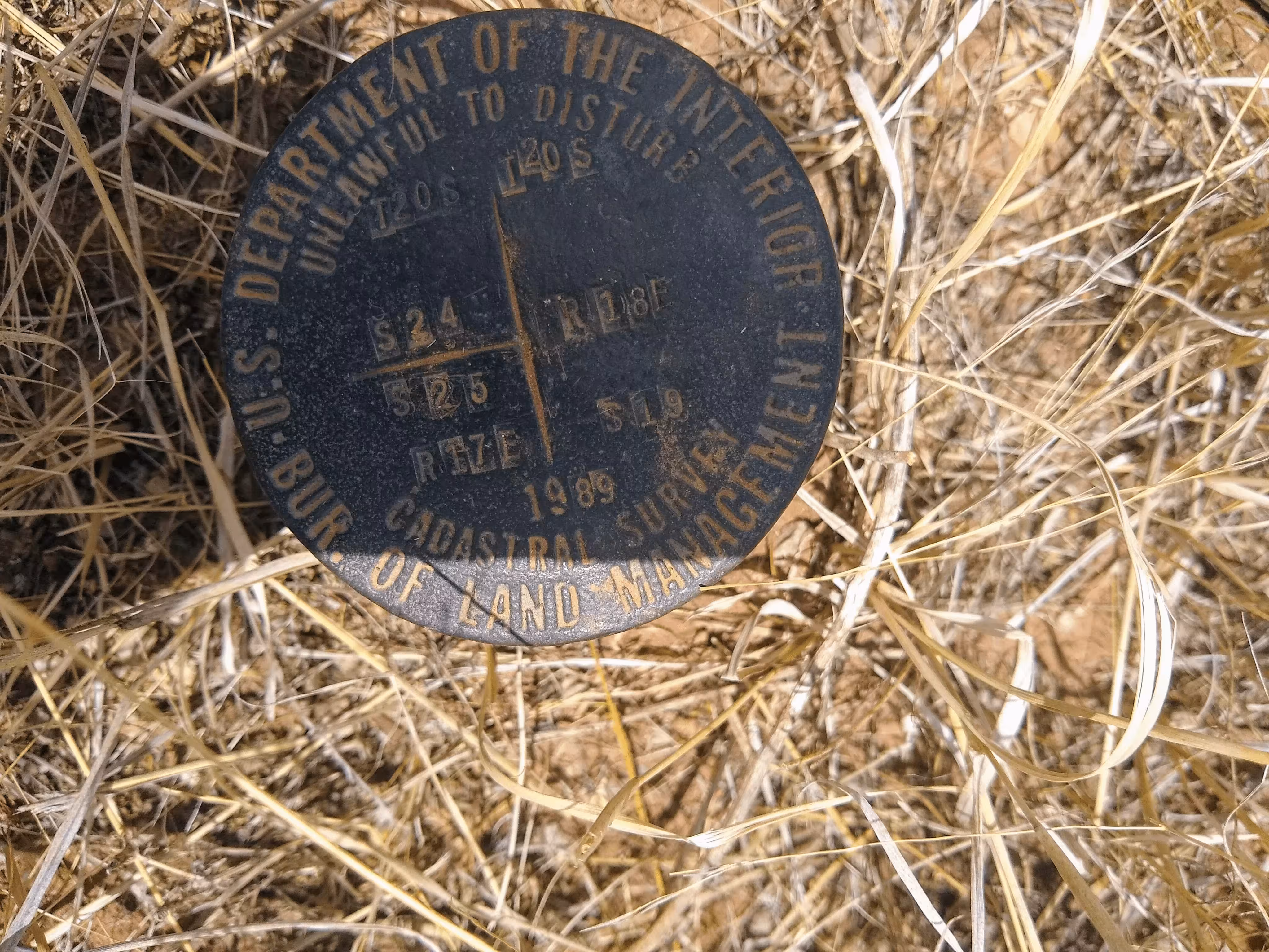
A closeup of T20S R17E S24 S25 T20S R18E S19 SC.
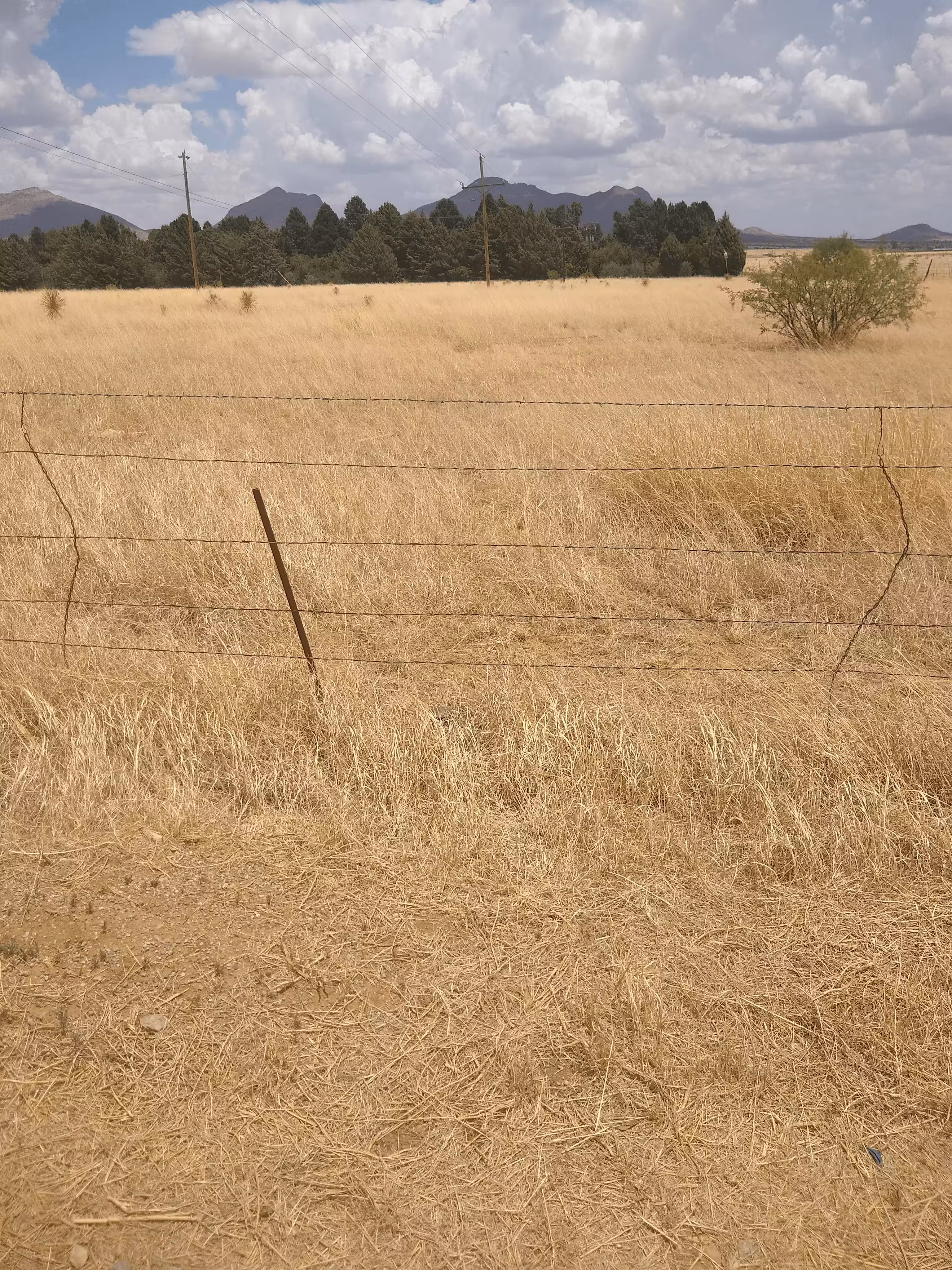
T20S R17E S24 S25 T20S R18E S19 SC from further back.
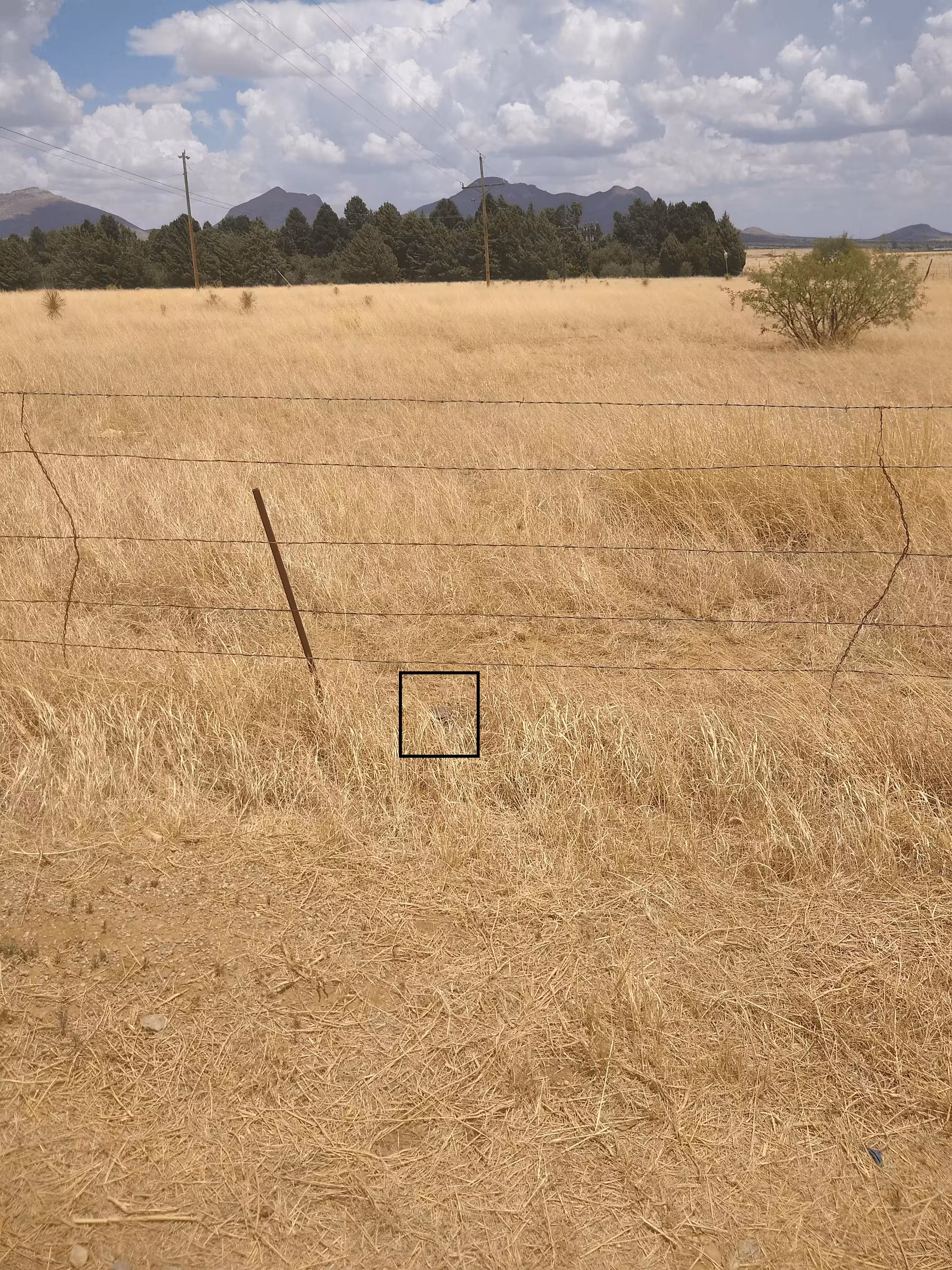
T20S R17E S24 S25 T20S R18E S19 SC from further back. The benchmark is in the square.