|
|
Main benchmarks recovered in good or poor condition. |
|
|
Main benchmarks that have been destroyed. |
|
|
Reference benchmarks recovered in good or poor condition. |
|
|
Reference benchmarks that have been destroyed. |
|
|
Azimuth benchmarks recovered in good or poor condition. |
|
|
Azimuth benchmarks that have been destroyed. |
|
|
A main, reference, or azimuth benchmark not searched for. |
"M 19"
| NGS PointID: | CZ0124 |
| Condition: | Small indents and very minor scratching |
| Stamping: | 2647.632 M 19 1933 |
| Coordinates: | 32.417215, -110.936526 |
| Elevation: | 2647.378 ft (3854.921 m) |
| Setting: | A square concrete post. |
| Monumentor: | USC&GS |
Datasheet Description:
14.8 mi N from Tucson. 14.8 miles north along U.S. Highway 80 from the post office at Tucson, Pima County, 0.2 mile south of Catalina School, 450 feet south of a well and a concrete reservoir base, at robinson ranch, and 50 feet west of the centerline of the highway. A standard disk, stamped 2647.632 M 19 1933 and set in the top of a concrete post projecting 8 inches above ground.
"M 19" is a benchmark monumented by the USC&GS in 1933 located in Pima County, Arizona.
The benchmark is on the other side of a fence from the old US 80. The fence can easily be passed around via a driveway to the north.
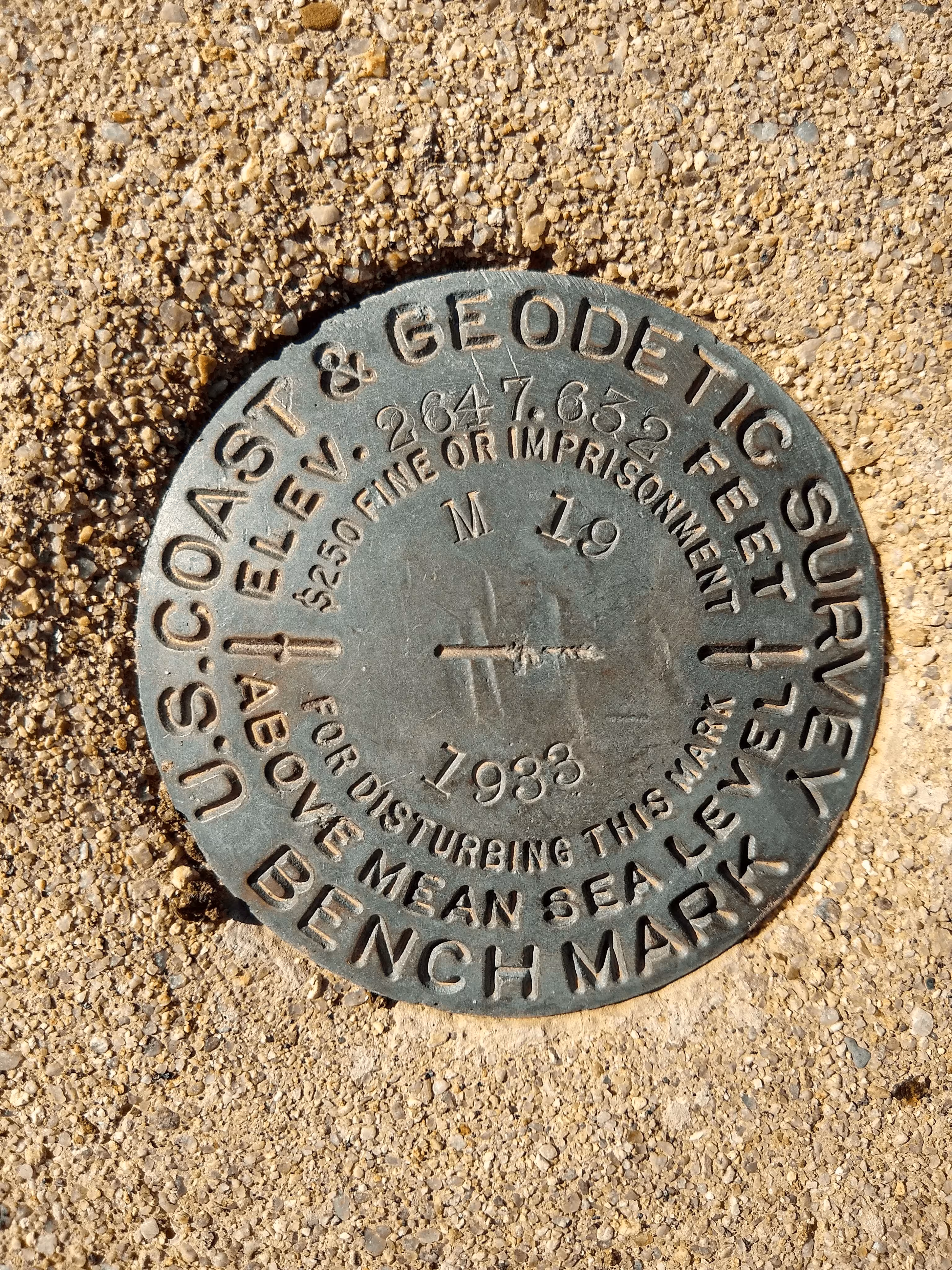
A closeup of M 19.
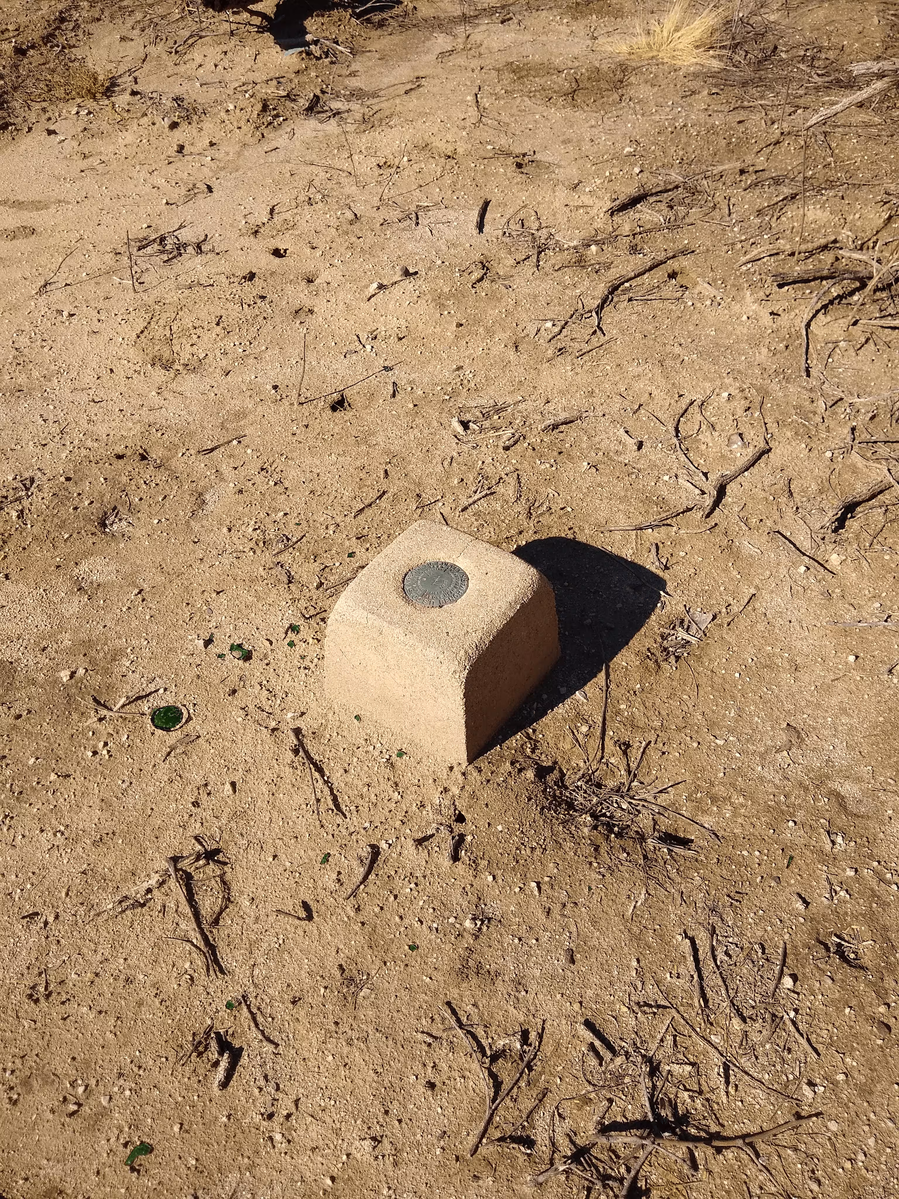
M 19 from further back.
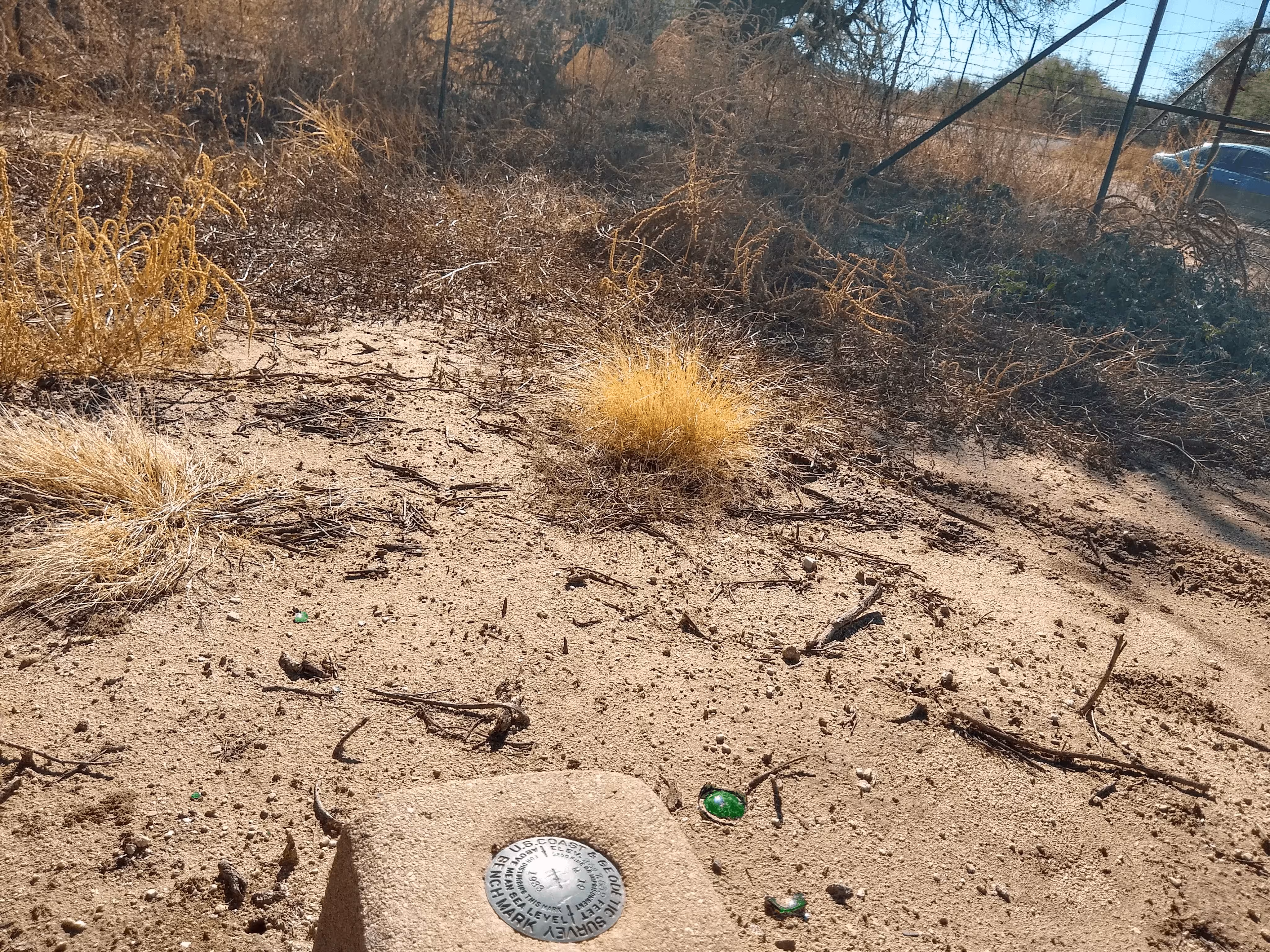
M 19 looking toward the Catalina State Park main entrance road.