|
|
Main benchmarks recovered in good or poor condition. |
|
|
Main benchmarks that have been destroyed. |
|
|
Reference benchmarks recovered in good or poor condition. |
|
|
Reference benchmarks that have been destroyed. |
|
|
Azimuth benchmarks recovered in good or poor condition. |
|
|
Azimuth benchmarks that have been destroyed. |
|
|
A main, reference, or azimuth benchmark not searched for. |
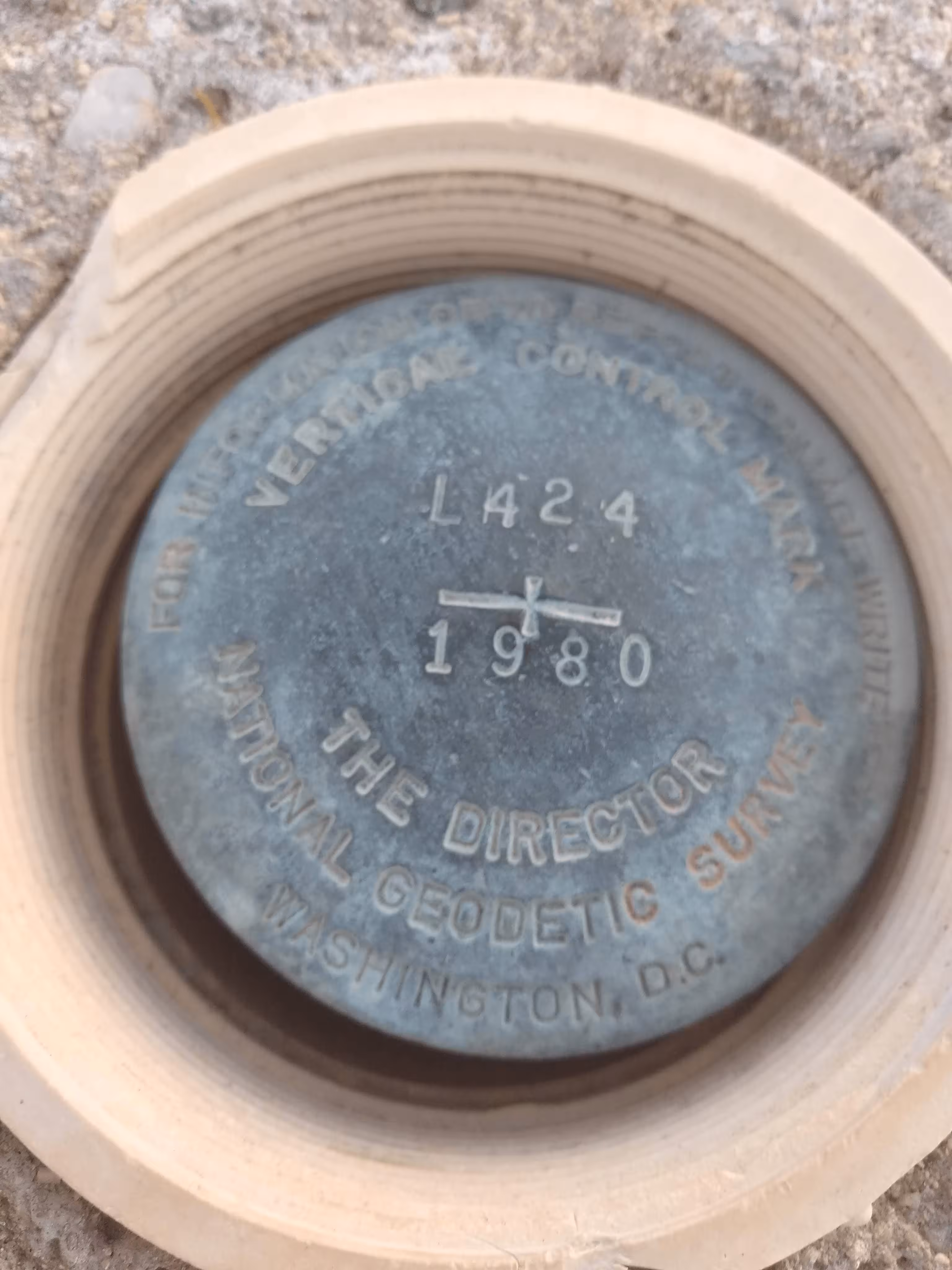
"L 424"
| NGS PointID: | CZ1453 |
| Condition: | Ware. |
| Stamping: | L 424 1980 |
| Coordinates: | 32.647562, -111.391547 |
| Elevation: | 1789.570 ft (545.461 m) |
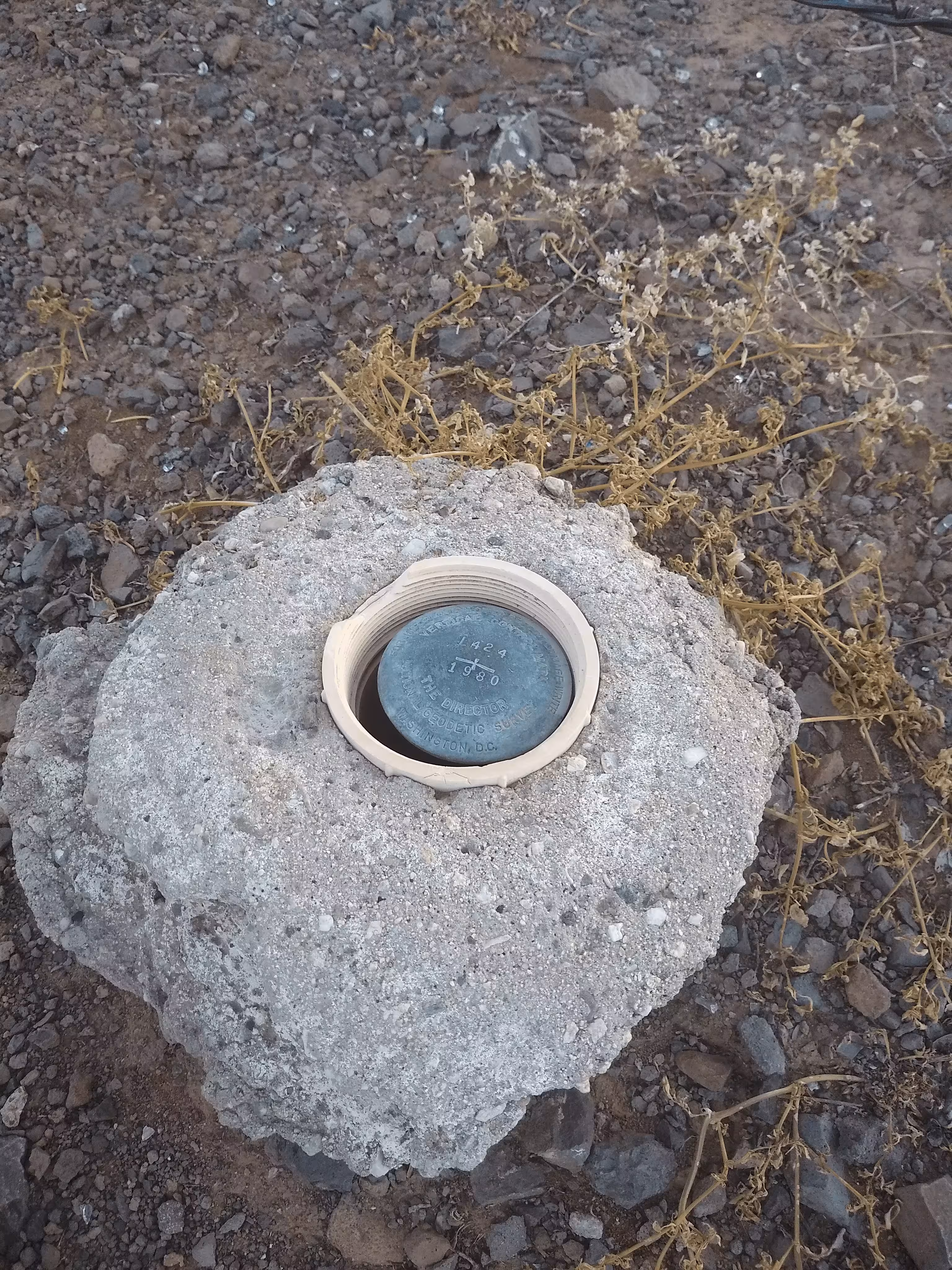
| Setting: | Mounted ontop of rod. |
| Monumentor: | USC&GS |
Datasheet Description:
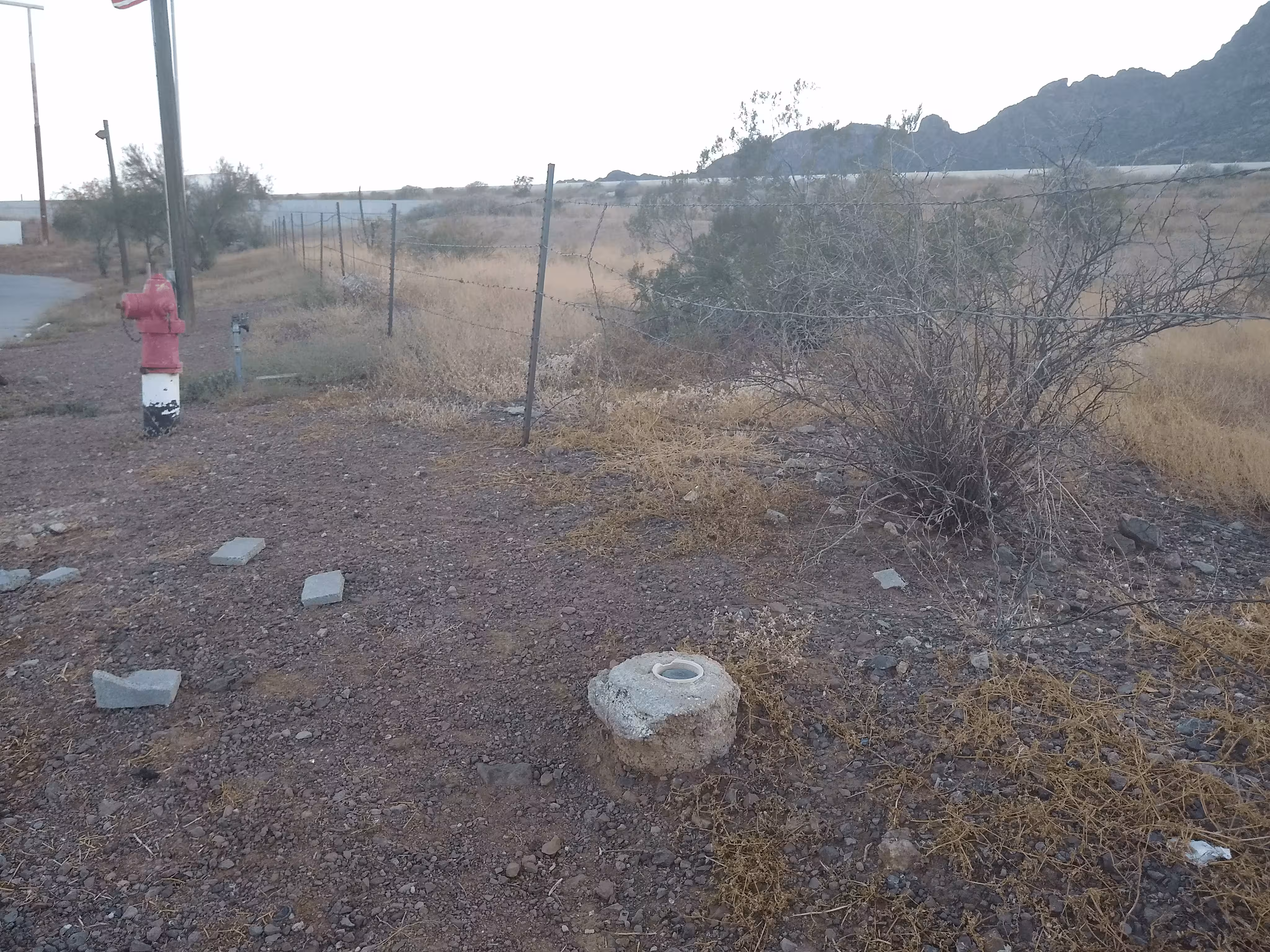
62.1 km NW from Tucson. The mark is 1 m above the parking lot. 62.1 kilometers (38.6 miles) northwest along the Southern Pacific Railroad from the station at Tucson, 0.2 kilometer (0.1 mile) southwest of the railroad, 0.2 kilometer (0.1 mile) southeast of the t-junction of Picacho Peak Road with a frontage road, at a stuckey pecan shop, 34.5 meters (113 feet) southwest of the south corner of and in line with the southeast face of the building, 10.5 meters (34.5 feet) south of the south corner of the concrete apron for the gas pumps, 5.0 meters (16.5 feet) northwest of a fire hydrant and 0.4 meter (1.3 feet) East of stuckeys west property line fence. The mark is 0.2 meters E from a witness post.
"L 424" is a benchmark monumented by the USC&GS in 1951 located in Pinal County, Arizona.
The benchmark is in a pipe in the ground. Parking is availible right next to the mark.