|
|
Main benchmarks recovered in good or poor condition. |
|
|
Main benchmarks that have been destroyed. |
|
|
Reference benchmarks recovered in good or poor condition. |
|
|
Reference benchmarks that have been destroyed. |
|
|
Azimuth benchmarks recovered in good or poor condition. |
|
|
Azimuth benchmarks that have been destroyed. |
|
|
A main, reference, or azimuth benchmark not searched for. |
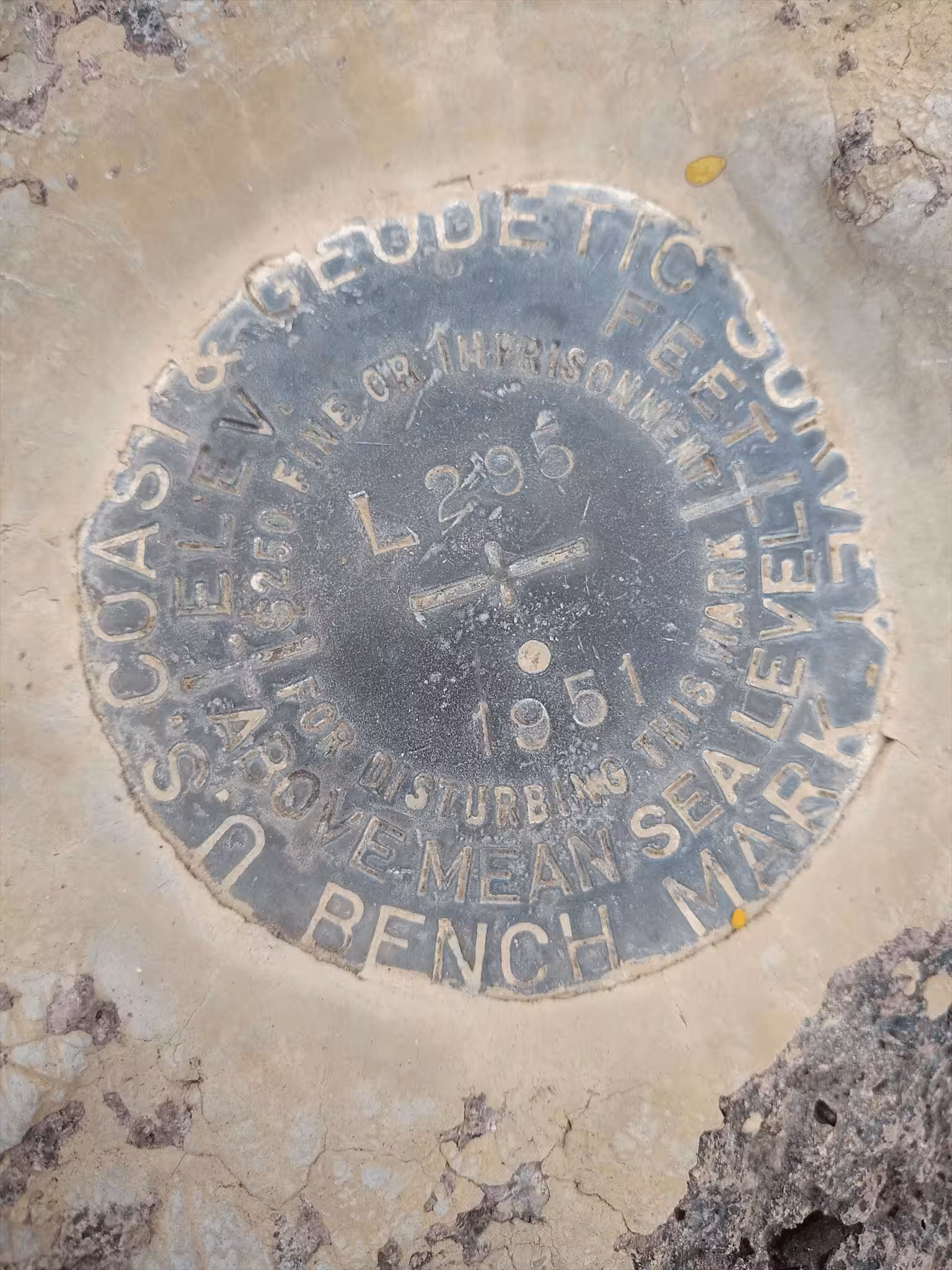
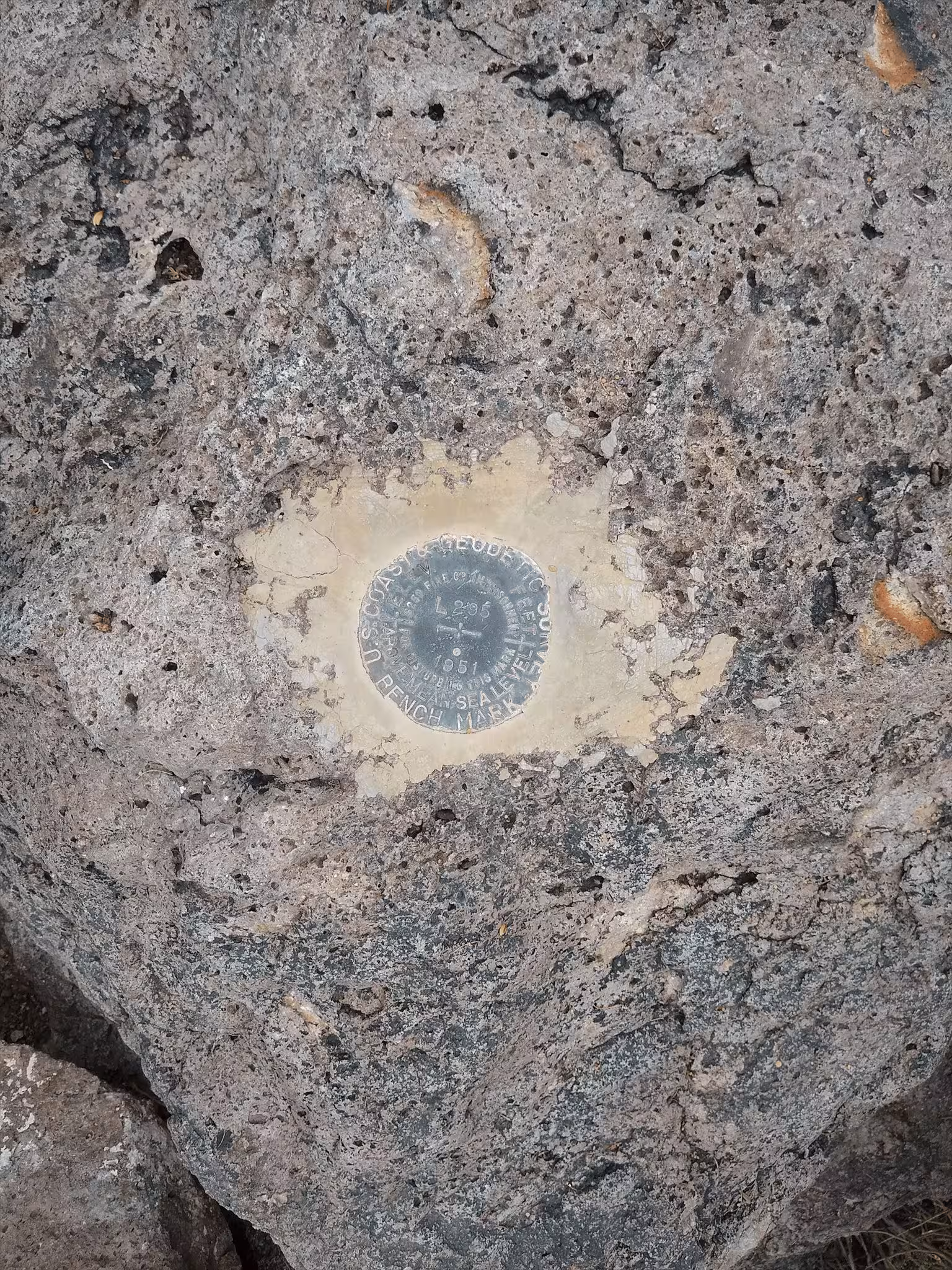
"L 295"
| NGS PointID: | CZ0754 |
| Condition: | Ware. |
| Stamping: | L 295 1951 |
| Coordinates: | 32.396125, -111.144694 |
| Elevation: | 2132.106 ft (649.866 m) |
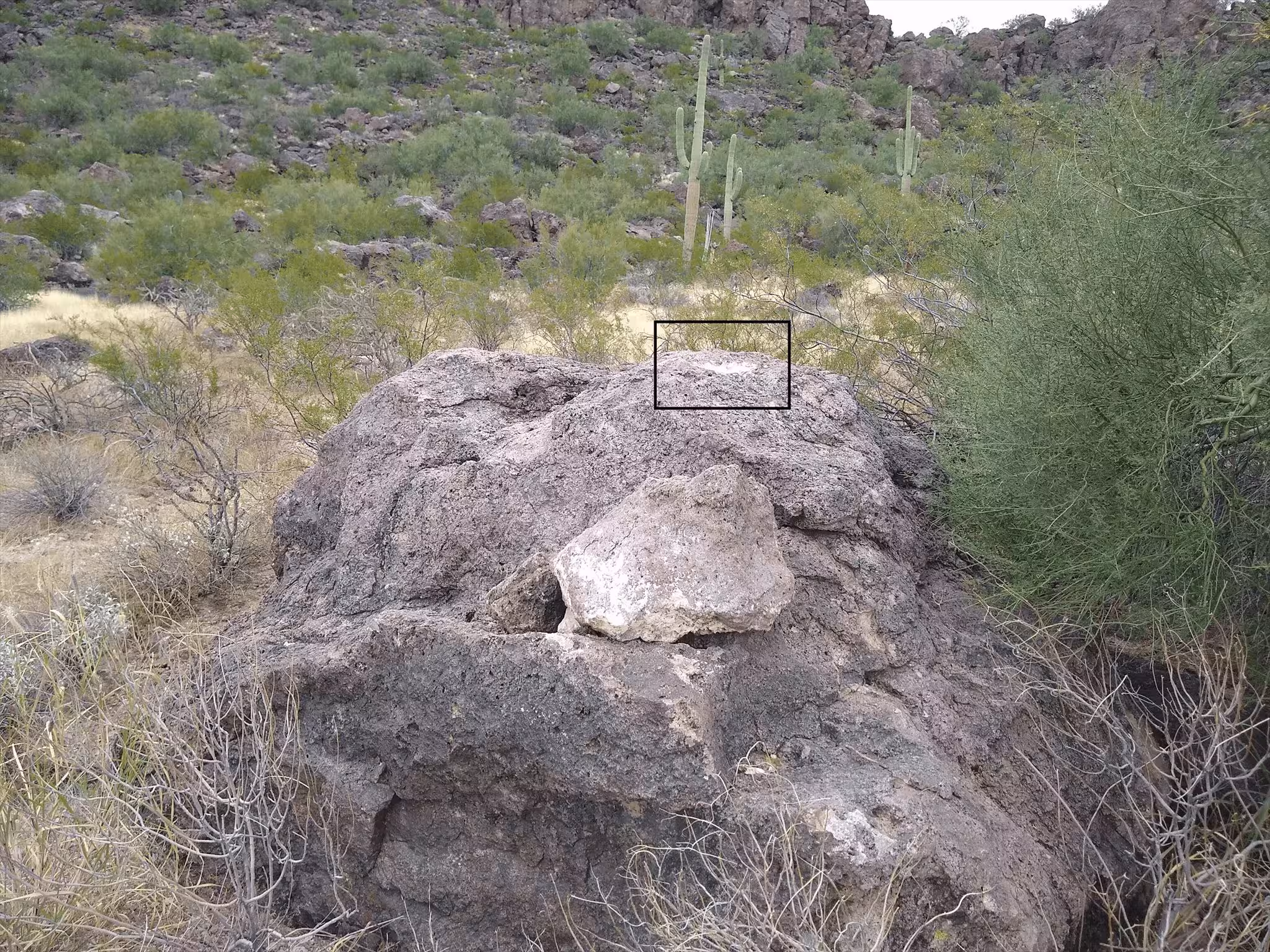
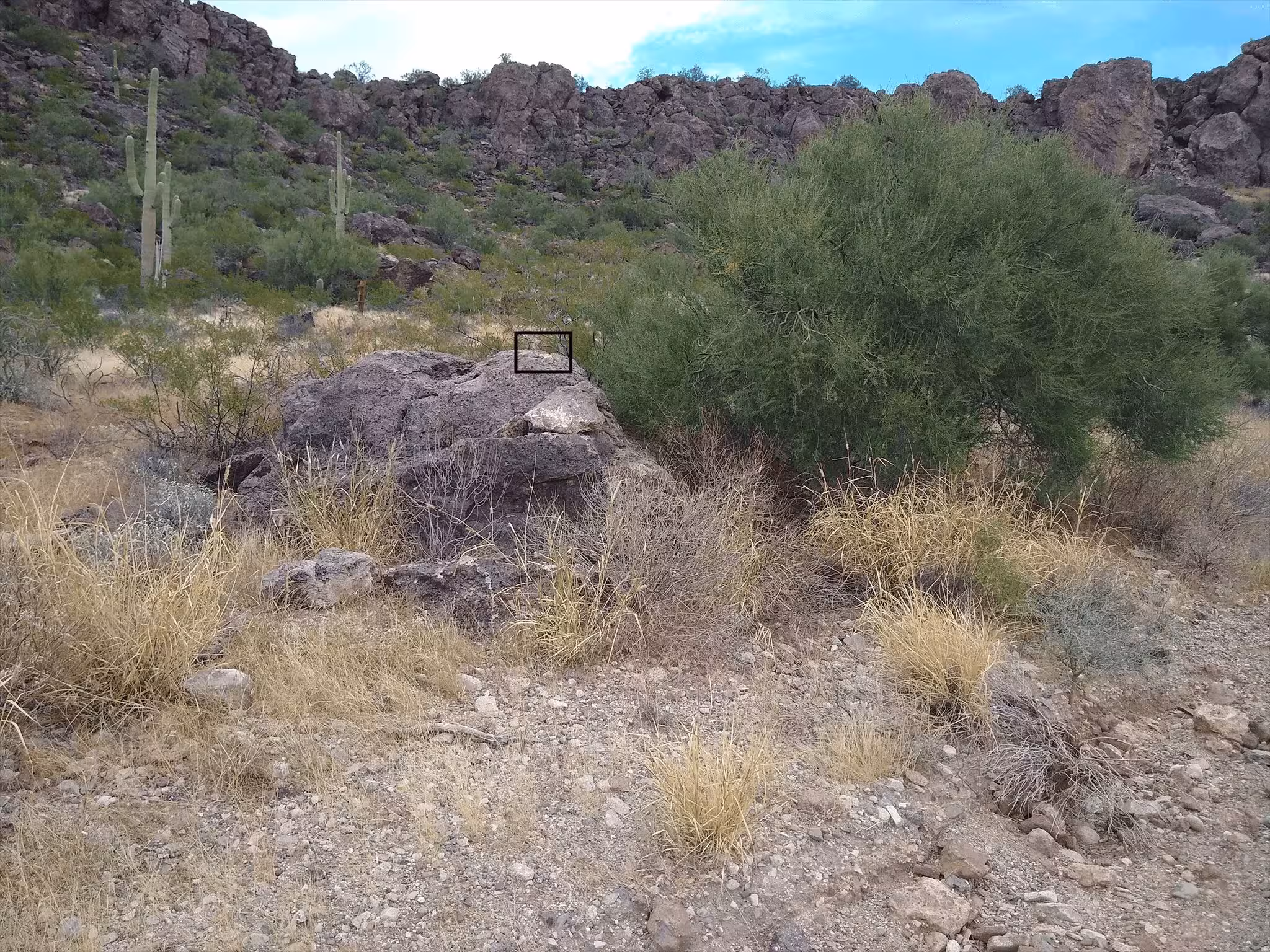
| Setting: | A large rock outcrop. |
| Monumentor: | USC&GS |
Datasheet Description:
2.2 mi S from Rillito.
0.2 mile southeast along State Highway 84 from the Southern Pacific Railroad station at Rillito, thence 1.3 miles south along a private road thru the Arizona Portland Cement Plant, thence 0.7 mile southeast along Silver Bell Road, 0.4 mile southeast of a cattle guard, 0.1 mile northwest of a summit of a pass, and in the top of a 6 by 8 feet sand stone boulder projecting 5 feet above the ground, 25 1/2 feet northeast of the center line of Silver Bell Road, and about 6 feet higher than the road.
"L 295" is a benchmark monumented by the USC&GS in 1951 located in Pima County, Arizona.
The benchmark is on top of a large rock outcrop on the side of the road.