|
|
Main benchmarks recovered in good or poor condition. |
|
|
Main benchmarks that have been destroyed. |
|
|
Reference benchmarks recovered in good or poor condition. |
|
|
Reference benchmarks that have been destroyed. |
|
|
Azimuth benchmarks recovered in good or poor condition. |
|
|
Azimuth benchmarks that have been destroyed. |
|
|
A main, reference, or azimuth benchmark not searched for. |
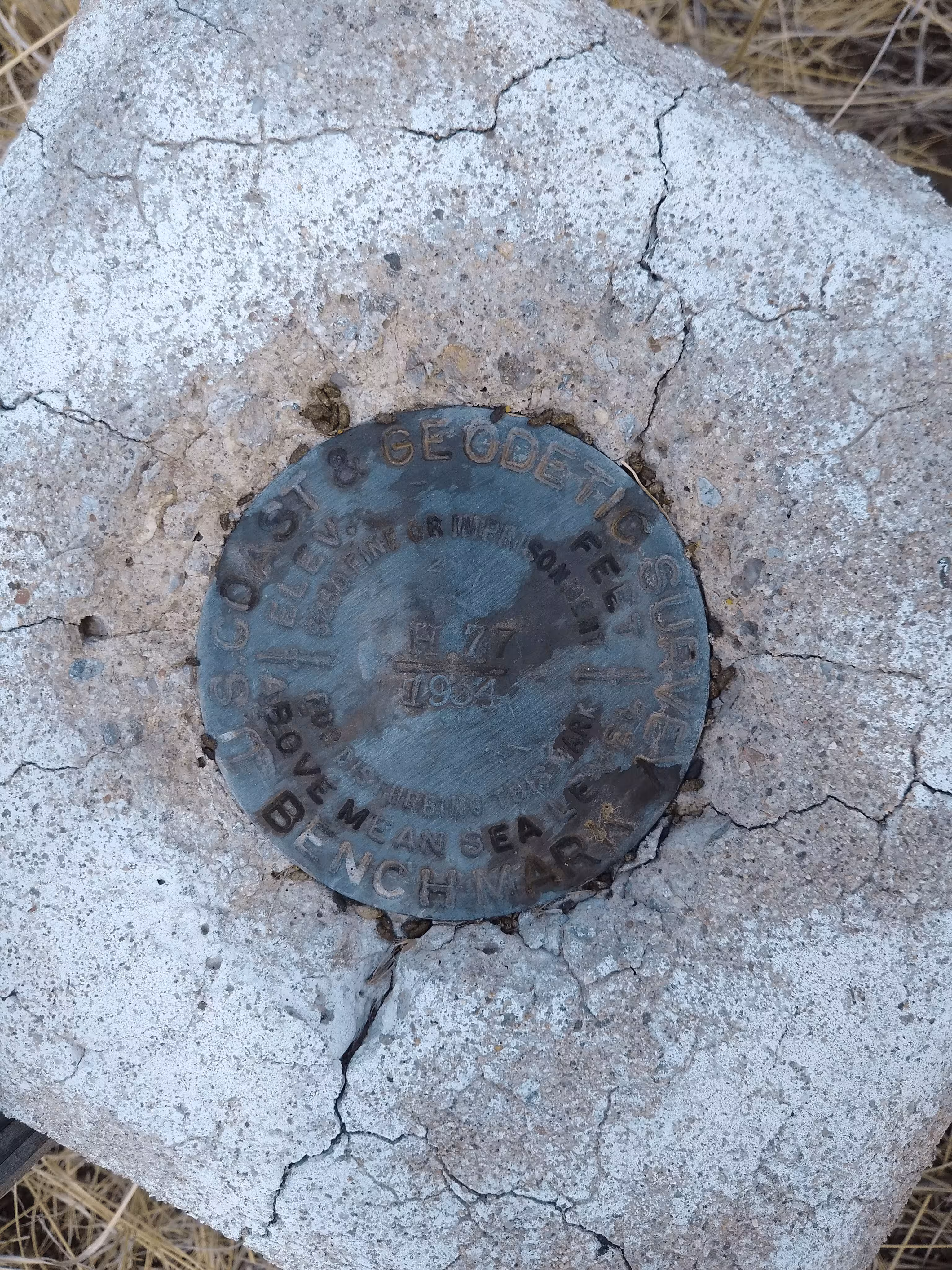
"H 77"
| NGS PointID: | CG0325 |
| Condition: | Ware and minor scratching |
| Stamping: | H 77 1934 |
| Coordinates: | 31.670722, -110.596556 |
| Elevation: | 4882.91 ft (1488.31 m) |
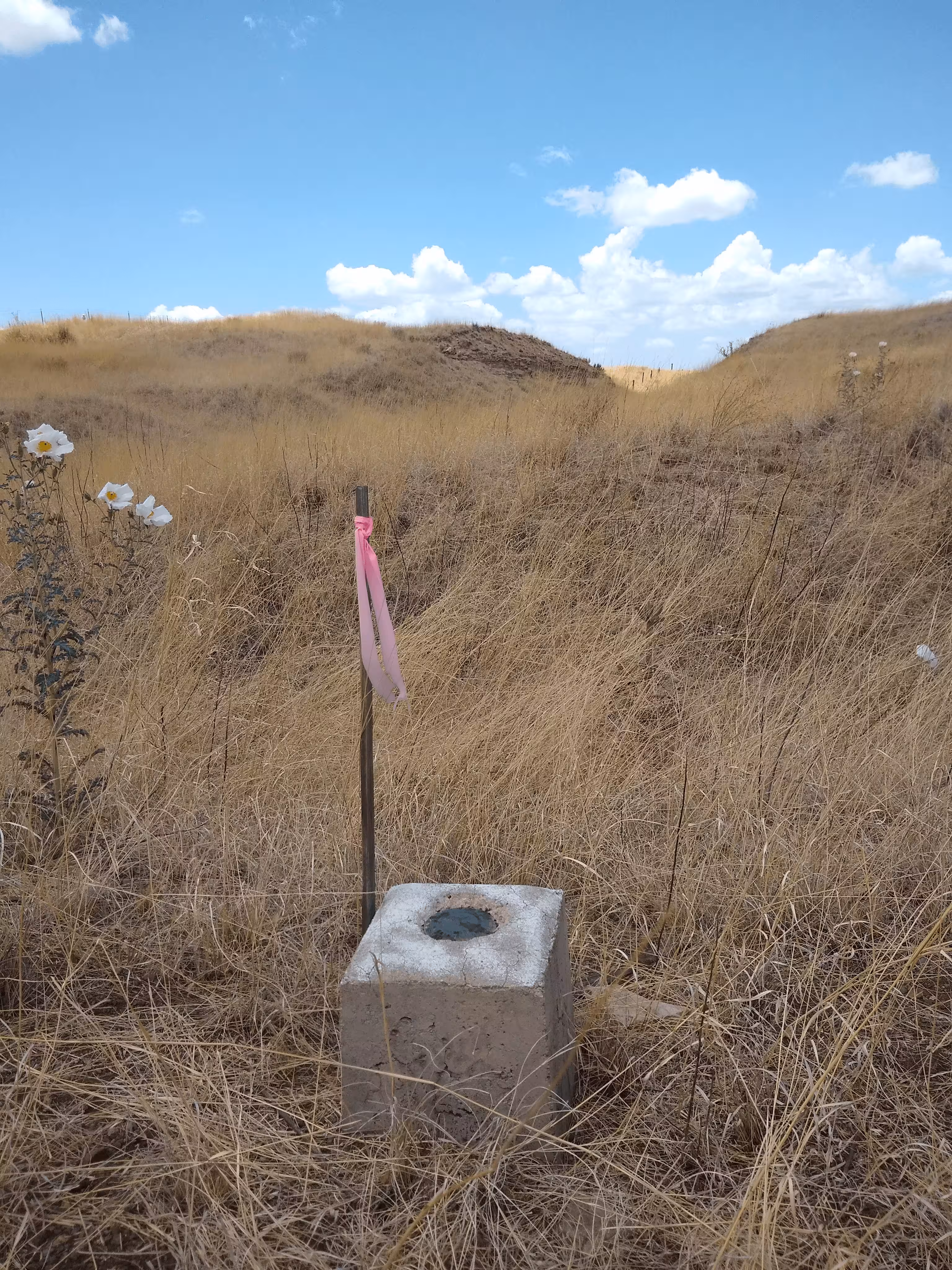
| Setting: | A square concrete post. |
| Monumentor: | USC&GS |
Datasheet Description:
3.5 mi E from Sonoita. 3.5 miles east along the Southern Pacific Co. railroad from Sonoita, Santa Cruz County, 4.5 miles west of Elgin, 2.3 miles west of Canelo, 25 feet east of the northeast end of culvert 1078 B, 30 feet northeast of the centerline of the track, and 22 feet southwest of a fence line. A standard disk, stamped H 77 1934 and set in the top of a concrete post.
"H 77" is a benchmark monumented by the USC&GS in 1934 located in Santa Cruz County, Arizona.
The benchmark is just west of a driveway. At this time there was a wooden post with a pink ribbon wrapped around the top next to the mark.