|
|
Main benchmarks recovered in good or poor condition. |
|
|
Main benchmarks that have been destroyed. |
|
|
Reference benchmarks recovered in good or poor condition. |
|
|
Reference benchmarks that have been destroyed. |
|
|
Azimuth benchmarks recovered in good or poor condition. |
|
|
Azimuth benchmarks that have been destroyed. |
|
|
A main, reference, or azimuth benchmark not searched for. |
"B 19"
| NGS PointID | CZ0304 |
| Reference Benchmarks: | None |
| Condition: | Scratches and ware present. |
| Stamping: | 4322.970 B 19 1933 |
| Coordinates: | 32.619078, -110.793817 |
| Elevation: | 4322.970 ft (1317.641 m) |
| Setting: | Rock outcrop. |
| Monumentor: | USC&GS |
Datasheet Description:
1.5 mi W from Oracle. 1.5 miles west along State Highway 77 from Oracle, Pinal County, 300 feet northeast of a boulder balanced on rock, 45 feet north of the centerline of the highway, in the south face of a large granite boulder, 2 feet east of the west end and about 2-1/2 feet above the ground. A standard disk, stamped 4322.970 B 19 1933 and set vertically.
"B 19" is a benchmark monumented by the USC&GS in 1933 located in Pinal County, Arizona.
The mark is easily accessable from American Avenue. It is easy to see on a prominent rock outcrop on the north side of the road.
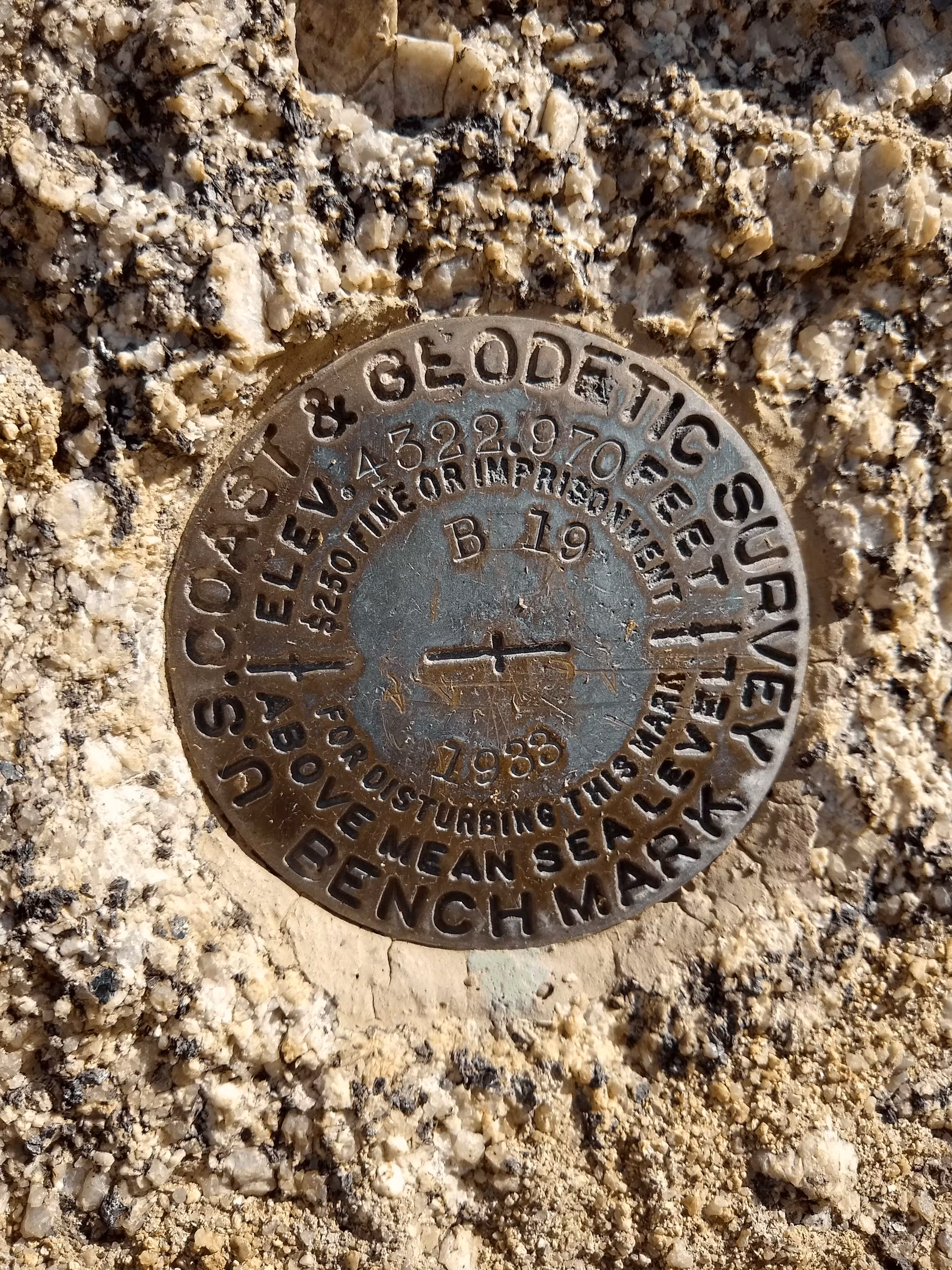
B 19 close up.
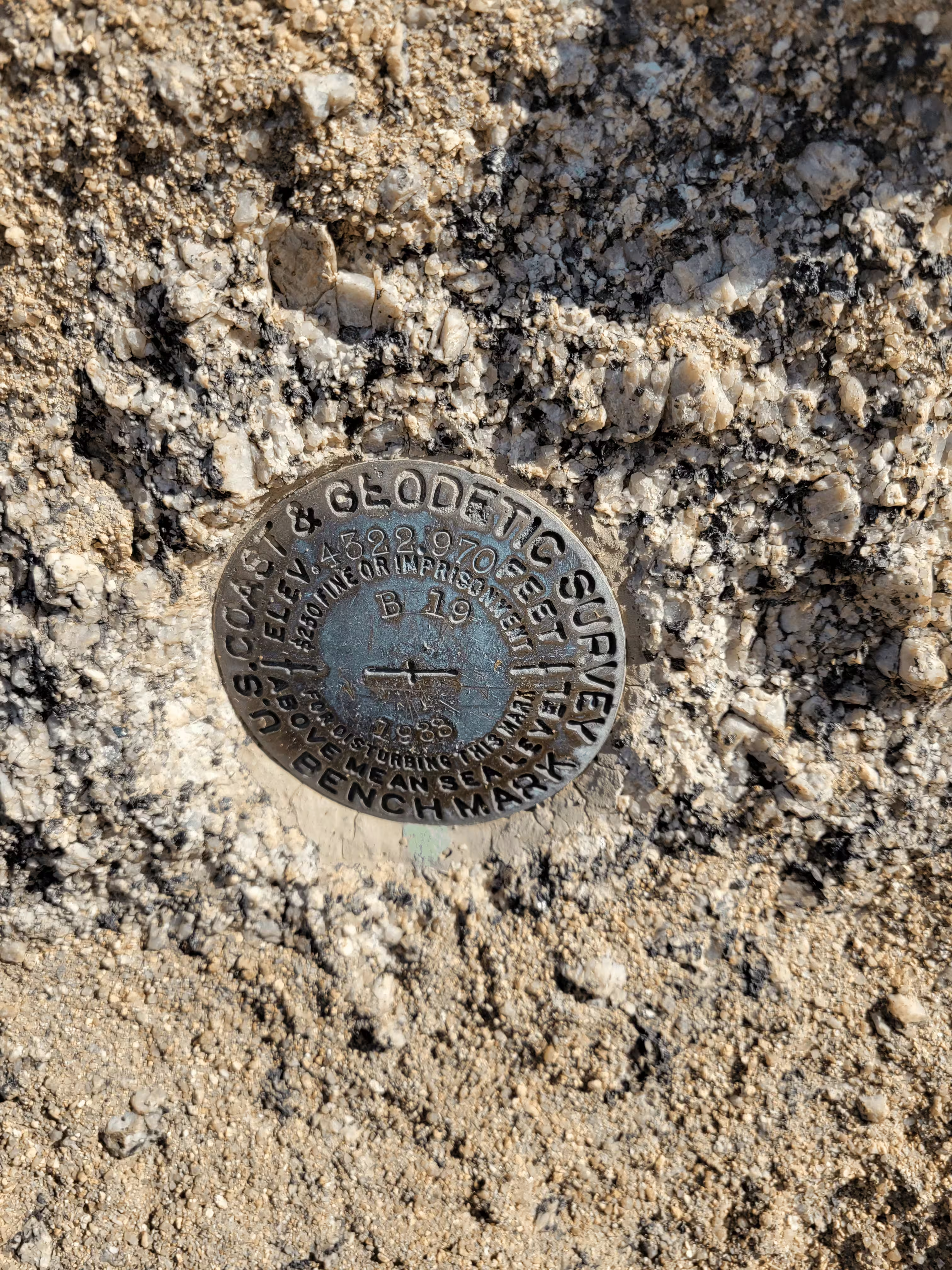
B 19 close up.
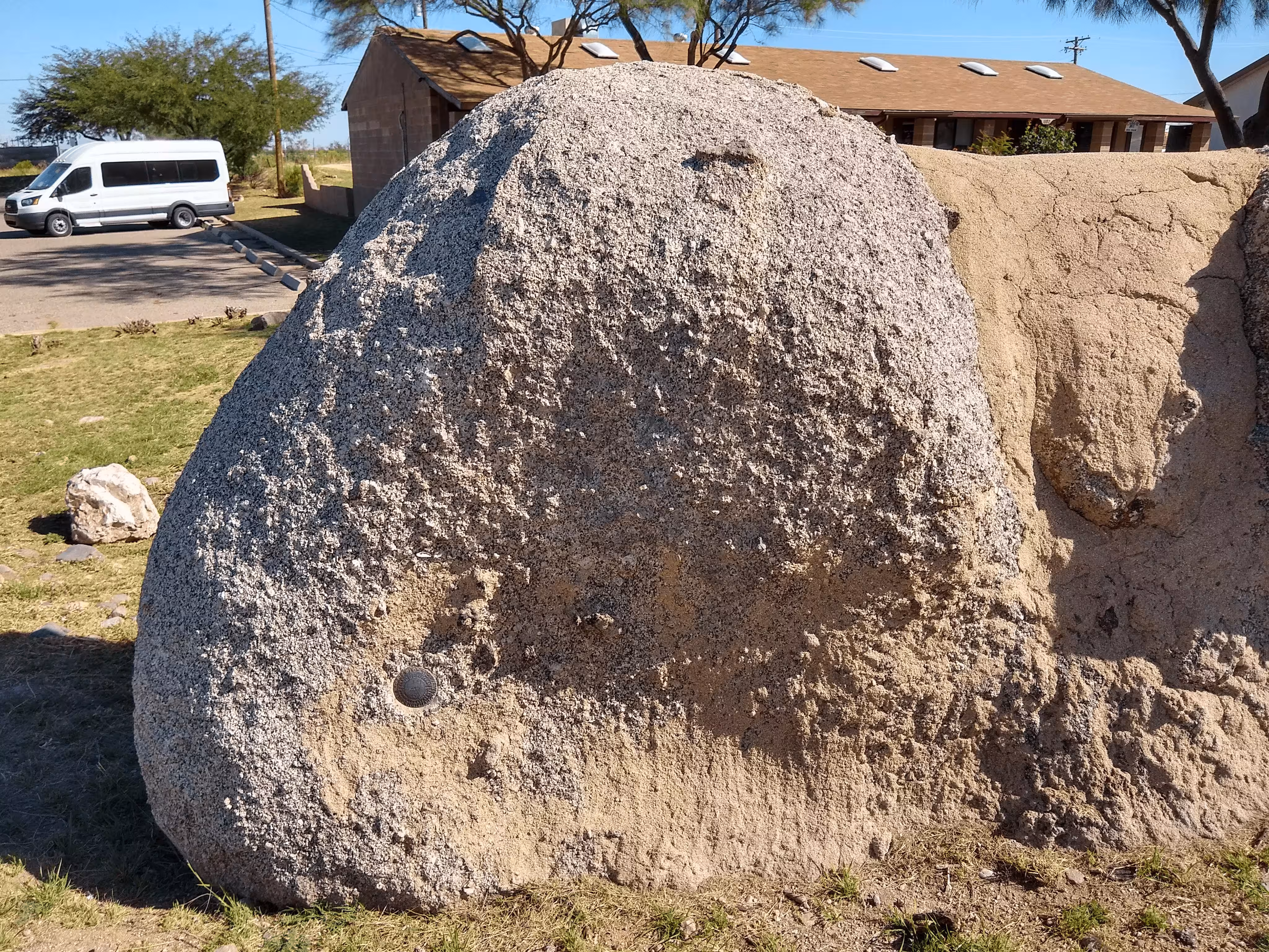
B 19 further back.
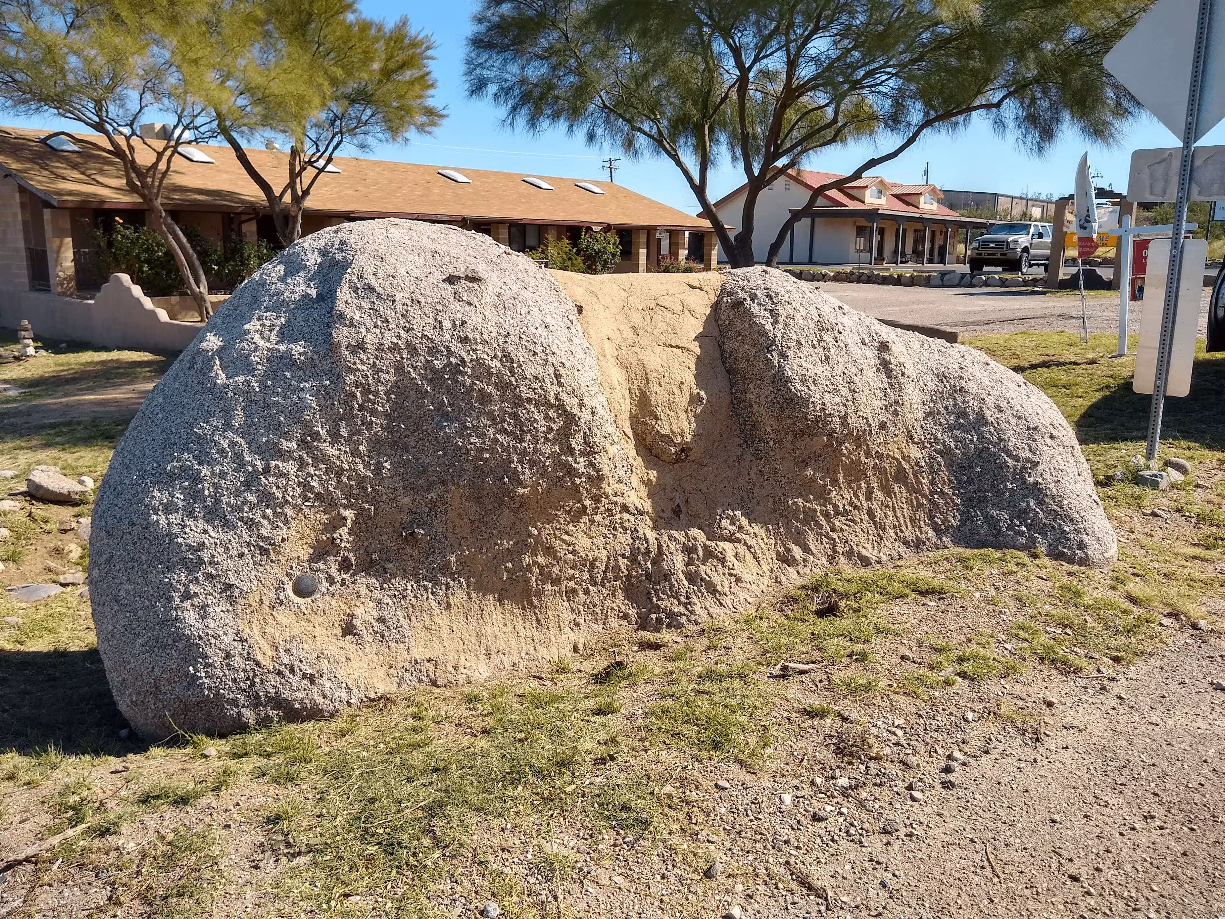
B 19 from a distnace.