|
|
Main benchmarks recovered in good or poor condition. |
|
|
Main benchmarks that have been destroyed. |
|
|
Reference benchmarks recovered in good or poor condition. |
|
|
Reference benchmarks that have been destroyed. |
|
|
Azimuth benchmarks recovered in good or poor condition. |
|
|
Azimuth benchmarks that have been destroyed. |
|
|
A main, reference, or azimuth benchmark not searched for. |
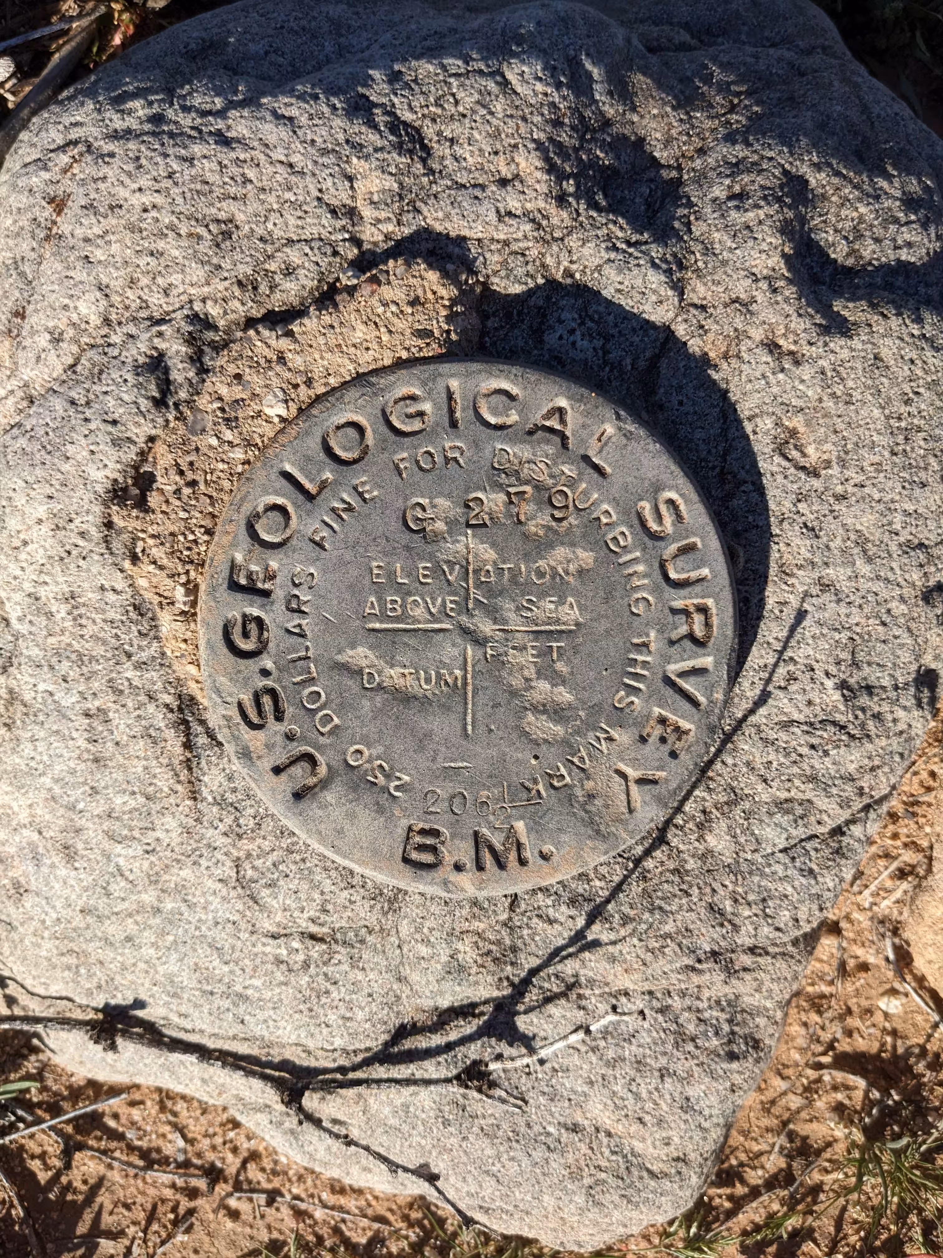
"206 1/2"
| NGS PointID | CZ0335 |
| Reference Benchmarks: | None |
| Condition: | Gashing. |
| Stamping: | G 279 206 1/2 |
| Coordinates: | 32.681528, -111.442389 |
| Elevation: | 1706.877 ft (520.256 m) |
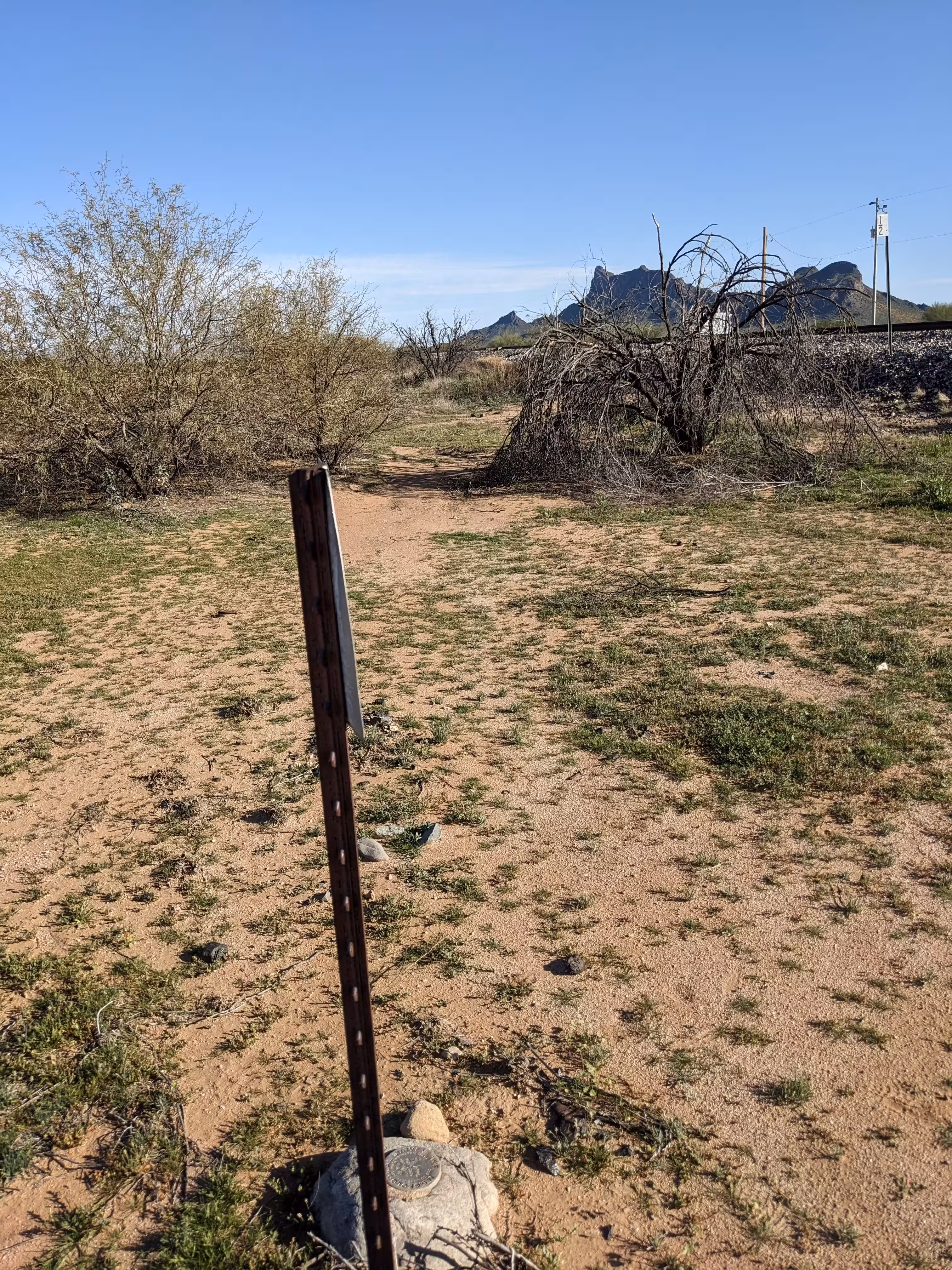
| Setting: | A boulder. |
| Monumentor: | USGS |
Datasheet Description:
4.1 mi SE from Picacho. About 4.1 miles southeast along the Southern Pacific Railroad from the district 33 elementary school at Picacho, in section 32, T 8 S, R 9 E, 9 rails southeast of a wooden twin channel box culvert under the track, 47 1/2 feet northeast of the northeast rail of the track, a US Geological Survey disk set in the top of a granite boulder, 5 1/2 feet northwest of a telephone pole, which bears the metal letter g, in line with a row of poles, 1.1 feet southeast of a metal witness post, and about 4 feet below the level of the track.
Old Datasheet Description:
Milepost 940, opposite, 50 feet northeast of track, in granite rock; aluminum tablet
"206 1/2" AKA "G 279" is a benchmark monumented by the USGS in 1905 located in Pinal County, Arizona. There is a witness post.
The benchmark is reachable from the I-10 frontage road, after crossing the tracks on foot. It is at mile 941 1/2 on the Southern Pacific Railroad.
The benchmark was apart of the benchmark line following railways from Yuma to New Mexico established from 1903-1907. In 1967 the USC&GS stamped the benchmark with G 279, adding it to their line of benchmarks they we monumenting.